
This is the return leg of the hike in yesterday’s post.
The trail north from Kiholo is a hit and miss affair. Sometimes it’s clear, more often not. But the idea is to follow close to the coast. Think of it as Goldilocks would: If it’s dry, hot and still, you’re probably too far inland. If it’s cooler, but wet, you got too close to the cliff, tumbled into the ocean, and are probably in immediate need of medical attention. If it’s dry, but with a nice cooling breeze, then you’re probably just right.
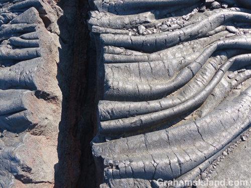
The trail covers the same pahoehoe lava flow experienced on the way south. Here though, a refreshing breeze and an expanse of ocean views, including a pair of whales blowing and slapping some way off, enhanced the experience.
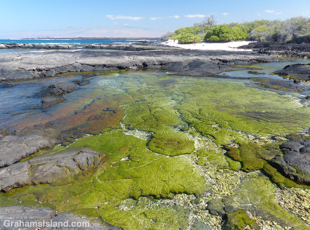
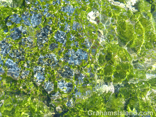
About half way along the trail is Ohiki Bay, a steep, mostly pebbled beach. A little farther still, some greenery appears, the cliffs dwindle, and the route follows the shore. Low pillows of lava have created inlets and pools, depending on the state of the tide. It was here that I found myself engrossed for the best part of an hour staring into the shallows. Incoming waves wrinkled the surface, highlighting the variety of colors and shapes.
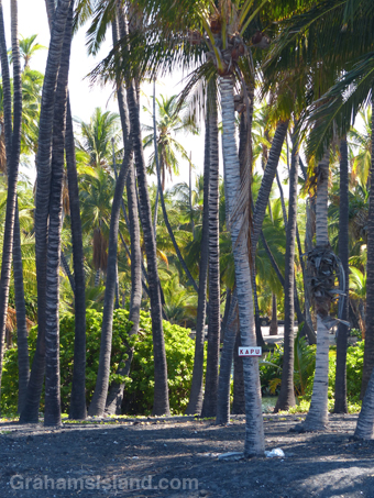
The greenery back from the shore is the Francis H. Ii Brown beach residence. Brown was a well-known Hawaiian golfer and legislator during the 1920s, ’30s, and ’40s who built this compound in the late 1920s. It was added to the National Register of Historic Places in 1986.
I’ve read that it’s possible to visit the place, being open one day a month, but I’m not sure that’s still true since the contact information on the sign has been erased. The encirclement of barbed wire and liberal use of Kapu signs don’t hint at any kind of welcome. Kapu is a Hawaiian word with several meanings including ‘sacred,’ ‘forbidden,’ and its modern day usage of “no trespassing’ or ‘keep out.’
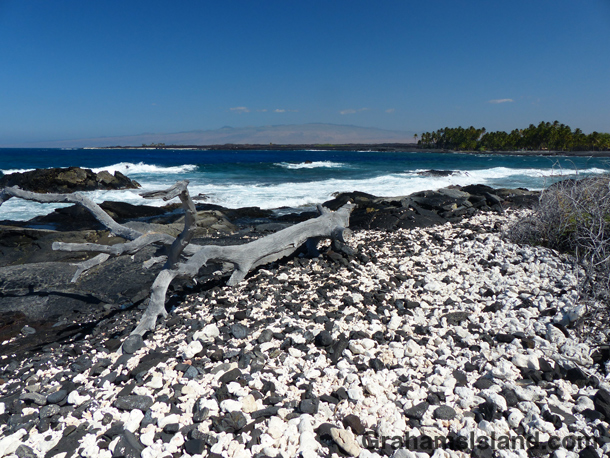
Immediately past the Brown residence is Keawaiki beach, another steep and mostly pebbled beach, but the trail back to the truck, half a mile inland, follows the barbed wire fence and access road back to the main highway.
In all, the round trip hike was about 7 miles and took 5 hours with a good deal of dallying along the way, but in my book, a most rewarding experience.
For more information about this, and other hikes on the Big Island, go to bigislandhikes.com. (This hike is listed as Kiholo to Keawaiki, starting from the southern end.)

Pingback: A walk around Kiholo Bay | Graham's Island
Pingback: A Bay to Keawaiki hike | Graham's Island
Pingback: Favorite photos from the early days | Graham's Island