
Water shimmers over colorful rocks.

Water shimmers over colorful rocks.

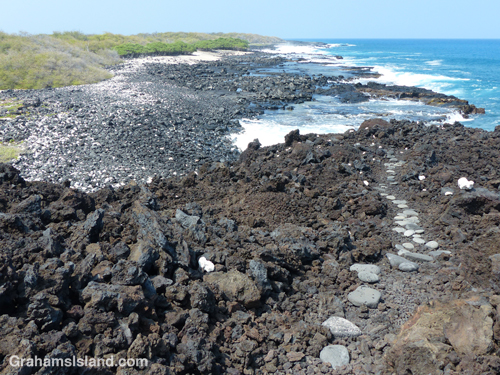
The start of the trail below the parking area at Kiholo.

The house built for Loretta Lynn at Kiholo.
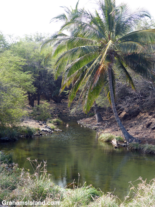
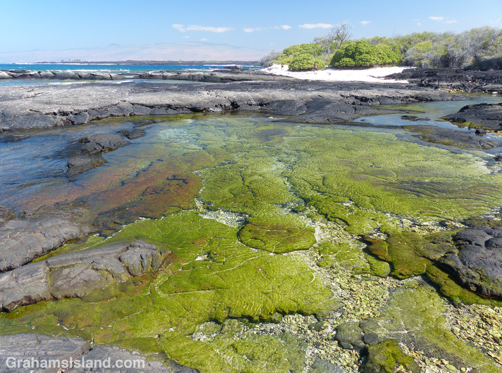
The anchialine pool at the south end of the first beach.
The trail winds down to the bench before Mano Point.
This hike is a not-too difficult, out and back, 4-mile round trip. Aside from wanting to check out this part of the coast, I also wanted to try out a new pair of shoes, more suited to hiking, rather than the old pair of walking shoes I’d been flogging my toes in recently.
The access road to the trailhead can be rough, but on this occasion had been recently graded, at least down to the private road near the bottom. The hike follows the coast south from the Kiholo parking lot. There’s camping here Friday through Sunday, but on this day it was much quieter – three people on the beach when I set out, not many more when I returned. The day was hot, as it usually is on this coast, and the vog was thick enough to chew on.
The hike starts out crossing the first of three black sand beaches. It’s part of Kiholo State Park Reserve, which means it’s a park for which the plans have not yet been finalized. Behind this first beach is a house built by country singer Loretta Lynn back in the 1980s. It’s boarded up now, but is tabbed to be some sort of visitor/cultural center in the new park. Check back in 10 years or so to see how things are going!
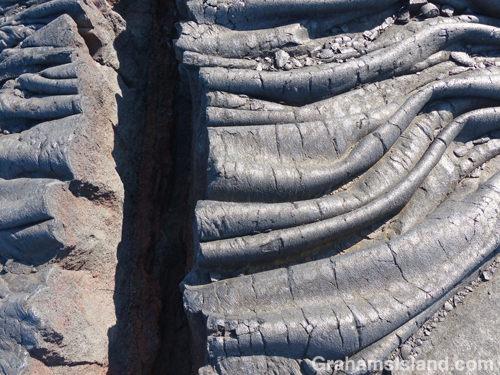
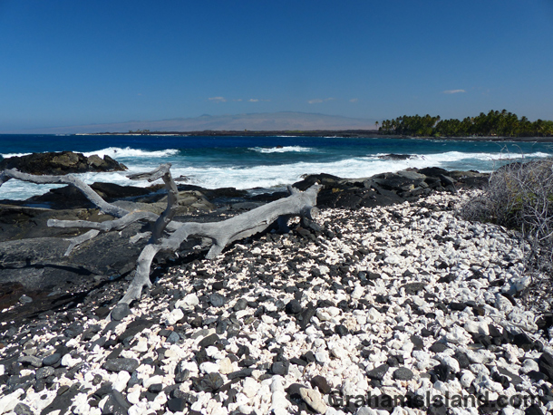
At the south end of the beach is an anchialine pool. After the pool, the trail winds up and over a’a lava to another smaller black sand beach. There’s another up and over to the third beach, Luahinewai, which is backed by a large private residence, overlooking another anchialine pool and surrounded by vegetation. The second and third beaches were deserted, the a’a lava lumpy, the new shoes doing a splendid job of cushioning my feet.
After this third beach the trail heads up onto the lava for a while and crosses inland from Nawaikulua Point until it reaches a lava bench backed by vegetation. The trail, which is marked by some rounded stones in the trail and white coral markers on the edges, ends here. Mano Point is reached by crossing the lava bench, which is not difficult but, as always, requires keeping an eye on the ocean. On this day the waves were thudding against the edge of the bench, sending spray into the air and some whitewater onto the bench.
It was a day for keeping toward the back of the bench. A couple of days earlier, when the surf was higher, it would have been a place to avoid altogether. On a calmer day one could walk along the edge of the bench. This is an area of tide pools, arches, and collapsed lava tubes that have become surging inlets.
Mano Point itself is not much of a point, but it is easy to identify because it’s where most of the vegetation ends. It’s also marked by a black-bordered, yellow sign (only the back of which is seen from the land), which I think means that no aquarium fish collection (a contentious issue here) is allowed south of the sign. The return is back the same way. I took a dip in the water at one of the beaches on the way back, but the surge was fierce and I ended up discovering black sand in unlikely places for a couple of days afterwards.
It’s not an earth-shaking hike, but enjoyable in its own way. There was a breeze on the coast as there usually is, some whales to be seen offshore, and my new hiking shoes performed admirably. That said, crossing behind the last beach en route to my truck, I felt a pricking in my foot and took off my shoe to find a kiawe thorn that had penetrated the sole. Not the fault of the shoe though, just an occupational hazard of hiking here.
For more information about the Kiholo to Mano Point hike, go to bigislandhikes.com/kiholo-to-mano-point.
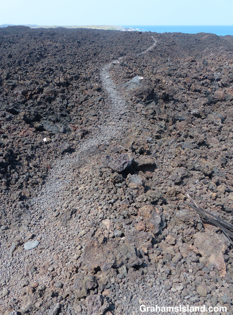
The trail heads across a’a lava after the third beach.
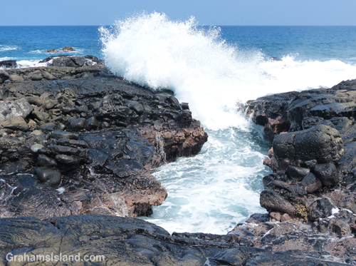
The water surges into a small inlet, probably an old lava tube.
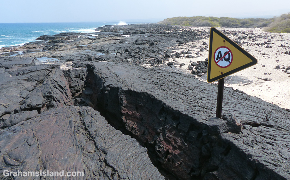
The sign at Mano Point which I think means ‘No Aquarium Fishing.’
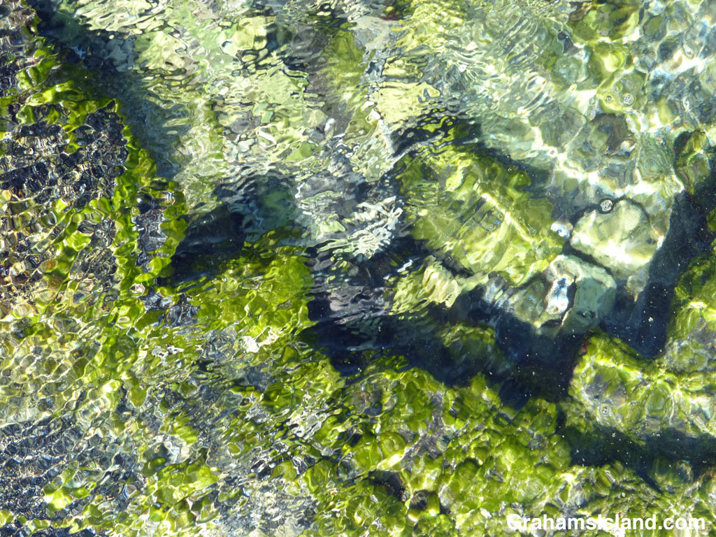
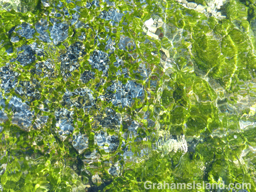
Water in a tide pool looking like a watercolor.

Water ripples in a colorful tide pool.
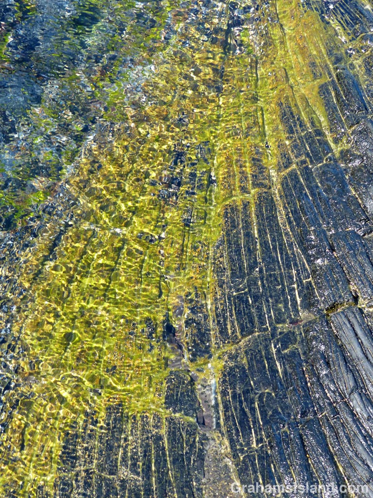
A tide pool, formed by ropey pahoehoe lava, shimmers with color.
This is the return leg of the hike in yesterday’s post.
The trail north from Kiholo is a hit and miss affair. Sometimes it’s clear, more often not. But the idea is to follow close to the coast. Think of it as Goldilocks would: If it’s dry, hot and still, you’re probably too far inland. If it’s cooler, but wet, you got too close to the cliff, tumbled into the ocean, and are probably in immediate need of medical attention. If it’s dry, but with a nice cooling breeze, then you’re probably just right.
The trail covers the same pahoehoe lava flow experienced on the way south. Here though, a refreshing breeze and an expanse of ocean views, including a pair of whales blowing and slapping some way off, enhanced the experience.
About half way along the trail is Ohiki Bay, a steep, mostly pebbled beach. A little farther still, some greenery appears, the cliffs dwindle, and the route follows the shore. Low pillows of lava have created inlets and pools, depending on the state of the tide. It was here that I found myself engrossed for the best part of an hour staring into the shallows. Incoming waves wrinkled the surface, highlighting the variety of colors and shapes.
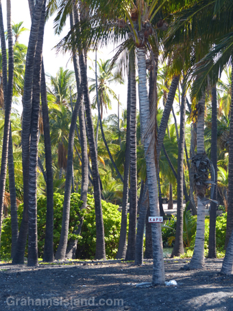
The greenery back from the shore is the Francis H. Ii Brown beach residence. Brown was a well-known Hawaiian golfer and legislator during the 1920s, ’30s, and ’40s who built this compound in the late 1920s. It was added to the National Register of Historic Places in 1986.
I’ve read that it’s possible to visit the place, being open one day a month, but I’m not sure that’s still true since the contact information on the sign has been erased. The encirclement of barbed wire and liberal use of Kapu signs don’t hint at any kind of welcome. Kapu is a Hawaiian word with several meanings including ‘sacred,’ ‘forbidden,’ and its modern day usage of “no trespassing’ or ‘keep out.’
Immediately past the Brown residence is Keawaiki beach, another steep and mostly pebbled beach, but the trail back to the truck, half a mile inland, follows the barbed wire fence and access road back to the main highway.
In all, the round trip hike was about 7 miles and took 5 hours with a good deal of dallying along the way, but in my book, a most rewarding experience.
For more information about this, and other hikes on the Big Island, go to bigislandhikes.com. (This hike is listed as Kiholo to Keawaiki, starting from the southern end.)
