
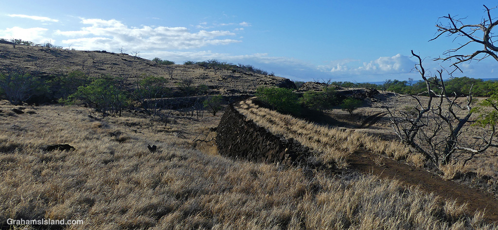
North of Mahukona, there’s a trail that follows the old sugar railway for a couple of miles. This photo shows one of the railway’s embankments, but there’s a bit more to it than that.
This embankment is not the original line. That can be seen to the left of it, the flat dry grass area, following the contours of the land. Traveling this route was very slow, so its course was smoothed out with embankments and cuttings. The original line’s course is to the right of the cutting. These changes cut the time it took to travel the line though it was never a high speed trip!

It sure looks dry. Sometimes slow travel is best I reckon
LikeLiked by 1 person
This part of the coast is very dry. I live about ten miles northeast and get 30 inches more rain a year!
LikeLiked by 1 person
It’s like that here as well. Even on my place, the bottom part gets more rain than at the house
LikeLiked by 1 person
Those kinds of variations can be very pronounced.
LikeLiked by 1 person
I like slow travel, Graham xx
LikeLiked by 1 person
I do too, but this railway was intended primarily for transporting sugar, so quicker transport was desirable. Also, the old winding route was more susceptible to rock falls and flooding.
LikeLiked by 1 person
That’s a great view, Graham. It’s fascinating to see the old, slow original line winding along the contour to the left, and how they tried to speed things up just a bit by building that embankment to smooth it out.
LikeLiked by 1 person
Yes, the reason for the changes is plain to see. The same can be said for some of the roads here too.
LikeLike
I like knowing the history these sorts of places. Thanks.
LikeLiked by 1 person
There’s a lot of history in this part of the island, which I too find interesting.
LikeLike