This Albizia tree leans precariously over a narrow road in North Kohala. The bottom photo shows the view from below it. I don’t tend to spend much time in that spot in case it chooses that moment to topple over, though the tree hasn’t budged in the 10 years I’ve lived here.
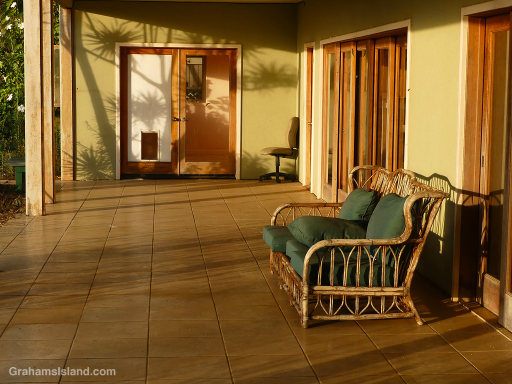
Looks very inviting, doesn’t it? A covered lanai in the late afternoon sun with a comfy, rattan sofa to relax on. The lanai above this is even more inviting, with a view toward Maui, currently blocked by trees.
But this is my neighbor’s old house, currently unoccupied and falling further into disrepair, with broken windows and a floor collapsing. I’d be leery of sitting on this sofa for fear of what’s living in it or that it might collapse. There’s also a chance that the hot tub on the upper lanai, could end up dropping on your head.
So perhaps, like many things these days, this is an invitation best experienced virtually.
Cattle Egrets are usually seen flying or on the ground, in the company of cattle, horses, goats, and lawnmowers, as they forage for food. I saw this one perched on an old snag, and it remained there for some time, looking this way and that, before taking to the air and disappearing.
I was driving home yesterday and I was struck by a contrasting view. The top photo shows the Keanuiomano Stream running down towards the Queen Ka’ahumanu Highway, the main road along the coast from Kailua Kona to the north.
I posted (here) about the river running high a few weeks ago, following the passage of Tropical Storm Calvin. Since then, there’s been a gradual decline in volume, but there’s still a trickle of water and the stream bed is full of pools. This area is popular with the goats, because it’s a good source of water and fodder after rainfall.
Crossing the road, the view is starkly different. The passage of Hurricane Dora triggered strong, dry trade winds. When fires broke out, they spread quickly (here). This view shows the aftermath of one of the relatively small fires, which burned about 500 acres next door to Mauna Kea Resort. The palm trees and houses on the left of the bottom image are part of the resort.
Ironically, when I took river running high photos, I checked out the other side of the highway for possible photos. I didn’t bother taking any, as I couldn’t see much because of the thick vegetation. Now it’s wide open down to the ocean.
Keanuiomano Stream has been bone dry for weeks, but yesterday’s passage of Tropical Storm Calvin transformed it into a roaring river. There was a lot of rain up in the Kohala Mountain area, which is the source of the stream. It was interesting, though, that the gullies that carry water off the leeward side of that mountain were still dry, so all that rain must have fallen mostly on the windward side and the east end of the mountain.
When the weather’s decent, Kohala Mountain Road offers some great views of the west side of the island. This one is of the South Kohala coast towards Hualalai. Kawaihae Harbor is on the right of the photo.
The North Kohala coast is quite rugged and exposed to strong trade winds and weather systems. This was a relatively calm day, but still capable of churning up white water along the shore.