


This week’s Sunday Stills challenge theme is ‘Paths.’ (See more offerings here.)
Kilauea Iki Trail is one of the more popular trails in Hawaii Volcanoes National Park. But last year’s volcanic activity, with numerous earthquakes, resulted in the park being closed for several months. Even after it reopened in September 2018, many parts of the park remained closed because the areas were too unstable to be opened to the public.
The Kilauea Iki Trail was one of those areas along with Thurston Lava Tube and Jaggar Museum. The latter two locations are still closed and Jagger Museum may never be reopened, but the Kilauea Iki Trail is currently listed as mostly open. Given that this is a loop trail, it would be wise to check ahead and find out what ‘mostly open’ means.
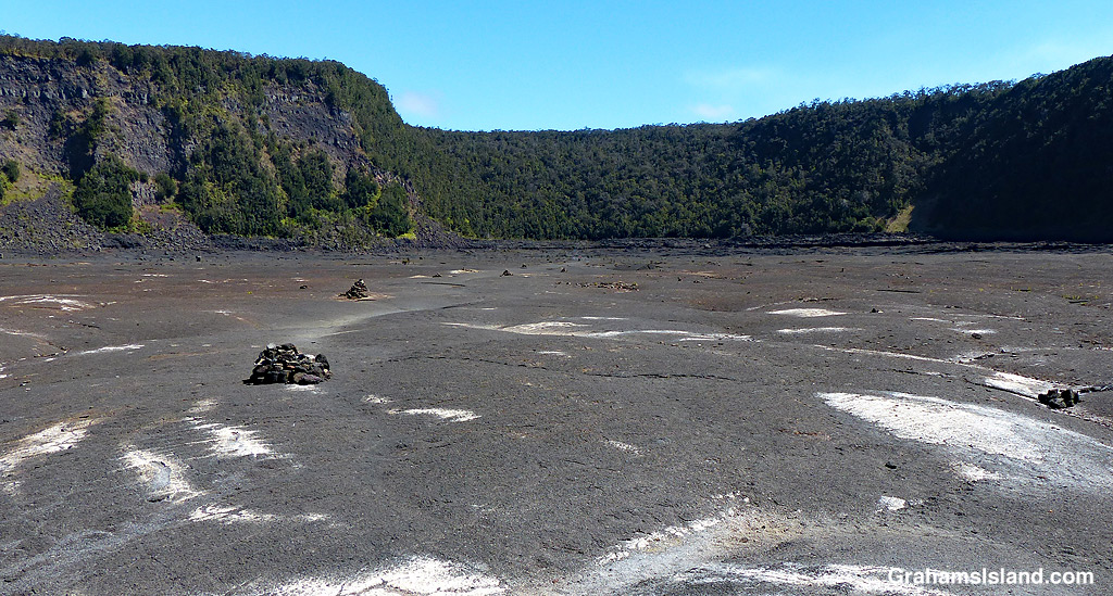
These photos were taken during a hike I took a couple of years back. The top photo shows the view from the part of the trail that follows the rim of the crater before it descends to the crater floor. The second photo shows two hikers heading out across the crater floor. The dark hill in the background is Pu‘u Pua‘i where a 1959 eruption poured lava out into the crater. The third photo shows hikers near the center of the crater where the path winds through broken areas of the crater floor. Below, cairns mark the trail across a flat area of the crater that leads to the switchback trail which takes hikers back up to the crater rim.
For more information about Hawaii Volcanoes National Park, go to nps.gov/havo/.

Awesome pictures! I didn’t realize Thurston Lava Tube and Jaggar Museum were closed. We’re planning a trip to the Big Island this fall. Do you think it’s still worth going to Hawaii Volcanoes? Have you visited the area since the recent eruptions?
LikeLiked by 1 person
You should check out the park’s website at https://www.nps.gov/havo/index.htm. They have the latest info there and a lot could change between now and the fall. However, I don’t think Jaggar will be open then, if ever. I’ve flown over the area since the eruption, but haven’t been to the park itself, though I might do so in the next few weeks. I have been down to Isaac Hale Park to see the new black sand beach and the edge of last year’s flow and that was awesome. If you have any questions about waht’s going on here, feel free to send me an email at grahamsisland@outlook.com. I’ll be happy to provide what info I can.
LikeLiked by 1 person
Thanks so much! I didn’t know about the new black sand beach. I’ll look at the links. Thanks for your help! 🙂
LikeLiked by 1 person
You’re welcome. Let me know if you need any other info.
LikeLiked by 1 person
Very interesting but there is something unnerving about the ground being so unstable, and visibly so too!
LikeLiked by 1 person
That’s true. It’s amazing to think how many people on Earth live close to active volcanoes or in places prone to earthquakes. I think it’s just something people get used to.
LikeLiked by 1 person
I wonder if part of us being adaptable is our ability to ignore or deny inconvenient truths!
LikeLiked by 1 person
That helps!
LikeLiked by 1 person
Great path showing the Big Island’s ever changing landscape, creating new paths every day. Gorgeous shots with good info, Graham!
LikeLiked by 1 person
Thanks, Terri. I might have to go down there again soon, just to see what things look like on the ground these days.
LikeLiked by 1 person