The approach to Kona Airport passes over barren lava fields and I often feel for people who must look down from the plane and wonder what the heck happened to the beautiful, tropical Hawaii they were looking forward to visiting. I know I felt that way on my first visit.
I saw these two fishermen on these rocks at the foot of a cliff in North Kohala. By the time I got organized, this is the photo I got. The photo I was after happened moments earlier, when the pair were being soaked by spray from a big set of swells breaking against the rock shelf the right of this photo. By the time the next big swells moved in the two of them had moved farther away from that spot and the photo opportunity had gone.
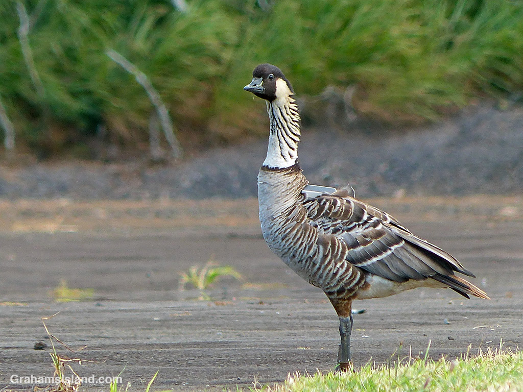
In last week’s Sunday Stills, Terri included a photo of a bald eagle with a transmitter on its back. In the comments, I mentioned that those trackers don’t stay on that long. Cue a few days ago when I saw this nene at Upolu. When I see nenes at Upolu, I report them to a contact at the Department of Land and Natural Resources (DNLR). The DNLR uses sighting information to build a picture of where the nenes are and where they go.
This is 32A, a bird I first saw in January of 2020. Back then, he didn’t have a tracker, but shortly after I saw him, one was attached. The DNLR thought the bird might be flying to and from Maui, but it turns out he wasn’t. Instead, the tracker has shown he mostly flies between Upolu, Hakalau, and Mauna Kea, all on the Big Island. However, the tracker is still on and still working, and I learned that they generally work for 3 to 5 years.
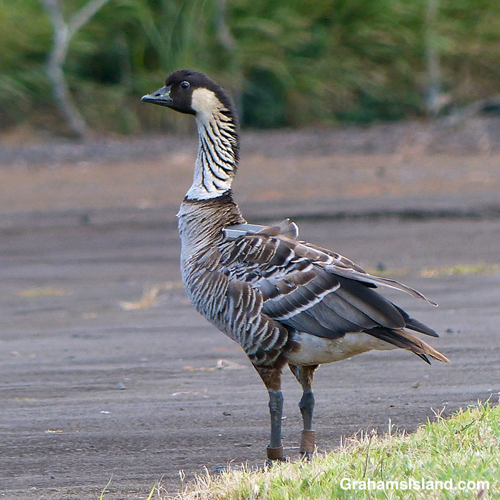
The reason I know this bird is 32A, besides the tracker, is that many nenes have bands on their legs to help with identification. In the second photo, the bands can be seen at grass level. The smaller band, on the left leg, is a US Fish and Wildlife tag. I’ve never been able to see any information on this smaller tag on any of the birds I’ve seen. The tag on the right leg is actually gray and shows the bird is one of almost 600 birds that were moved to the Big Island from a golf course near Kaua’i airport, between 2011 and 2016. These birds more than doubled the population of Big Island birds at that time. The fact that the tag is on the right leg means the bird is a male. The fact that the tag is brown and barely readable shows this bird has been wading through some very muddy conditions!
There are two streams that tumble down the hillside in Hawai’i Tropical Bioreserve & Garden. This one is Alakahi Stream and the section in the photo is known as Boulder Creek Falls for fairly obvious reasons.
For more information about Hawai’i Tropical Bioreserve & Garden, go to htbg.com.
A typical early Saturday morning at the beach. The campers set up Friday night, but not too many are up and about until it starts getting warm. This photo was taken just after 7 a.m. when coffee and breakfast is the priority for most of those who are up, though not the kids of course!
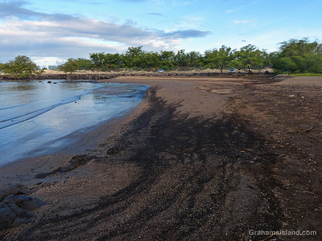
I’ve posted a fair number of photos taken on early morning walks in the vicinity of Pelekane Beach, between Kawaihae harbor and Puʻukoholā Heiau National Historic Site. During the winter months, I haven’t stopped there because it’s still dark when I go by, but recently I had an opportunity to visit in the now lighter early morning.
I parked my car in my usual spot and was about to get out and walk along the beach when I realized that there was no beach. Where I usually walked was now water. I got out and saw that the lagoon behind the beach now extended into the back of the beach. Not only that, but the beach was radically different. Instead on being gently sloping sand it was now marked with steep slopes and small sandy cliffs.
I think the dramatic changes are probably due to the storms and downpours that pounded the area this past winter. The good news is that it’s still a great spot for an early morning walk!