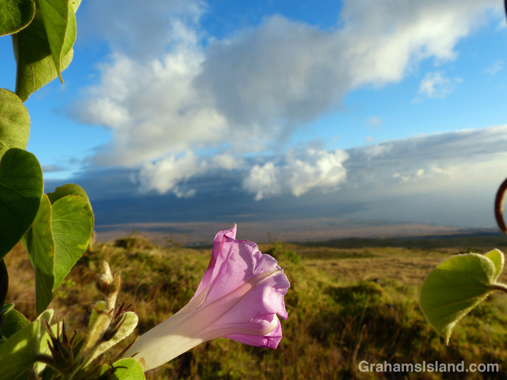
This common morning glory (Ipomoea purpurea) was twined on a fence alongside the mountain road, overlooking the Kohala coast.

This common morning glory (Ipomoea purpurea) was twined on a fence alongside the mountain road, overlooking the Kohala coast.

Miloli’i is an old Hawaiian fishing village near the southwest corner of the Big Island. A few miles north is Miloli’i Beach Lots Subdivision, a private community with an undeveloped park. Since the name includes the word ‘beach,’ it will come as no surprise to learn that there’s no beach of any description in the subdivision. There is, however, a reasonable spot to get in the water, at the park, which is accessed by crossing this little plank bridge. If you head straight out from there, in no time at all you’ll find yourself in Taiwan.

About ¾ of a mile east of the parking area at Kiholo State Park Reserve is this channel or ‘auwai. It connects what remains of Kiholo fish pond with the ocean. King Kamehameha 1 is credited with building the fish pond though he may have actually improved one that was already there. In his day, the pond was much larger than it is today, a lava flow from one of Mauna Loa’s periodic eruptions having filled in a good deal of it.
Turtles and, of course, fish go back and forth through this channel, which also flushes brackish water from the pond. While the pond is on private land, it’s always fun to pause on the little bridge and scan the channel to see if anything is on the move.
For more information about Kiholo fish pond, go to www.nature.org/ourinitiatives/regions/northamerica/unitedstates/hawaii/placesweprotect/kiholo-preserve.xml.
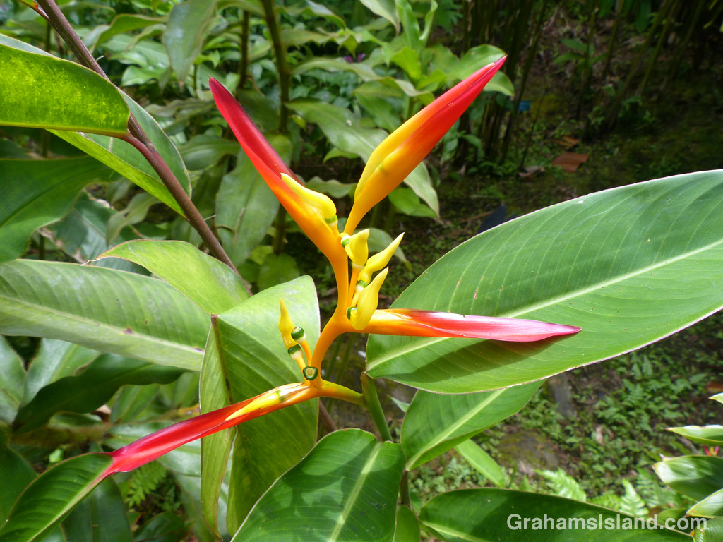
I saw this striking Heliconia Schumaniana at Hawaii Tropical Botanical Garden, north of Hilo.
For more information about Hawaii Tropical Botanical Garden, go to htbg.com.

The rolling pastures of the Kohala hills as seen from the mountain road in the late afternoon.
The Kauhola Point lighthouse is a modern affair, an automated light atop a tall metal pole. It replaced the previous, more traditional-looking lighthouse that was demolished in 2009. In the photo, the old base of that lighthouse can still be seen as several small block shapes toward the tip of the point. Therein lies the story.
The old lighthouse was demolished because erosion was eating away at the land near the base. The passing of time will surely remove even these remnants in the next few years.
In a way, this situation is a microcosm of the whole state. Many people think of the state of Hawaii as the eight main islands at the southeast end of the chain, but it encompasses hundreds of islands stretching away to the northwest for more than 1,500 miles. These small islands were formed over the same hotspot that fuels Kilauea Volcano today, but as the tectonic plate beneath the islands moved northwest, so the islands stopped growing and began to shrink under the forces of erosion. Over time, they too will disappear one by one.

Last May, I posted here about the hike from the end of Highway 270 down to the beach at Pololū and up on to the ridge on the other side. There, a bench awaits the hardy hiker, as well as wonderful views along the coast and into Honokane Nui Valley. I’m happy to report that the bench, which was in bad shape last time I was there, has been replaced by one with a plastic frame. While this might be aesthetically less pleasing, it should last a good deal longer.
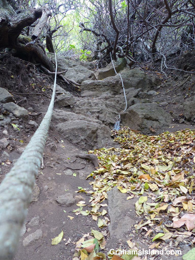
I also mentioned that not far beyond this point, the trail into Honokane Nui Valley got wiped out by a landslide in the earthquake of 2006. Now, instead of switch-backing down to the valley floor, the trail goes straight down. The precipitous drop is made passable by a series of ropes, to hang on to on the way down, and to haul on on the way up. It’s a great workout though not necessarily the safest one around. If a rope gives way, it could be a long and nasty fall. Let the user beware.
The top photo shows what the entry into this section of trail looks like. This part is steep, then it drops off out of view. The second photo shows a steeper section with two ropes to hang on to.
For more information about the Pololū hike, go to bigislandhikes.com/pololu-valley/.
This week’s posts are in response to the WordPress photo challenge on the theme of ‘transient.’
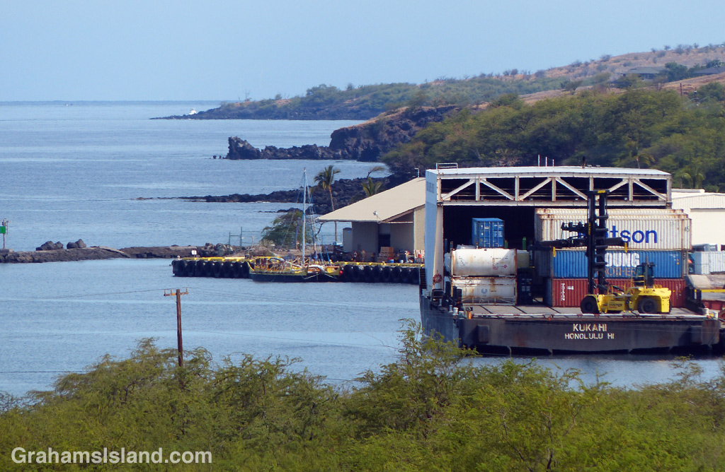
There are two commercial ports on the Big Island, Hilo on the east side, and Kawaihae on the west. This is a view of Kawaihae harbor with the inter-island barge unloading at the dockside. In Hawaii, many goods are shipped to Oahu and then distributed to the other islands on barges.
Also at the dock, beyond the barge, is the Hawaiian voyaging canoe, Makali’i. This boat had just returned to the water after a long refit on the island. The following day, it set off to join other boats in Oahu, welcoming home the Hawaiian voyaging canoe, Hokuleʻa, from its 3-year Mālama Honua Worldwide Voyage.
Two wildly different vessels, but both engaged in the very transient business of crossing open waters.
For more information about Hokuleʻa and the Polynesian Voyaging Society, go to www.hokulea.com.
