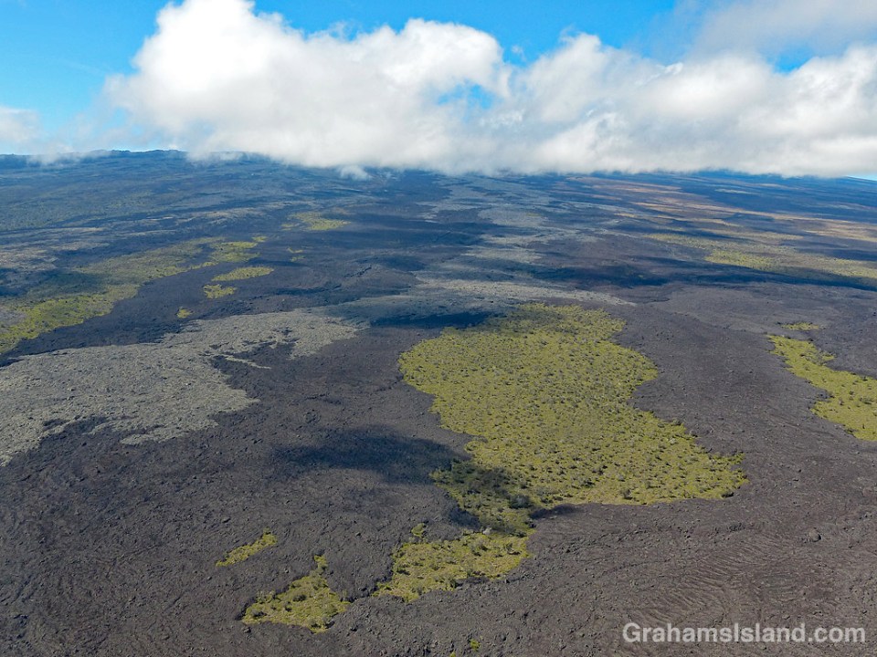
These lava flows, on the northeast slopes of Mauna Loa, show some of the colors lava takes. Together with the untouched islands of vegetation and cloud shadows, I think they make an interesting patterned landscape.

These lava flows, on the northeast slopes of Mauna Loa, show some of the colors lava takes. Together with the untouched islands of vegetation and cloud shadows, I think they make an interesting patterned landscape.
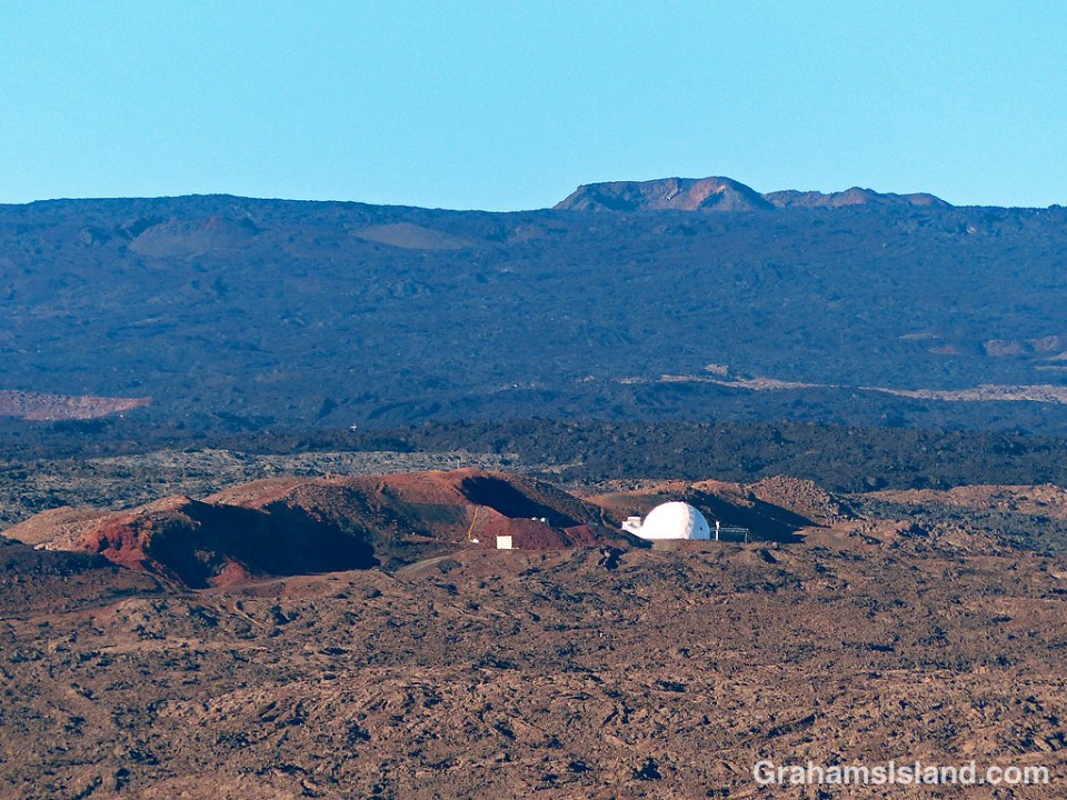
 Sitting at around 8,200 feet on the northern slope of Mauna Loa, is the HI-SEAS (Hawai’i Space Exploration Analog and Simulation) site. The dome is where a crew of volunteers stays, simulating what could face a similar crew living on Mars. The terrain has similarities to Mars, the crew can only go outside in space suits, and communications are delayed by 20 minutes as they would be in real transmissions between Earth and Mars.
Currently, I believe the dome is empty. The last mission, scheduled to run for eight months from February 15, 2018 through October 15, 2018, was canceled after a few days because of some kind of accident, the details of which were never released.
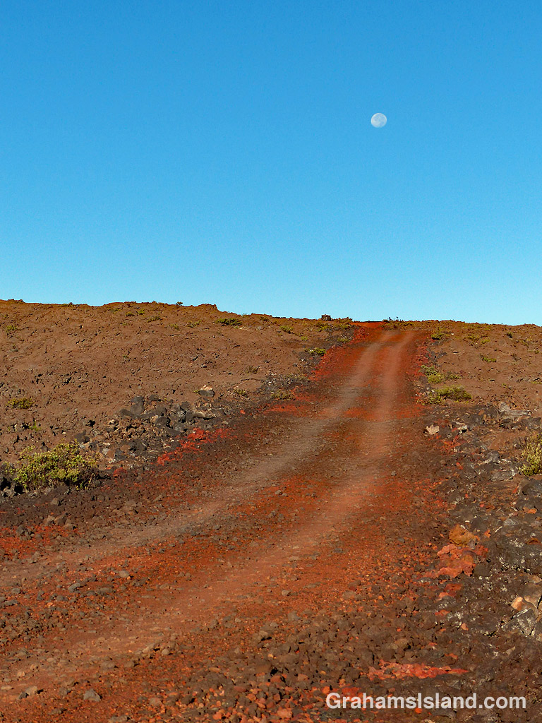
The second photo shows the approach road to the HI-SEAS site with a near full moon above. Public access to the site is not allowed for obvious reasons, but I do think it would be great fun to dress the kids up as little green Martians and take them trick or treating there. Imagine being inside the dome when there’s a knock on the door.
For more information about HI-SEAS, go to hi-seas.org/.

 The top of Mauna Kea is dotted with telescopes, but Mauna Loa’s summit is bare save for some small pieces of equipment monitoring the volcano’s seismic activity and small changes in inflation and deflation.
However, just above the 11,000 foot level on Mauna Loa’s northern slope is the Mauna Loa Observatory. The observatory is operated by the National Oceanic and Atmospheric Administration – Earth System Research Laboratory – Global Monitoring Division.
Since 1958, the observatory has been monitoring changes in the atmosphere and in particular, levels of carbon dioxide, one of the leading contributors to global warming. It’s the world’s oldest continuous carbon dioxide monitoring station, which is ironic given that it’s situated in one of the few countries on Earth not subject to global warming (and if you’re wondering how that works, all you have to do is go to the beach, stick your head in the sand and, voila, no more global warming.).
In the top photo, the two domes on the left house solar sensors operated by the Mauna Loa Solar Observatory which shares the site. The bottom photo shows the observatory under a near full moon. And in the middle is a view back down the road to the observatory, an up and down, winding one-lane road, which is one of my favorite drives on the island.
For more information on the Mauna Loa Observatory, go to https://www.esrl.noaa.gov/gmd/obop/mlo/.

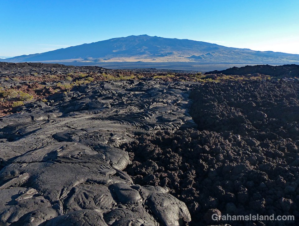
This photo shows the two main types of lava found on the Big Island. On the left is pahoehoe lava and to the right, a’a lava. They’re noticeably different. Pahoehoe lava is typically rounded and smoother, and the height of the flow is quite modest. A’a flows are characterized by a rough, clinker surface and the flow height is greater. Both types of lava can be produced by the same eruption and even in the same flow, depending on conditions.
Pahoehoe flows occur when lava is hot and fluid. Typically, pahoehoe flows result from an eruption that outputs lava at a lower rate, has a lower flow rate and a slower moving flow front. The slower movement of the flow allows a skin to form on the surface and this insulates the lava within. The flow is actually made up of a large number of ‘toes.’ Each toe flows for a short time, a matter of minutes. When it stops, the lava inside causes the toe to expand until the skin cracks and releases a new toe.
A’a flows are more viscous, but with a higher flow rate and faster flow front. The lava in the center of the flow is very dense with a layer of rough clinker on top. As the flow advances, the front tumbles over itself breaking into more rough pieces.
It’s easy to see from the photo that walking is much easier over pahoehoe lava than a’a lava. That’s when it’s cooled of course. When it’s red hot and flowing, it’s best not to get too close.
This flow was on the north side of Mauna Loa, looking across to Mauna Kea.
For a more thorough description of the difference between a’a and pahoehoe lava, go to http://volcano.oregonstate.edu/book/export/html/131
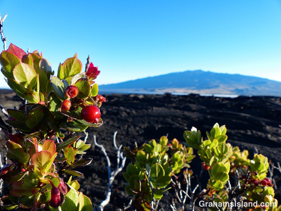
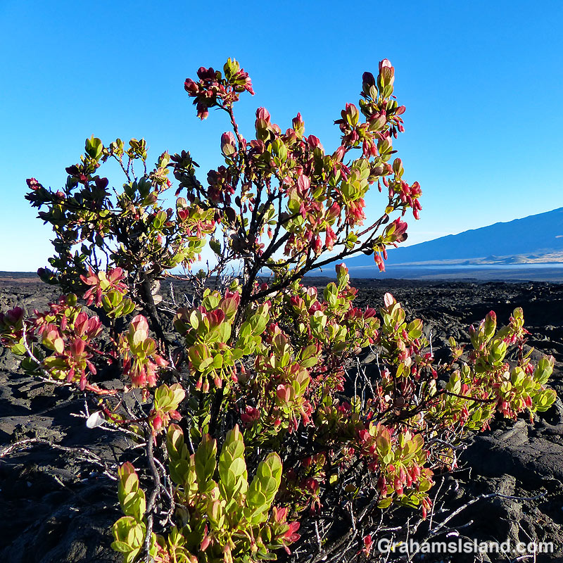
Ohelo ‘Ai (Vaccinium reticulatum) is an endemic plant also known as Hawaiian blueberry. It’s seen here growing on the inhospitable slopes of Mauna Loa, with Mauna Kea in the background.
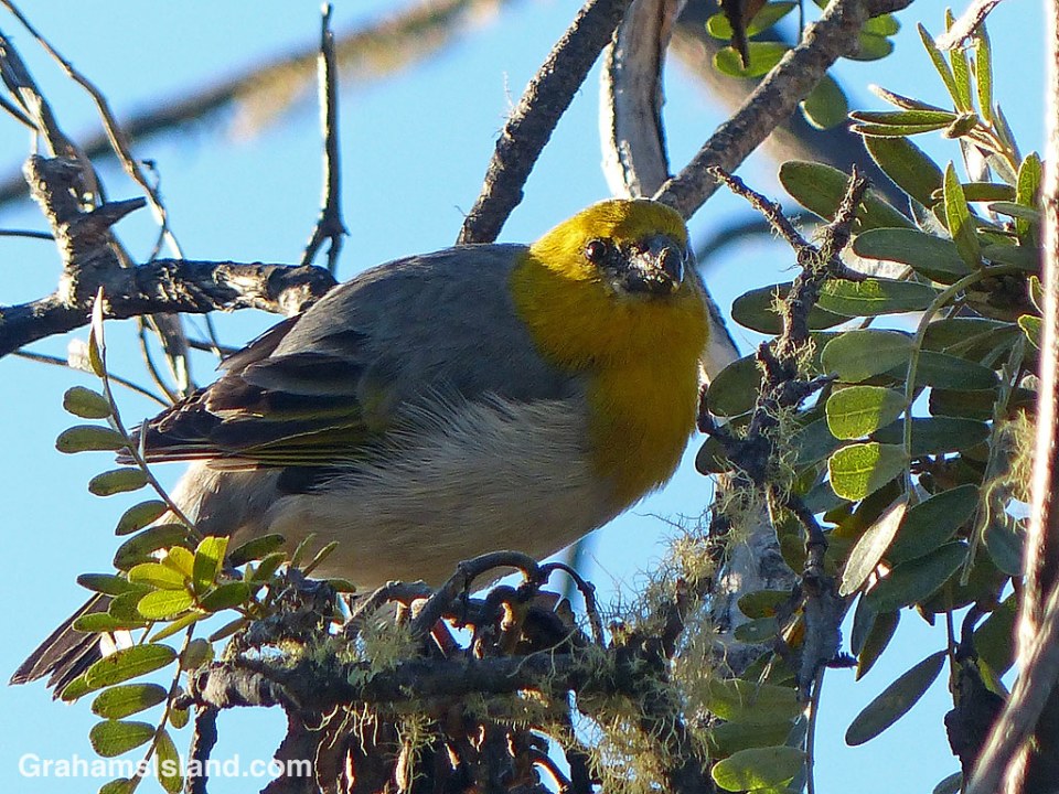
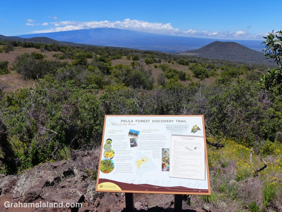
 I haven’t ever been a real birder, but since moving to Hawaii I’ve been more drawn to them. Because of this interest, one of my favorite places to visit on the Big Island is the Palila Forest Discovery Trail. Opened in July, 2016, this one mile loop trail passes through Mauna Kea’s unique, high-elevation dry forest.
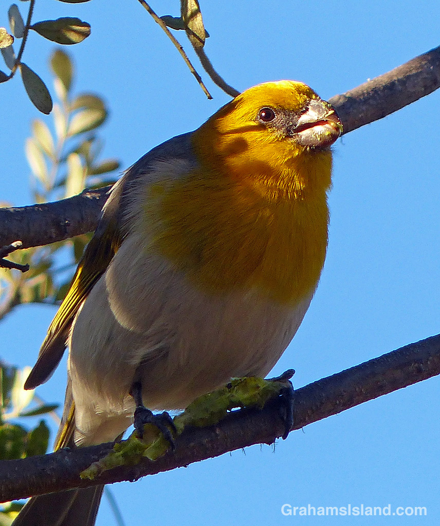
The endangered palila (top two photos, eating a mamane seed), which I posted about previously here, is the signature bird to be seen there, but there are many other kinds of birds, both native and introduced, in the area. In addition, the trail has a good variety of other wildlife from bugs to wild pigs. To top it off, the views towards Mauna Loa (below) and Maui are wonderful.
Finally, the drive to the trail goes along Old Saddle Road, which is a fun drive and a place where I often see pueos, the native Hawaiian owl, as well as wild turkeys and other birds and wildlife. All in all, a trip I never tire of making.
The Palila Forest Discovery Trail is featured on the Hawaii Island Coast to Coast Trail, a selection of sites that offer birding opportunities on the Big Island. For more information about Hawaii Island Coast to Coast Trail, go to hawaiibirdingtrails.hawaii.gov/.
For more information about Palila Forest Discovery Trail, go to dlnr.hawaii.gov/restoremaunakea/palila-forest-discovery-trail/.
Posted in response to the WordPress photo challenge, ‘Favorite place’.
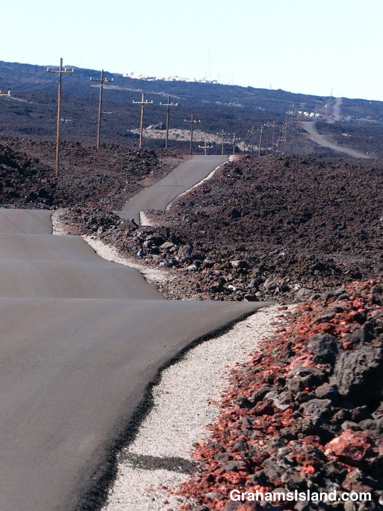
The road to the Mauna Loa Observatory is a one-lane highway, currently in good condition, and chock full of ups and downs and bends. It’s a fun drive with wonderful views, but it’s one that demands attention lest one drifts onto the unforgiving lava on either side or plows into an oncoming vehicle.
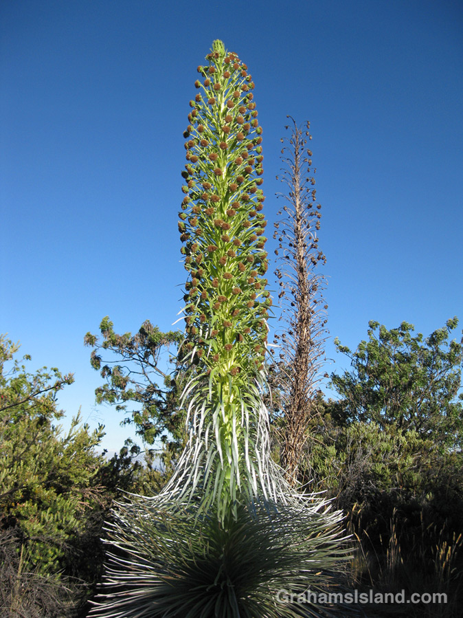
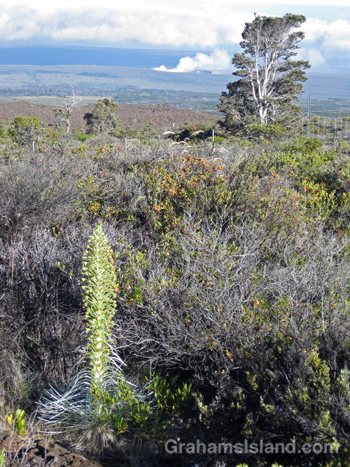
This is the time of year when silverswords bloom. These plants, members of the sunflower family, are endemic to Hawaii. There are slightly different silverswords growing on Mauna Loa, Mauna Kea and Haleakala on Maui. The plants are very susceptible to root disturbance and the activities of goats, pigs and humans has led to their decline. They’re making a comeback now thanks to fenced enclosures and careful management.
These photos were taken on Mauna Loa a few years back. The flower stalks were about 6 to 8 feet tall. The plants live for up to 30 years, but once they bloom, they die (like the one in the background of the top photo).
In the second photo, the ongoing eruption of Kilauea’s Pu’u O’o vent can be seen.
For more information about Mauna Loa silverswords, go to nps.gov/havo/learn/nature/endangered_ahinahina.htm.