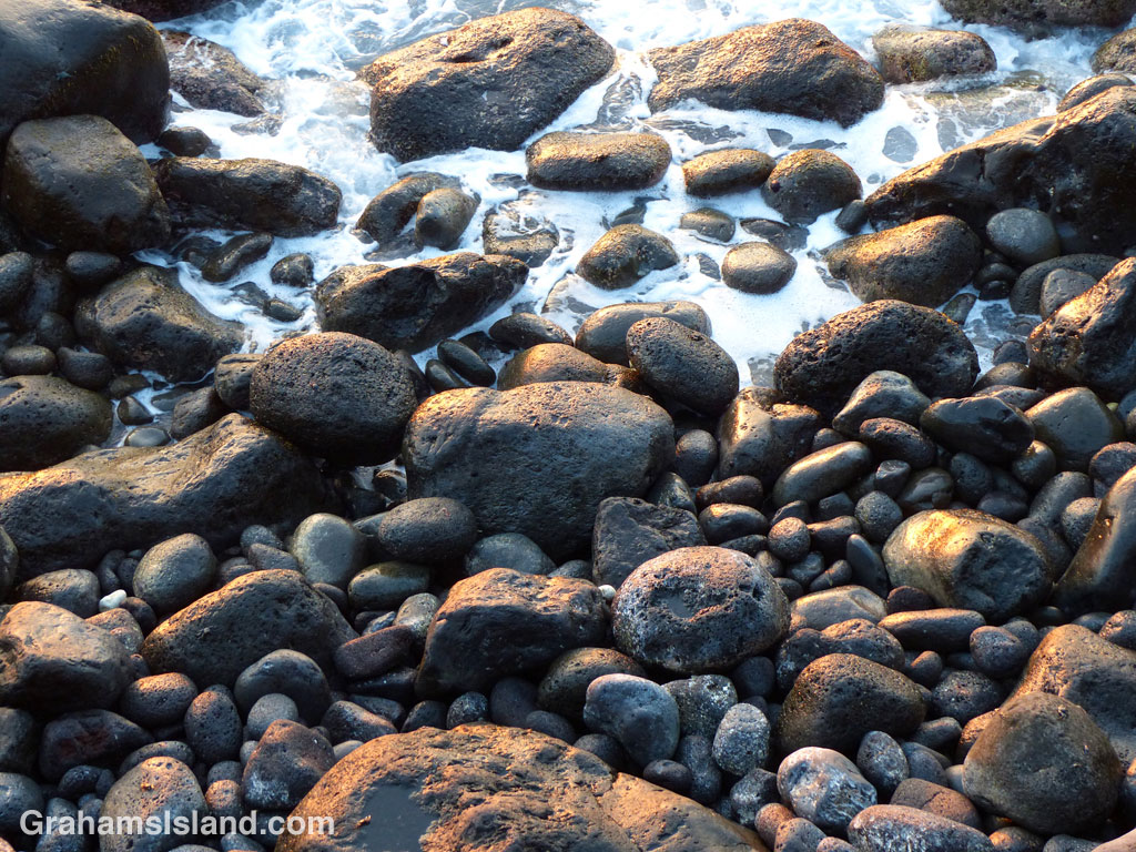
I like seeing how light reflects off wet rocks at the water’s edge.

I like seeing how light reflects off wet rocks at the water’s edge.
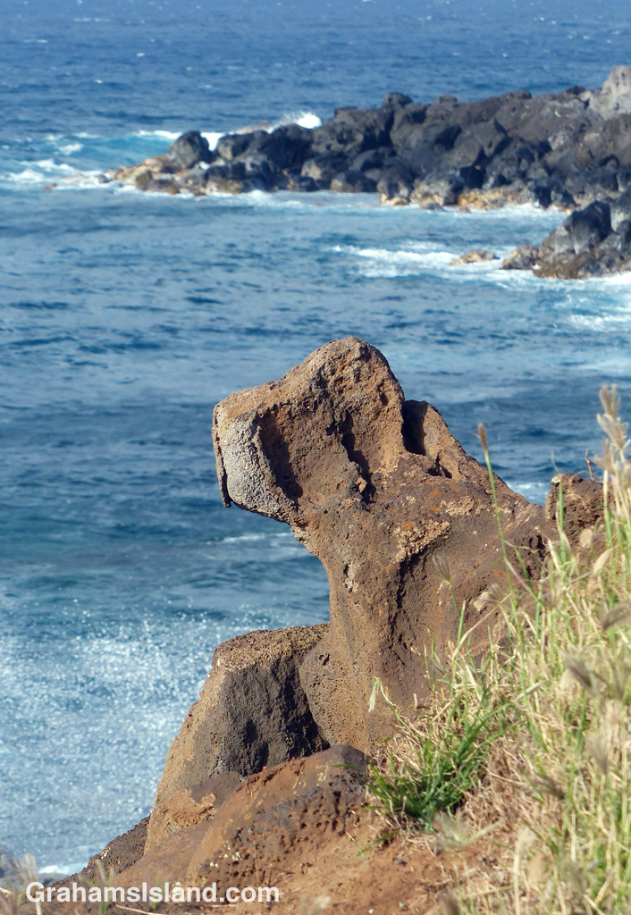
I was taking one of my regular walks along the coast when, for some reason, I noticed this rock that I must have walked past a hundred times or more. This time, something about the light and shadows suggested the profile of a sitting dog and I immediately dubbed it guard dog rock. Now when I pass it, that’s all I can think of, as if it has always held that significance for me.
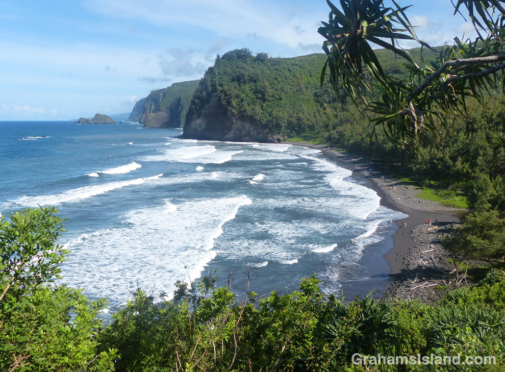

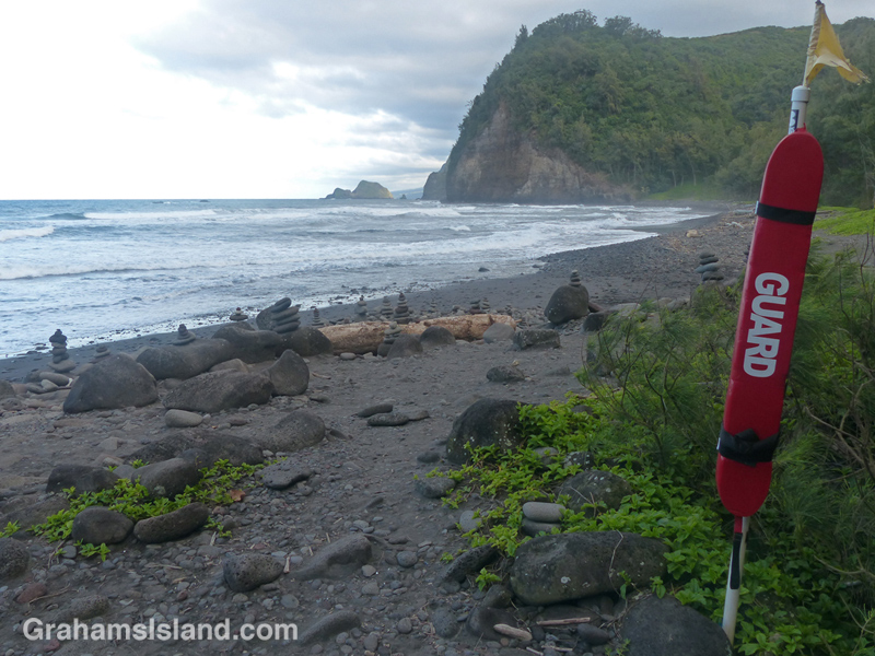
Pololu valley lies at the end of highway 270. It’s a popular destination. Most people find a parking space (not easy), snap a few photos, then climb back in their cars and try to get out without hitting anything (there’s no real turnaround).
A moderate number brave the steep switchback trail to the beach. This is worth it as better views open up, even part way down the trail. It’s 15-20 minutes down, 25-30 back up, depending on your condition and rate of hiking. If it’s rained recently the ground can be super slick.
Once at the beach there are options. (Bear in mind that only the beach is public. Everything else is private land.) There’s the view inland, up the Pololu River valley to the mist-shrouded Kohala Mountains. There’s the area just inland from the beach where people camp among the trees even though that’s not allowed. There’s the beach itself, which is mostly rounded rocks with black sand if the tide is low. And there’s the ocean, which looks inviting after that hot, sweaty hike, but is exceedingly dangerous with fierce rips, and only for those who really know what they’re doing, which excludes me.
Then there’s another option which very few take. This is to walk to the far side of the valley (following the trail just inland from the beach itself is easiest) until it trends upwards into a narrow gulley. This area gets a lot of rain, so this part of the trail is likely be muddy. It’s steep, narrow, and cut off from any breezes that may have been blowing on the beach. From time to time, views back to the beach open up and are worth taking in, if only to catch your breath.
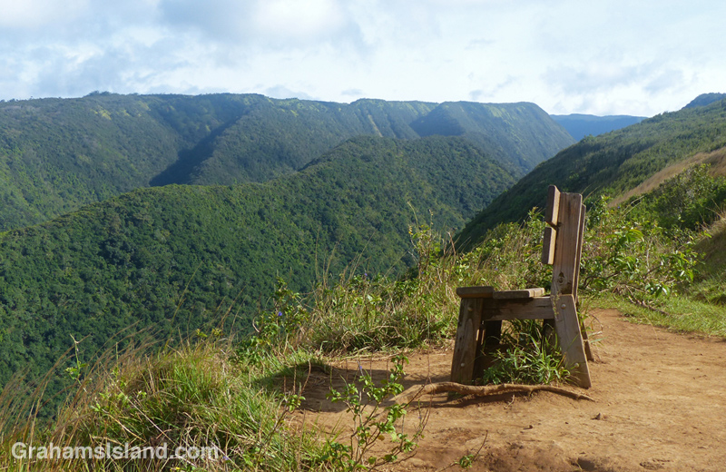
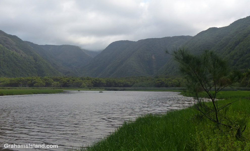
After a while the trail comes out into the open and is less steep. I always think this is the end, but it’s not. It dips again into a shallow valley with low hung branches and much traveled by wild pigs. Then it’s up the other side, far less steep than the first part of this stage, until the trail pokes through some low bushes into an open area. And there, in my humble opinion, is one of the finest sights on the island.
There are views up the Honokane Nui valley towards the mountains. There are views along the coast and out across the ocean. And to make it more enjoyable, there’s a bench where you can sit and take it all in. I have to say that on my most recent visit the bench was in much worse shape than the last time I saw it. The wood supports had rotted out on one side so there was a jaunty lean to it. But with care, it was still possible to enjoy a solid seat with an unparalleled view.
From the parking area to the bench is about an hour walk (your timing may vary). Beyond the bench, the trail descends into the next valley, but an earthquake in 2006 rearranged this, basically taking the trail and dropping it several hundred feet. You can still get down there, but it involves scrambling directly down a steep hillside using ropes that have been strung there. Bear in mind that the ropes are no doubt going through the same decline that the bench has.
From the bench, the hike back to the parking area is about the same as it was on the way out (steep hike down, steep hike up). The last time I did this I saw a ton of vehicles and people around the parking area, 20 or 30 people on the beach, and three on the hike from the beach to the bench and back.
For more information about the Pololu hike, go to bigislandhikes.com/pololu-valley/.
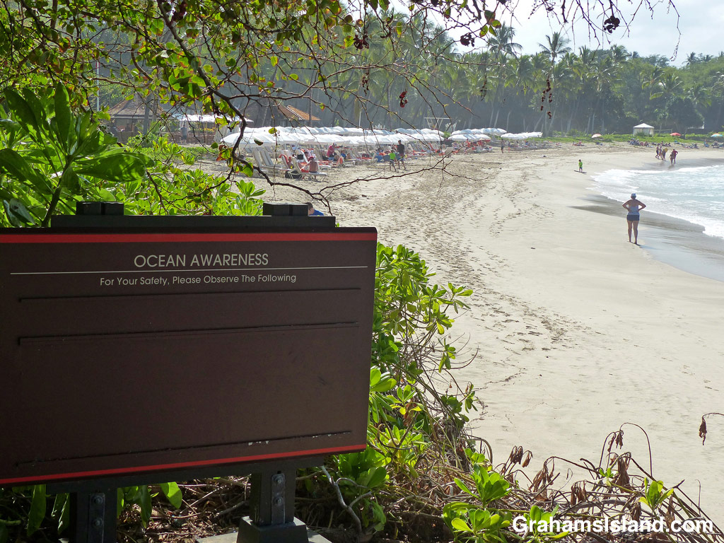
Usually, beach resorts have warnings about anything and everything that might pose a risk to patrons, that and expose the resort to any kind of liability. But on this day, all bets were off.
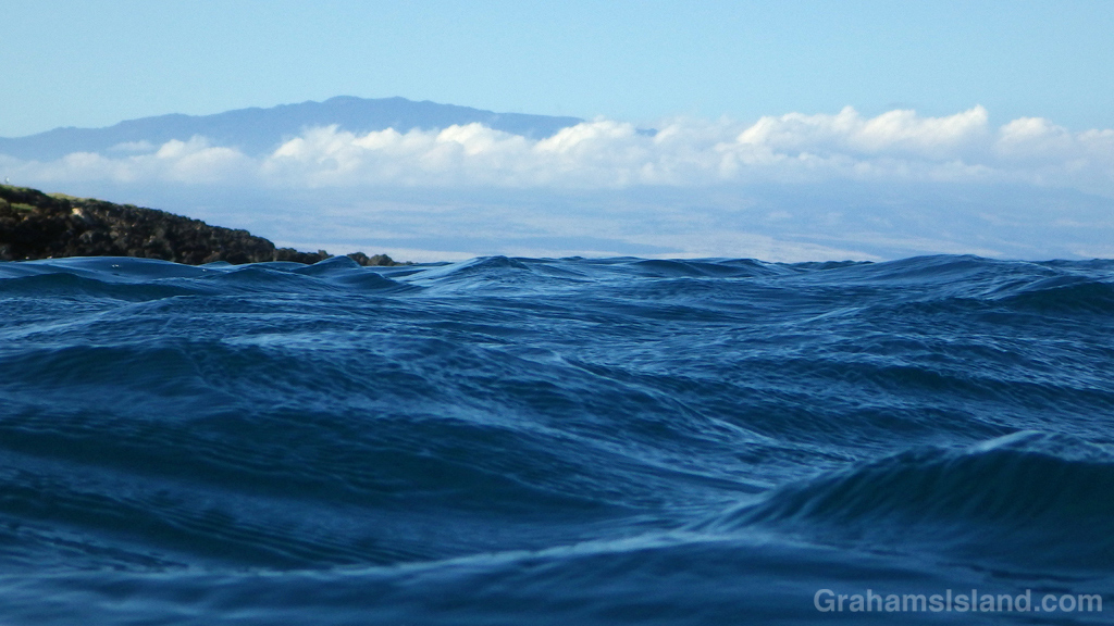
I like the different perspective when seeing things from the water, in this case Hualalai, the third most active volcano on the Big Island after Kilauea and Mauna Loa.

This fixer-upper shack sits on the coast not far from Mo’okini Heiau in North Kohala. It comes with a pair of vehicles that could also use a little work.
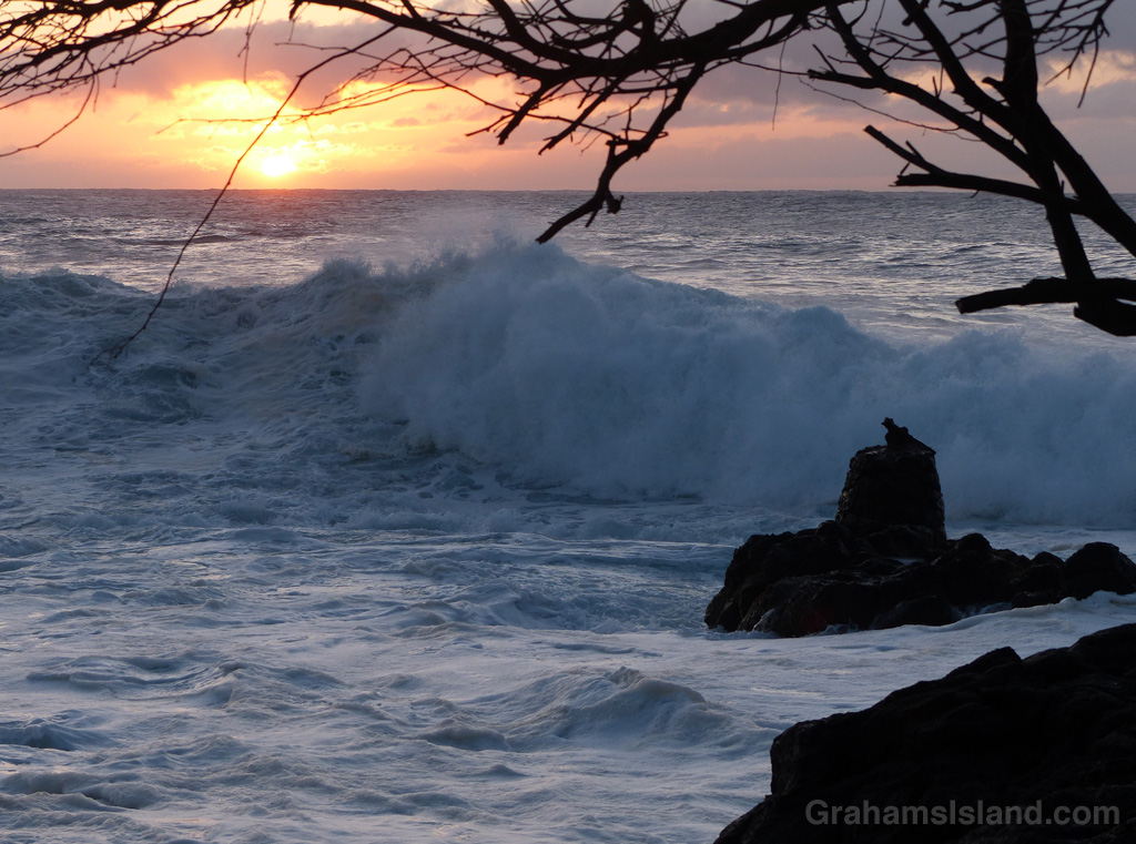
Surf rolls in as the sun dips toward the horizon.

This is I05 who was the subject one of my first posts on this blog. In that photo he was resting. Here we see him doing calisthenics. Ha, just kidding. This was actually a brief position adjustment between two lengthy spells of resting.
Monk seals, though few in number, often haul out to rest around the island. It’s important not to get too close while they do so. Besides being illegal, disturbing their resting periods can be stressful and adversely affect their health. Also, if they get used to humans being close by, it’s only a matter of time before there’s an encounter where someone gets bitten. This is likely to result in the animal having to be relocated to the uninhabited northwestern islands.
This was the first time I’ve seen I05 in almost 5 months so it was good to see him again and still in such good shape. The green tinge to his skin around his nose and flippers is algae and he will likely molt in the none too distant future. Molting is usually an annual occurrence, during which he’ll shed the top layer of his skin and fur.
I05 is the brother of Waimanu and was the uncle of Elua, the subject of this post. I’m not sure why, but as far as I know I05 was never given a name. I confess that I call him Igor, though I can’t remember why.
For more information about Hawaiian monk seals, go to www.pifsc.noaa.gov/hawaiian_monk_seal/ or www.marinemammalcenter.org/hawaii.
