
Cutting through the lava between Mauna Kea and Mauna Loa are these two roads. The lower one is Saddle Road, the upper one a road leading to the military base at Pōhakuloa Training Area.

Cutting through the lava between Mauna Kea and Mauna Loa are these two roads. The lower one is Saddle Road, the upper one a road leading to the military base at Pōhakuloa Training Area.
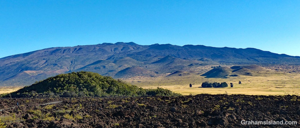
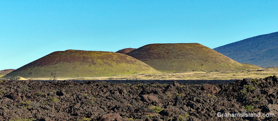
In Hawaii, one meaning of the word ‘pu’u’ is ‘a protuberance of some kind.’ This can be anything from a pimple to a hill, but ‘hill’ is the most common usage I encounter, as a general reference or in place names.
Pu’u O’o is the cinder cone that is home to the vent on Kilauea Volcano that was active from 1983 until earlier this year. Pu’u Wa’awa’a is an old cinder cone that is now managed by the Division of Forestry & Wildlife. A common thread is that, in Hawaii, a hill is a cinder cone because all of Hawaii is volcanic and the landscape is liberally dotted with cinder cones.
The top photo shows Mauna Kea and the large array of pu’us on its southern slopes. In the foreground is Pu’u Huluhulu, which means hairy hill. There’s a trail to the top of this pu’u which offers good views of Mauna Kea and Mauna Loa.
The bottom photo shows grassed over pu’us in Pōhakuloa Training Area, which is a military base located in the region between Mauna Loa, Mauna Kea and Hualālai volcanoes.
On the Big Island, several pu’us are accessible to hikers, usually with a trail curving up to the top and then around the rim of the pu’u. Even if the pu’u isn’t that high, it invariably stands out from its surroundings and offers good views.

It should be no surprise that Hawaii generates a good deal of solar power. Many houses have panels, but there are also larger arrays serving communities. These solar panels are at Waiki’i Ranch, a planned community, on old Saddle Road. I like that they’re sitting next to an old water tank.

Driving down old Saddle Road, one late afternoon, I saw this dramatic storm cloud sliding down the side of Kohala Mountain. Later, when I headed over the mountain road, I saw the cloud had settled over Kawaihae, dumping rain over the normally desert dry area.
Posted in response to this week’s WordPress Photo Challenge ‘Liquid.’

 On the first decent day after a long spell of grey, wet weather, I headed up to the Palila Forest Discovery Trail, just off Saddle Road on the lower slopes of Mauna Kea. I figured that even if the weather let me down, it’s a drive that I enjoy, so it would be OK regardless.
However, the closer I got to my destination, the less promising it looked. When I got to the junction, where a 4-mile dirt road leads to the trailhead, I almost turned around since it seemed unlikely there would be anything to see. The mountain looked shrouded in cloud, but since it’s only a 15-minute drive and the road didn’t look too muddy or washed out, I thought I’d give it a go.
When I pulled into the deserted parking area, the sky was grey, the air was damp, but it wasn’t actively raining and the visibility was OK, so I set out on the mile-long loop trail. As usual, I could hear a fair number of birds. It’s just spotting them that’s the trick there. But there are a couple of places on the trail that seem to get a lot of action and this day was no exception, including my first photos of a Hawaii ‘elepaio (Chasiempis sandwichensis sandwichensis).
Oahu, Kauai, and Hawaii Island each have their own species of the endemic ‘elepaio, which is a member of the flycatcher family. The Big Island version is more boldly marked than the other two and this one obligingly set down in a mamane tree not too far away, affording me a decent view and the opportunity to take photos.
One tidbit that I found interesting about the bird is that when ‘elepaio were seen to frequent a given koa tree, this was a sign to canoe makers that the tree was likely insect infested and unsuitable for making a canoe.
For more information about Palila Forest Discovery Trail, go to dlnr.hawaii.gov/restoremaunakea/palila-forest-discovery-trail/.
Posted in response to this week’s WordPress Photo Challenge ‘Unlikely.’

A view of Hualali volcano in the late afternoon sun, sandwiched between the lower slopes of Mauna Kea, in the foreground, and heavy clouds overhead.
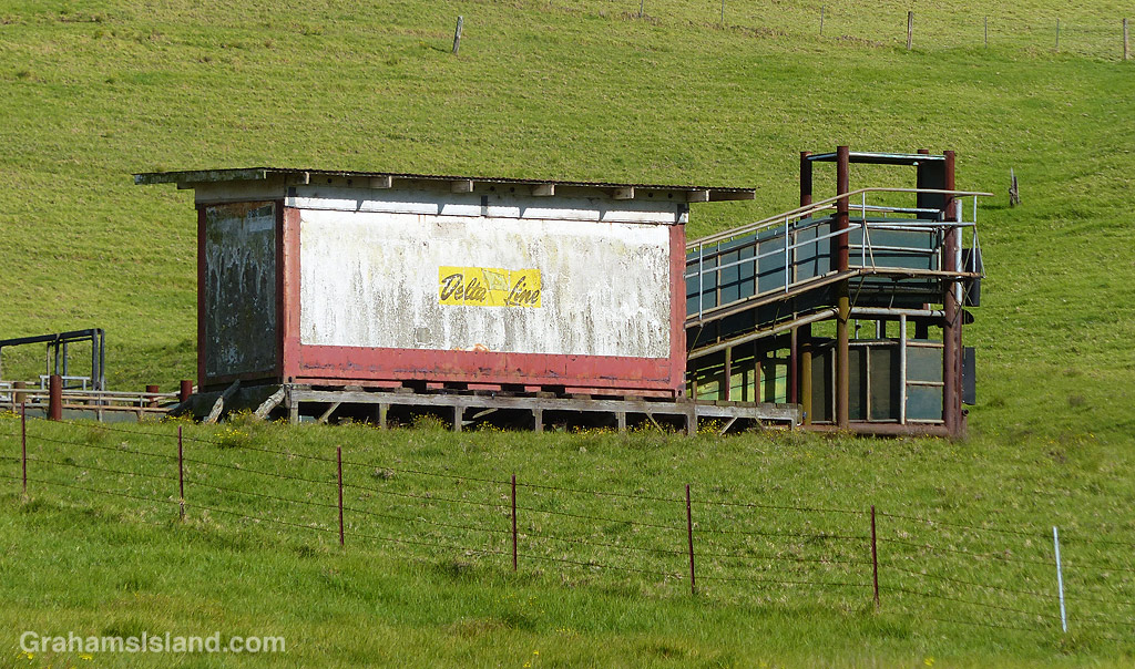
As old Saddle Road winds upward from Waimea it passes through ranch land. This corral is clearly a going concern as evidenced by the loading ramps and surrounding fencing, but my eye is always drawn to the weathered ‘Delta Line’ structure. I’m not sure what it once was or what its purpose is now, but it appears to be in regular use.
Besides cattle, this is a good area to see pueo, the endemic Hawaiian short-eared owl.

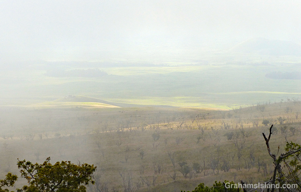
Many times when I travel on Old Saddle Road, there comes a point where I’m exiting the clouds or disappearing into them. I like to take photos in this zone, experimenting as the level of the clouds comes and goes.
The top photo has that transition from clouds to clarity, but I also like the ethereal quality of the lower photo as patches of sun illuminate the pastures below.
 Graham's Island