
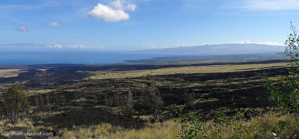
Looking north from the old Mamalahoa Highway, in the distance is Kohala Mountain on the right and Maui on the left. The black lava curving down to the ocean is the Kaʻūpūlehu lava flow from Hualalai Volcano. This flow, which occurred in 1800/1801, was the last time Hualalai erupted, though the volcano is still considered active.

So, does that render the soil unusable for a time? I know here, where the time since eruption is in the 10 thousands at least, the soil is top rate.
LikeLiked by 1 person
A lava flow is very inhospitable growing territory, where most of the soil and vegetation has been eliminated. There are tenacious plants which can survive in such territory, and these, growing and dying will create new soil. On the west side of the island, this is a very slow process because it’s so dry. It happens quite a bit quicker on the east side because it rains there most days!
LikeLike
That’s very informative, thank you, Graham.
LikeLiked by 1 person
You’re welcome.
LikeLike
I guess the flows turn into solid rock so they scar the landscape permanently. Although it is not really a scar. Just nature doing its thing.
LikeLiked by 1 person
All of Hawaii is lava so the scars aren’t permanent. It depends on how much rain falls and this part of the island is mostly very dry. Flows this old on the east side would have pretty good vegetation coverage by now.
LikeLiked by 1 person
It’s a beautiful scene xx
LikeLiked by 1 person
It’s a great view, and interesting too. I hadn’t realized this was the last flow from Hualalai.
LikeLiked by 1 person
Beautiful!
LikeLiked by 1 person
It’s an awesome view.
LikeLike