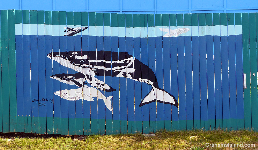
This humpback whale art was painted in 2016 on a fence around the local car tow company, which is located in the heart of downtown. There’s also a whale tail farther down the fence.
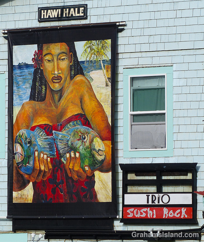
This image has been on this wall for as long as I’ve lived here. It was getting very faded until recently when this vibrant new version appeared. It was only then that I noticed that the image is painted on some kind of canvas and attached to the wall.
For authentic street art it’s hard to beat Blake’s Corner, where a variety of ever-changing small bits of art can be found amongst a small patch of aloes and other plants, at the end of a covered walkway.
This week’s Friendly Friday challenge theme is ‘Street Art.’ See more responses here.
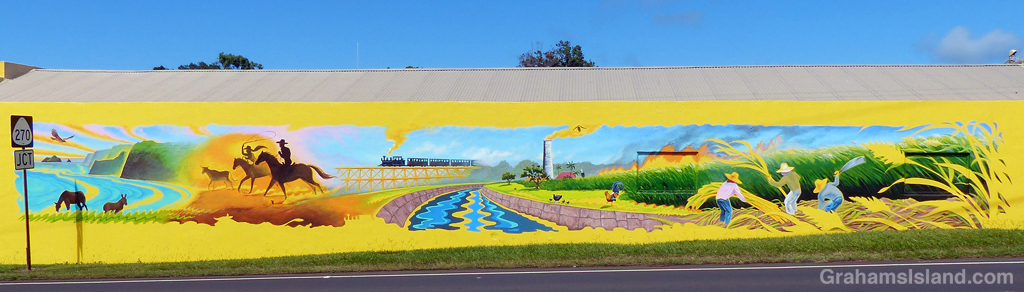
Here’s a tour of some of the street art in beautiful downtown Hawi. The actual walking tour would take you about the same amount of time as it will to read this post, since Hawi is not a big place. But, it being an arty community, there’s a fair bit of street art in a small area. As for graffiti, I posted a bit of that just the other day (here).
I posted about a mural in progress a while back (here). This is another mural on one of the solid fence sections that surround the concrete slab, all that’s left of the Hub Pub after it burned down.A mural on the side of Hawi Post Office, painted by local high school kids, which I previously posted in 2018 (here).
This week’s Sunday Stills challenge theme is ‘Winter.’ See more responses here.
There are seasons in Hawaii, but they’re not as markedly different as they are on the mainland. So when it comes to a seasonal challenge theme I tend to fall back on migratory creatures. When it comes to winter, I think of humpback whales.
Humpbacks spend their summers in Alaska, which is their prime feeding ground. They come to Hawaii to calve and to mate. The first humpbacks arrive in Hawaii in October or November, but the high season for them is January through March. They can be seen anywhere around the island, but the prime viewing spots are on the more sheltered west side, from Kailua Kona all the way up to Upolu, at the island’s northern tip.
In Hawaii, a pu’u is a hill. These are old cinder cones that dot the landscape from the coast to the top of Mauna Loa and Mauna Kea.
Along Old Saddle Road, the land and it’s pu’us are grass-covered. This pastureland is cattle, horse, and sheep country, with a lot of goats thrown in for good measure. The land is steep and and rough and the grass varied, but the rainfall is heavy enough that there’s a lot of it.
Old Saddle Road is one of my favorite drives on the island, particularly in the early morning (above) and late afternoon (below).
Posted in response to Friendly Friday challenge theme of ‘Splendour in the Grass.’ See more responses here.
This week’s Sunday Stills challenge theme is ‘From Your Window.’ See more responses here.
There’s a very large mango tree in the yard, which is an erratic producer of fruit. Some years, there’s not much. Other years, the tree looks like an overdecorated Christmas tree. In those times, it’s best not to spend much time under the tree, particularly when it’s windy, because the thud of fruit hitting the ground is frequent (though, standing under that tree is risky any time, since large branches are prone to breaking off).
When fruit does start to fall, wild pigs move in. There are always windfalls available and the pigs love this easily-accessed treat. The pig population around here varies, mostly depending on whether hunters are active in the area. Pigs are nocturnal, so do most of their foraging at night, but the younger ones are more likely to venture out in daylight hours, either because they haven’t yet learned how dangerous that is, or because it’s harder for them to get a look-in when the big pigs are around.
This year, there have been as many as nine pigs in the yard at one time, but this younger pig was out by itself. As there were quite a few mangos on the ground, it was being quite choosy as to which ones to eat. Hard ones will be shunned, unless that’s all there is. This mango was just right, and the pig was tucking in until something disturbed it and it ran off, but not without its prize.
Mostly the pigs are a source of entertainment and don’t bother me. The exception is when they roam past the bedroom window in the middle of the night and get into arguments, grunting and squealing. They also have a very ripe smell, which drifts in through the open window. Fortunately, they’re easy to disperse. I just do my large, angry dog impersonation, consisting of a few loud barks, and they disappear like they’ve been shot out of a cannon.
This week’s Sunday Stills challenge theme is ‘Bodies of Water.’ (See more responses here.) Last Sunday, I posted photos of the Kohala valleys. This week, I’m posting a bit about what goes on in them and elsewhere on the island.
The top photo is shows the mouth of the Waipi’o River looking back toward the cloud shrouded Kohala hills. The river, is fed by water passing over Hi’ilawe Falls and other waterfalls deep in the fingers of the valley. Like all water courses on the Big Island, its flow is greatly increased by the often heavy rainfall.
The second photo shows a waterfall, farther down the coast, cascading into a pool at the bottom before flowing out to the ocean. Some of these waterfalls drop more than a thousand feet. Some cascade into valleys, some directly into the ocean. During dry spells, the water flows are greatly reduced and many falls, those that are entirely rain fed, disappear for a while. When rains are heavy, the water flow is so great that some falls blend together to form a sheet of falling water.
On the east side of the island is Wailuku River, the longest river on the island. This flows down to the ocean in Hilo, and on its way, tumbles over the aptly named Rainbow Falls (third photo). The falls and rainbows are best seen in the early morning. This stretch of the river is very dangerous with flash floods being common. People get swept away here every year.
Finally, the bottom photo shows the biggest lake on the island, which can be found at the top of Mauna Kea! Lake Waiau is fed by rainwater and snow melt, mostly in the winter. That it exists at all is something of a mystery. The ground on Mauna Kea is highly permeable, and it’s not fully understood what the layer is beneath Lake Waiau that enables it to retain water. Lake Waiau is not just the biggest lake on the island, it’s the only one. Green Lake, the biggest lake previously, disappeared during Kilauea’s 2018 eruption (photos and story here).
This week’s Friendly Friday challenge theme is ‘Color Harmonies.’ See more responses here.
I like the colors in this photo of a kayak fisherman, with his red hat and yellow kayak. He has a fairly typical setup, with two or three rods attached in one way or another. He’ll have some bait in the kayak and probably a few beverages and snacks.
I was surprised to see him passing so close, but figured that he’d seen me and was being careful. In the end, I was glad I stopped to take this photo because just after I started swimming again, a large lure and hook passed in front of me on his unseen trailing line. Had I not stopped I’d probably have been hooked, reeled in, gutted, and barbecued. Not a bad way to go, really, I guess.
This week’s Sunday Stills challenge theme is ‘Mountains and Valleys.’ See more offerings here.
Kohala Volcano is the oldest volcano on the Big Island and has long been extinct, having last erupted around 120,000 years ago. Since then, the various processes of erosion, from rainfall to landslides, have carved deep valleys into the volcano. Waipio, the easternmost of these valleys, is accessible by vehicle (4-wheel drive only), horseback, or on foot. It has permanent inhabitants so access within the valley is restricted.
The other valleys are most easily seen from the air, along the Kohala coast. The top photo shows Waimanu Valley. This can be accessed by foot from Waipio, after a long and arduous hike, and permits are available for camping there. Waimanu River can be seen on the far side of the valley and is one last obstacle to be crossed to reach the camp site, which is in the strip of land between the river and the ocean. The steep sides are typical of these valleys and another consideration to keep in mind when thinking about hiking here.
The middle photo shows a fairly typical view directly into one of the valleys from the ocean. Again, notice the steep valley sides and the abundance of foliage, evidence that this is the wet side of the island.
The bottom photo shows valleys cutting through the mountain farther inland. There’s little or no water running in this view. A few valleys have spring-fed streams, but most depend on rain for water flow. However, when it does rain, it can rain long and hard. Flash floods are common. It’s not a shock when campers in Waimanu Valley are cut off and unable to make the return hike.
I’ll do another post about the water courses for next week’s Sunday Stills challenge.