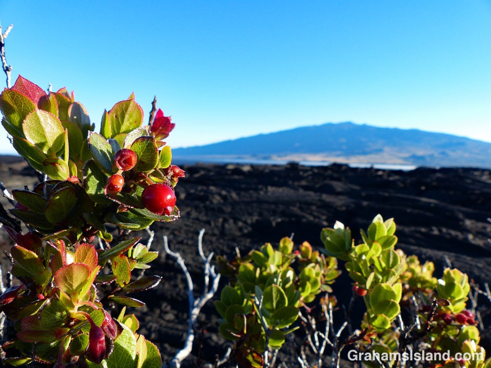
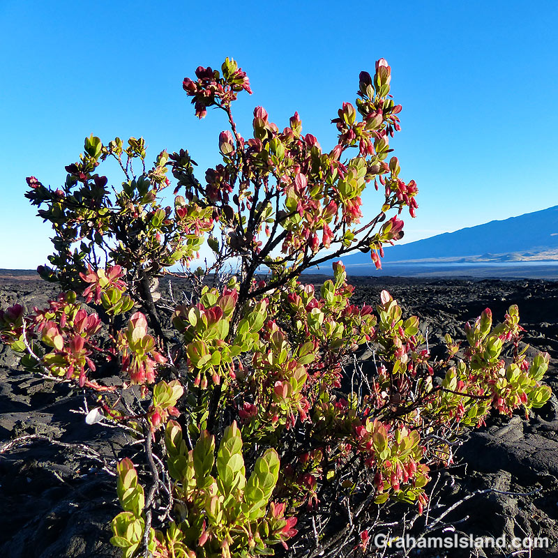
Ohelo ‘Ai (Vaccinium reticulatum) is an endemic plant also known as Hawaiian blueberry. It’s seen here growing on the inhospitable slopes of Mauna Loa, with Mauna Kea in the background.

Ohelo ‘Ai (Vaccinium reticulatum) is an endemic plant also known as Hawaiian blueberry. It’s seen here growing on the inhospitable slopes of Mauna Loa, with Mauna Kea in the background.

 Over the last few weeks, several people have asked me how I’ve been affected by Kilauea Volcano’s latest eruption in a subdivision in Puna. I’ve been happy to respond that, where I live, I’ve hardly been affected at all.
I live near the northern tip of the Big Island and the current eruption is taking place in the southeast corner of the island. This eruption is also not like the recent one in Guatemala, with a deadly explosive element. Instead, it has settled into a steady, if prolific stream of molten lava, burning buildings in its path on the way to the coast. This behavior makes the direct impact of the eruption a more localized affair. If a person lived in the vicinity of the lava flow path, they’ve probably been forced to leave their home with no indication of when they might be able to return. But for the rest of the island, the lava itself poses no threat. What does affect, not only this island, but also others in the Hawaiian chain, is vog.
Vog, a blend of the words ‘volcanic,’ ‘smog,’ and ‘fog,’ is the result of gases from an eruption reacting with moisture and sunlight. It varies in intensity depending on the output of the volcano and it varies in who it affects depending on the wind.
Vog has been around a while, since the volcano has been erupting, pretty much continuously, since 1983. That 1983 eruption was at the Pu’u O’o vent. Then, in 2008, a new vent opened in Halemaʻumaʻu Crater, within the summit caldera. With two active vents, the vog got noticeably worse. This year’s new eruption has added to the output and also thrown in some ash deposits on areas within range.
The northeast trades are the dominant winds here and when they blow, the vog is blown along the south coast of the Big Island and then up along the west coast. Typically it will reach Kailua Kona, about halfway up, or a little farther north.
Up here on the northern tip the trades blow strong, too strong for many people who find it too windy. But the advantage of those winds is that they keep the vog at bay. Ironically, this past winter, the winds were more variable and we had more vog up here than usual. But since this current vent opened, the trades have been fairly consistent and have kept this part of the island mostly vog free.
Yesterday was an exception. The winds weakened and the vog crept north, which is what the photos are about. The top one, I’ve run before. It shows Hualalai Volcano seen from the water off the north Kohala coast. The bottom photo was taken yesterday from roughly the same area (though without zooming in). Hualalai is gone! That headland is about 400 yards away and I’d estimate that visibility was around 2 miles. I couldn’t even see the horizon. The water just faded away into the vog.
Even when it’s voggy, it doesn’t bother me too much, but some people are more affected. The air becomes acrid and sore throats and noses are common. Luckily, the winds picked up during the day and conditions improved, so we’ll see what happens.
 A final response to the last edition of the WordPress photo challenge with a theme of ‘All time favorites.’
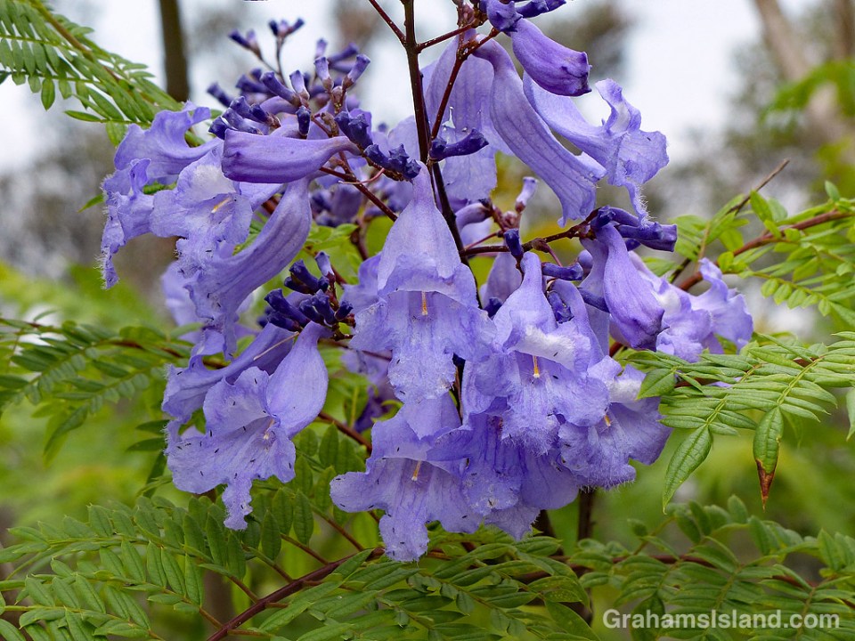
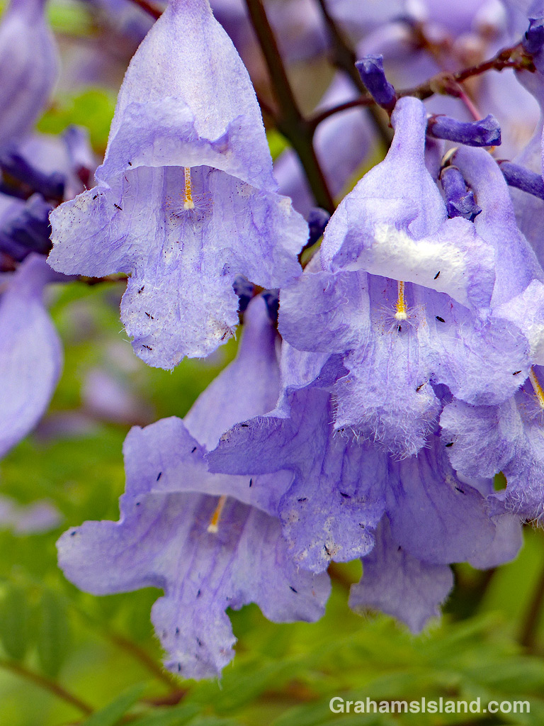
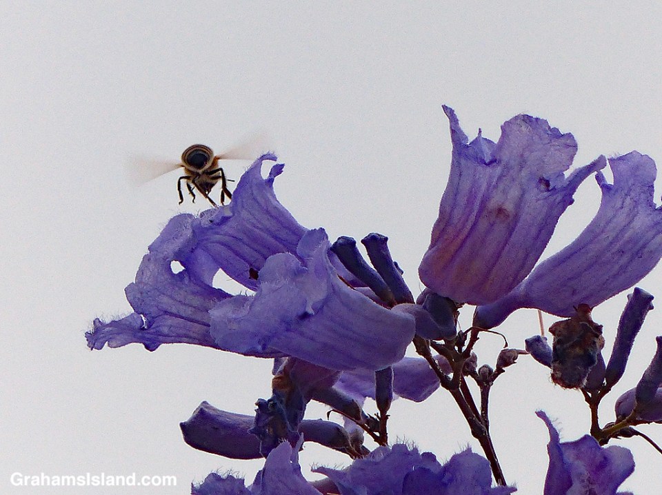
I headed back to Pu’u Wa’awa’a last week, because this is the time of year when several kinds of trees are in bloom. One of those trees is the jacaranda, which blooms from April to June, and produces masses of blue to lavender flowers. Jacarandas prefer cooler elevations so the lower areas of Pu’u Wa’awa’a are right in their zone.
I wasn’t disappointed. Several trees were covered with these delicate flowers, which somewhat made up for the fact that the entire hill was shrouded in thick vog, exacerbated by the ongoing eruption down in Puna.
 Another response to the last edition of the WordPress photo challenge with a theme of ‘All time favorites.’
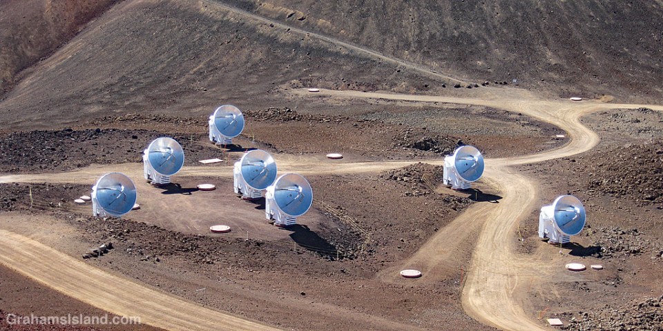
I post this for two reasons. The first is that recently I had an exchange on this blog with the wife of the Director of the Submillimeter Array (SMA). The second is that Mauna Kea is a favorite place of mine to visit.
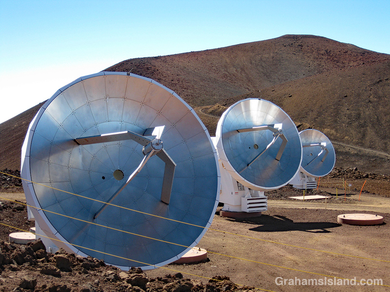
So here are a couple of photos of the SMA taken a few years back. The dishes are mounted on those little round pads in the photos, and they can be moved to different pads to produce different configurations. In my ignorance of most things scientific, I marvel at the idea of moving a dish a few meters makes a big difference in observations of things way the heck out there in space. That’s not an official measurement there.
The top photo shows seven of the eight dishes that make up the array.
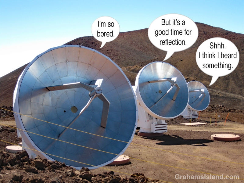
The other photos, of three dishes and what immediately popped into my head when I saw them, show why I never made it as a scientist.
For more information about the Submillimeter Array, go to https://www.cfa.harvard.edu/sma/.

The twisted remains of a dead tree lie, under heavy skies, on an old lava field at Hawaii Volcanoes National Park.
For more information about Hawaii Volcanoes National Park, go to nps.gov/havo/.
Posted in response to this week’s WordPress Photo Challenge ‘Twisted.’

A little over a week ago, I posted photos here of the lava lake at Overlook vent, in Halema’uma’u Crater at the summit of Kilauea Volcano. Here’s a photo of the crater as early morning light illuminated the scene. Around that time the lava was repeatedly spilling out onto the crater floor.
Perhaps you’re wondering if anything has changed in the short time since then. If so, the answer is yes. The lava lake has disappeared, dropping more than 500 feet below the level of the crater floor. Exactly how far its fallen is hard to find out because the people who monitor it have been busy with other things.
On Monday, after a period of increased seismicity, the crater floor of Pu’u O’o vent, the other active vent on Kilauea, collapsed sending a huge ash plume into the sky. When the ash cleared all the lava had disappeared from the vent. This coincided with ominous rumblings and grumblings east of the vent, along the East Rift Zone. Small earthquakes shook the ground. Cracks appeared in paved roads. Lava was believed to be bubbling underground.
On Thursday morning, a magnitude-5.0 earthquake caused another collapse at Pu’u O’o crater. On Thursday afternoon, around 5 p.m., lava erupted in the middle of the Leilani Estates subdivision in the Puna district. A fissure appeared in the ground and molten lava bubbled forth, shooting into the air. This lasted around 2 hours, then ended.
On Friday, yesterday, other fissures opened and poured forth lava, closed again, only for new eruptions to occur elsewhere, but in the same general area. Leilani Estates has been evacuated and is now patrolled by the National Guard. Dangerous sulphur dioxide hangs in the air. Will a full blown eruption occur in that area or will it shut down and appear somewhere else? Nobody knows. People who had to leave their home on 20 minutes notice don’t know when they’ll be able to return or whether there will be anything to return to.
Up here, on the northern tip of the island, there is no danger, though two earthquakes, a magnitude-5.4 around 11:30 a.m. on Friday, and a much more noticeable magnitude-6.9 around 12:30 p.m., were definitely felt. By the time you read this, chances are everything will have changed. That’s the unpredictable, unexpected and often unlikely life, living on an active volcano.
Posted in response to this week’s WordPress Photo Challenge ‘Unlikely.’


The Overlook vent, in Halema’uma’u Crater at the summit of Kilauea Volcano, has been active since 2008. The level of the lava in the vent goes up and down, mostly 100 feet or so below the crater floor.
Last week, I was looking at the daily activity report and saw that the level was just 30 feet or so below the crater and lava was again visible from Jaggar Museum for the first time since April, 2015. My wife and I had visited during that previous viewing window and thought we’d like to do so again, particularly if the level rose until lava spilled onto the crater floor.
Next day, the level had dropped 40 feet. So much for that. The day after, it was back up 30 feet. We decided to monitor the situation. The lava kept rising, and over the weekend spilled out beyond the vent. Then it went down again. Then it came up again. Etcetera, etcetera.
On Monday, the lava spilled out over the crater floor and we thought about going early Tuesday, but the level dropped and we decided to wait. Tuesday morning, lava was spilling out. We decided to definitely go Wednesday morning (yesterday).
As noted in the previous post here, the issue is that the volcano is about 100 miles from where we live, a two-and-a-half to three-hour drive. Last time we got up at midnight to begin the journey. This time, we gave ourselves an extra hour’s sleep, trading that for breakfast at Ken’s in Hilo at 3 a.m..
So alarms went off, coffee was made, and tiramisu eaten (breakfast of champions), and we hit the road. Happily, the trip over was made under a mostly clear, starlit night and we rumbled into the Jagger Museum parking lot right on schedule at 4:30 a.m.. This time we were better prepared with actual warm clothing. With clear skies and a moderate breeze, it was chilly, especially for Hawaii.
There were already several people there, but not as many as in 2015, so it was easy to find a good viewing spot. Alas, we didn’t get to see lava spilling out because, as I learned later, the volcano had begun a mild deflationary phase (going down) after spilling out in even earlier hours of the morning.
Still, it was worth the journey. For a while, the lava lake was quite active, bubbling away and throwing up spatters in several different areas. One of the things I like about the lava lake, when it’s visible, is that the surface is mostly dark, but it’s cut through by ever-changing lines of bright lava. Sometimes, lava will burst forth from these lines in a frothing hotspot. Other times, a line might disappear as activity moves elsewhere.
These photos show activity along the crater wall (top), a hotspot on the edge of the pool (second photo), morning light seeping in above the volcano (third photo), an active hotspot in the center of the lava lake (bottom).
Posted in response to this week’s WordPress Photo Challenge ‘Lines.’


Hawaii has the reputation of being a tropical paradise, but arriving at Kailua-Kona Airport looks anything but. The final approach to the airport comes over the 1801 Huʻehuʻe lava flow from Hualali volcano. This flow is still quite barren with next to no vegetation. For first-time visitors, touching down on actual tarmac can come as something of a relief.
Exiting the plane, it will most likely be hot, but sunny? Not so much, especially if touchdown is after noon. Typically, clouds roll in during the morning and vog (volcanic smog, caused by pollutants from Kilauea Volcano) settles over the area. The appearance, seen in these photos, is sometimes called ‘concrete skies.’ Not a bad description.

