Category Archives: Volcanoes

Mauna Loa hike – going up

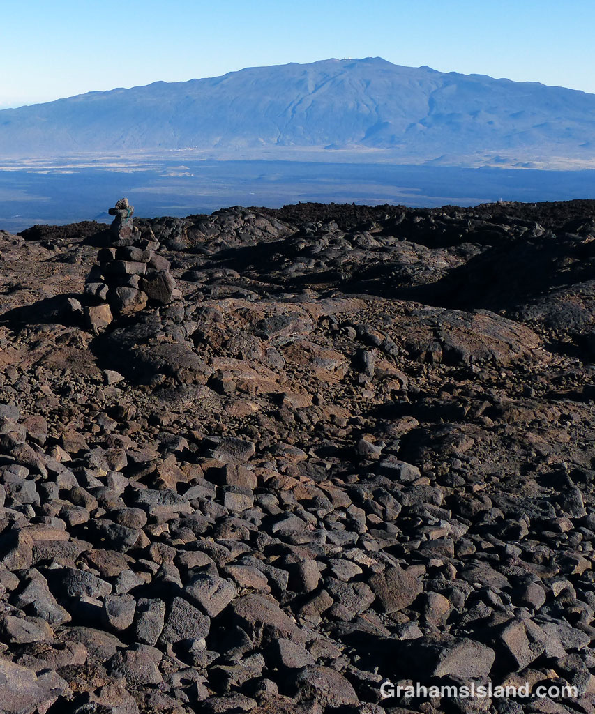
Mauna Loa Saddle
Pu’us on the west side of the saddle between Mauna Loa and Mauna Kea, with the Kohala Mountains peeking above the clouds in the background.
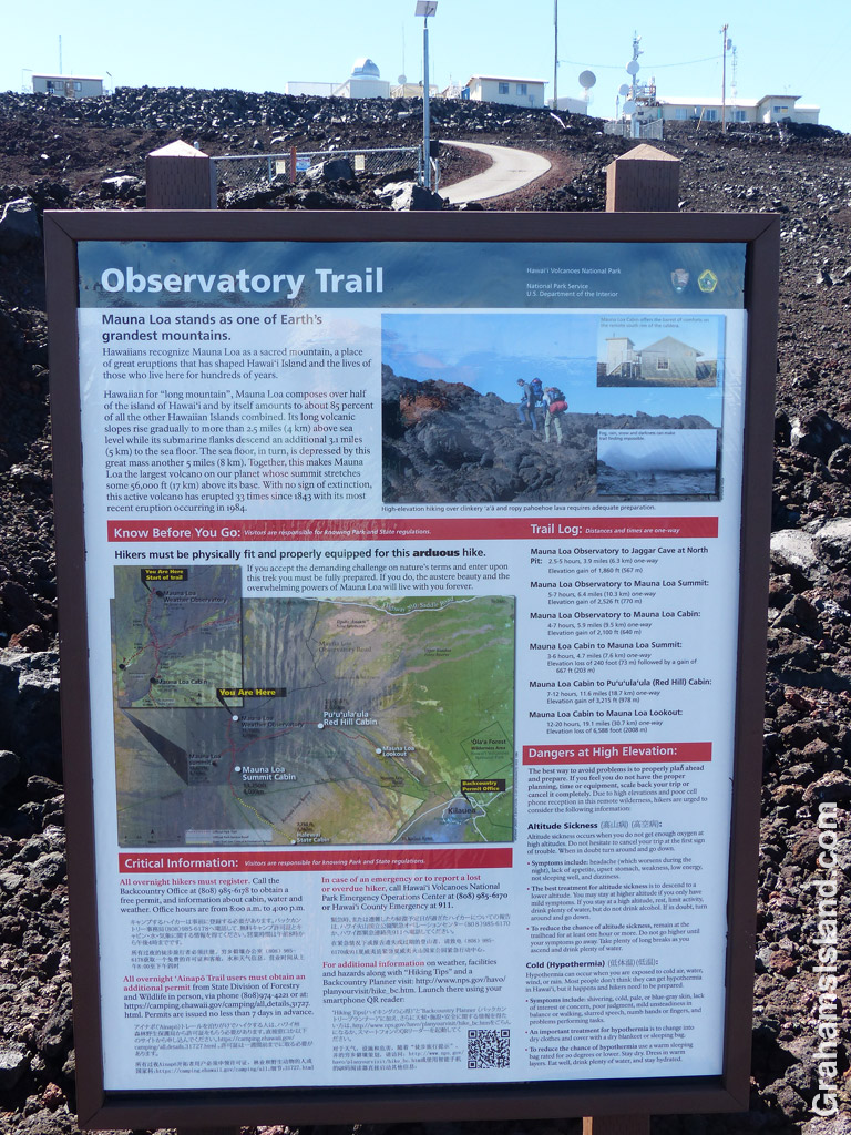
Mauna Loa Notice
The trail notice below the observatory.
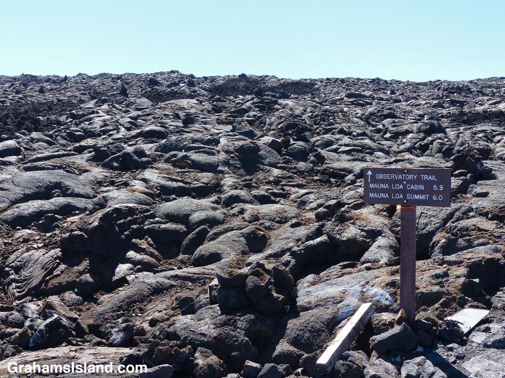
Mauna Loa Trailhead
The trailhead, a case of spot the cairns.
Mauna Loa 1st Road
The trail, marked by the cairn, crosses the road. The rocks in the foreground are the road!

There are two hiking routes up Mauna Loa. One is the Mauna Loa Trail starting out from Hawaii Volcanoes National Park. This is a 40 miles or so round trip, a multi-day hike requiring a permit. See nps.gov/havo/planyourvisit/hike_maunaloa.htm for information. The other trail is the Observatory Trail, which is reached from Saddle Road. This is the trail I took.

The trail begins at the Mauna Loa Observatory, which monitors atmospheric change. The road up to the observatory begins a hundred yards or so Hilo side of the Mauna Kea Road – Pu’u Huluhulu Native Tree Sanctuary junction. It’s about 17.5 miles and, contrary to some reports, is currently in excellent condition having obviously been repaved in the none too distant past. It’s still single-lane and goes up and down and around many bends, so drive carefully.
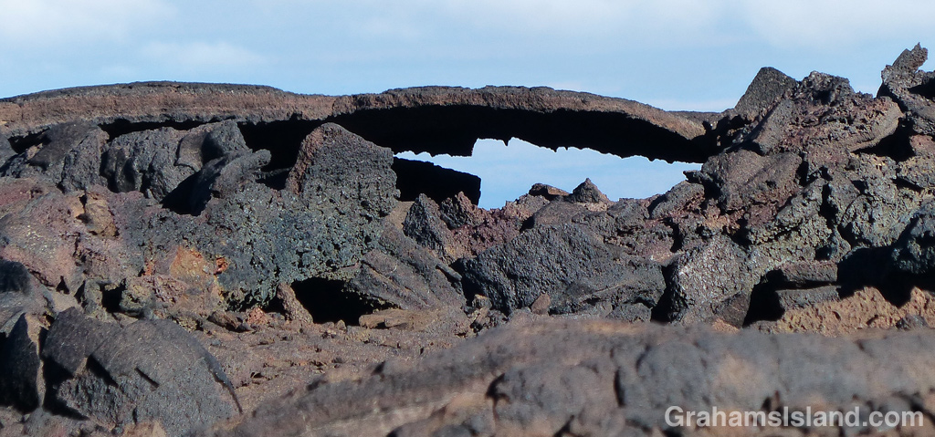
Mauna Loa Tube Remnant
This remnant of a lava tube gives some idea of how thin the top can be.

I intended this to be a day trip, which requires an early start. There are two ways to do this. One is to drive up in the evening, sleep in the parking area overnight (all the while acclimating to the altitude), and head out early. The other, which I chose, is to drive up to the observatory early in the morning, spend an hour or so acclimating, and then head out. I left home at 5 a.m. and arrived at the parking area at 7 a.m.. En route I nearly ran over a sheep wandering in the road in the dark and, at the junction, got to see an orange sunrise being welcomed by white-robed followers of what I assumed was some sun-worshipping group.

The trail starts at about 11,000 feet and goes up some 2,700 feet to the summit. It’s a high altitude trail prone to sudden weather changes so the usual cautions apply. There’s a sign at the trailhead that outlines why this hike could be your last. I joke, but the concerns are real. I’d picked a day of fine, settled weather, but packed food, water and clothing for an unscheduled overnight stop.

That said, I headed out on the very rough dirt road that is the start of the trail. This is a road for 4-wheel drive trucks with strong motors and lifted suspensions that make the truck bed seem detached from the wheels. I’ve hiked at altitude a moderate amount and not had any problems, but I know to take my time and be alert to signs of altitude sickness.

After about half a mile the trail proper takes off to the left. There’s a nice, clear sign marking the spot. The trail itself is less obvious. Most of this trail is marked by cairns. Sometimes there’s a splash of white or yellow paint, sometimes a stick or pole, but the cairns are the main guide. The only thing is, the cairns aren’t always obvious as the trailhead photo shows. It’s a good idea to identify the next cairn before leaving the one you’re at.

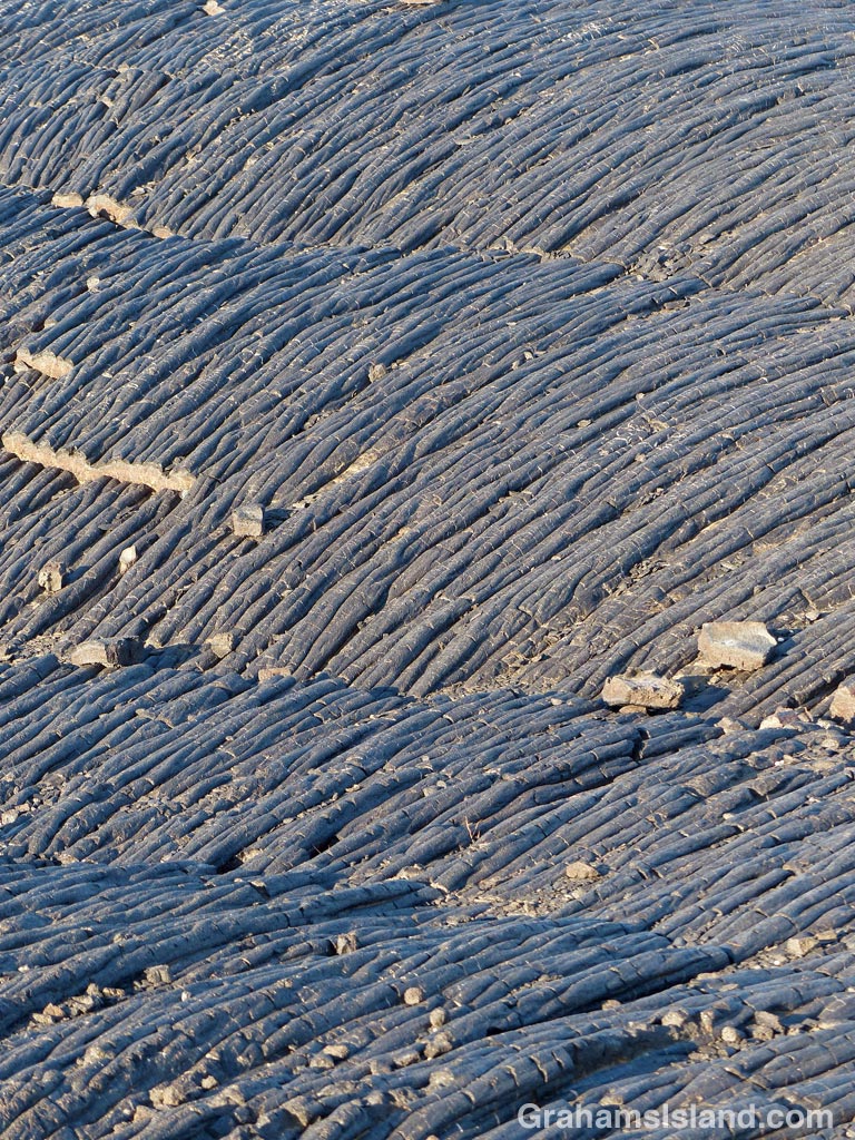
A lot of this trail passes over rounded pahoehoe lava. I prefer hiking on this to sharp a’a lava. At least with pahoehoe I have a solid surface to place my foot and to push off from. That said, there are times when the surface crackles and I’m keenly aware the area is riddled with lava tubes, some topped with a thin crust that could easily give way. That’s one reason why I try not to stray from the trail.

When I hike, I often have songs running through my head and, on hikes like this, I inevitably end up humming “Put one foot in front of the other” from the 1970 movie Santa Claus is Comin’ to Town (don’t ask). It is, however, a one-foot-in-front-of-the-other kind of hike, a steady climb at a steady pace, watching ones steps.

About 45 minutes in, I crossed the dirt road I’d started on (which zigzags up the mountains most of the way to the summit). I’d walked up the road once before looking for this crossing and hadn’t identified it. Now I recognized that I’d walked past it. A lot of the trail is like this – a mishmash of lava and ups and downs, with a distinctive feature here and there. There’s a broken lava tube marked by two big cairns and another junction with the road. The trail follows the road at this point until it comes to a gate marking the national park boundary. Then it veers off, up the hill, to the right on an easily followed cinder section, crosses the road a third time, and finally winds up another half mile to the edge of North Pit, the northern most feature of Moku’āweoweo, the summit caldera.

Dare I say that this view isn’t the most spectacular? The floor of North Pit is only about 10 feet below the rim and, since it stretches out a good way ahead, that’s really most of what there is to see at this point. It’s still an impressive view. The trail to Mauna Loa cabin angles across the North Pit floor and in the distance are the higher cliffs of the main crater. Best of all, I was feeling pretty good, it was only 11:00 a.m. (three and a quarter hours to this point), and the weather continued to be and look great.

Tomorrow, I’ll post my hike from North Pit up the Summit Trail.

For more information about the Mauna Loa Observatory Trail, go to bigislandhikes.com/mauna-loa or instanthawaii.com (under Things To Do, check Scenic Drives for the road up to the observatory and Hikes & Trails for the trail).
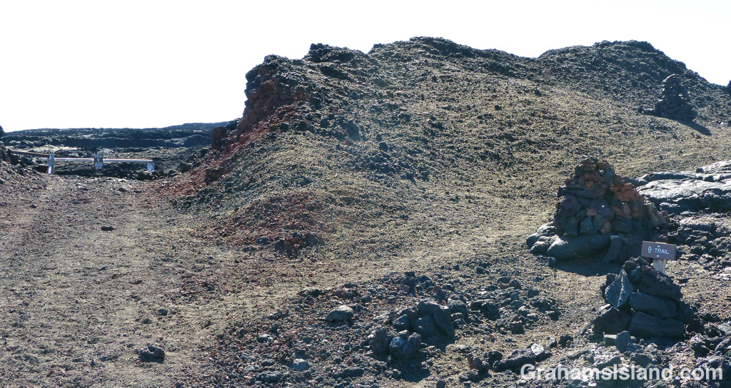
Mauna Loa Gate
The road ends at a locked gate. The trail takes off up to the right.

What goes up Mauna Kea …

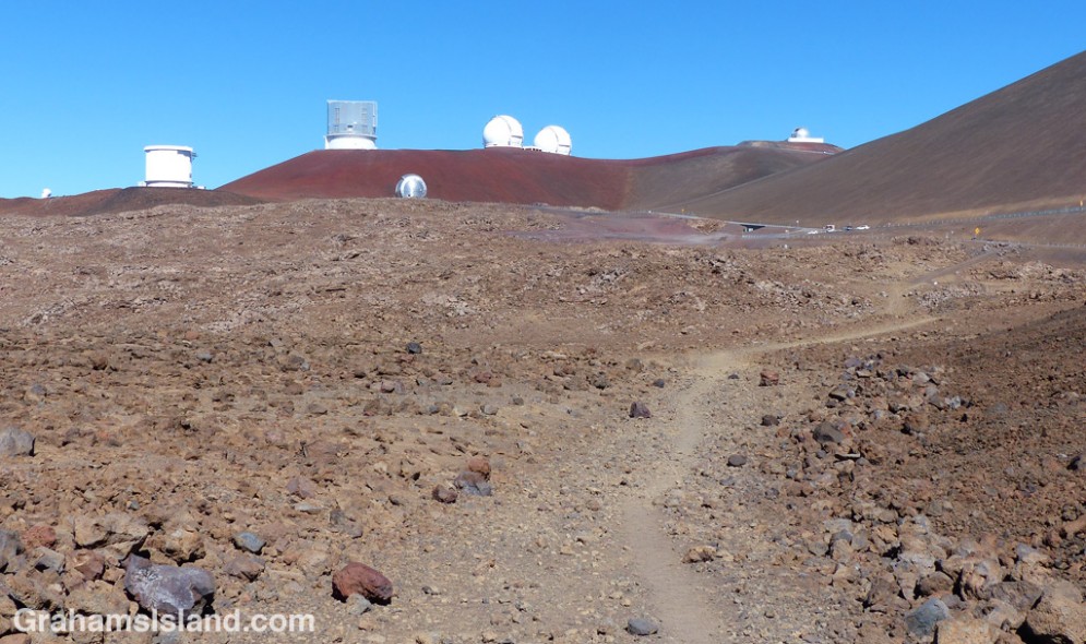
The trail starts just below the loop road that links the telescopes.

The trail starts just below the loop road that links the telescopes.

Lake Waiau.

Lake Waiau.

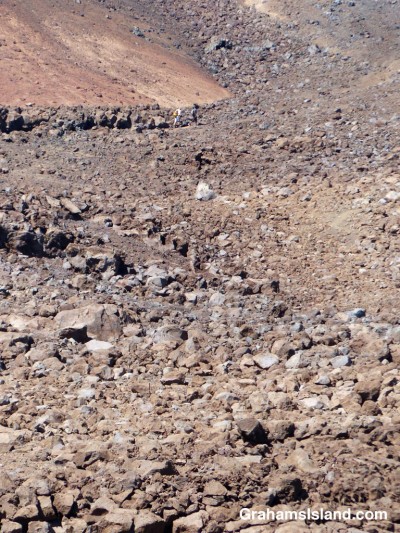
The trail passes through unforgiving landscape. Two hikes are just visible at the top center.

The trail passes through unforgiving landscape. Two hikers are just visible at the top center.

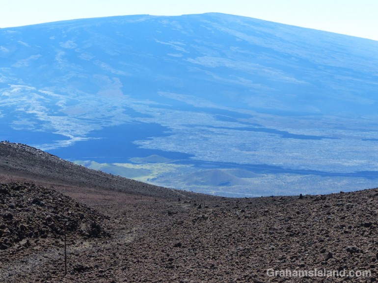
Looking across at Mauna Loa. The trail is visible at bottom left.

Mauna Kea silverswords grow in the otherwise barren cinder landscape.

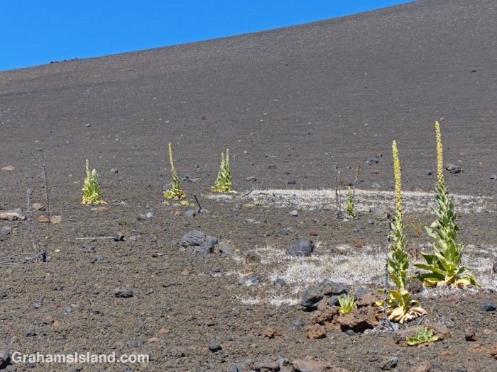
Mullein, Verbascum thapsus, grows in the otherwise barren cinder landscape.

I took a hike on Mauna Kea recently. I’ve been up the mountain before in the car and I’ve done a hike or two going around the volcano. This time I thought I’d tackle the Summit Trail. The trail starts at the Mauna Kea Visitor Center at about 9,250 feet and goes 6 miles to the summit at about 13,800 feet. That’s around 4,550 feet of elevation gain. It’s also high altitude, which means it’s not an easy trail.

My plan was to ‘try out’ the trail. I figured if I made a one-way trip it would give me a good insight about whether to try the round trip. My idea was to get a ride from the visitor center to the top, then hike down, because that has to be easier than going up, doesn’t it? Cue ominous music.

I got to the visitor center before opening time and spent an hour acclimating to the altitude. I chatted with one of the volunteers at the desk and she said she preferred the hike UP the mountain. She asked if I had walking sticks, which I didn’t. Tactfully, she didn’t follow up by asking about next of kin. At least the weather was good – sunny and dry, but cool.

By starting early I’d hoped I might snag a ride with a work vehicle heading up to the telescopes that dot the summit. They all passed me by, either fully loaded or, I suspect, forbidden from picking up hitchhikers. That gave me a problem. I’d just left the visitor center and knew there were no 4-wheel-drive vehicles there, which is what visitors going to the summit should be driving. I couldn’t expect a ride until one arrived and the occupants had acclimated as I had. Faced with the prospect of waiting an hour or more I headed off up the trail. I could hike the first ¾ mile, to where it passed close to the road again, and try and get a ride from there.

The trail started off up a rough dirt road that quickly transitioned to a trail. When I say up, I mean up. Mauna Kea is shaped like a classic volcano. It looks, and is, steep.

I huffed and puffed up the slope, feet slipping on the loose cinder underfoot. I began to understand what the woman at the visitor center meant; coming down would be treacherous. Going up was hard work too, but at least I felt I’d earned the frequent stops to recover and appreciate how much elevation had been gained.

I reached the road at around 10,200 feet and soon got a ride to the top. The actual summit of Mauna Kea is along a short trail across from one of the parking areas. I didn’t take it this time having been there before. Instead, I headed off on the road that loops around the top. It’s a surreal place, a barren, windswept, cinder landscape dotted with high-tech telescopes gathering information from the farthest reaches of the universe.

The trail down starts just below where the road begins its loop. It’s easy going at first, through a small valley, over a ridge and down a steeper bit to a saddle. This is where the main trail intersects another one heading to Lake Waiau. Lake Waiau is a small, somewhat perplexing lake. At 13,000 feet it sits on a volcano made up of highly permeable rock at an elevation where it gets very little in the way of rainfall. It’s not entirely clear why the lake exists at all though it undoubtedly does. The day I was there, it appeared quite full and green.

After the side trip to the lake, I started down again. Almost immediately I missed the trail down. I thought it intersected the Lake Waiau trail toward the road, but I soon realized that wasn’t true. So I angled across to the right one over loose lava, slipping often, but finally regaining the proper track.

Soon after, I met two other hikers who I’d seen in the parking lot earlier. They were hiking the round trip, up and down. We chatted a while before they continued. They were younger and fitter than I, though their conversation had left me with the impression that they weren’t looking forward to the return journey.

It’s a steady downhill slog, mostly with a loose surface underfoot (at one point I fell, my feet slipping out from under me, luckily leaving me with nothing worse than a couple of scrapes on one hand). I’d like to say the effort was worth it for the views, but the truth is, I can’t. Across the saddle, is Mauna Loa, which is a bigger volcano than Mauna Kea, but doesn’t look it. Mauna Loa (which means ‘long mountain’) has enormous mass, but not striking, steep sides. Otherwise, I was looking mostly at my feet or the same kind of landscape I was walking on.

This was one of those hikes where I kept thinking that the place where the trail passed close to the road where I’d got my ride, must be just over the next ridge. But one ridge followed another and there were several of them before that observation became true. Then I was back on territory I’d climbed up that morning. The woman at the visitor center was right: it was easier going up.

When I got back to my car, a visitor there asked me about the hike, whether it was worth it. “No,” I said. He was disappointed. He was keen on the hike; his partner, less so. But the truth is, it’s a slog up and down over a barren, cinder landscape. Yes, there are plusses. There’s a stark beauty in the place and the lake is worth it. But, to me, it’s more for the person who likes to be able to say ‘Yeah, I did that hike.’

For more information about the Mauna Kea Summit Trail and Lake Waiau, go to bigislandhikes.com/mauna-kea and ifa.hawaii.edu/info/vis/visiting-mauna-kea/hiking.


Nearly there. The visitor center and road is visible on the left.

Nearly there. The visitor center and road is visible to the left of the red cinder cone.

Hualalai from the North Kohala coast

Hualalai

A tranquil view of the volcano, Hualalai. It last erupted in 1801, but is still considered active. If it does go off again, it could be very bad news for the Kohala coast resorts and the airport at Kailua Kona, which is built on the flow from one of the last eruptions.

For more information about Hualalai, go to hvo.wr.usgs.gov/volcanoes/hualalai/.