Tag Archives: Kailua Kona

Highway Department mistakes

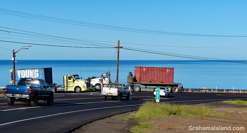
This is the highway intersection about a mile east of Kawaihae. It’s the junction of three roads, Kawaihae Road coming down from Waimea, Akoni Pule Highway from Hawi and North Kohala, and Queen Kaʻahumanu Highway (better known as ‘Queen K’) from Kailua Kona.

It’s always been a problematic junction because Kawaihae Road and Queen K are part of the main loop road around the island, but the right of way at this junction was the Kawaihae Road to North Kohala road. Traffic would get backed up on Queen K, particularly in the afternoon, and accidents were common. Compounding the problem was that the road from Kawaihae carried a lot of trucks coming to or from the port there.

So earlier this year a revision of the intersection was started. A right turn lane was added to Queen K, for traffic going up the hill to Waimea, and a right turn lane was added Akoni Pule Highway for people headed south. (There was already a left turn lane on Kawaihae Road for people going south.)

Don’t worry if this makes no sense, because it makes no sense. What was being set up seemed doomed to failure.

The problem was that the new right turn lane from Kawaihae onto Queen K was fitted with a yield sign. This meant traffic from Waimea, turning left onto Queen K had to give way to traffic heading up the hill, but had the right of way over traffic turning south.

The first accident happened before the intersection was finished. Someone failed to make this right turn and plowed into the guard rail opposite. Shortly after this, two cars collided in the middle of the junction. There were more near misses and accidents.

The yield sign was changed to a stop sign. This helped, but did nothing to stop the confusion of drivers coming down from Waimea. White poles were added to the lane divider for the right turn lane from Kawaihae. Bumps were placed in the other lane for traffic going up the hill. The accidents continued, as did the near misses.

These photos show that right turn lane coned off, as the powers that be have decided to take out the right turn lane. So what we have managed here is several months of work and adjustments has caused a bunch of accidents and near misses and now a good portion of that work is going to be undone and returned to its original unsatisfactory configuration. Your tax dollars at work!

It’s not been a great period for the highway department. A major project saw the main road north of Kailua Kona to the airport widened from two to four lanes. This was delayed for several months because plans given to the road construction company failed to include right turn lanes into Kaloko-Honokohau National Historical Park. The problem here was that it’s national historical park because there are a lot of Hawaiian artifacts in the area, so a new archeological study had to be carried out.

And my personal favorite was the construction of a new highway south from Kailua Kona, intended to relieve traffic congestion in that area. The new highway connected to a previously confusing and dangerous ‘Y’ layout, that became a four-way intersection complete with traffic lights. It was opened with much fanfare and the only issue was that people, tourists and locals alike, had no clue where they were supposed go because there was no signage showing which road went where. Yes, that’s an exaggeration. There was one sign, left over from the previous configuration of the intersection, that now directed people in the wrong direction.

And the moral of this story is that, if you visit the Big Island, please drive with caution.

Posted in response to this week’s Friendly Friday challenge on the theme of ‘Mistakes.’ See more responses here.

C-17 Globemaster

c-17 globemaster

Kekaha Kai State Park, north of Kailua Kona, is a pretty park with some excellent beaches. It’s also right under the flight path for aircraft heading to Kona International Airport (officially known as Ellison Onizuka Kona International Airport at Keahole).

What this means is that a steady stream of jets, on final approach to the airport, pass overhead, and not that far overhead either. It’s not the quietest park in the state.

While most of the aircraft are operated by the usual airlines, a few military planes pepper the skies. This one is a C-17 Globemaster, a military transport plane. It was arriving from Oahu, delivering firefighting equipment for the military’s Pohakuloa Training Area.

c-17 globemaster details

Honokohau Harbor entrance

Honokohau Harbor entrance

Honokohau Harbor, just north of Kailua Kona, is the main small boat harbor on the west side of the Big Island. In addition to private pleasure craft, a lot of charter boats operate out of the harbor, taking guests out to fish, snorkel, dive, and whale watch.

While it looks placid in this photo, once outside this harbor entrance, boaters are in the Pacific Ocean and conditions can change dramatically in a very short time.

Pride Of America

Cruise ship

Cruise ship Pride Of America
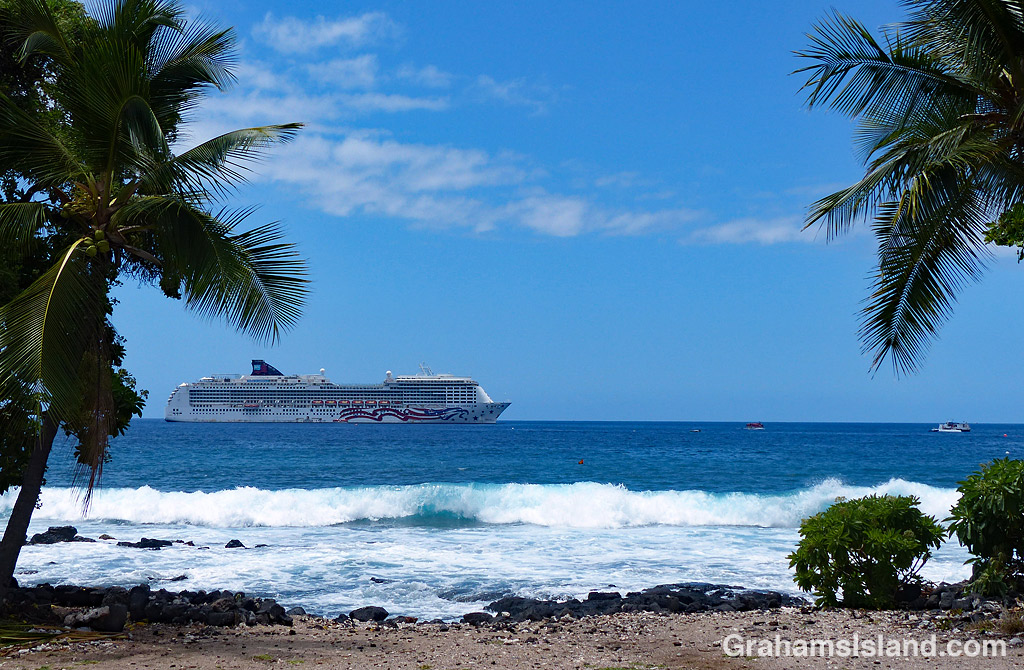
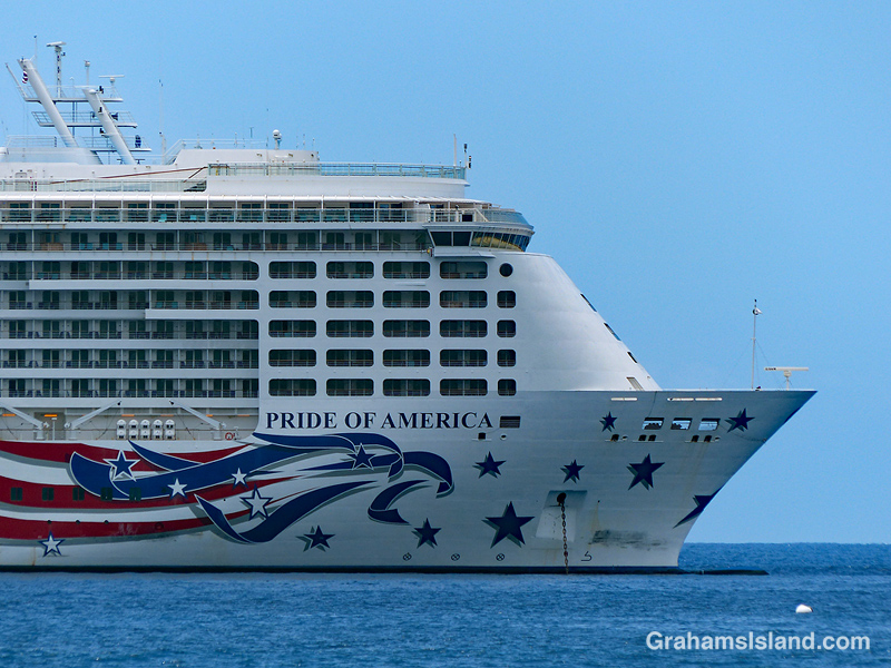
Every Wednesday, the cruise ship Pride Of America drops anchor off Kailua Kona and ferries people ashore to explore the offerings of the town and of the Big Island.

What I like most about the ship is how the name is reflected in the paintwork – all red, white, and blue, and stars and stripes. Indeed this ship was built in the U.S.A. and sails under an American flag. And even though the name of the company that operates the ship is Norwegian Cruise Line, it’s now an American company. Best not to mention that Norwegian Cruise Line’s parent company is based in Bermuda, and not because it’s warm and sunny there.

Cruise ship name

Ironman 2018

Ironman winner Patrick Lange
Ironman cyclist leaving Hawi
Ironman cyclists
Ironman cyclist in blue

Saturday saw the running of the 40th edition of the Ironman World Championships in Kailua Kona. This is the event featuring a swim of 2.4 miles, a bike ride of 112 miles, and a run of 26.2 miles. As in previous years, I participated in this event by walking out to the main road and taking photos, whenever possible from a nice shady spot.

Actually, this year’s race was run in prime conditions for the athletes. It was overcast with occasional light rain and only a gentle breeze from time to time. Consequently many records were set, including new course records for both men and women.

The top photo shows men’s winner and defending champion, Patrick Lange of Germany, zipping by on his way back towards Kona. Second photo, Great Britain’s Susie Cheetham heads out of Hawi. Third photo, Dan Plews of NewZealand (1685) leads Robin Schneider of Germany (2310), and Neil Eddy of Great Britain (2070). These three finished the bike leg in fairly close proximity, but after the marathon run, Plews finished 21 minutes ahead of Eddy and 45 minutes ahead of Schneider. Fourth photo, Jodie Robertson of the U.S.A demonstrates the importance of color coordination while cycling. Bottom, a large group of riders roll into Hawi, the turnaround point of the bike leg.

For more information about Ironman, go to Ironman.com.

Ironman group

Island hopping

Mokulele plane landing at Kona

Honolulu Airport
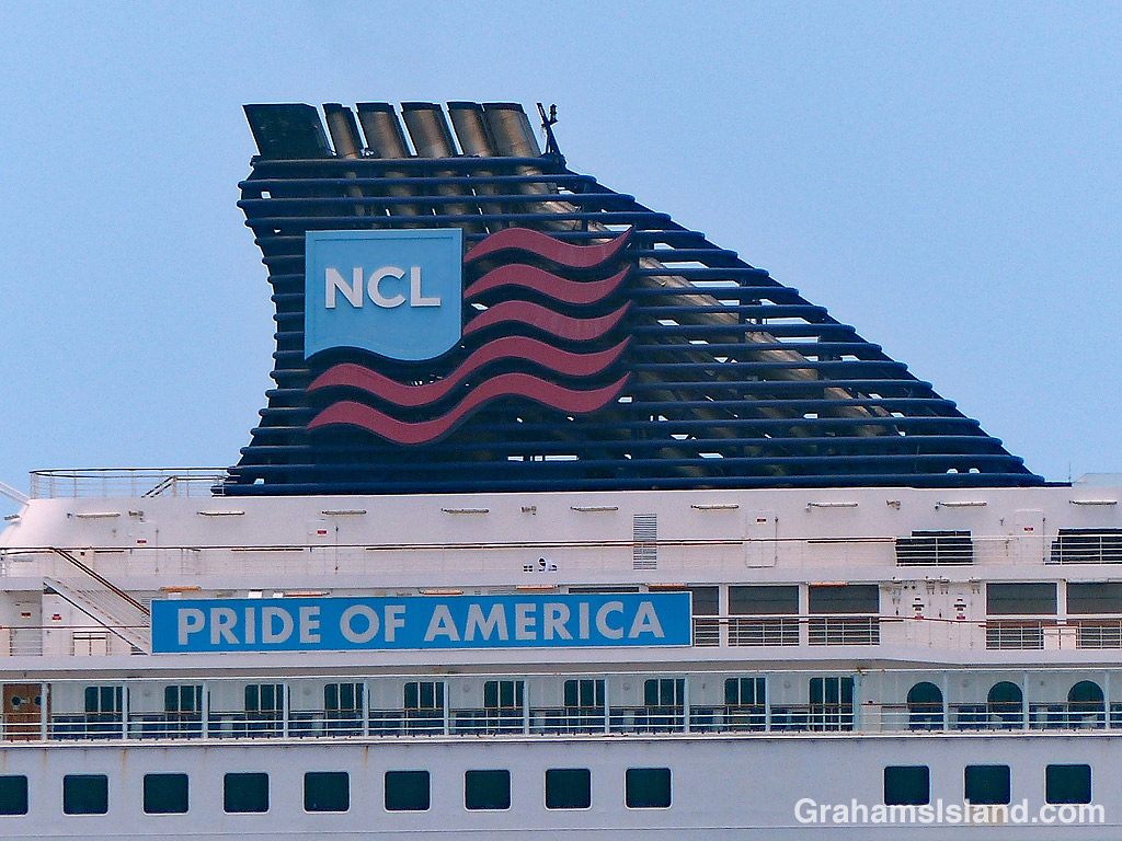
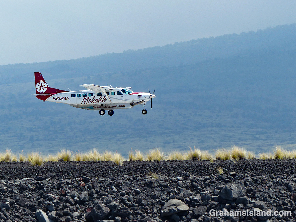
In Hawaii, it’s not unusual for people to commute between islands. Many medical professionals are based in Honolulu, but have offices on the Big Island which they visit on a weekly basis. The same can be said for other professionals: lawyers, scientists, engineers and the like. Politicians and government officials go back and forth on a regular basis.

But it’s not just professionals. Skilled tradespeople might work on any of the islands, commuting on a daily or weekly basis. Highway construction crews likewise move from island to island depending on where and what projects are being worked on. Musicians and other artists are regular island hoppers. The list goes on.

There’s one mode of transport for all these people and that’s air travel. There are no inter-island ferries. The Hawaii Superferry operated from 2007 to 2009 but was suspended when the Hawaii Supreme Court ruled that a second environmental impact statement was required. One concern with a ferry is the increased risk of spreading invasive species and diseases of plants and animals.

Hawaiian Airlines is the biggest operator in the islands, with the lion’s share of the inter-island business. It operates from its hub in Honolulu, but also offers direct flights between the other islands. The second photo shows the distinctive tails of a couple of its planes at Honolulu Airport.

Smaller airlines have also offered inter-island routes. These include Aloha Airlines, Go! Airlines and Island Air. These three ceased business in 2008, 2014, and 2017 respectively. Currently, the only other island airline is Mokulele Airlines, though it doesn’t fly to Kauai. They service some smaller airports and operate smaller planes such as the one above, coming in to land at Kona Airport.

Posted in response to this week’s Sunday Stills challenge is on the theme of ‘Transportation or Commute.’ (More responses here.)

Signs: No Lay Net

Signs-No Lay Net

Lay nets are also known as gill nets. They can be hundreds of feet long and many feet deep with floats on the top edge and weights on the bottom. The problem with them is that, rather than targeting specific food fish, they can catch anything swimming by including turtles and monk seals. Because of this, they’re banned in certain areas, though not everywhere in Hawaii.

To me, this photo represents how the ban works. This section of the Kona coast is one of those areas where lay nets are banned. Someone has gone so far as to erect a sign in the lava near the coast. But that’s about it. In due course, the sign will fall down. It probably won’t be replaced. In the meantime, enforcement of the ban is spotty at best. Even when a violation is called in, chances are no one will be out to check on the situation until long after the net has been hauled and the netters gone home.

Abstracts: Cruise ship windows

Abstracts-cruise ship windows

Every week, a cruise ship drops anchor off Kailua Kona and passengers are ferried ashore to explore the delights of the town or to go on tours of the island. While it’s there, the ship dwarfs the town.

This image shows a section of the ships side, row upon row of cabin windows. Technically, one might be expected to refer to these as portholes, but I don’t think that applies to cruise ships, which are basically giant floating hotels.