This week’s Sunday Stills challenge theme is ‘Calm.’ (See more offerings here.)
Seeing the sun going down after work, I headed down to Kawaihae harbor. After the sun dipped below the horizon, the sky turned peachy and I watched this sailboat slipping over the gently rippling water. It struck me as a very calm, relaxing scene.
On a recent swim I saw these two fish passing by. They looked like chubs, but not ones I’d seen before. I snapped a quick photo, not expecting it to be great, but hoping it would help me identify the fish. I need not have worried.
After they passed, they made a series of approaches and retreats. They appeared as curious about me as I was about them, which is something of a characteristic of chubs. Eventually, they moved away and I carried on, catching up to two others I had been swimming with. I asked them if they’d seen these fish and they said no.
I was describing what they looked like when the two of them showed up again. Once more they looped around, checking out these new people before finally heading south, not to be seen again.
When I got home it was easy to identify them as rainbow chubs, also known as blue-stripe chubs, with their distinctive blue markings. What was interesting is that their home is the Eastern Pacific, from Ecuador north to California. But some can get carried over to the Central and Western Pacific. As such, they’re rare in Hawaii, so this is one of those fish I might never see again. A matter of being in the right place at the right time.
In my attempts to identify what I see in the water, I use John P. Hoover’s book The Ultimate Guide to Hawaiian Reef Fishes, Sea Turtles, Dolphins, Whales, and Seals. His website is hawaiisfishes.com.
This week’s Friendly Friday challenge theme is ‘Whereabouts.’ See more responses here. ‘Whereabouts’ means ‘the place or general locality where a person or thing is.’
My whereabouts are the Big Island, Hawaii, which is also the place where Captain James Cook, of the British Royal Navy, lost his life on February 14, 1779. He was killed by native Hawaiians with whom he was involved in a dispute over the loss of a cutter from one of his ships. I won’t go into a detailed history here, but more information about Captain Cook can be found at www.captaincooksociety.com/.
Captain Cook’s whereabouts were often uncertain, in that he was an explorer who visited unknown or little known places around the world. Not only did he sail to far flung places, but he made excellent, detailed maps and charts of the places he visited, which made him highly thought of in the British Admiralty, and which made it easier for future travelers to know their whereabouts.
Between 1768 and 1779 Cook made three voyages around the world. The first two focused on the search for the theorized southern super-continent of Terra Australis. The third was intended to find the Northwest Passage across the northern part of North America.
It was on this third voyage that Cook became the first European to officially visit Hawaii (as opposed to other European commercial ships that were believed to have been there before). He sailed on to the north to attempt (unsuccessfully) to fulfill his commission before returning to Hawaii.
This time he anchored in Kealakekua Bay on the Big Island (official name, Hawaii Island). He was well received, in part because his arrival coincided with a Hawaiian festival for the god Lono. After a month, Cook left to resume his voyage, but when one of his ships lost a mast, he returned to Kealakekua Bay.
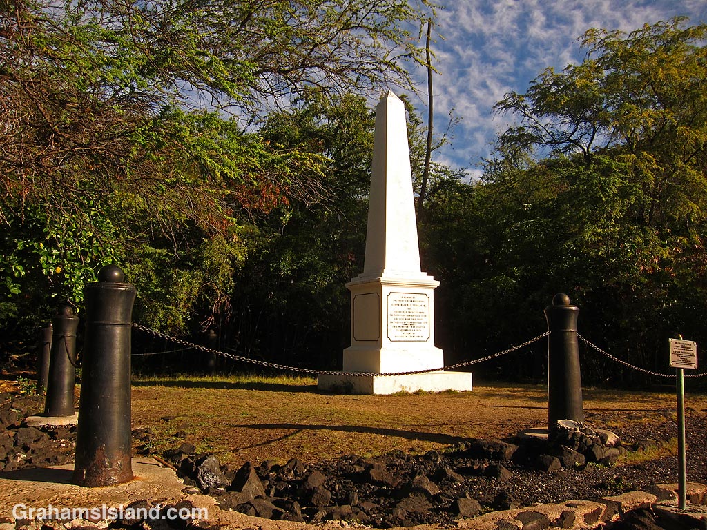
Unfortunately, by then the festival for Lono was over and his return was not greeted with the same enthusiasm. Soured relations led to several incidents culminating the theft of a ship’s cutter and the incident that led to Cook’s death. However, the killing of Cook did not diminish his standing in the eyes of the Hawaiians. In 1874, the Captain Cook monument was put in place and, in 1877, the land on which it stands was deeded to Britain by Princess Likelike as a sign of respect.
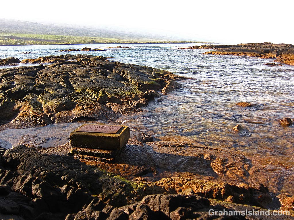
The top photo shows the monument, surrounded by a chain supported by twelve cannons from HMS Fantome. The second photo shows the inscription on the monument. I particularly like the bit about how he discovered these islands, islands which were occupied by a substantial population governed by an established royal line. The third photo is the plaque marking the spot where Captain Cook is believed to have been killed. Below is the location of that plaque in relation to Kealakekua Bay, which is the water beyond the rocks in this photo.
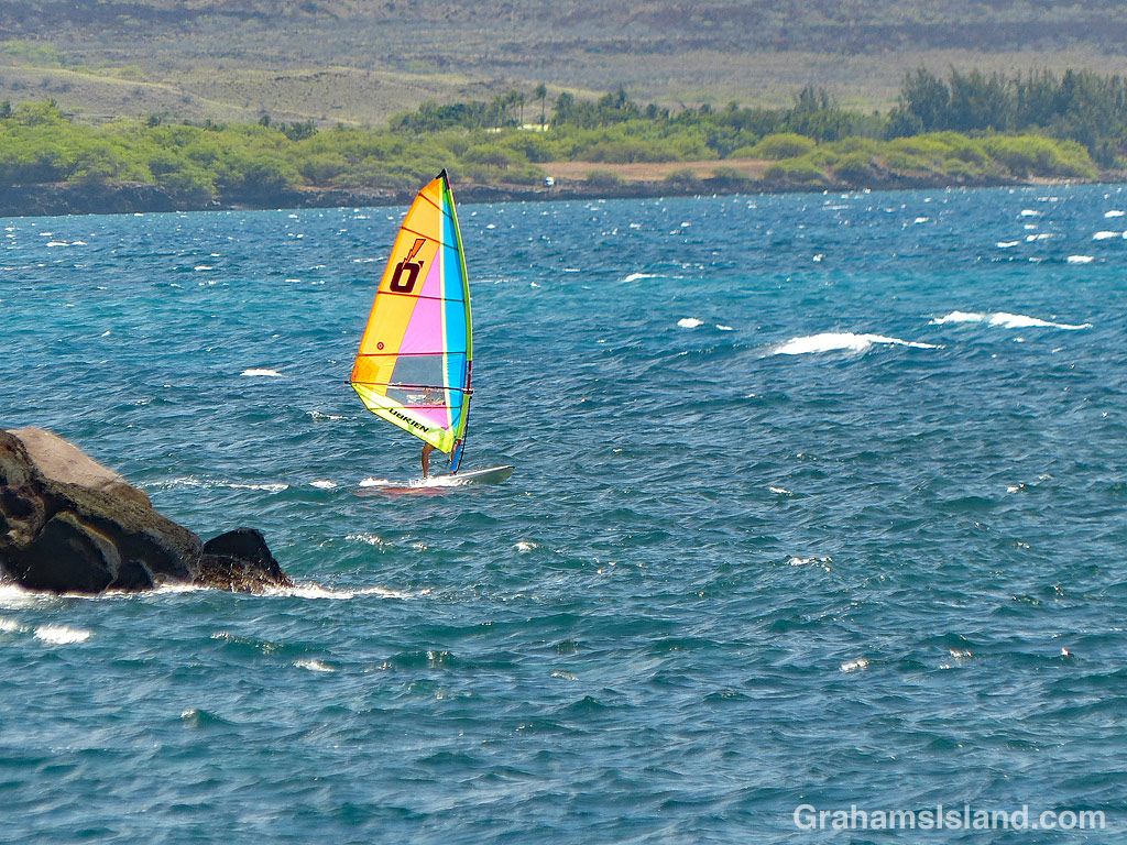
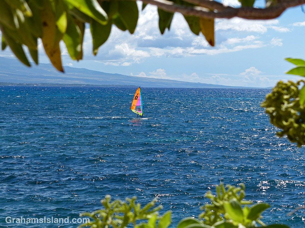
For whatever reason, I don’t see a lot of windsurfers in the waters around the Big Island. This is a bit surprising as there’s lots of water and the wind blows with a good deal of enthusiasm. Perhaps it’s just that most people favor surfing or paddle boarding.
Whatever the reason, I thought I should get photos of this windsurfer working his way along the coast near Kawaihae, since it might be a while before I see the like again.
Posted in response to this week’s Friendly Friday challenge on the theme of ‘Moving.’ See more responses here.
Most people going to Green Sands Beach, near South Point, hike in or pay for a local to transport them in one of a variety of dubious-looking trucks. Once there, people head down to the beach to swim or broil on the green sand.
Beyond the place where the trucks stop is a pu’u and a hike over this hill and down the other side takes one to this bench, which overlooks the bay, though not the beach itself. It’s a quiet spot unless the wind is howling, which it often is, but the view is lovely and it makes a great resting spot before either carrying on along the coast, or returning whence one came.
This week’s Friendly Friday challenge theme is ‘Secrets.’ See more responses here.
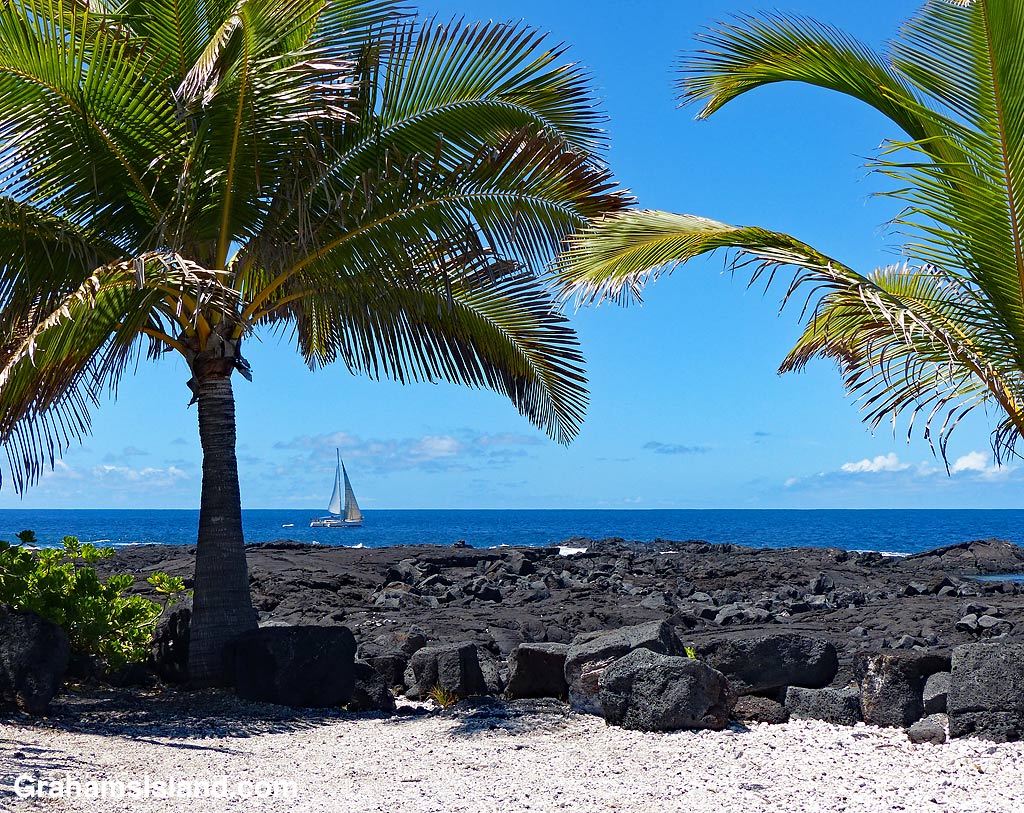
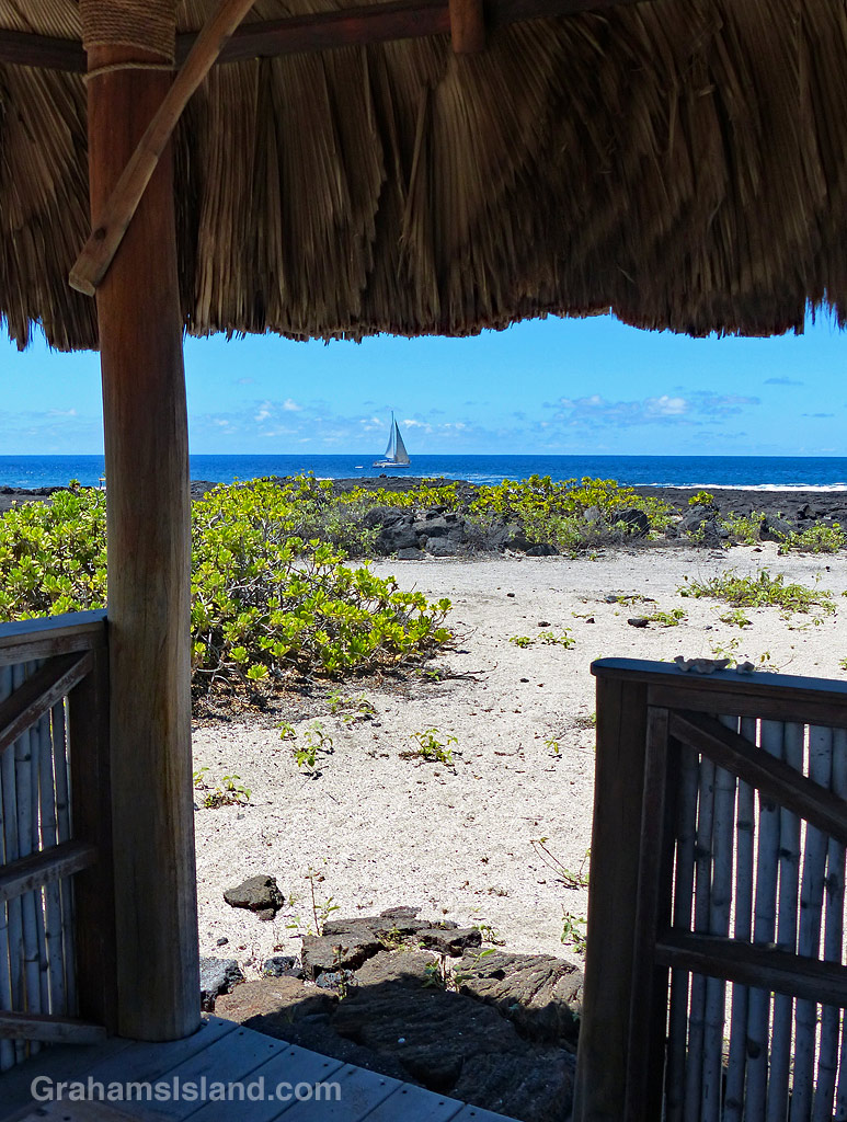
Here are a couple of secretive glimpses of a sailboat heading north along the Kona coast. I used to sail for a good many years until I sold my last boat, a twelve-foot San Fransisco Bay Pelican. In that boat, I used to putter around the bay for the fun of it, but I also took it on longer journeys. Before that, I used to have a bigger sailboat and also crewed on the boats of others.
While I like bay sailing, what I really enjoyed was sailing somewhere, not just the activity, but the passage making – navigation, nights spent in the open ocean under the stars.
The boat in these photos could do that, though I’m not sure I could anymore – too used to my creature comforts these days.
This week’s Friendly Friday challenge theme is ‘Alternative Version.’ See more responses here.
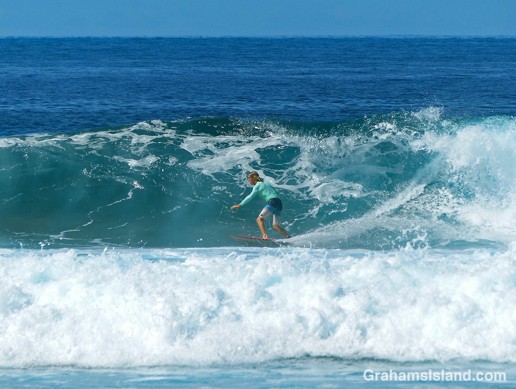
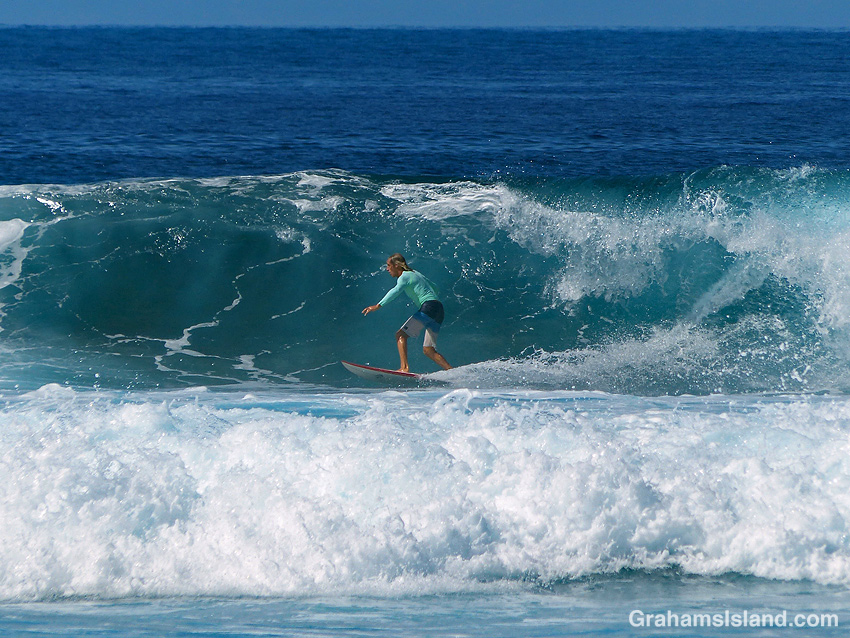
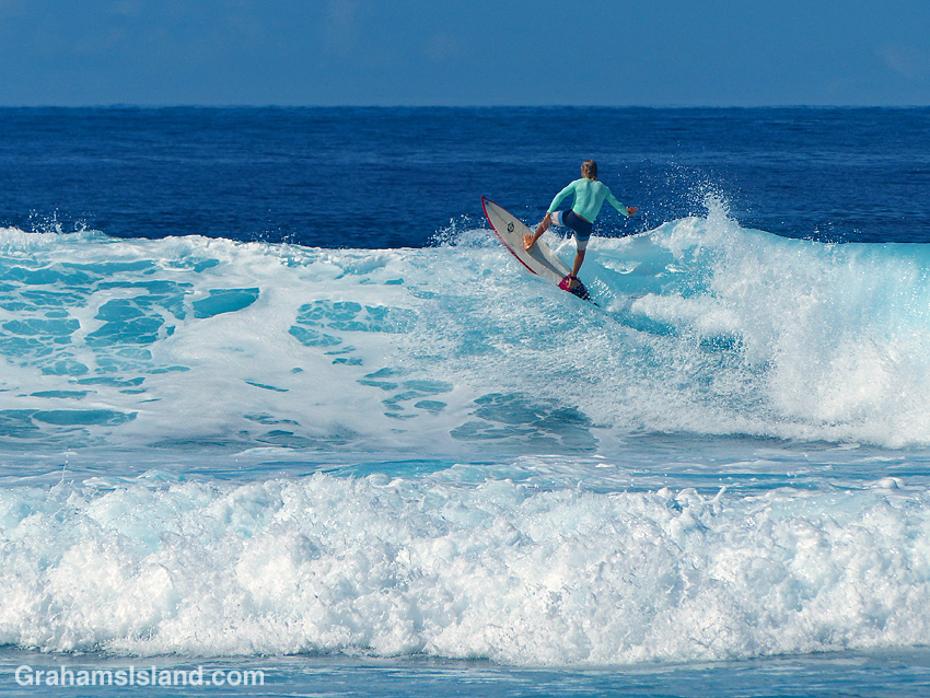
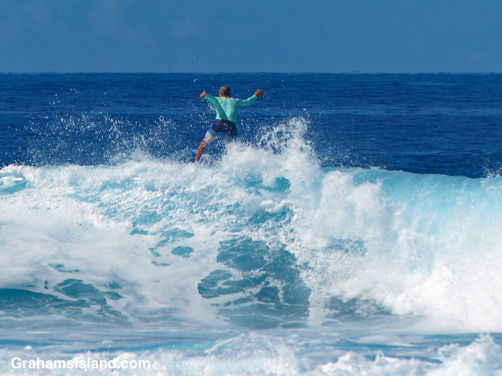
Surfing originated in Hawaii and is a quintessential Hawaiian activity. When the surf’s up, so is absenteeism at the workplace. For last week’s challenge, I posted a photo of surfers waiting for a wave.
This week, I’m posting photos of one of those surfers catching a wave. In the photos, the surfer cuts a curve down the face of a wave, zips along its base, and then climbs up the face again. At the top, he jumps off, no doubt to wait for the next wave he can catch.
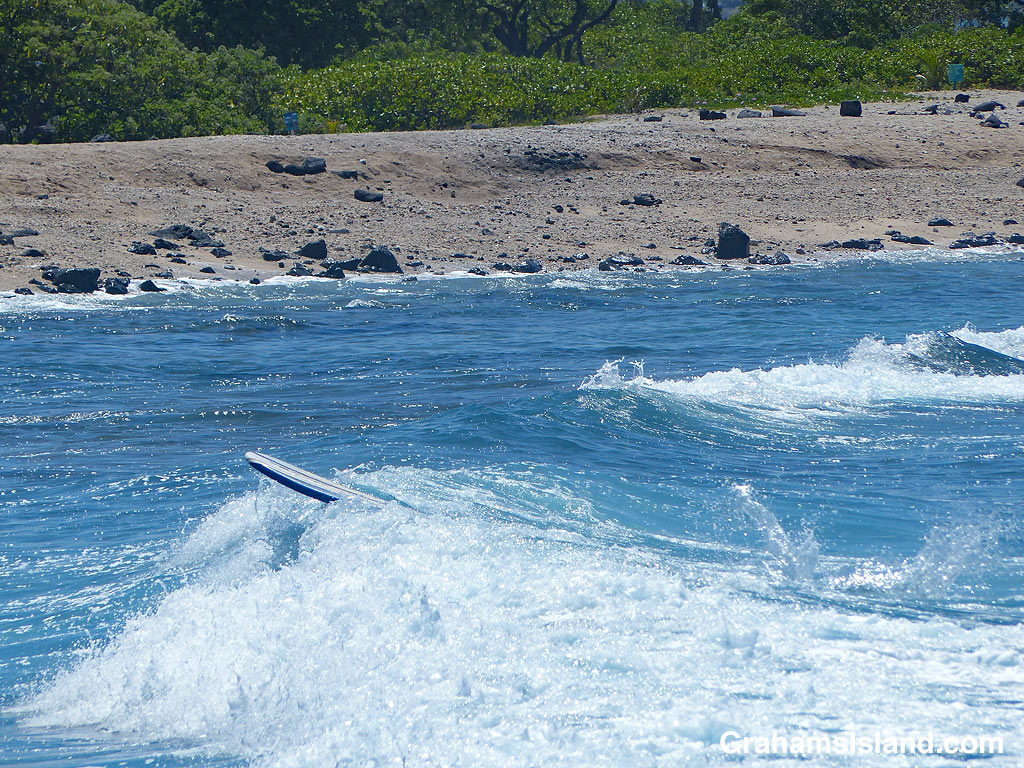
And the alternative version? Wipeout! In the bottom photo an unoccupied surfboard heads to shore, still tethered to the ankle of the out-of-sight surfer who wiped out moments before.
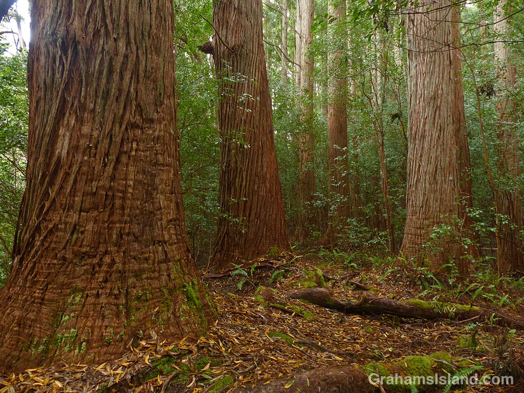
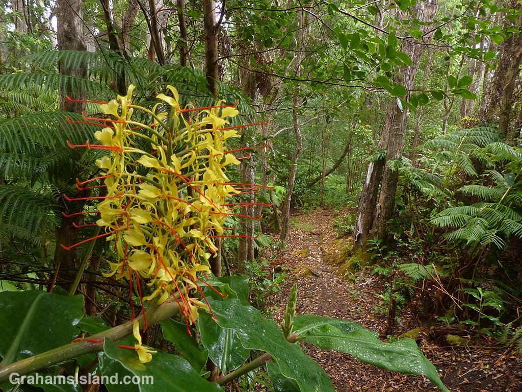
I recently went hiking in the Kalōpā State Recreation Area, not far from Honoka’a, on the northern end of the island. I’d been there before, but only to check it out, so this was an opportunity to explore the trails more thoroughly. One of the treasures of this area is that it features plants that were on the island before even the native Hawaiians arrived.
The recreation area is about 100 acres, and it neighbors the 500 acre Kalōpā Forest Reserve. At an elevation of around 2,000 feet, and on the wet side of the island, it’s cool and damp. There are a variety of trails that intersect and criss cross, which allows hikers options from short loops of less than a mile, to a 6+mile hike around the perimeter.
I took one of the longer routes and it reminded me greatly of hikes I’d taken back in the Pacific Northwest where I used to live. Light rain, water dripping from the overhead canopy, ferns bordering the trail, and tall trees stretching up into a grey sky. These were all features of those hikes. Only the species were different. Eucalyptus, ohia, and kopiko instead of firs and cedars.
The photos show – Top: towering trees line the trail alongside Kalōpā Gulch. Above: A view down into Kalōpā Gulch. Flash floods often race down this gully so it’s a good idea to watch your step. Third photo: Strangler figs envelope native trees and take over resulting in weird, twisted shapes. Below: The old Jeep Road, bordered by invasive kahili ginger, cuts through the center of the area. It’s hard to imagine anyone driving this trail.