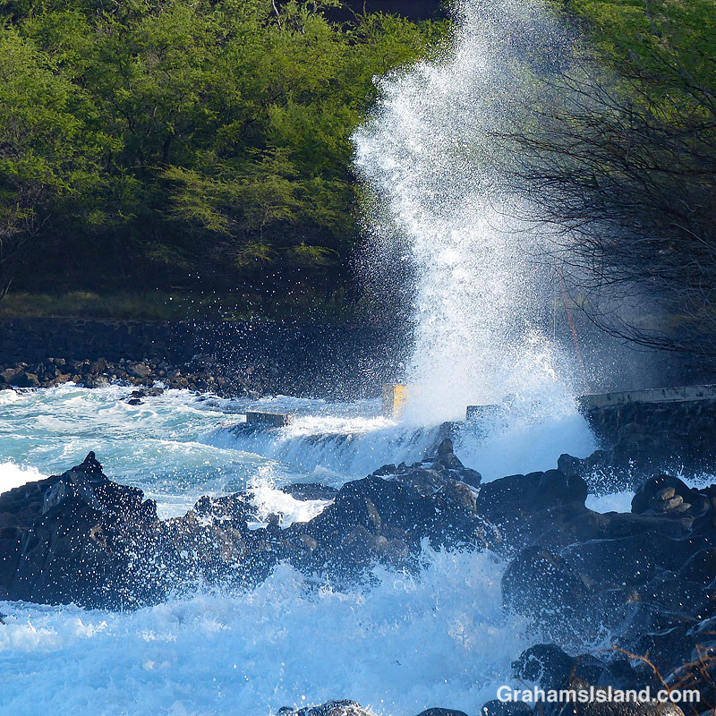
I like to go snorkeling whenever I get the opportunity, but there are some days when that’s not possible. This is a photo of my local snorkeling spot. That’s the parking area on the right, and the place where I generally park my car is right where that tower of spray is.
In other words, this was the kind of day to find something else to do, such as take photos from the shore.
Posted in response to Becky’s October Squares challenge theme of ‘Kind.’ See more responses here.
The trail winds down through woods and abundant vegetation.
Steps lead down from the mossy pass featured in a previous post.
Recently, I posted a couple of photos (here) of a section of the Halema’uma’u Trail in Hawaii Volcanoes National Park. I thought I’d follow up with a few more photos of the trail, which runs from near the visitor center down to the edge of the summit caldera of Kilauea Volcano.
For more information about Hawaii Volcanoes National Park, go to nps.gov/havo/.
The trail suddenly emerges at the edge of the summit caldera of Kilauea Volcano. In the morning, the bench is a shady spot to take in the view.Halema’uma’u Trail carries on across the caldera, marked by cairns, but this section has been closed since 2008, when the Halema’uma’u Crater vent became active. These days it would lead straight into the depths of the greatly enlarged Halema’uma’u Crater.
Back in June, I went to Hawaii Volcanoes National Park to do a little hiking. The park had recently reopened and I thought it would be a good time to do some of the popular trails near the summit that are usually crowded. I was right about this because I saw hardly anyone all day.
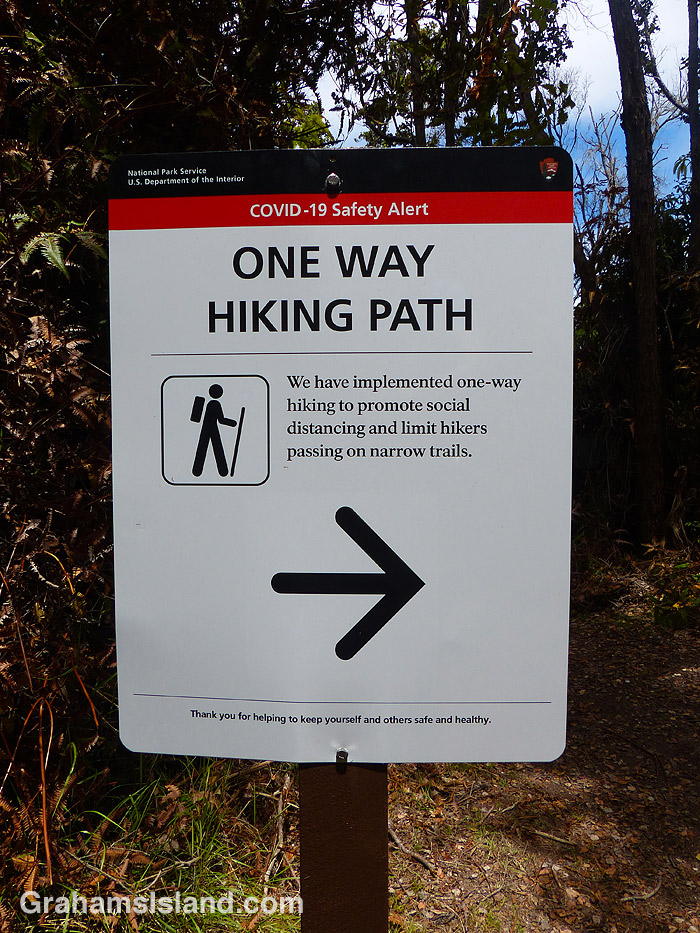
One of the trails I hiked was the Byron Ledge Trail and when I got to a junction near the end of it I came across this sign. I knew the park had made the popular Kilauea Iki Trail one way, but I hadn’t known about it applying to any other trails.
As you might have guessed, I arrived at this spot from the pointy end of the arrow. I’d hiked the trail in the wrong direction. The problem was that there was nothing at the other end of the trail letting me know I shouldn’t enter. When I hiked Kilauea Iki later, it was the same: at the parking lot there was a sign saying hike this way, but nothing at the other entrances to the trail.
On my way out of the park I stopped at the entrance and mentioned this to the ranger on duty. When I returned to the park in August, I asked the ranger at the entrance if they were still doing one way traffic on some of the trails. She said they weren’t. I wasn’t surprised. To do it properly, it would require a lot of signage and, with the Visitor Center closed, it would be hard to get the message across to everyone who visits the park.
For more information about Hawaii Volcanoes National Park, go to nps.gov/havo/.
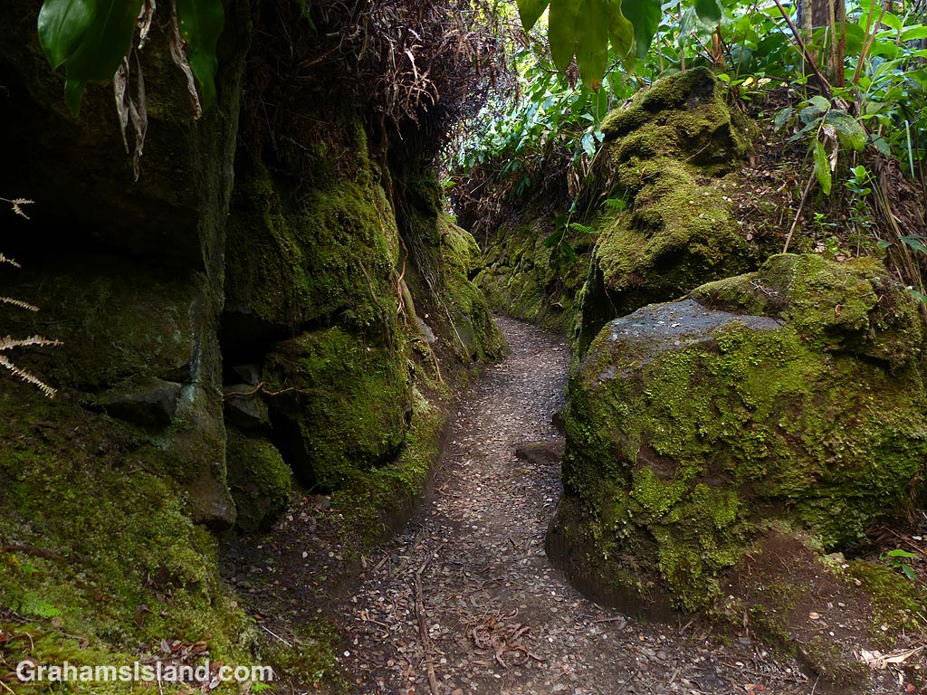
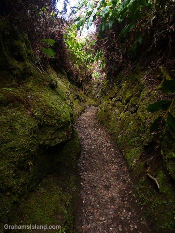
The Halemaumau Trail in Hawaii Volcanoes National Park takes hikers from near the visitor center down to the floor of the summit crater of Kilauea Volcano. It mostly passes through trees and some lush tropical foliage, this being the wet side of the island. Part of the way down the trail eases through a channel between two walls of rock, which are covered in moss. It’s a quite beautiful passage and, in this harsh volcanic area, has a remarkably soft feeling to it.
For more information about Hawaii Volcanoes National Park, go to nps.gov/havo/.
There’s a good variety of fish at Two Step including raccoon butterflyfishes, seen here mingling with goatfishes and yellow tangs.
A barred filefish swims by with a startled look on its face, which is just their usual look.
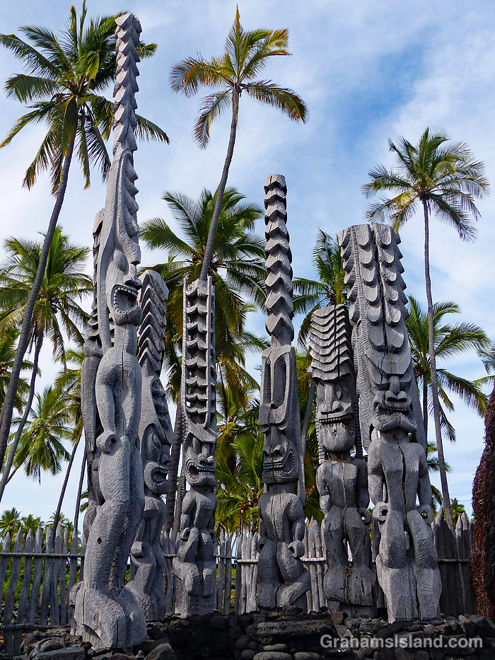
Ki’i at Pu’uhonua o Hōnaunau National Historical Park, better known as Place of Refuge.
This week’s Friendly Friday challenge theme is ‘Anniversaries.’ See more responses here.
Often, on our wedding anniversary, my wife and I go to Hawaii Tropical Bioreserve and Garden (formerly Hawaii Tropical Botanical Garden). This year the garden was shut, and still is, probably until tourists return to the islands. So a different anniversary is my birthday, which is not marked with candles on a cake, since that would be prohibitively expensive, but usually by a trip somewhere and a meal out. This year we went down to snorkel at Two Step and then had a wander around Pu’uhonua o Hōnaunau National Historical Park, otherwise known as Place of Refuge, which is right next door.
Two Step is a very popular snorkeling spot on Honaunau Bay, south of Captain Cook. This is a marine reserve so no fishing is allowed and the fish tend to be more numerous and mellow because of this. It’s a popular spot to see and swim with dolphins, though I haven’t done either of those things there. Currently, it’s not nearly as busy since there are very few tourists on the island and those that are here are diligently following quarantine rules (I’m trying to keep a straight face writing this!).
After our swim we made the short walk to Pu’uhonua o Hōnaunau National Historical Park. The park is on the south side of the bay and, at the moment, is fully open only on Fridays, Saturdays, and Sundays. However, on the other days, pretty much everything else is accessible, it’s just that the parking lot and visitor center are closed. What this means is that there’s basically nobody there so our visit was quiet and uncrowded. The park is an important place in Hawaiian history, and the location is beautiful. What’s not to like?
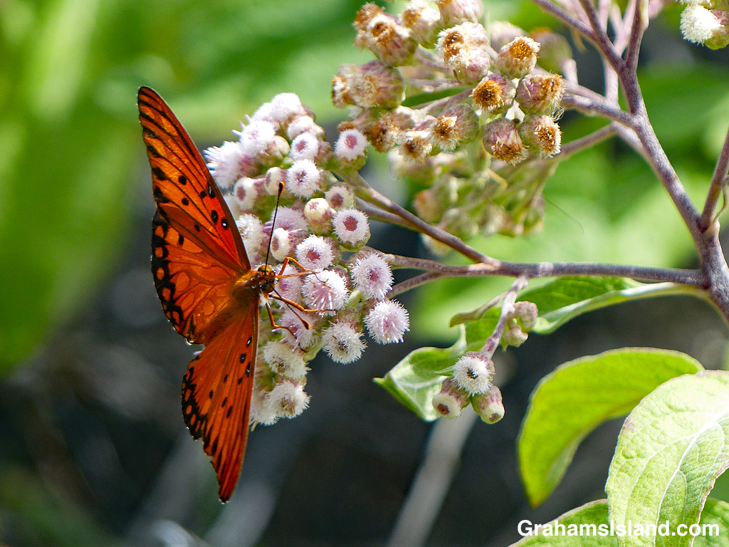
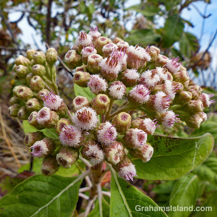
Pluchea carolinensis is also known as sourbush and cure-for-all. This latter name probably comes from its medicinal use in its native range, which is the tropical Americas. It’s a member of the aster family – Asteraceae.
The plant was first reported in Hawaii in 1931 and on the Big Island in 1933. It’s believed to be an accidental introduction, possibly associated with shipping to Hawaii and within the islands. The onset of World War II prompted the plant’s spread through the Pacific, probably in military shipments.
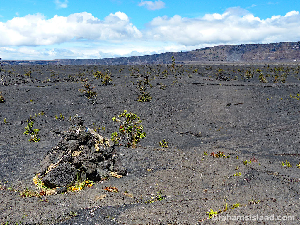
On the Big Island it’s most often seen in drier coastal areas, but it can tolerate a variety of climates and conditions. These photos were taken on the Puna Coast Trail in Hawaii Volcanoes National Park.
For more information about Hawaii Volcanoes National Park, go to nps.gov/havo/.
Halemaumau Crater, at the summit of Kiluaea Volcano, underwent profound changes during the 2018 eruption. When lava drained from the summit vent, the crater floor experienced a series of collapses, radically changing the appearance of the crater and its surrounds.
I had seen this area from the air and posted about it (here). The middle photo was taken during that flight and shows where a section of Crater Rim Drive slid into the crater. When I last visited the park, I got a different view of this.
The recently reopened Byron Ledge Trail has good views across the crater. In the top photo, the chunk of road is clearly visible with its white line running down the middle of it. The bottom photo shows the longer view across the crater with the road in the distance. In the center of the photo, equipment used to monitor the volcano’s activity, can be seen. The tree in the foreground is an ‘ōhi‘a lehua with its brilliant red flowers. It’s an early colonizer of new lava flows and all those little dark spots on the main crater floor are ‘ōhi‘a lehua trees, mostly still shrub-sized at this time.
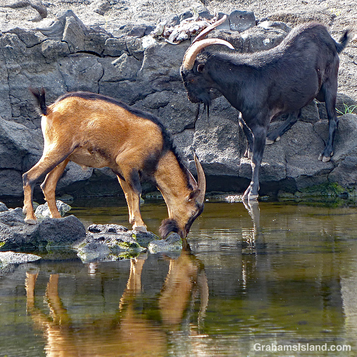
A recent visit to Pu’uhonua o Hōnaunau National Historical Park, otherwise known as Place of Refuge, included this encounter with a herd of goats. The goats were passing through and stopped to get a morning drink in the ponds. These anchialine ponds are connected to the nearby ocean through underground channels. Because of this, the levels of water in the ponds vary with the tides.
In the ponds, fresher water floats on top of saltwater from the ocean, which is why they’re a good watering hole for the goats. Back in the days when Hawaiian royalty lived on these grounds, the ponds were used to hold fish for future consumption by those living here.