Category Archives: Parks

Kilauea Military Camp

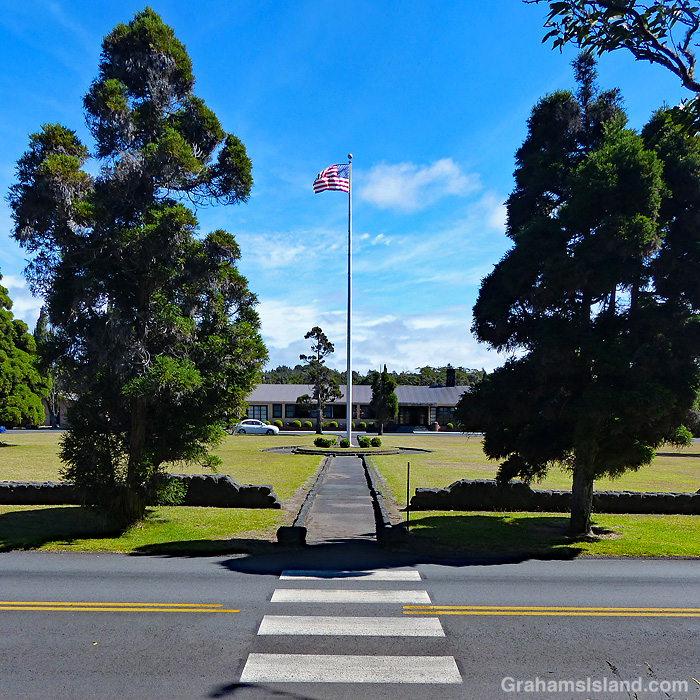
This is a view across Chain of Craters Road, in Hawaii Volcanoes National Park, toward the flagpole and entrance of Kilauea Military Camp. The camp was founded in 1916, the same year as the park, as a rest and relaxation facility for military personnel. Today, it continues to fill that same function though the facilities are somewhat nicer than they were back then. There’s an array of cottages, a store, theater, sports facilities, gas station, laundromat, even a bowling alley.

While it’s been an R&R post for most of its existence, during WWII it was used as a prisoner of war camp and as a Japanese internment camp.

For more information about Kilauea Military Camp, go to https://www.kilaueamilitarycamp.com/. For more information about Hawaii Volcanoes National Park, go to nps.gov/havo/.

Posted in response to Becky’s July Squares challenge theme of ‘Perspective.’ See more responses here.

Kilauea trails

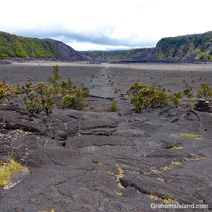
Kilauea Iki Trail in Hawaii Volcanoes National Park

Hawaii Volcanoes National Park recently opened up more areas of the park that had been closed because of the Covid-19 virus pandemic. I thought this was a good opportunity to hike some of the summit trails that I usually avoid because they’re more accessible and popular with tourists. I put together a loop hike that would have been great had all the trails listed as open actually been open.

Despite this glitch, I had a good time and enjoyed the variety of landscapes the park has to offer. The top photo shows the part of the Kilauea Iki Trail that traverses that crater. The crater floor is a little under a mile across. This crater used to be much deeper before an eruption in 1959 filled it up another 400 feet. There is some vegetation, but the crater floor is mostly bare lava and steam can often be seen rising in various places.

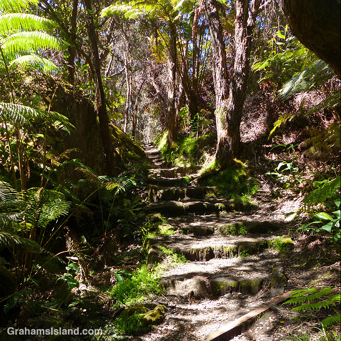
The middle photo was taken on the Halema‛uma‛u Trail, which winds down from the summit into Halema‛uma‛u Crater. Despite the trail’s proximity to the vent in the crater, which was active until May 2018, vegetation thrives here as it does on many trails in the park.

The bottom photo shows a section of active steam vents alongside the Crater Rim Trail. This section of the trail is paved because the area normally sees very heavy use. When I was there, it was mostly deserted because of the lack of tourists on the island. The buildings on the horizon are the Volcano House Hotel which recently reopened for business, though the restaurant is still closed.

For more information about Hawaii Volcanoes National Park, go to nps.gov/havo/. For more information about Volcano House Hotel, go to hawaiivolcanohouse.com/.

Posted in response to Becky’s July Squares challenge theme of ‘Perspective.’ See more responses here.

Beach pea vine

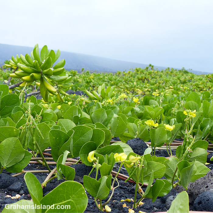
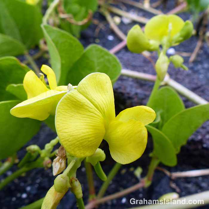
Beach pea vine (Vigna marina) is an indigenous plant with flowers and seed pods that clearly identify it as a member of the pea family. It fares well on the coast because it’s salt tolerant. It spreads, forming large swathes stretching away into the distance, as in the top photo.

Posted in response to Becky’s July Squares challenge theme of ‘Perspective.’ See more responses here.

Chain of Craters Road

A view from the air gives a different perspective on Chain of Craters Road in Hawaii Volcanoes National Park. The road winds it’s way from the park entrance down to the coast. And why is it called Chain of Craters Road? Well, there are two big clues in this photo.

For more information about Hawaii Volcanoes National Park, go to nps.gov/havo/.

Posted in response to Becky’s July Squares challenge theme of ‘Perspective.’ See more responses here.

Signs: Nēnē crossing

This week’s Friendly Friday challenge theme is ‘Unusual.’ See more responses here.

Nēnē, the endemic Hawaiian geese, are long-distant relatives of Canada geese. They were listed as an endangered species, until the end of last year when their status was changed to ‘threatened.’

Because of the nēnē’s precarious numbers, it isn’t unusual to see “Slow, Nēnē Crossing” signs, particularly in areas where nēnē breed. Because their numbers are on the rebound on the Big Island, it’s also not unusual for me to see nēnē, on my daily walks or when I was working. But in my years on the island, I never saw a nēnē anywhere near one of the warning signs, until earlier this year, just before the lockdown. This sign and these two birds were in Hawaii Volcanoes National Park, where a fair number of the birds live and breed.

I had to stop and get a photo of this unusual event, fortunately without getting myself or the birds killed (it’s a busy, narrow road). The only disappointing thing about this encounter was that neither of the nēnē actually crossed the road. I guess I’ll have to wait another seven years to witness that.

Spencer Beach Park

Spencer Beach Park, near Kawaihae, is a popular spot for families. With protected water, sand, shade, and facilities it’s got most everything little kids need. On weekends it can get crowded, but during the week it’s usually possible to find a quite spot.

The park is right next door to Puʻukoholā Heiau National Historic Site so it’s possible to visit both places from one parking spot.

Boiling Pots

Boiling Pots is part of Hilo’s Wailuku River State Park. In this photo, the pots can just be made out through the tree in the center. It looks serene here, but it’s a dangerous spot. The river is prone to flash floods and when it’s roaring, the water in the pots looks like it’s boiling, hence the name. People have been sucked under and trapped in hidden caves and lava tubes. There are lots of warning signs, but many people still think they know better. Not all of them are right.

Long-tailed blue butterfly

The long-tailed blue butterfly (Lampides boeticus) is believed to have been accidentally introduced to Hawaii in the 1880s. Accidental or not, it wasn’t a good thing. Its common name, bean butterfly, gives a clue as to the problem. It damages a wide variety of bean and pea plants, both domestic and commercial.

These photos were taken on the Puna Coast Trail in Hawaii Volcanoes National Park. The plant is Vigna marina or beach pea, an indigenous plant that grows well in the harsh, exposed coastal area that the trail passes through.