
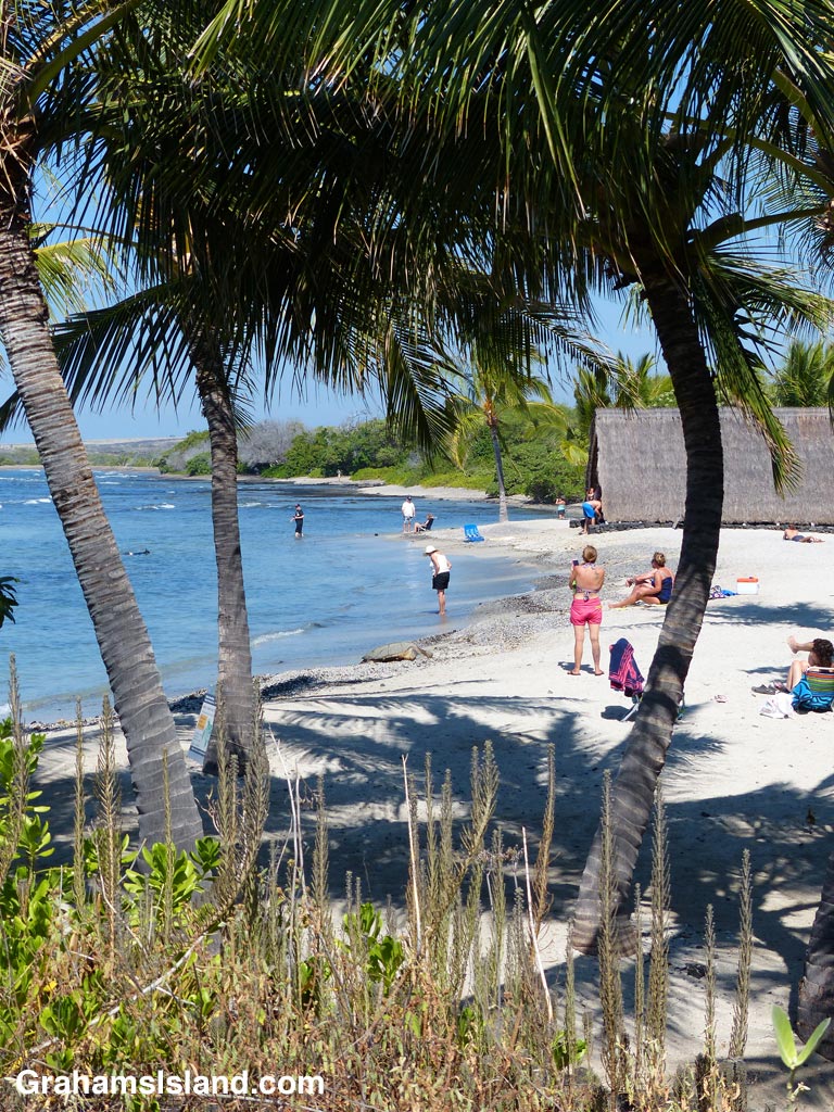
A view of the beach at the Aiopio Fishtrap in Kaloko-Honokohau National Historical Park. There’s a large turtle in the center of the photo at the water’s edge, not the best spot in the world to get some undisturbed rest.
Category Archives: Parks
Signs: Rainbows next 3 miles
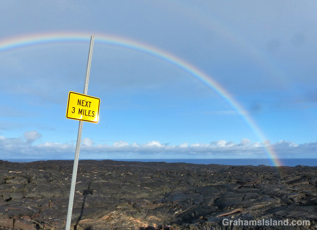
I saw this sign when I was hiking out to see the current lava flow from Pu’u O’o to the ocean. Sure, the sign was a little vague, but I figured it must refer to the rainbow which it appeared to point to.
By golly, the sign was right. There were rainbows for the next 3 miles.
Green Turtle sunbathing
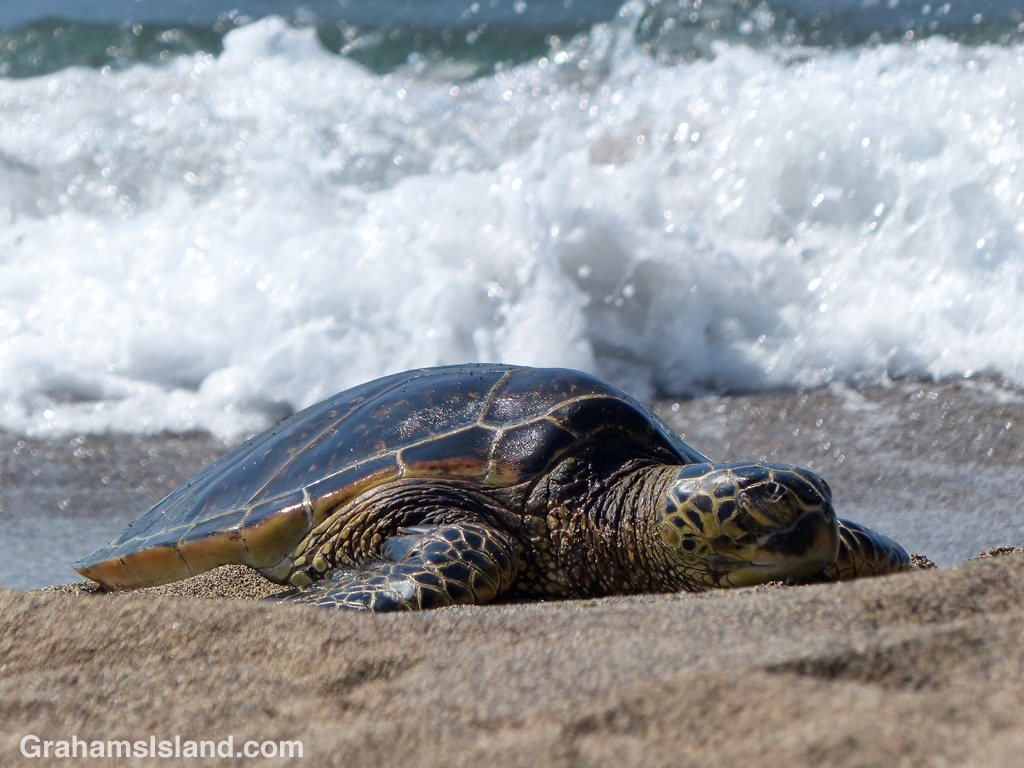
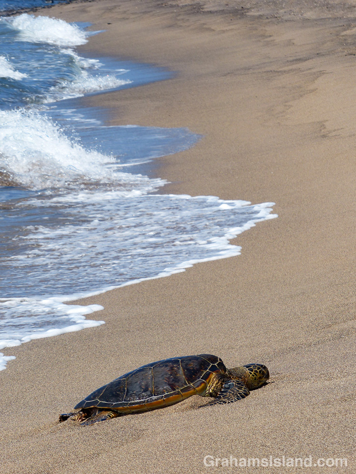
One of the attractions of Kaloko-Honokohau National Historical Park, north of Kailua Kona, is that it’s a popular resting spot for Hawaiian green sea turtles. This turtle was hauled out on a long curve of golden sand known as Honokohau Beach. He had the spot to himself, which is good. People are supposed to stay at least 20 feet away from turtles, but many don’t.
For more information about Kaloko-Honokohau National Historical Park, go to bigislandhikes.com/kaloko-honokohau-park/.
Abstracts: Queen’s Bath fish
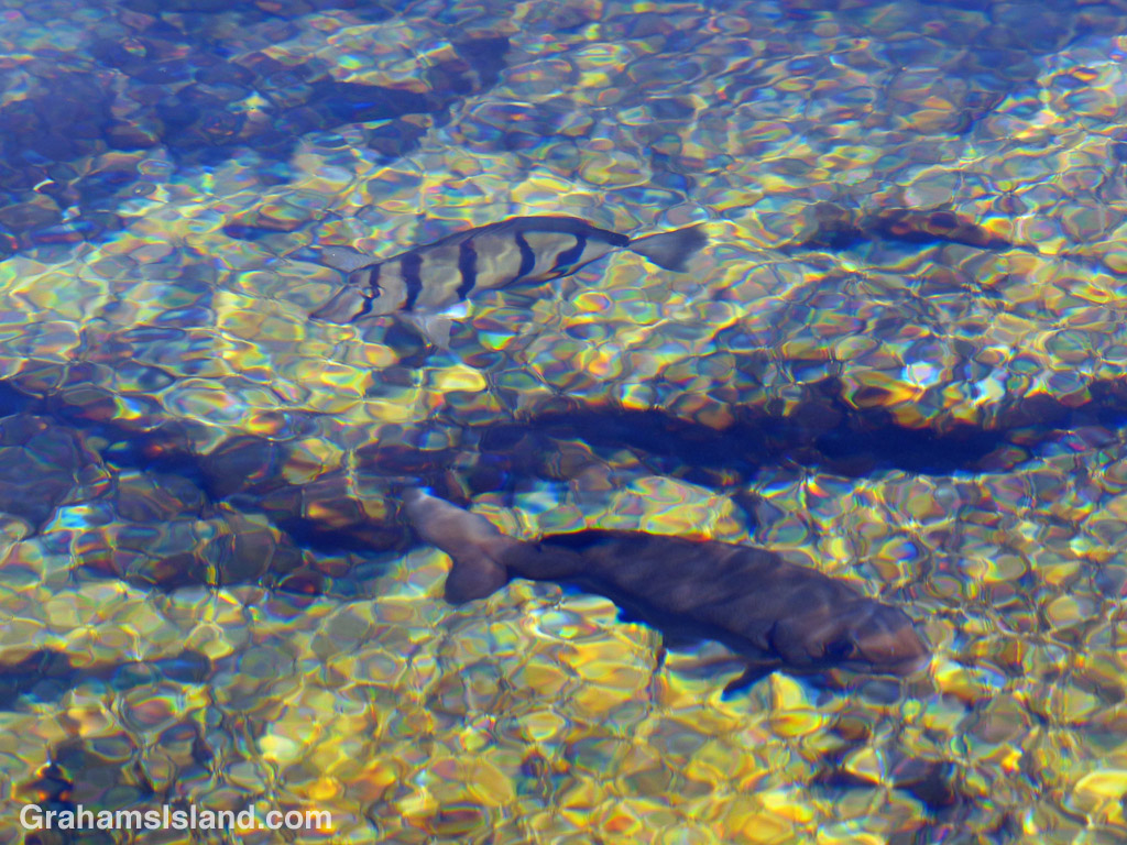
Kaloko-Honokohau National Historical Park, just north of Kailua Kona, contains a feature known as the Queen’s Bath. This is an anchialine pond, containing a mix of freshwater and saltwater. Freshwater seeps into the pond from rainfall. Saltwater infiltrates through cracks in the lava. Because of this, the water level rises and falls with the tide. I can verify this as I took this, and other photos, sitting on a rock near the water’s edge. Just before I left, I realized my feet were now resting in water, the level having risen.
Anchialine ponds are unique ecosystems and this one contained several fish including these two. The one in the back is a convict tang. Not sure what the other one is. What I liked about the pond is the stained glass effect it created.
For more information about Kaloko-Honokohau National Historical Park, go to bigislandhikes.com/kaloko-honokohau-park/.
Kahuku hike
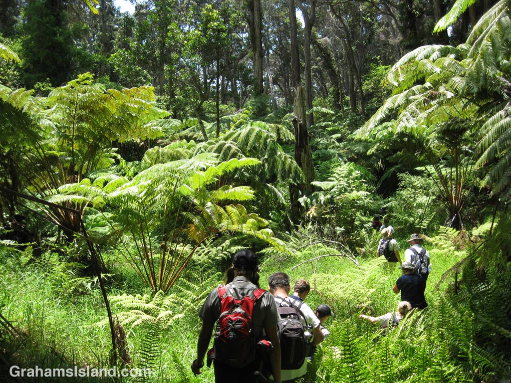

Kahuku is part of Hawaii Volcanoes National Park. Its 116,000 acres was added to the park in 2003, an estate purchase of former ranch land. This purchase almost doubled the size of the park.
Not far from the southern tip of the Big Island, the entrance to Kahuku is about an hour’s drive from the main park entrance, but the two areas are contiguous, joined at the summit of Mauna Loa.
These photos are from a guided hike in Kahuku that I did a while back. The hike went through fairly dense old growth Hawaiian forest that had been spared because it was in a steep gully and thus not suitable for clearing for pasture. There was no real trail.
Currently this part of the park is closed because trees with Rapid ‘Ōhi’a Death (ROD) have been found in the lower part of the park and the goal is to prevent it spreading to other areas.
For more information on the Kahuku Unit of Hawaii Volcanoes National Park, go to nps.gov/havo/planyourvisit/kahuku-hikes.htm or bigislandhawaiitravelguide.com/places/puu-o-kahuku-at-hawaii-volcanoes-national-park.html
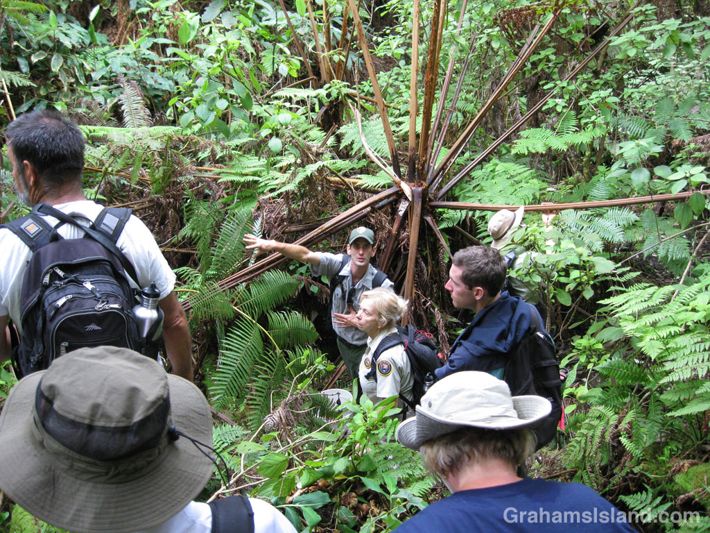
Puapo’o lava tube tour


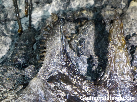
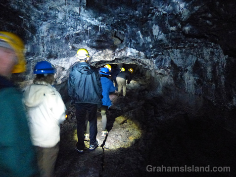
As part of the National Park Service centennial celebration, Hawaii Volcanoes National Park has been offering a guided tour of Puapo’o lava tube. This tour has been offered in the past, but not for several years.
Puapo’o is a pristine lava tube meaning that its rock formations are intact and life in the tube is largely undisturbed. Contrast this with the park’s popular Thurston lava tube, where all the finer lava details have long since been broken off by visitors.
There’s a hike to the tube, which is deep within a forest rich in tree ferns.
The tube entrance is accessed by a ladder and then it’s on into the dark. Whereas Thurston lava tube is well lit and has a mostly flat floor for easy walking, Puapo’o, which is about a mile long, was lit only by our headlamps and rocks littered the tube floor. It’s not a tour for the claustrophobic or nervous.

Those rocks on the floor match recesses in the tube ceiling show where rock falls have happened. A month before, one of our rangers had been leading a tour when there was an earthquake, a common occurrence in the park. The group left the tube, but the next visit found a new rock fall.
We scrambled over rocks, and sat in the dark in a large, amphitheater-like part of the tube. As we progressed, the rangers pointed out different lava formations from lava-sicles to bathtub rings to puapo’os for which the tube is named. And even in this pitch dark place, there is life – moths, crickets, and spiders, one a huntsman and the other a tiny, near invisible thing that builds gossamer webs. Also, living on the tube walls, are unique microbial colonies, which are being studied for medical uses.
Eventually, we scrambled up a rocky slope and out through a narrow opening, back into the forest.
For more information about the Puapo’o lava tube tour, go to nps.gov/havo/planyourvisit/lava-tube-tour.htm.

Hike to Kilauea’s lava flow

The Lava Ocean tour boat edges up to the new bench in the ocean, created by the flow.
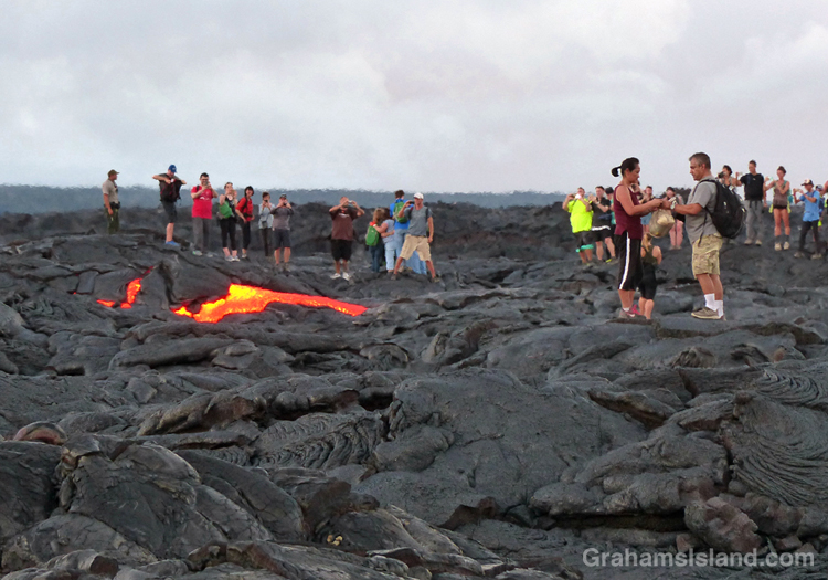
This photo was taken within a few seconds of this lava breakout beginning. The couple on the right hadn’t yet noticed it.
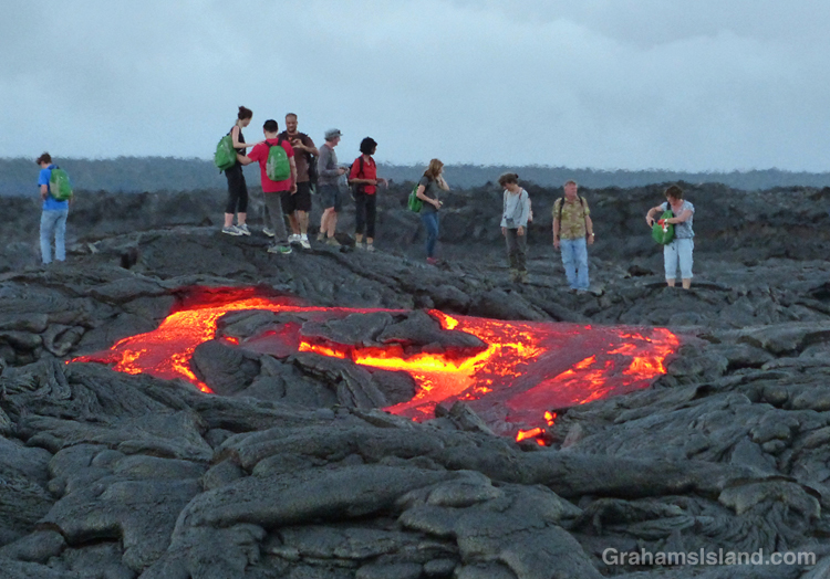
The breakout spreads …
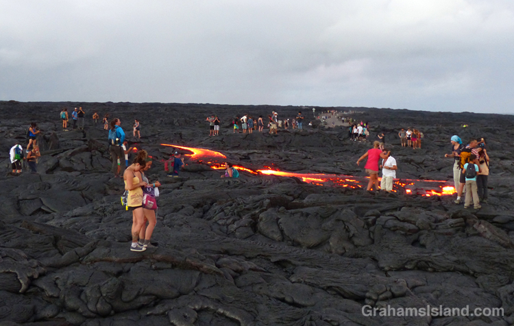
… and extends toward the water. This was about as far as it got while I was there. All these people are standing on the active flow.
Last week, I posted twice (here and here) about a boat trip to see lava entering the ocean from Kilauea Volcano’s Pu’u O’o vent. Since then the ocean entry widened dramatically to more than 700 feet. With all that activity, I thought another hike to the flow was in order. This time, instead of hiking from the viewing area at Kalapana, I decided to go through Hawaii Volcanoes National Park.
The hike starts on the coast, at the end of Chain of Craters Road. It’s about an 8.5 mile round trip, and follows the emergency gravel road constructed in 2014. While the whole area is a stark covering of old lava flows, I liked seeing ferns and the occasional shrub getting a toe hold in cracks and under ledges. And then, with late afternoon light slanting from behind and rain showers approaching from ahead, a brilliant rainbow lit up the sky.
Regarding the current flow, the USGS website notes that “the entire area presents a significant hazard to visitors.” It goes on to list dangers from toxic gasses, explosive events, and unstable ground. So it was with some surprise that when I arrived, I found the flow crawling with people. This wasn’t because it had suddenly stopped and cooled. At the edge, where it crossed the road, the red glow of active lava could be seen. I talked to one of the park rangers keeping an eye on things. He said all they could do was post signs and try and make people understand the dangers. They had roped off some areas and people just stepped over the ropes. It gave me a warm glow to know that, if someone was injured here, that person would understand it was their own fault and wouldn’t turn around and try to sue the park service for millions.
I wandered down the edge of the flow to the cliff where the new bench being formed by the lava could be seen. Then back to the road and I figured, if everyone else is doing it, it must be safe, right? Ha, ha. The thing is, standing next to the flow, the heat was significant, and stepping on to it, it got hotter still. My feet got distinctly toasty, so I took a couple of photos and turned around. A few minutes later, I happened to be looking in the direction of one of the clumps of people standing on a lump of lava. Suddenly, a river a red burst from near the base of the lump. A breakout, and a decent-sized one at that.
Naturally, the people nearest to the breakout quickly moved away from the danger. Ha, just kidding. People rushed toward the lava because, though the surface was obviously unstable and could turn to deadly, molten liquid at any moment, it probably wasn’t going to happen to the lump they stood on. Frankly, it was all a bit surreal.
Later, I saw the ranger I’d talked to earlier doing a brisk trade in fixing the detached soles of shoes – flat tires, he called them – where heat from the flow had melted the glue. As the light dimmed, numerous glowing red patches of lava showed up, speckled with white and yellow flashlights as people meandered through the dark.
It was time to go before someone out there misstepped. I had a three hour drive ahead of me and I didn’t want their screams ringing in my ears.
For more information about Kilauea Volcano and it current eruption, go to hvo.wr.usgs.gov/activity/kilaueastatus.php.
For more information about boat trips to see the lava, go to lavaocean.com.

A rainbow rises over the road to the flow.
Flowing to the ocean

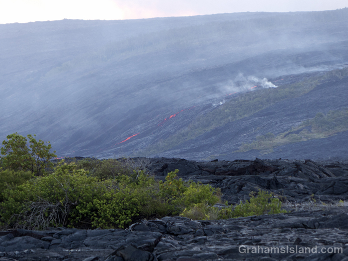
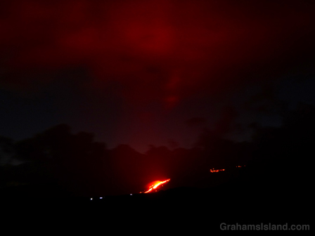
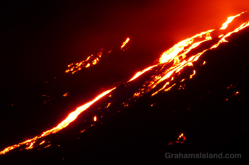
In April, I posted here about a trip last year to see lava bubbling up at Kilauea Volcano. That activity was in the Overlook vent of Halema’uma’u Crater. On May 24, Kilauea’s other active vent, Pu’u O’o, began a new breakout of lava toward the southeast. This is a path that flows have taken many times before. The first active lava I saw was back in 2010 when such a flow reached the sea and put on a spectacular show.
This May 24 flow is also headed to the sea. By June 28 it had reached Pūlama pali, a steep slope leading down to the coastal plain. On July 7 it was less than three-quarters of a mile from the ocean, and creeping slowly over previous flows that have taken this path. That’s when I went down to take a look and took these photos.
At its current rate of progress, the flow will reach the ocean in a week. But it could speed up or stop, so it’s really a case of wait and see.
There is one note of irony. I have a map from 1975 showing the road that ran along this coast before being covered by various flows from the volcano. In 2014, a flow from the Pu’u O’o vent headed east, threatening the town of Pahoa and the main highway into that corner of the island. One response to that situation was to bulldoze an emergency highway along the coast, at a cost of $10 million or so, following the route of the old road. It was never used as that flow stopped short of Pahoa. If the current flow travels another a half mile or so, the emergency highway will be covered again without ever being used. Such is life.
For more information about Kilauea Volcano and it current eruption, go to hvo.wr.usgs.gov/activity/kilaueastatus.php.

