

The small mirror in the Cassegrain cabin of the James Clerk Maxwell Telescope on Mauna Kea, can be rotated to direct information to a variety of instruments. Here, it reflects about the only empty spot in the crowded space.
Hawaiian cleaner wrasse services a bullethead parrotfish
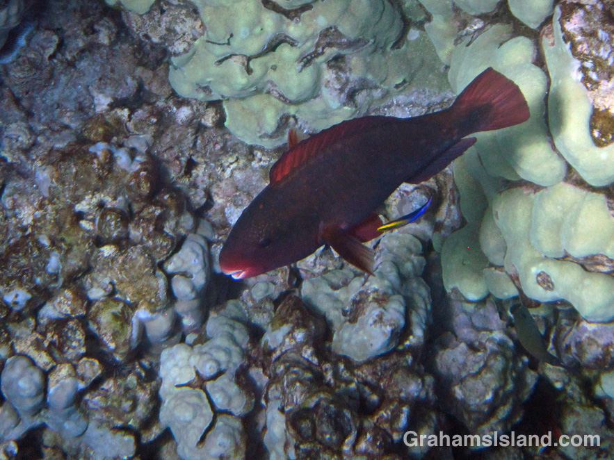
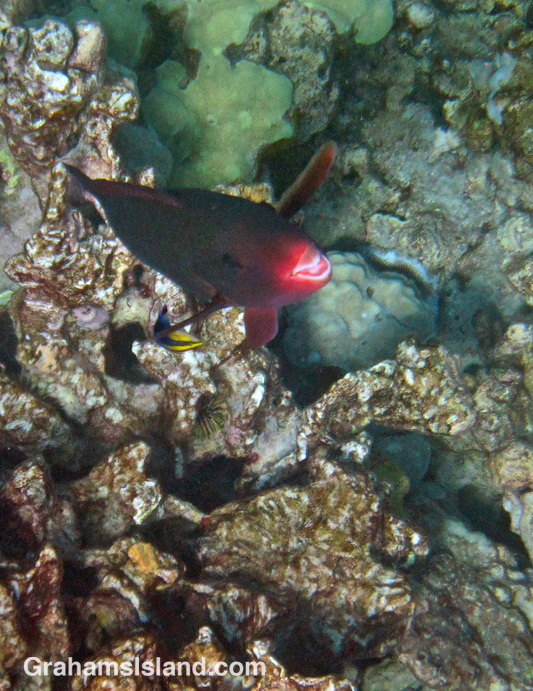
Hawaiian cleaner wrasse are small blue and yellow fish that clean the mucus, dead tissue and parasites off other fish. They establish permanent stations on the reef, and fish that need cleaning swim up and hover around until it’s their turn.
A fish can get nipped during a cleaning, but they also seem to enjoy the process and the sensation of the cleaner wrasse dragging its fins over a client’s body – a one-stop clean and massage. This bullethead parrotfish seemed positively ecstatic during its clean, several times sporting a look of bliss on its face.
Maybe next time I’m in the water, I’ll dive down and give it a go.
Mourning gecko stretches on a bird of paradise
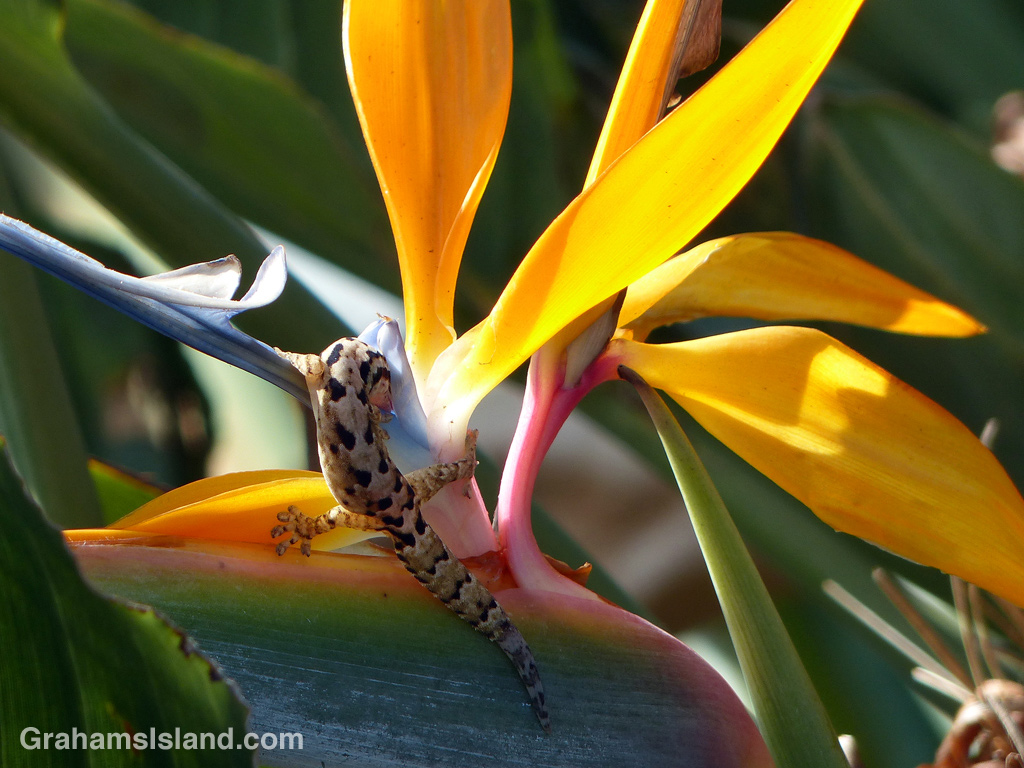
Flexibility is important in nature, as this mourning gecko demonstrates while drinking from a bird of paradise flower. If I tried that, I’d be laid up for a week.
Chocolate ball ginger
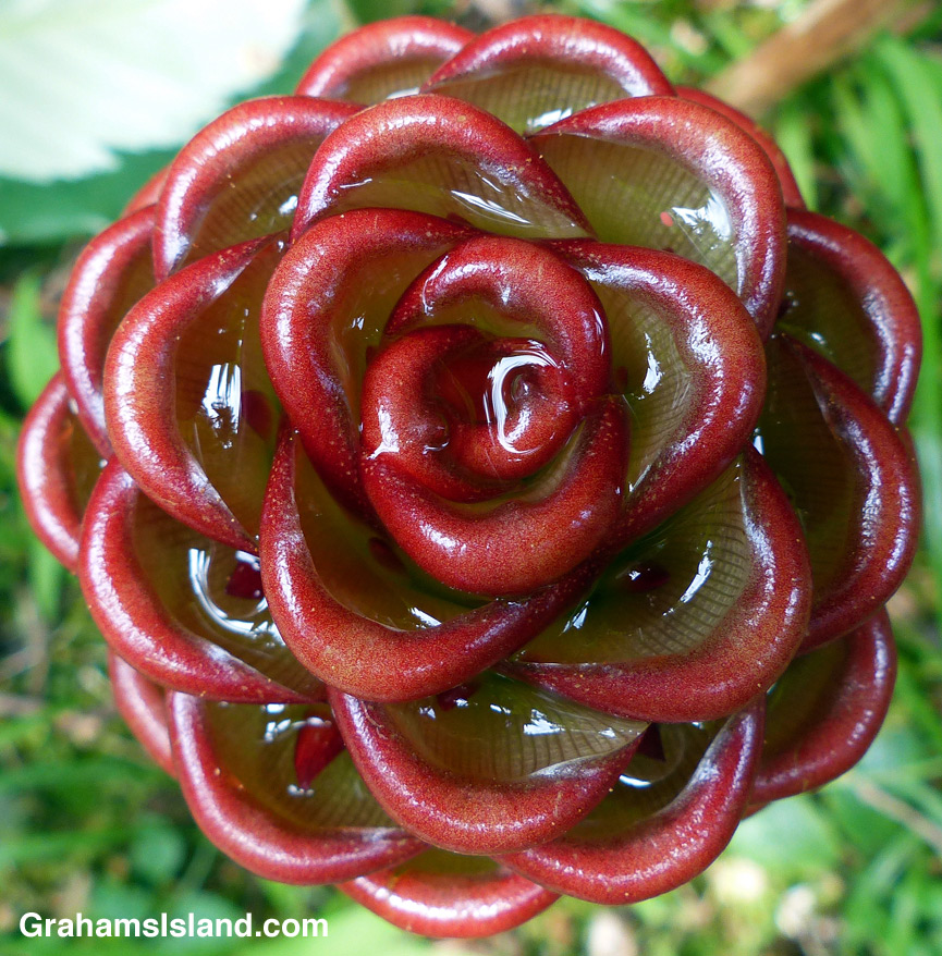
Chocolate ball ginger (Zingiber macradenium) is a beehive ginger, so-called because of their shape and composition. Their form means the many little cups are great collectors of water. They probably make great drinking spots for geckos, birds and other small creatures. Probably also a great environment for breeding mosquitoes.
For more information about Hawaii Tropical Botanical Garden, go to htbg.com.
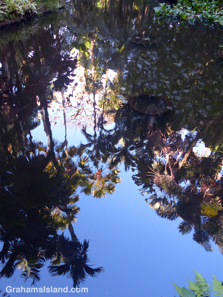
Abstracts: Lily Lake reflections
Runaway cow

I like cows, but they can be nervous creatures. Escapees from the local dairy farm are quite common and not a big deal (unless I stop to consider the very large bulls sharing the same fields these cows escape from so easily). The cows rarely get into trouble, in part because they have to travel more than a mile before reaching the main road.
On this day, I was walking down the dirt road to the coast when this cow galloped around a corner, a quarter-mile distant, headed in my direction. She’d clearly been panicked by something and I knew that when she saw me, she might panic again.
The road widened just ahead so I eased up to that spot and hugged the fence line, hoping the cow would carry on past without becoming alarmed. She loped along, up on the bank on the far side of the road. Then, about 100 yards from me, she stopped, ears up, eyes staring. Clearly, I’d been spotted. I didn’t look her way, turning around and pretending I hadn’t noticed. The last thing I wanted was for her to head back the way she came with me walking along behind, stoking her fears.
Luckily, her existing anxiousness got the better of her and she thundered past along the bank, which is when I took this photo. What generally happens is that, eventually, someone from the farm sees the cow or cows on the road and rounds them up. The cows are inevitably relieved to be back in their pasture and all is well – until the next time.
The Nāpau Trail – Through the woods


Yesterday, I posted about the first part of the Nāpau Trail in Hawaii Volcanoes National Park, which crosses extensive lava fields. Today’s post picks up from there, on the rim of Makaopuhi Crater, where the trail slips into dense forest on its way to the Nāpau Crater overlook.
It’s a remarkable contrast between the stark lava and thriving forest. Birdsong is continuous. Ferns of every kind grow in abundance. Bamboo orchids pop out here and there. And above it all, tall Ohia trees provide the backbone of the forest. This forested trail is clear, but somewhat overgrown. I was hiking in shorts and, at the end of the day, my legs were generously scratched.
Early on in this section, it’s possible to get views of Makaopuhi Crater. Also in this area is the junction with the Nāulu Trail, which starts out at the Kealakomo Overlook, farther down Chain of Craters Road.
The forested part of the trail is about 2.5 miles and towards the end of it is an old Pulu factory. The sign there reads: “Between 1851 and 1884 great quantities of pulu, the soft, reddish-brown fiber covering the coiled fronds of the tree fern (hāpuʻu), were harvested on Hawaii. Much of it was processed within these walls, later to be shipped from Keauhou Landing to foreign markets for use as stuffing in pillows and mattresses.” Unfortunately, in drier climates, pulu quickly breaks down so the industry collapsed.
A little farther along is another junction. To the left is the very basic Nāpau campsite, a few open flat areas and an outhouse. To the right, the trail continues to the overlook, where I was lucky enough to have a wonderful, clear view of Puʻu ʻŌʻō, busily pumping out sulphur dioxide and other gases, and of course, million upon millions of gallons of lava, currently entering the ocean on the southeast coast.
Picking the right day for the hike is not always obvious and weather changes quickly around here. At the visitor center, on the way in, it was completely overcast and drizzling, but by the time I got to the trailhead the sun was out and a nice breeze blew. The wind direction is also important. On this day, the northeast trades were blowing and the vog trailed away to the southwest, which is fine for this hike. But if the wind blows more easterly or south of east, then this trail would be downwind of emissions from the volcano, which could potentially be a dangerous situation.
For more information about this, and other hikes on the Big Island, go to bigislandhikes.com.
For more information about Hawaii Volcanoes National Park, go to nps.gov/havo/.
For more information about Kilauea Volcano and it’s eruptions, go to hvo.wr.usgs.gov/kilauea/history/main.html.
The Nāpau Trail – Over the lava

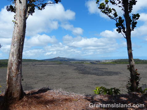
The Nāpau Trail in Hawaii Volcanoes National Park, is a 13-mile round trip. It passes over extensive lava fields, plunges into dense forest, and ends at the Nāpau Crater overlook. The overlook offers a terrific view (weather permitting) of Puʻu ʻŌʻō, one of two active vents on Kilauea Volcano. In today’s post I’m going to cover the lava fields portion of the hike with the second part coming tomorrow.
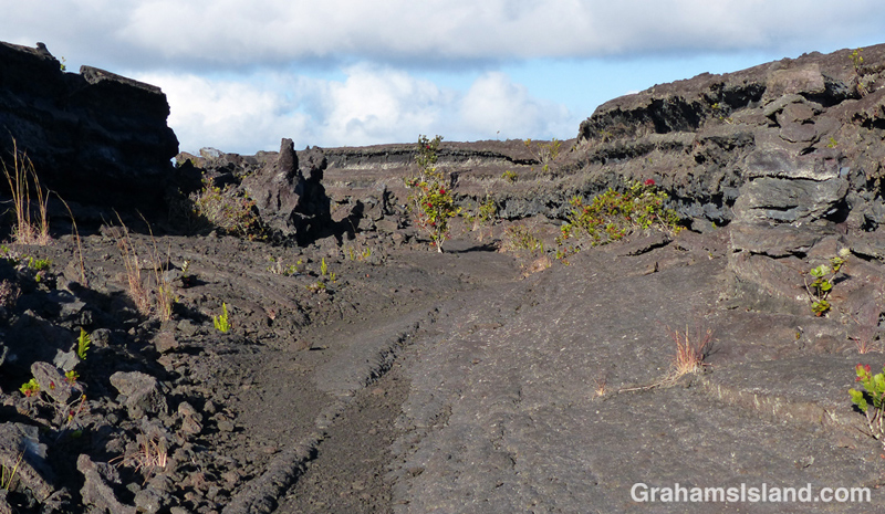
From the Mauna Ulu parking area, the first mile or so is a well-trodden trail to Pu’u Huluhulu (hairy hill) cinder cone. The foot of Pu’u Huluhulu is where the Nāpau Trail branches off across the lava. It’s a stark landscape, but with lots of interest. The trail passes over surface flows and through channels where lava rivers ran.
The Park’s website notes that the Nāpau Trail “follows the path that magma takes as it makes its way underground from its source at the summit to the point where it comes to the surface near Puʻu ʻŌʻō.” The many steam vents around Mauna Ulu are testament to this.
And in this hostile landscape, nature is at work. The lava fields are dotted with tenacious plants establishing a toehold. Ohia trees and ferns are most frequently seen, but grasses and other plants lend color to this sea of gray and black.
It’s 2.2 miles of unbroken lava from the Pu’u Huluhulu junction to the rim of Makaopuhi Crater, but at that point the trail changes in an almost surreal way. I’ll post that section tomorrow.
For more information about this, and other hikes on the Big Island, go to bigislandhikes.com.
For more information about Hawaii Volcanoes National Park, go to nps.gov/havo/.
For more information about Kilauea Volcano and it’s eruptions, go to hvo.wr.usgs.gov/kilauea/history/main.html.


