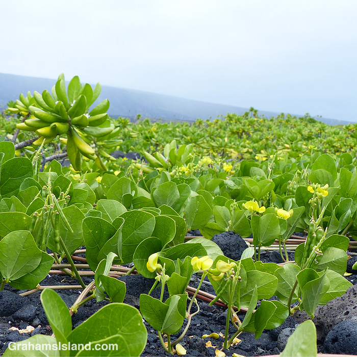
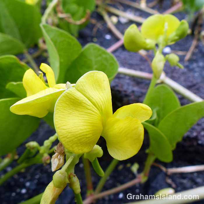
Beach pea vine (Vigna marina) is an indigenous plant with flowers and seed pods that clearly identify it as a member of the pea family. It fares well on the coast because it’s salt tolerant. It spreads, forming large swathes stretching away into the distance, as in the top photo.
Posted in response to Becky’s July Squares challenge theme of ‘Perspective.’ See more responses here.
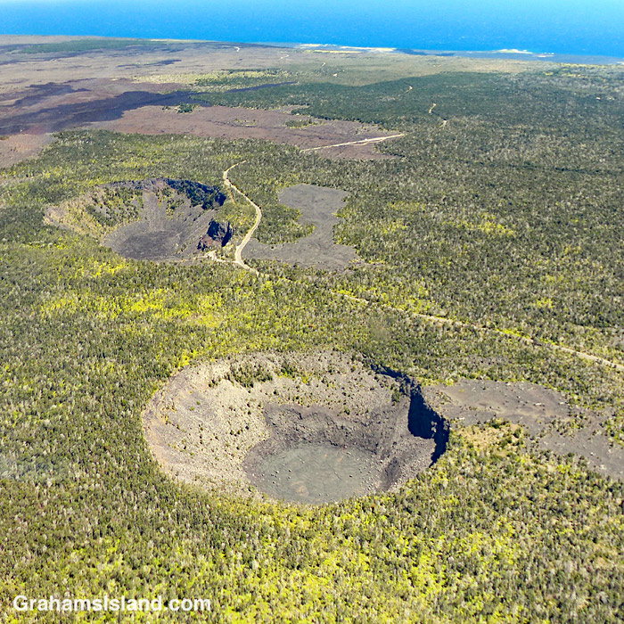
A view from the air gives a different perspective on Chain of Craters Road in Hawaii Volcanoes National Park. The road winds it’s way from the park entrance down to the coast. And why is it called Chain of Craters Road? Well, there are two big clues in this photo.
For more information about Hawaii Volcanoes National Park, go to nps.gov/havo/.
Posted in response to Becky’s July Squares challenge theme of ‘Perspective.’ See more responses here.
This week’s Friendly Friday challenge theme is ‘Unusual.’ See more responses here.
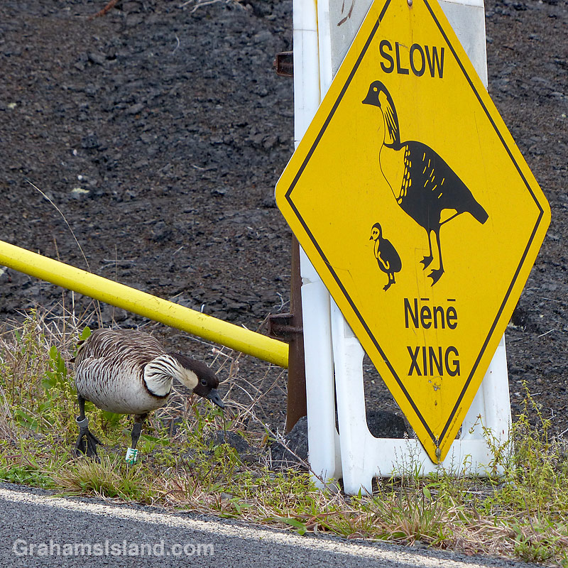
Nēnē, the endemic Hawaiian geese, are long-distant relatives of Canada geese. They were listed as an endangered species, until the end of last year when their status was changed to ‘threatened.’
Because of the nēnē’s precarious numbers, it isn’t unusual to see “Slow, Nēnē Crossing” signs, particularly in areas where nēnē breed. Because their numbers are on the rebound on the Big Island, it’s also not unusual for me to see nēnē, on my daily walks or when I was working. But in my years on the island, I never saw a nēnē anywhere near one of the warning signs, until earlier this year, just before the lockdown. This sign and these two birds were in Hawaii Volcanoes National Park, where a fair number of the birds live and breed.
I had to stop and get a photo of this unusual event, fortunately without getting myself or the birds killed (it’s a busy, narrow road). The only disappointing thing about this encounter was that neither of the nēnē actually crossed the road. I guess I’ll have to wait another seven years to witness that.
I’m still surprised by what I see in some of the most inhospitable-looking areas on the island. I saw this grasshopper out in the lava fields on the Puna Coast Trail.
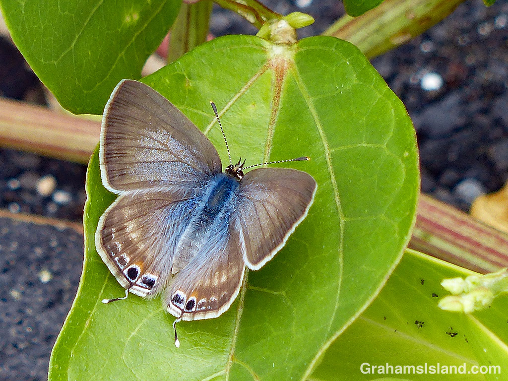
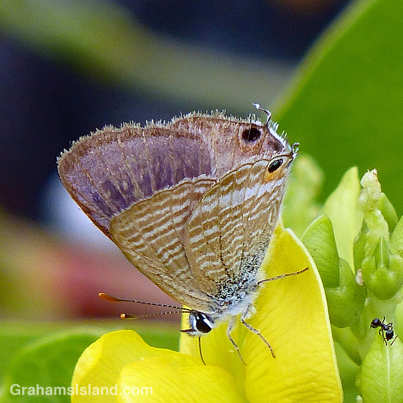
The long-tailed blue butterfly (Lampides boeticus) is believed to have been accidentally introduced to Hawaii in the 1880s. Accidental or not, it wasn’t a good thing. Its common name, bean butterfly, gives a clue as to the problem. It damages a wide variety of bean and pea plants, both domestic and commercial.
These photos were taken on the Puna Coast Trail in Hawaii Volcanoes National Park. The plant is Vigna marina or beach pea, an indigenous plant that grows well in the harsh, exposed coastal area that the trail passes through.
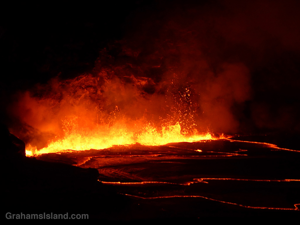
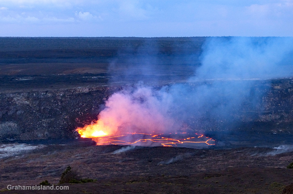
Lava fountains flare up alongside the rim of the active vent in Halemaʻumaʻu Crater at the summit of Kilauea Volcano.
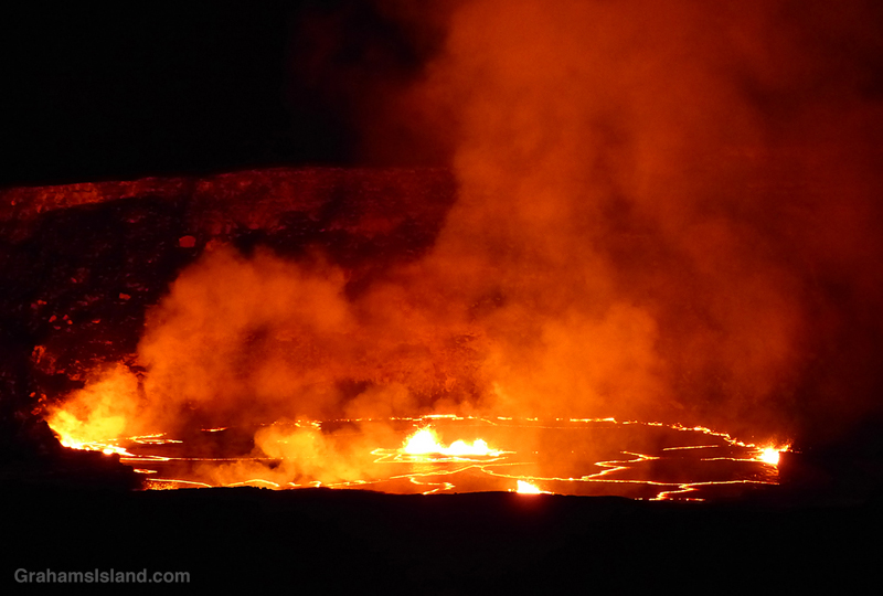
The walls of the crater illuminated by the lava.
This week’s Sunday Stills challenge theme is ‘Mother Earth.’ See more offerings here.
The Big Island is home to Madame Pele, who in Hawaiian culture is the goddess of volcanoes. She is the creator of new land as well as a destroyer. These photos were taken on April 24, 2018. (An account of that visit, and more photos, can be found here.) On May 1, the lava in the lake began to drop. Within a week, it had dropped more than 700 feet and continued falling. Lava had also disappeared from Pu’u O’o, the other active vent on Kilauea.
The drop in lava levels was due to magma in the system moving down the east rift zone of the volcano where it emerged in a series of vents in Leilani Estates, a housing subdivision in the southeast part of the island. This new eruption lasted until late August, 2018, since when the volcano has been quiet.
While there has been no visible activity, below ground, magma has been moving through the system, notably into Kilauea’s summit chamber. It’s surely only a matter of time before Madame Pele makes her presence known again on one of the world’s most active volcanoes.
The early morning light shows the crater and land around Halemaʻumaʻu Crater. This is a scene that no longer exists. Since this photo was taken, not only is the vent no longer active, but the crater floor has collapsed numerous times and the walls have also subsided in places.
This is the third and final part of a three-part description of a hike along the Puna Coast Trail in Hawaii Volcanoes National Park (See part 1 here, part 2 here).
The last part of the trail before ʻĀpua Point crosses over the only stretch of ʻaʻā lava on the trail which, as can be seen in the second photo, is markedly more rough and jagged than pahoehoe lava. This ʻaʻā is part of a 1969 flow from the same eruption at Mana Ulu that produced the pahoehoe lava that most of the trail passes over. The Mauna Ulu eruption lasted from 1969 to 1974.
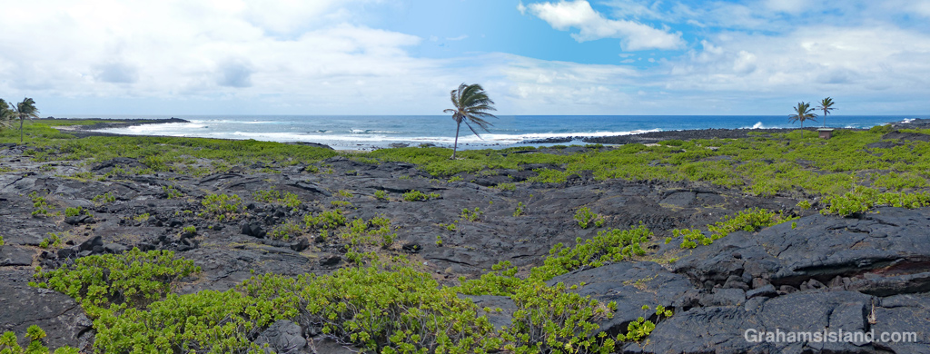
ʻĀpua Point is like a little oasis in a bleak landscape. Flows from the Mauna Ulu eruption reached the ocean on either side of the point, but the point itself was spared. The top photo is a panoramic view of the coast, stitched together (not well) from two photos, to show the view from ʻĀpua Point’s outhouse – actually a composting toilet. This toilet also represents the sum total of the facilities for anyone thinking of camping there.
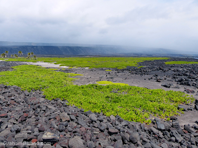
ʻĀpua Point itself is a rocky coastline jutting into the ocean. But behind this wall of rock, a sandier area hosts fields of naupaka, sea purslane, and other plant life, as seen in the third photo. Also in the background of this photo, a passing shower runs along Hōlei Pali. As I mentioned in part one of this description, the trail can be hot, wet, and windy, but for my hike, I saw moderate breezes, some overcast skies, and just a few spritzing showers.
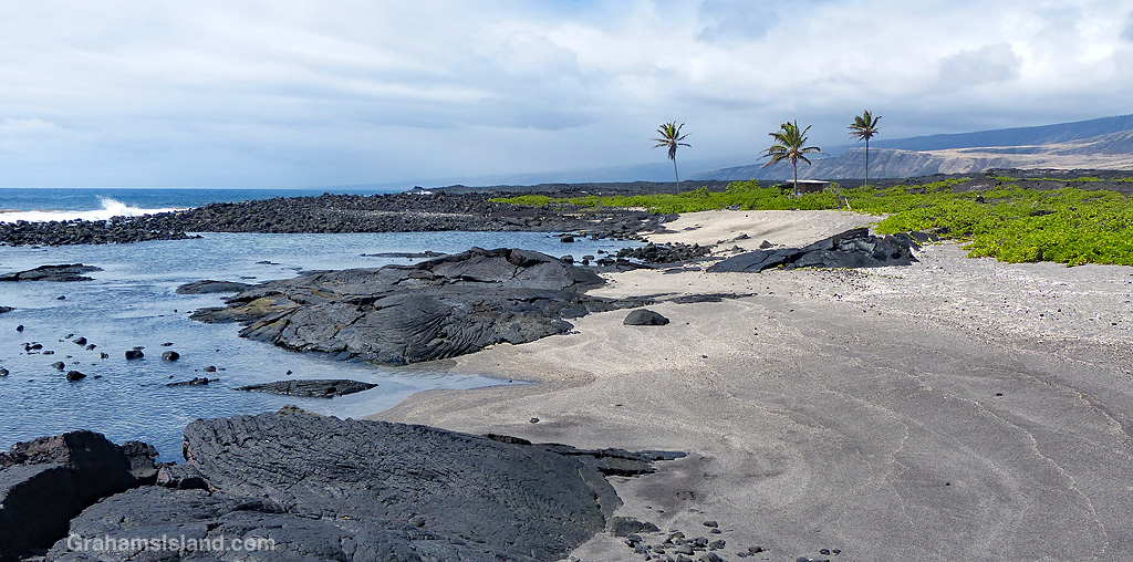
Swimming in the ocean along this coast is very dangerous because of high surf and strong currents. But at ʻĀpua Point there are shallow pools, suitable for soaking, that are protected from the surf by a border of rocks. There are also a few small sandy beaches such as the ones in the photo below.
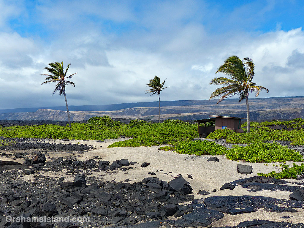
Besides the composting toilet, there is one other structure on ʻĀpua Point. It’s a small shed with an open covered area beside it, surrounded by naupaka and a few palm trees. This covered area represents pretty much the only shade to be found on the entire hike. The shed is used by the Hawksbill Sea Turtle Recovery Project, which monitors and protects endangered hawksbill turtles which use this area for nesting. I believe the nesting season runs from May to September, so I might have to return sometime after that.
And speaking of returning, from here it was time to turn around and hike the 6.6 miles back to the car. The hike took me about 3 hours each way with, of course, numerous stops for photography and just to enjoy the views.
This is the second part of a three-part description of a hike along the Puna Coast Trail in Hawaii Volcanoes National Park (See part 1 here).
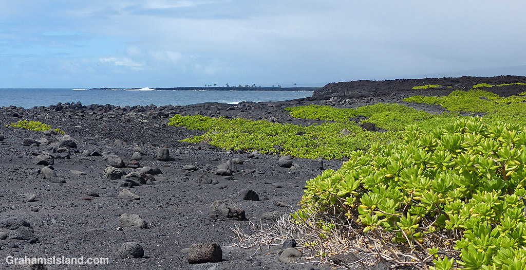
As the trail reaches the coast, it passes over an older flow that has a fair amount of vegetation on it. The third photo shows the trail cutting through a swathe of naupaka, sourbush, and assorted grasses.
This area was, despite the threat of volcanic activity, well occupied by early Hawaiian people. Along the trail are several reminders of that including the structures below. The photo, below middle, shows the amazing abilities of plants to grow in even the most daunting locations. The roots are somewhere deep in the lava, from which the trunk of this noni snakes upward. The large, nobbly fruit can be seen on this plant. This fruit, when ripe, has a pungent aroma which supposedly smells like vomit!
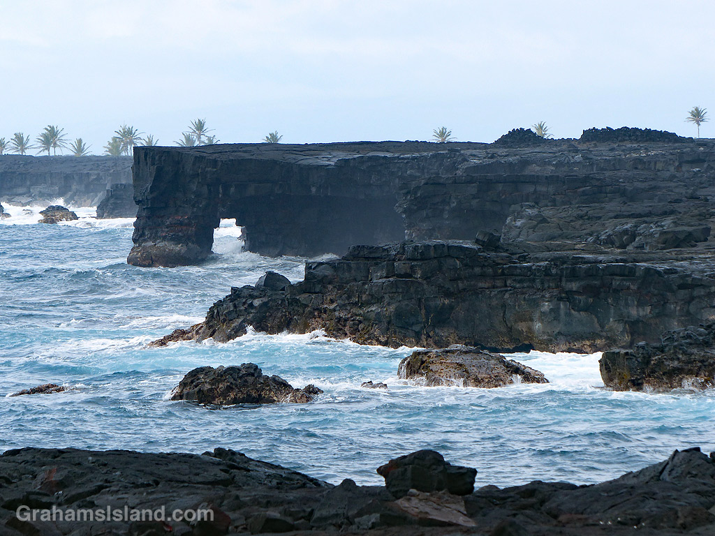
The bottom photo shows an area of rocks and black sand on the coast, backed by an extensive field of naupaka. Beyond that, the trail passes close to a pair of sea arches seen in the top photo and the one at top right. This is a rugged coastline and, when the weather is rough, huge waves can crash up and over the lava. It’s also an unstable coast with rocks and sections of cliff liable to tumble into the ocean.
In the background of the top and bottom photos are the palm trees of ʻĀpua Point, which will be the focus of the third and final post about this trail, tomorrow.