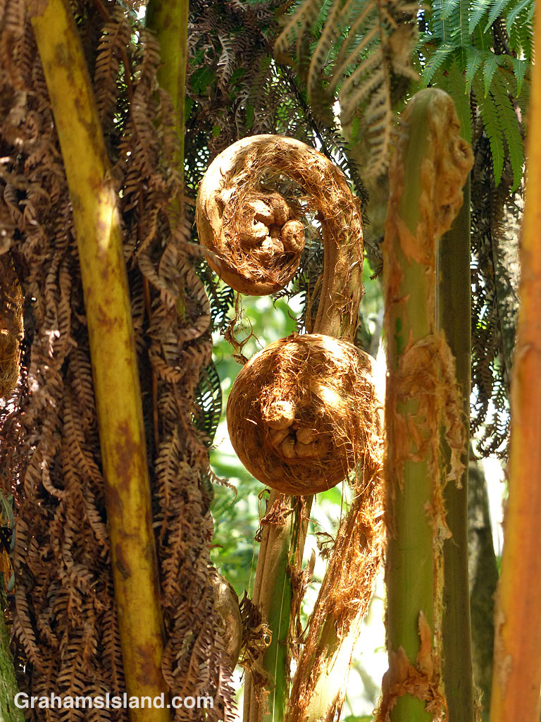
Hapu’u ferns uncoil alongside the Pu’u O’o Trail, off Saddle Road.

Hapu’u ferns uncoil alongside the Pu’u O’o Trail, off Saddle Road.
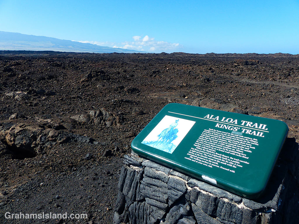
 The Kings’ Trail, is more properly known as the Ala Kahakai Trail (shoreline trail) or the Ala Loa Trail (long trail). The trail was created in the 1800s and stretched 175 miles from Upolu, at the northern tip of the island, down the west coast and up the south coast, to Kalapana in the southeast corner.
It passed through 220 ahupuaʽa, which were land divisions stretching from the ocean to the mountains. This meant that each ahupuaʽa contained the necessary resources to sustain its inhabitants.
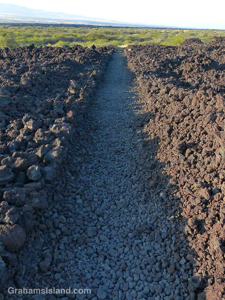
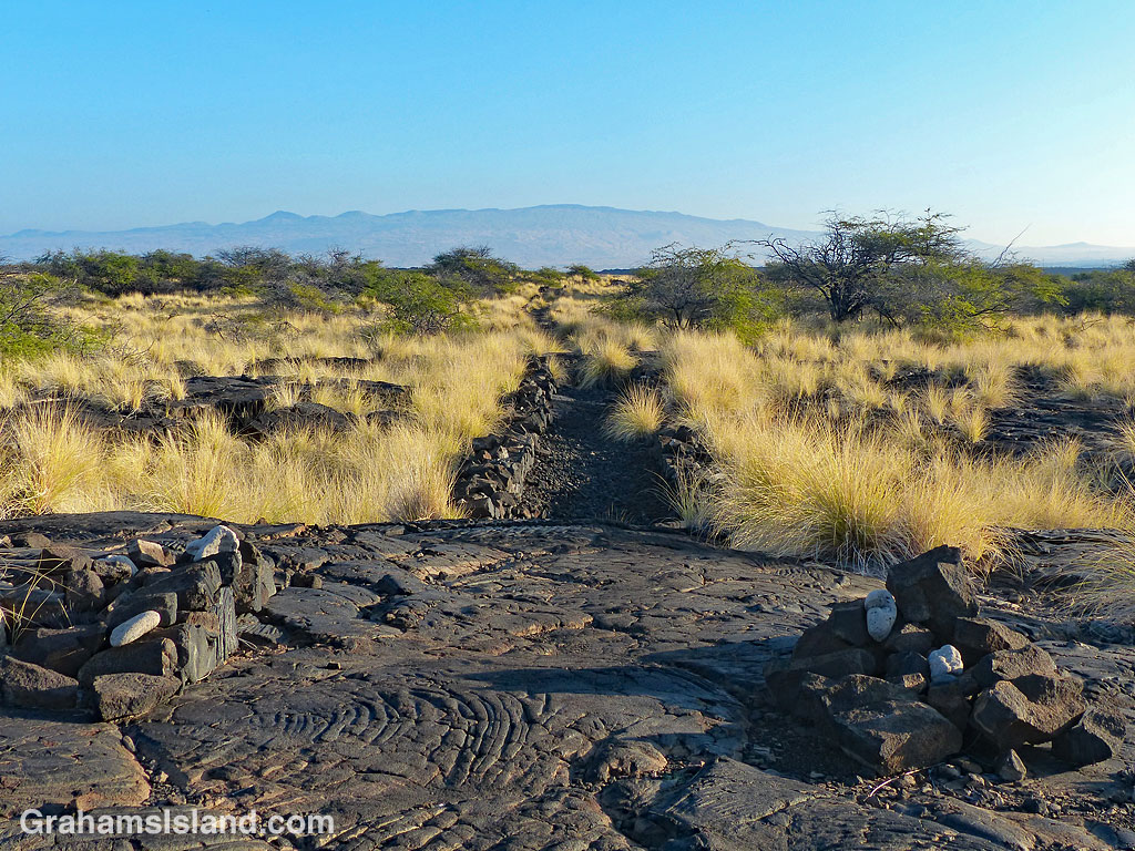
These days, some sections of the trail are open for hiking, but others cross private land. The goal is to reopen as much of the trail as possible to public use. These photos are of parts of the trail passing down the Kohala coast. In many places the trail is ramrod straight to make passage easier, though the surface is often uneven.
Posted in response to this week’s Friendly Friday challenge on the theme of ‘Pathways.’ See more responses here.
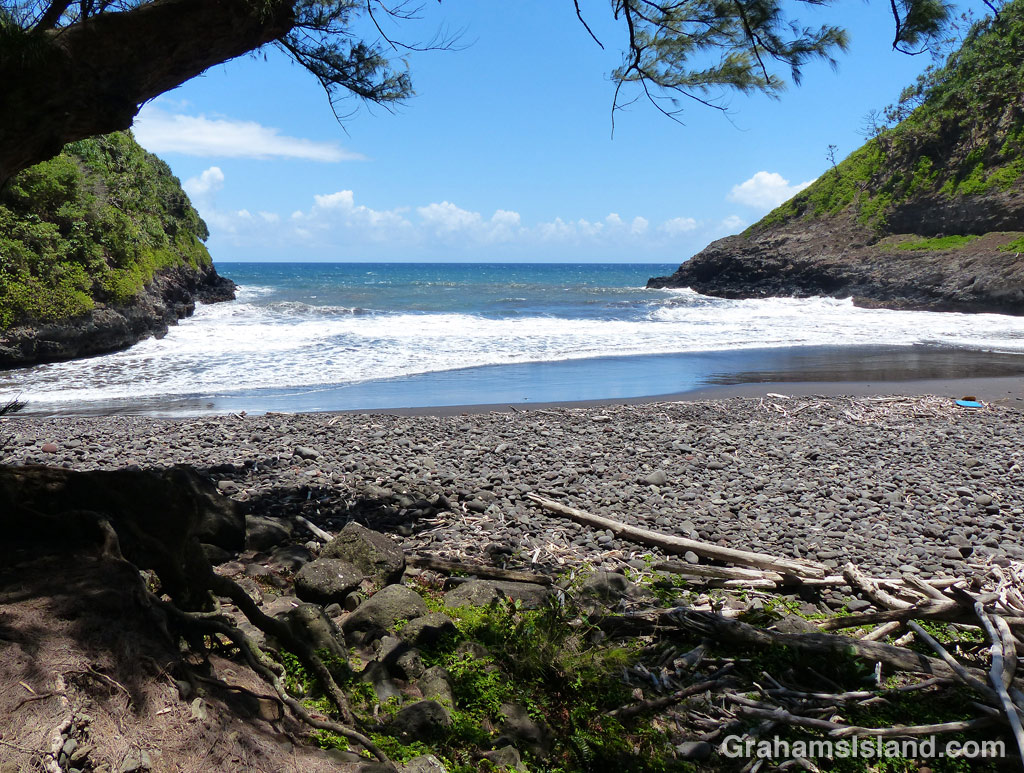
At the end of Highway 270, on the northern tip of the island, is Pololu Valley. There’s a trail down to the beach there and, at the other end of the beach, another trail leading up to a bench that overlooks Honokāne Nui valley.
Not far beyond the bench, the trail was destroyed by an earthquake in 2006. It’s still possible to descend to the valley, but the trail goes straight down a steep slope and ropes are in place to make this possible. There are no guarantees that these ropes are in good condition and the slope certainly isn’t. If you do descend this section, the trail passes through varied vegetation and ultimately leads down to a rocky beach at the mouth of Honokāne Nui valley.
Beyond Honokāne Nui, there’s another trail that continues over the next hill and down into Honokāne Iki valley. That valley opens up to this beautiful little bay, which is quite protected and, at low tide, has a nice sandy beach. Be aware though that this is private land and in use on a regular basis.
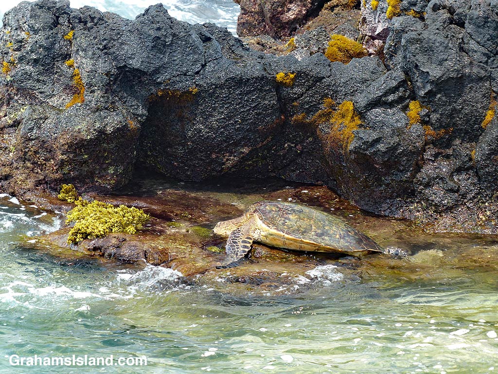
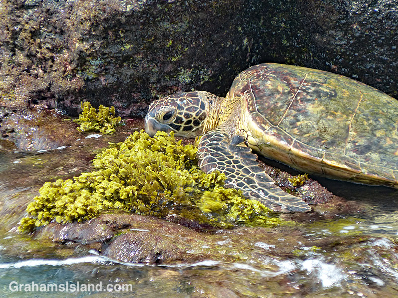
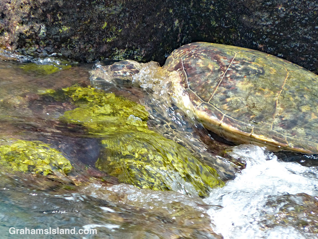
 Toward the end of a hike along the coast, I came across this turtle feeding in a shallow tidal area. There was good grazing to be had, but the problem was that the ledge was continually swept by incoming waves.
The turtle would swim in and access the ledge from the shore side (on the right in the top photo). Then he lumped forward to where the good grazing was and buried his head in it.
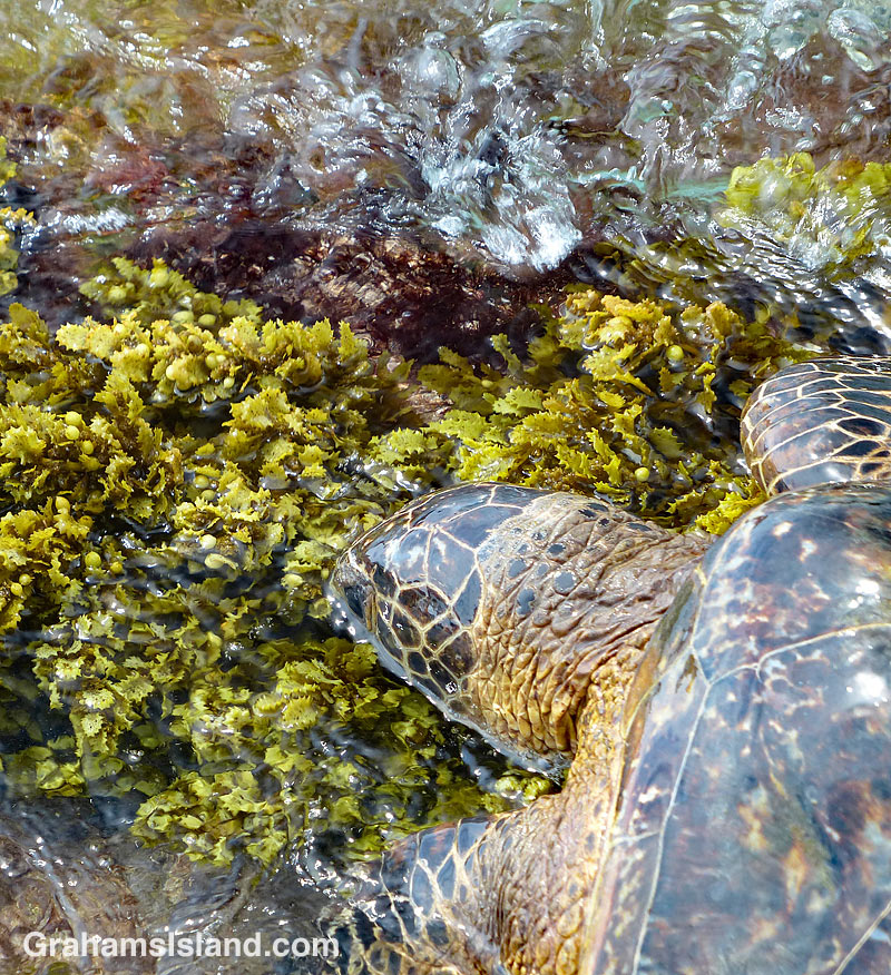
Waves would surge in and sluice over him (below). Sometimes, the receding wave had enough oomph that it would wash the turtle over the front edge of the ledge. Then he’d swim around and start over again.
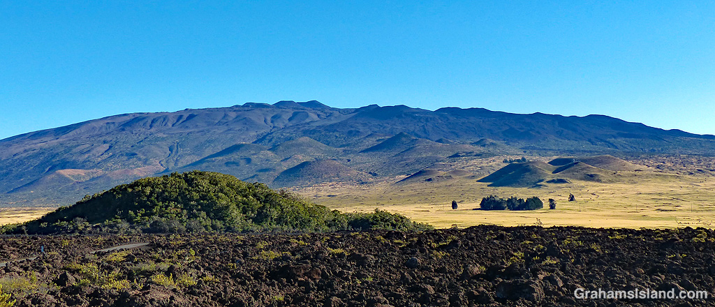
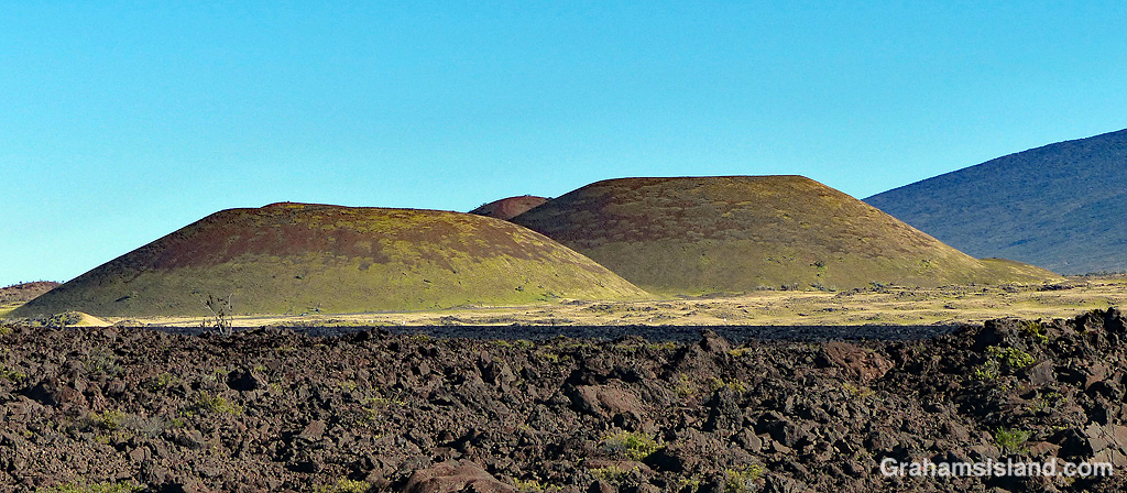
In Hawaii, one meaning of the word ‘pu’u’ is ‘a protuberance of some kind.’ This can be anything from a pimple to a hill, but ‘hill’ is the most common usage I encounter, as a general reference or in place names.
Pu’u O’o is the cinder cone that is home to the vent on Kilauea Volcano that was active from 1983 until earlier this year. Pu’u Wa’awa’a is an old cinder cone that is now managed by the Division of Forestry & Wildlife. A common thread is that, in Hawaii, a hill is a cinder cone because all of Hawaii is volcanic and the landscape is liberally dotted with cinder cones.
The top photo shows Mauna Kea and the large array of pu’us on its southern slopes. In the foreground is Pu’u Huluhulu, which means hairy hill. There’s a trail to the top of this pu’u which offers good views of Mauna Kea and Mauna Loa.
The bottom photo shows grassed over pu’us in Pōhakuloa Training Area, which is a military base located in the region between Mauna Loa, Mauna Kea and Hualālai volcanoes.
On the Big Island, several pu’us are accessible to hikers, usually with a trail curving up to the top and then around the rim of the pu’u. Even if the pu’u isn’t that high, it invariably stands out from its surroundings and offers good views.

When I was last at the Golden Pools of Keawaiki, I encountered this metallic skink skittering along the water’s edge and then clambering up over the lava. I’m always impressed by creatures that live in such a harsh environment.


On a recent hike at Pu’u Wa’awa’a, I was ambling along one of the trails when I heard squeals and a commotion in the grass a few feet off to the side. A mongoose shot out from cover hotly pursued by a second one. They took off down the trail, away from me, before vanishing into the undergrowth on the other side.
A couple of minutes later, this one reemerged, trotting away on the trail before it turned suddenly and gave me this look. I don’t think my presence had registered earlier, so it must have been a bit surprised to see me. Don’t know what happened to the other one, but since I didn’t hear any horrendous screeching, I suspect it got away.
For more information about Pu’u Wa’awa’a and its trails, go to puuwaawaa.org.
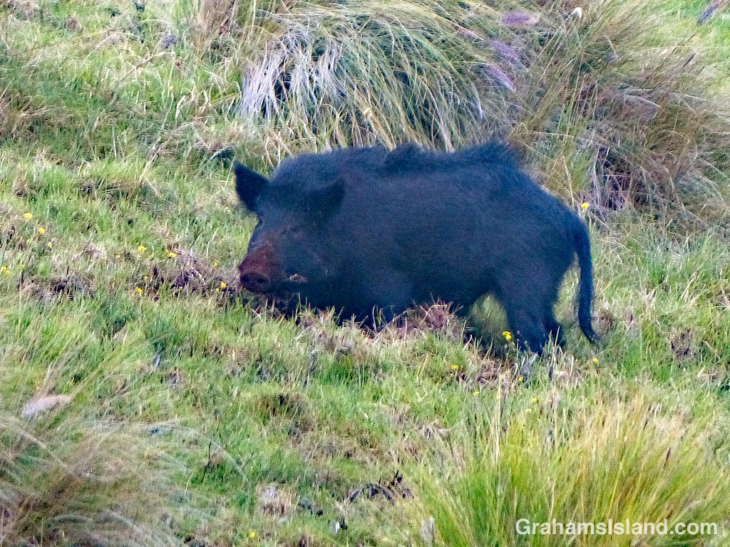
 On an early morning hike at Pu’u Wa’awa’a, I saw this wild pig on the hillside above me. It was busy rooting around in the dirt, hence the brown snout. Wild pigs can do an enormous amount of damage in their foraging. The photo at right shows one of many areas alongside the trail that has been dug up by pigs. These areas are susceptible to erosion when it rains.
I was glad the pig was a ways up the hill as the other damage they can do is to people who get too close. Given the size of this one, I suspect I’d have come off second best.
