Tag Archives: Hiking

Goat brigands

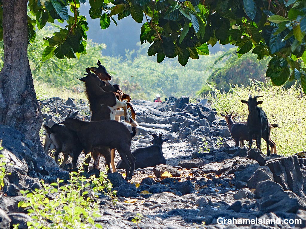
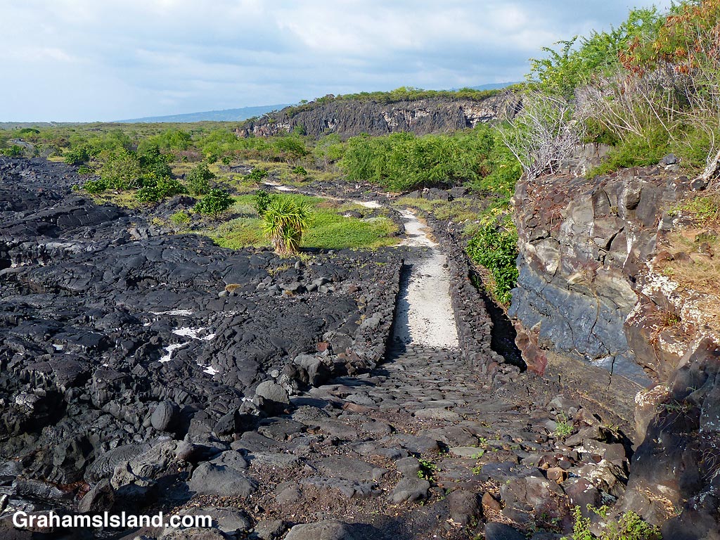
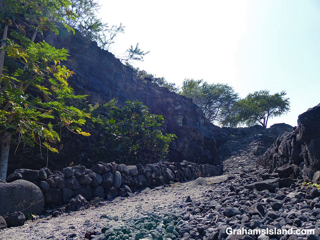
Hiking on the 1871 trail, heading south from Pu’uhonua o Hōnaunau National Historical Park, I came on this scene. A herd of goats blocked the trail. They watched me from the shadows. Two of them raised themselves onto their hind legs and repeatedly butted heads.

In the deep shade of the trees they carried the look of a gang of brigands, ready to relieve hikers of their valuables or, more likely, since they’re goats, something to eat. That could be just about anything from a carrot to the hiker’s shoes.

As I got closer, the goats filtered into the trees and scrub, disappearing from view. Perhaps next time I won’t be so lucky.

For more information about the 1871 Trail, and other hikes on the Big Island, go to bigislandhikes.com.

For more information about Pu’uhonua o Hōnaunau National Historical Park, visit https://www.nps.gov/puho/index.htm.

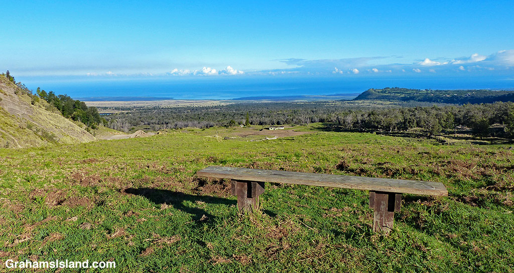
Posted in response to this week’s WordPress Photo Challenge, ‘I’d rather be…,’ because I’d rather be hiking.

Pu‘u Loa petroglyphs

Not far from the coast, in Hawaii Volcanoes National Park, is Pu‘u Loa petroglyphs trail. It’s only a mile and a half round trip, but visits a place with a huge number of petroglyphs. A raised boardwalk circles part of this area, giving a good view of the petroglyphs without adversely impacting them.

One of the main features of this area and its petroglyph field is explained on a display seen in the second photo. It reads, ‘The name Pu‘uloa (large hill) carries a kaona (hidden meaning)—hill of long life. Families with genealogical ties to these lands come here to place the piko (umbilical cord) of their child. Their hope is that the mana (spiritual guiding energy) of Pu‘uloa would bless that child with a long and prosperous life, and root them to their ancestral lands. Each puka (hole) is created to house a single child’s piko. Of over 23,000 petroglyphs found at Pu‘uloa, 16,000 are piko-related carvings—a testament to the importance of both Pu‘uloa and ‘ohana (family).’

For more information about Pu‘u Loa petroglyphs, go to https://www.nps.gov/havo/learn/historyculture/puuloa.htm.

(On the park’s website, Pu‘u Loa is two words, but on the sign it is one word, hence the inconsistency.)

Green Sand Beach

This week’s WordPress photo challenge is ‘Tour Guide’ which I’m happy to use as my theme for this week’s posts. Since this is Hawaii, a good place to start is at the beach. This one is Papakōlea Beach, better known as Green Sand Beach. It’s about 3 miles northwest of South Point, the most southerly point in the United States.

The beach lies in a bay formed when the ocean eroded one side of an old cinder cone, Pu’u Mahana. The green color of the sand is a result of olivine in the lava. Since it’s heavier than other things in the lava, it stays on the beach. Swimming is possible in the shelter of this deep bay, but be careful. This coast is notorious for dangerous surf and strong currents.

It’s 2 1/2 miles to the beach from the parking area. There’s a very rough four-wheel drive road, which you can drive, or locals will ferry you out for a fee. The other alternative is to hike out along the coast, which is what I did.

You’re not likely to have the beach to yourself, but you will have a share of a beautiful, remote beach, a view all the way to Tahiti (you might have to stand on a rock), and the opportunity to broil on the distinctive green sand.

Clouds from Pu’u Wa’awa’a

A few days ago I did another hike up Pu’u Wa’awa’a, a large cinder cone north of Kona. I planned the hike to coincide with one of the days of latest sunrise here, just after 7 a.m.. My idea was to arrive at the trailhead at 6 a.m., when the gate opens, and head up as quickly as I could in order to get the best shot at early morning light from the summit. This meant getting up by 4 a.m. and setting out by 5 a.m.

Defying all historical precedents, I was there five minutes early. The new automated gates opened before me and in no time I was hotfooting up the trail, flashlight in hand, in order to avoid breaking an ankle in the one of the many potholes in the old road that makes up the first part of the trail.

One advantage of hiking in the dark is that I didn’t stop every five minutes to take a photo of a goat or bug. Still, an hour into the hike, as the light improved, I couldn’t help but pause when I spotted a large wild pig excavating – no other word for it – a large hole in the hillside in the search for worms and the like (alas the photos weren’t great – not enough light).

By 7:30 a.m. I reached the top of the climb. I already knew I wasn’t going to get the hoped-for blaze of early morning sun – too many clouds from the get-go – but this photo shows the moody light that greeted me. I considered this a worthy consolation prize. And then there was the fact that I had the summit to myself for 90 minutes, and the mamane trees on the west side were in bloom and attracting Hawaii ‘amakihi and hordes of bees (look for several dozen photos of these in the near future!).

For more information about Pu’u Wa’awa’a and its trails, go to puuwaawaa.org.

Alakaha Ramp bench

At the top of the Alakaha Ramp, on the 1871 Trail from Pu’uhonua o Hōnaunau National Historical Park to Ho’okena, is this little weathered bench. It offers shade and a lovely view to the north, the point of land being the park.

For more information about the 1871 Trail, and other hikes on the Big Island, go to bigislandhikes.com.

For more information about Pu’uhonua o Hōnaunau National Historical Park, visit https://www.nps.gov/puho/index.htm.

Better Days: Girdled tree

A dead tree stands out on Pu'u Wa'awa'a

This dead tree on the slopes of Pu’u Wa’awa’a did not die of natural causes. The pale strip near the bottom of the trunk is where the tree was girdled.

The tree is, I’m pretty sure, a silk oak. Native to Australia, these trees were introduced to Hawaii around 1880. When in bloom, they present a mass of brilliant orange flowers, but they seed prolifically and also produce an allelopathic substance that inhibits the growth of other plants. Because of this, they can crowd out native plants, of which there are many on Pu’u Wa’awa’a, so trees in areas where they have become too dense or are not wanted, are girdled.

For more information about Pu’u Wa’awa’a and its trails, go to puuwaawaa.org.

Alakaha ramp on the 1871 Trail

Lookng down Alakaha Ramp with Keanae'e Cliffs on the rightA view of Alakaha Ramp and Alakaha Bay.

In 1871, an old trail from Nāpō’opo’o to Ho’okena was improved to make it passable for horses. Because of this, it became known as “Two Horse Trail.” The northern section of this trail was paved in 1918, but the southern section was left untouched and this became the 1871 Trail, which heads south from Pu’uhonua o Hōnaunau National Historical Park.

One feature of this trail is the Alakaha ramp at the southern end of Alakaha Bay. The ramp was built to allow trail users to safely ascend Keanae’e Cliffs.

According to bigislandhikes.com, “Prior to the construction of the ramp, access to Ki’ilae (an ancient village) was by ladder or rope only. The earliest mention of the ramp is from 1868, but the ramp likely existed prior to that time. The ramp requires periodic maintenance. It had deteriorated so much in the early 1900s that cowboys called the ramp the “one foot out trail” because they always kept one foot out of the stirrups in case they needed to bail off their horse.”

The top photo looks down the ramp with Keanae’e Cliffs on the right. In the middle photo, the ramp and trail with Alakaha Bay on the left. Below, hiking up toward the ramp with Keanae’e Cliffs on the left.

For more information about the 1871 Trail, and other hikes on the Big Island, go to bigislandhikes.com.

For more information about Pu’uhonua o Hōnaunau National Historical Park, visit https://www.nps.gov/puho/index.htm.

Lookng up Alakaha Ramp with Keanae'e Cliffs on the left.

The view north from Pu’u Wa’awa’a

The view from a bench of the hike up Pu’u Wa’a Wa’a.

Another post on the WordPress photo challenge theme of ‘serene.’

The hike up Pu’u Wa’a Wa’a is a steady climb, but there are several benches along the way for a quiet break. This bench looks north, toward the South Kohala coastline and North Kohala hills.

The trail isn’t crowded at any time of day, but in the early morning, it’s positively serene.

For more information about Pu’u Wa’a Wa’a and its trails, go to puuwaawaa.org.