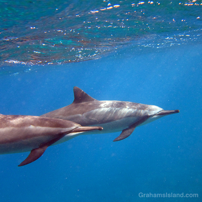
A pod of spinner dolphins stopped by my local snorkeling spot. (Link, link)
Lāhainā Noon, when shadows disappear in Hawaii. (Link)
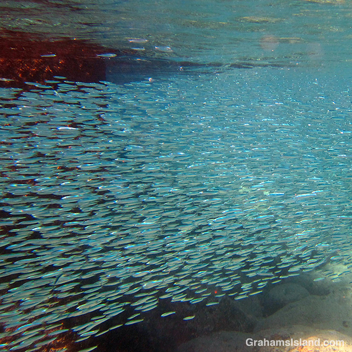
Shoals of Hawaiian silversides were abundant in the summer. (Link)
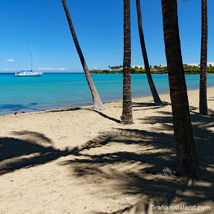
With no tourists here, Anaeho’omalu Bay was a sea of tranquility. (Link)
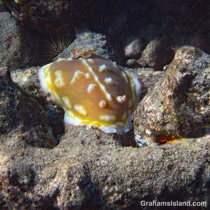
Some clumpy nudibranchs spent a few weeks in a local bay. (Link)
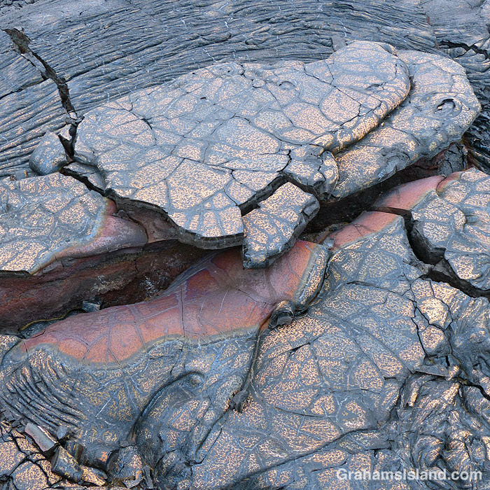
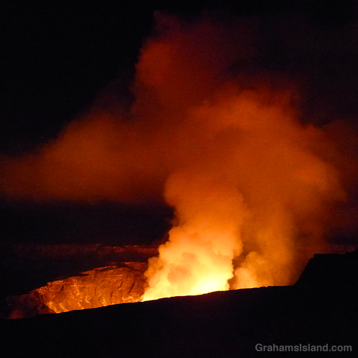
The year ended with a bang when Kilauea Volcano erupted again. (Link)
This week’s Sunday Stills challenge theme is ‘Your 2020 Retrospective.’ See more responses here. Also posted in response to Becky’s January Squares challenge theme of ‘Up.’ See more responses here.
In this retrospective I’ve focused on events and photos that were uplifting for me during the difficult year that was. Most of these photos haven’t run before, but were taken at the same time as those in posts that ran in 2020. Links to the original posts are at the end of the captions.
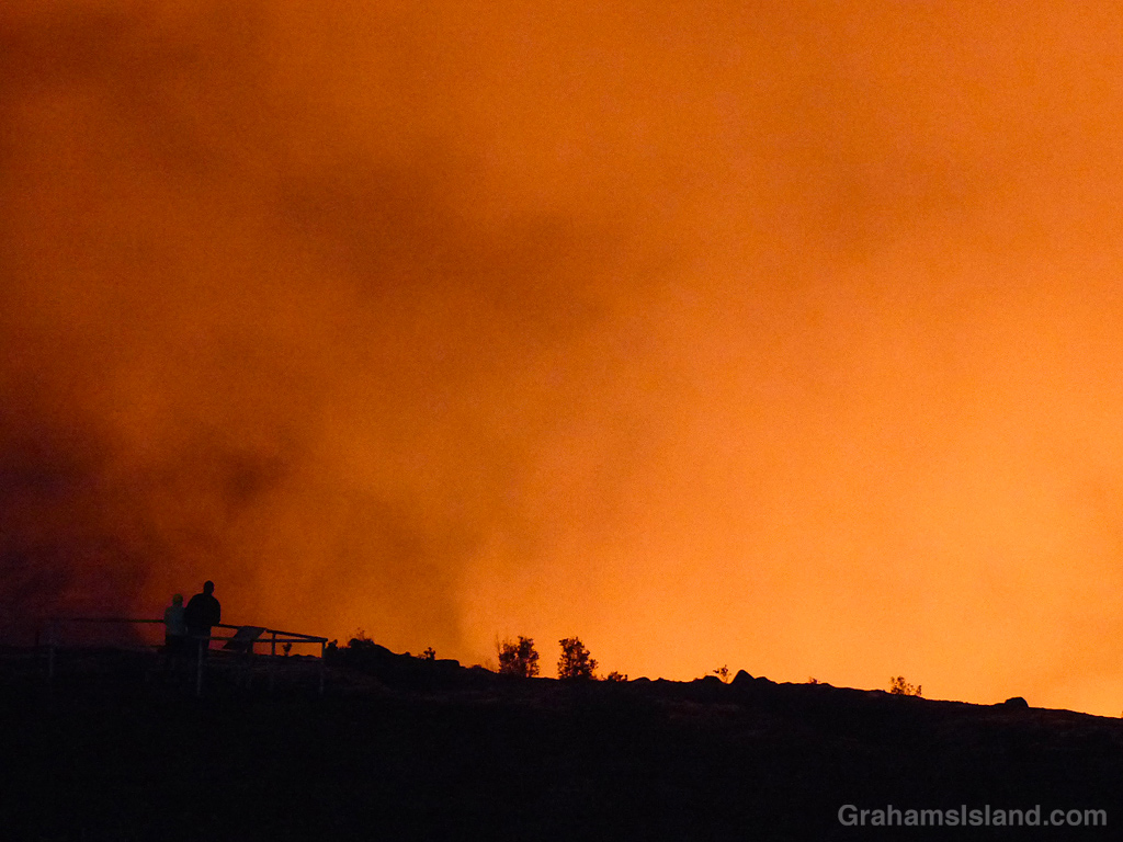
I woke up on Monday morning to the news that Kilauea Volcano had erupted again. Three vents had opened in Halemaʻumaʻu crater at the summit of the volcano. After the first flurry of activity, the eruption settled down to two of the vents pouring lava into the crater, evaporating a water lake that had formed since the 2018 eruption, and creating a new lava lake at a healthy rate.
This obviously called for action on my part in the form of going down and taking a look. Despite the paucity of tourists on the island, early reports warned that viewing areas were becoming crowded with long waits for parking spaces. But where many people prefer to visit in the late afternoon and wait for it to get dark, I like arriving in the wee hours of darkness and waiting for dawn.
Consequently, yesterday morning I got up at 12:45 a.m. (after a relaxing 3 hours of sleep) and left the house at 1:15 a.m.. The benefit of driving at that hour is that, while the sky is dark, traffic is light. In this instance a second benefit was a wonderful starlit drive, though I couldn’t fully appreciate it since I felt a certain obligation to keep my eyes on the road. Driving over Saddle Road though, I did notice a red glow off to my right, a sure sign of volcanic activity at Kilauea.
I got to the park at 3:45 a.m. and headed for the Kilauea Overlook, the prime viewing area. Parking was easy to come by and the crowds weren’t too heavy. While the vents couldn’t be seen from there (or any of the viewing areas) the sky billowed with orange and red clouds of steam and smoke. The second photo was taken there and I like how the glow illuminates the rock face of the crater.
I drove back to the overlook at the Steaming Bluff. This was farther from the eruption site, but virtually deserted. The top photo was taken there. I wanted to capture the eruption and the starry night, which I couldn’t do at Kilauea Overlook because the eruption dominated everything.
After a short stay there, I moved on to the Keanakākoʻi Overlook at the southeastern corner of the Kilauea summit caldera. This viewing site required a hike in of about a mile on the old Crater Rim Drive, long since closed to vehicles because of damage from previous eruptions. The third photo shows people at the overlook watching the activity. I left there as it started to get light.
So was it worth the early start and long day? Absolutely! The views weren’t as compelling as those from Jaggar Museum, now closed and erased from the online maps, but there aren’t many places on earth where a person can drive to the rim of an active volcano and watch an eruption with any degree of safety. At Kilauea, this is possible, so I take every opportunity to do so because each episode of volcanic activity is different and there’s no telling what I might see.
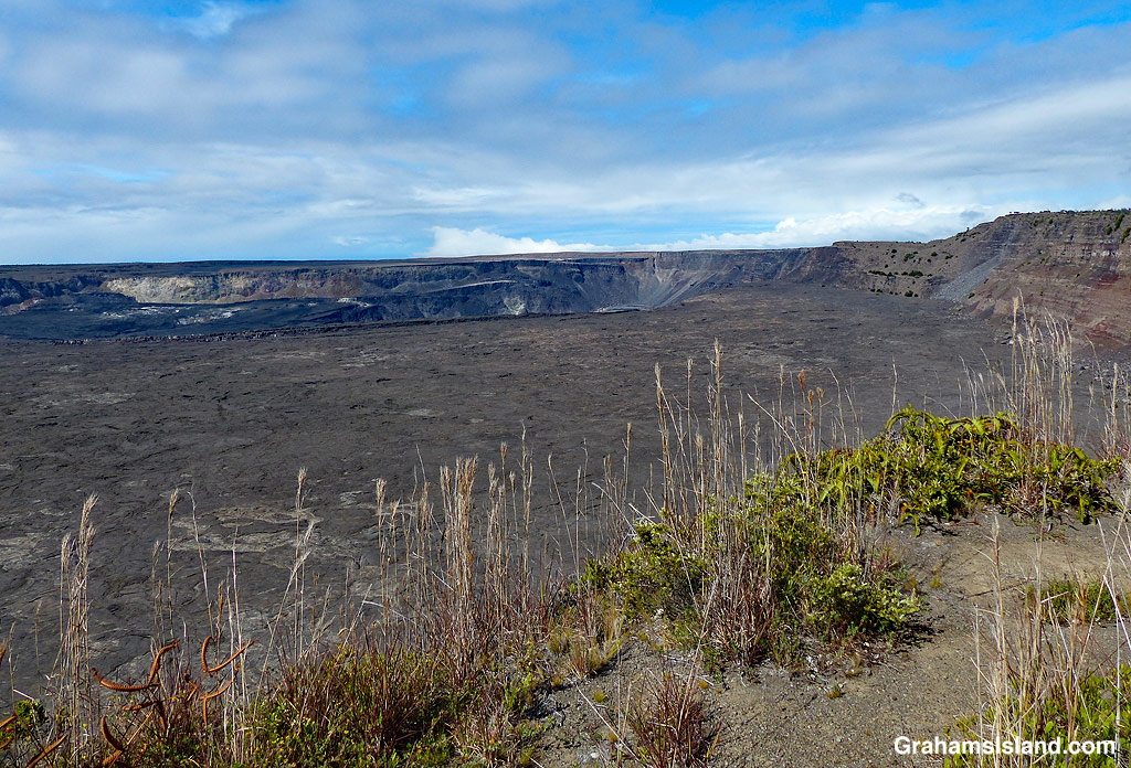
And the bottom photo? That was taken in June when I went hiking in the park. It was taken from the rim of Halemaʻumaʻu crater somewhere between where the top and second photos were taken. They’re a little different!
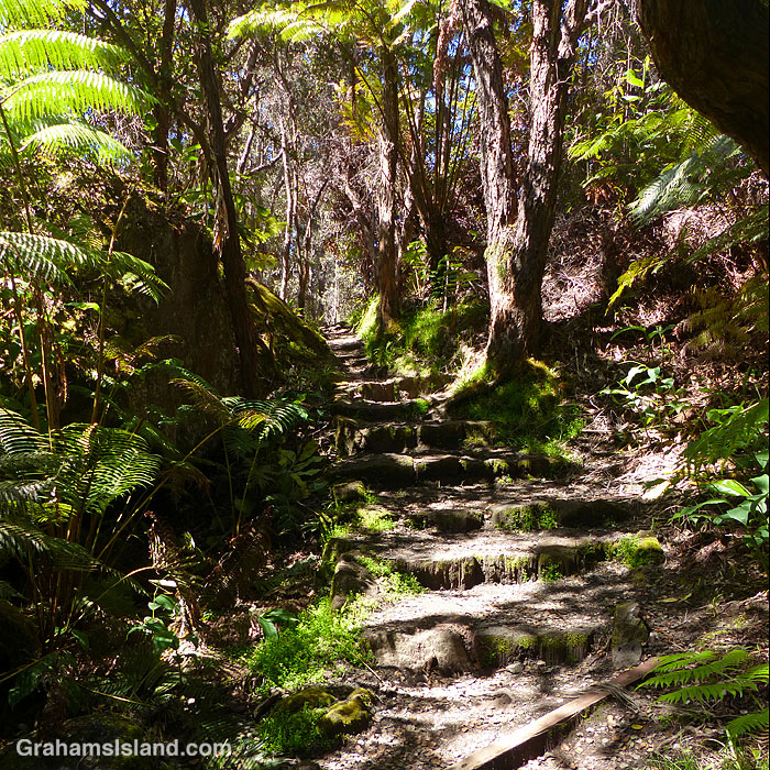
When I visited Hawaii Volcanoes National Park in the summer I hiked the Kilauea Iki Trail again. On that occasion, I descended into the crater on the western end and came back up on the eastern end. Shortly after I got up to the crater rim I took the top photo.
The trail continues around the northern rim of the crater and I continued walking. Three minutes after I took the first photo, I came to another overlook into the crater and the bottom photo shows the view I got there, an illustration of how quickly the weather can change in this area.
For more information about Hawaii Volcanoes National Park, go to nps.gov/havo/.
Back in June, I went to Hawaii Volcanoes National Park to do a little hiking. The park had recently reopened and I thought it would be a good time to do some of the popular trails near the summit that are usually crowded. I was right about this because I saw hardly anyone all day.
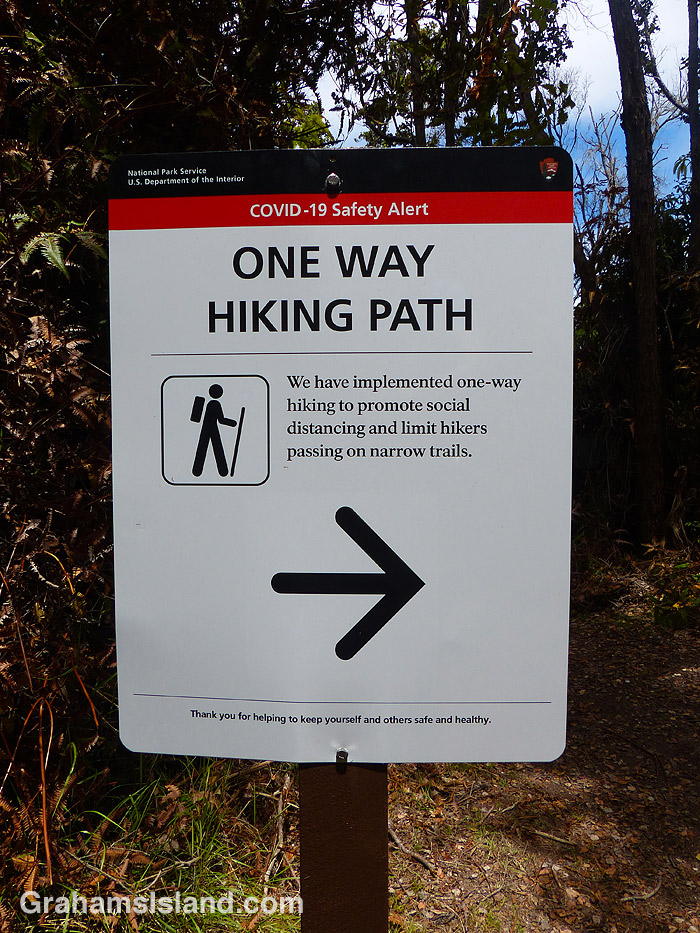
One of the trails I hiked was the Byron Ledge Trail and when I got to a junction near the end of it I came across this sign. I knew the park had made the popular Kilauea Iki Trail one way, but I hadn’t known about it applying to any other trails.
As you might have guessed, I arrived at this spot from the pointy end of the arrow. I’d hiked the trail in the wrong direction. The problem was that there was nothing at the other end of the trail letting me know I shouldn’t enter. When I hiked Kilauea Iki later, it was the same: at the parking lot there was a sign saying hike this way, but nothing at the other entrances to the trail.
On my way out of the park I stopped at the entrance and mentioned this to the ranger on duty. When I returned to the park in August, I asked the ranger at the entrance if they were still doing one way traffic on some of the trails. She said they weren’t. I wasn’t surprised. To do it properly, it would require a lot of signage and, with the Visitor Center closed, it would be hard to get the message across to everyone who visits the park.
For more information about Hawaii Volcanoes National Park, go to nps.gov/havo/.
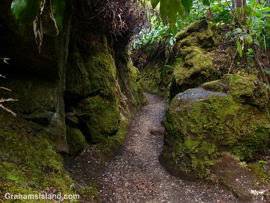
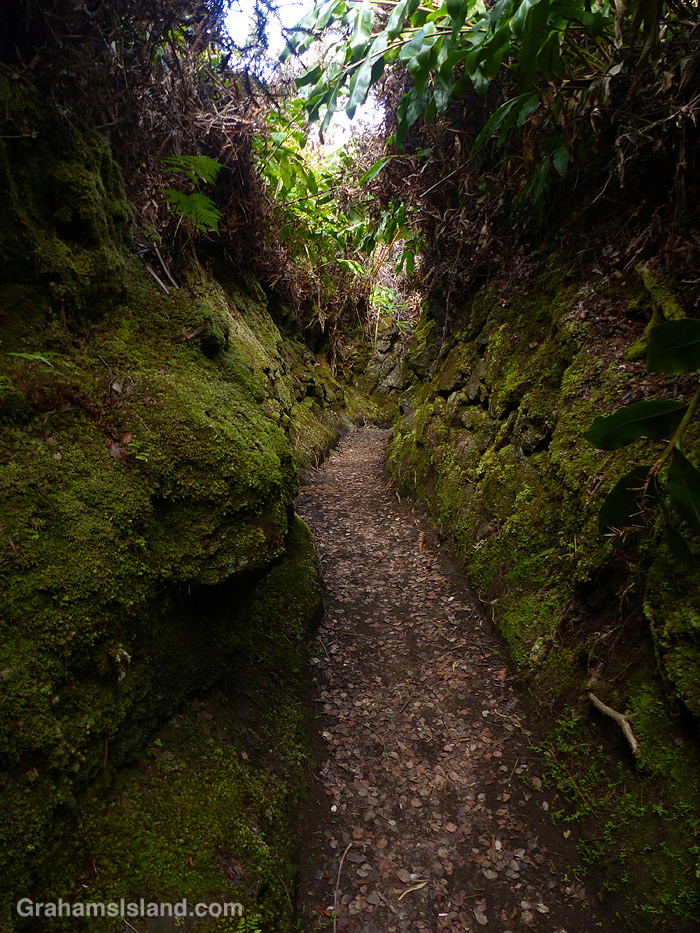
The Halemaumau Trail in Hawaii Volcanoes National Park takes hikers from near the visitor center down to the floor of the summit crater of Kilauea Volcano. It mostly passes through trees and some lush tropical foliage, this being the wet side of the island. Part of the way down the trail eases through a channel between two walls of rock, which are covered in moss. It’s a quite beautiful passage and, in this harsh volcanic area, has a remarkably soft feeling to it.
For more information about Hawaii Volcanoes National Park, go to nps.gov/havo/.
Halemaumau Crater, at the summit of Kiluaea Volcano, underwent profound changes during the 2018 eruption. When lava drained from the summit vent, the crater floor experienced a series of collapses, radically changing the appearance of the crater and its surrounds.
I had seen this area from the air and posted about it (here). The middle photo was taken during that flight and shows where a section of Crater Rim Drive slid into the crater. When I last visited the park, I got a different view of this.
The recently reopened Byron Ledge Trail has good views across the crater. In the top photo, the chunk of road is clearly visible with its white line running down the middle of it. The bottom photo shows the longer view across the crater with the road in the distance. In the center of the photo, equipment used to monitor the volcano’s activity, can be seen. The tree in the foreground is an ‘ōhi‘a lehua with its brilliant red flowers. It’s an early colonizer of new lava flows and all those little dark spots on the main crater floor are ‘ōhi‘a lehua trees, mostly still shrub-sized at this time.
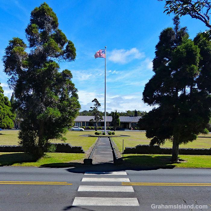
This is a view across Chain of Craters Road, in Hawaii Volcanoes National Park, toward the flagpole and entrance of Kilauea Military Camp. The camp was founded in 1916, the same year as the park, as a rest and relaxation facility for military personnel. Today, it continues to fill that same function though the facilities are somewhat nicer than they were back then. There’s an array of cottages, a store, theater, sports facilities, gas station, laundromat, even a bowling alley.
While it’s been an R&R post for most of its existence, during WWII it was used as a prisoner of war camp and as a Japanese internment camp.
Hawaii Volcanoes National Park recently opened up more areas of the park that had been closed because of the Covid-19 virus pandemic. I thought this was a good opportunity to hike some of the summit trails that I usually avoid because they’re more accessible and popular with tourists. I put together a loop hike that would have been great had all the trails listed as open actually been open.
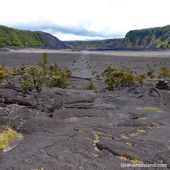
Despite this glitch, I had a good time and enjoyed the variety of landscapes the park has to offer. The top photo shows the part of the Kilauea Iki Trail that traverses that crater. The crater floor is a little under a mile across. This crater used to be much deeper before an eruption in 1959 filled it up another 400 feet. There is some vegetation, but the crater floor is mostly bare lava and steam can often be seen rising in various places.
The middle photo was taken on the Halema‛uma‛u Trail, which winds down from the summit into Halema‛uma‛u Crater. Despite the trail’s proximity to the vent in the crater, which was active until May 2018, vegetation thrives here as it does on many trails in the park.
The bottom photo shows a section of active steam vents alongside the Crater Rim Trail. This section of the trail is paved because the area normally sees very heavy use. When I was there, it was mostly deserted because of the lack of tourists on the island. The buildings on the horizon are the Volcano House Hotel which recently reopened for business, though the restaurant is still closed.
For more information about Hawaii Volcanoes National Park, go to nps.gov/havo/. For more information about Volcano House Hotel, go to hawaiivolcanohouse.com/.
Posted in response to Becky’s July Squares challenge theme of ‘Perspective.’ See more responses here.