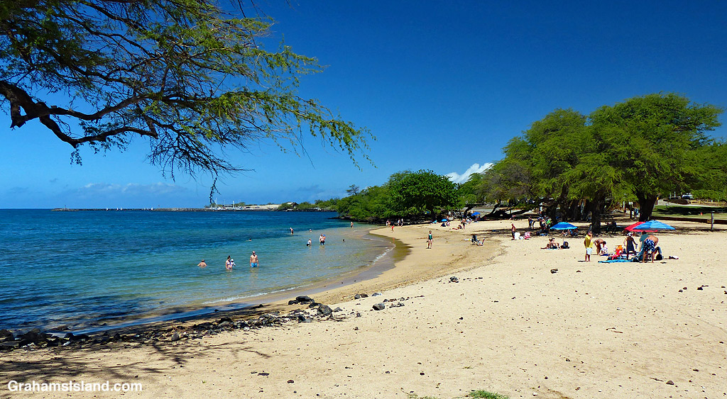
Spencer Beach Park, near Kawaihae, is a popular spot for families. With protected water, sand, shade, and facilities it’s got most everything little kids need. On weekends it can get crowded, but during the week it’s usually possible to find a quite spot.
The park is right next door to Puʻukoholā Heiau National Historic Site so it’s possible to visit both places from one parking spot.
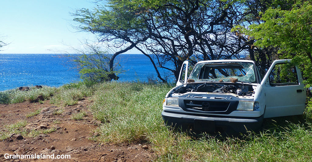
Blue skies, blue ocean, and a smashed up abandoned car, not an unusual sight on the island, in part because it’s quite expensive to get rid of a car responsibly.
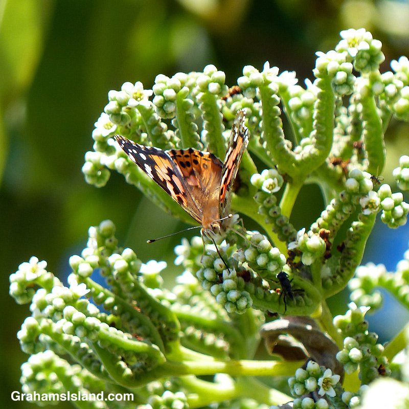
A painted lady butterfly feeds on the small blooms of a tree heliotrope. This particular tree heliotrope stand by itself on a small beach on the North Kohala coast. It’s a popular destination for a variety of butterflies and bugs.
Looking across Kahuwai Bay toward the Kona Village Resort
The sign on the fence says it all.
Some of the damaged buildings lining the shore.
On March 11, 2011, the northeastern part of Japan was jolted by an earthquake registering 9.0 on the Richter scale. While the quake caused extensive damage, the resulting tsunami was even more destructive. Water surged up to six miles inland and flooded more than 200 square miles of land. Perhaps the best known result of this tsunami was the meltdown at the Fukushima Daiichi Nuclear Power Plant, after it was overrun by the surging waters.
Here in Hawaii, a few hours after the earthquake, tsunami waves washed up on shore. The waves were up to 10 feet high, but the damage was not as great as was feared. However, along the west coast of the Big Island, there was flooding and damage to coastal properties.
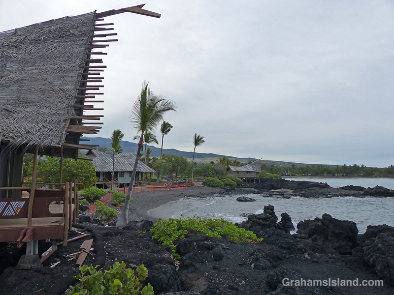
One of those properties was the Kona Village Resort, situated to the north of Hualalai Resort. Damage to the resort’s properties was sufficient to force its closure. The property then sank into the swamp that is insurance settlements and financial shenanigans. During this time, the buildings deteriorated.
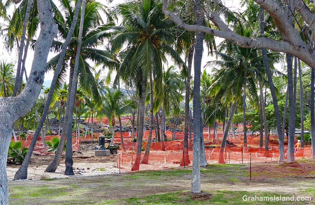
Originally, the resort was supposed to reopen this summer, but that was pushed back a year, then more. Currently, sometime in 2022 is the planned reopening, but this being Hawaii, that date shouldn’t be taken too seriously. When I walked the beach past the site, work was going on, but I saw only a handful of workers and a couple of active machines. It didn’t appear to be a project going full-steam ahead.
The current work site, lots of orange netting but not much action.At a casual glance things don’t look too bad, but the roof thatching is mostly gone, the buildings are open to the elements, and there’s other damage in and around the area.It’s still a beautiful setting and the beach is enticing.
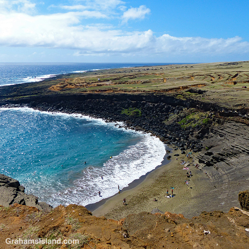
Puʻu Mahana is an ancient cinder cone near the southern tip of the island. It is best known for Papakōlea beach, the green sand beach, which formed when the ocean cut into one side of the pu’u, creating the bay seen here. The sand’s green color is due to the presence of the mineral olivine. (More photos here.)
Posted in response to Becky’s April Squares challenge theme of ‘Top.’ See more responses here.
This is the third and final part of a three-part description of a hike along the Puna Coast Trail in Hawaii Volcanoes National Park (See part 1 here, part 2 here).
The last part of the trail before ʻĀpua Point crosses over the only stretch of ʻaʻā lava on the trail which, as can be seen in the second photo, is markedly more rough and jagged than pahoehoe lava. This ʻaʻā is part of a 1969 flow from the same eruption at Mana Ulu that produced the pahoehoe lava that most of the trail passes over. The Mauna Ulu eruption lasted from 1969 to 1974.
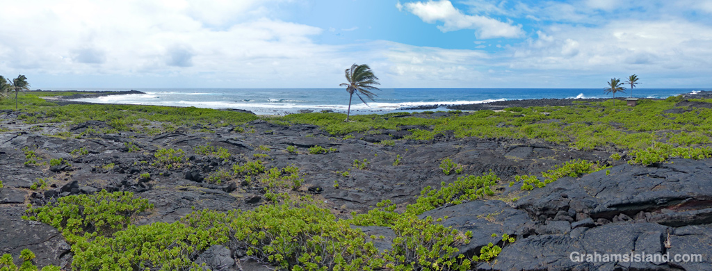
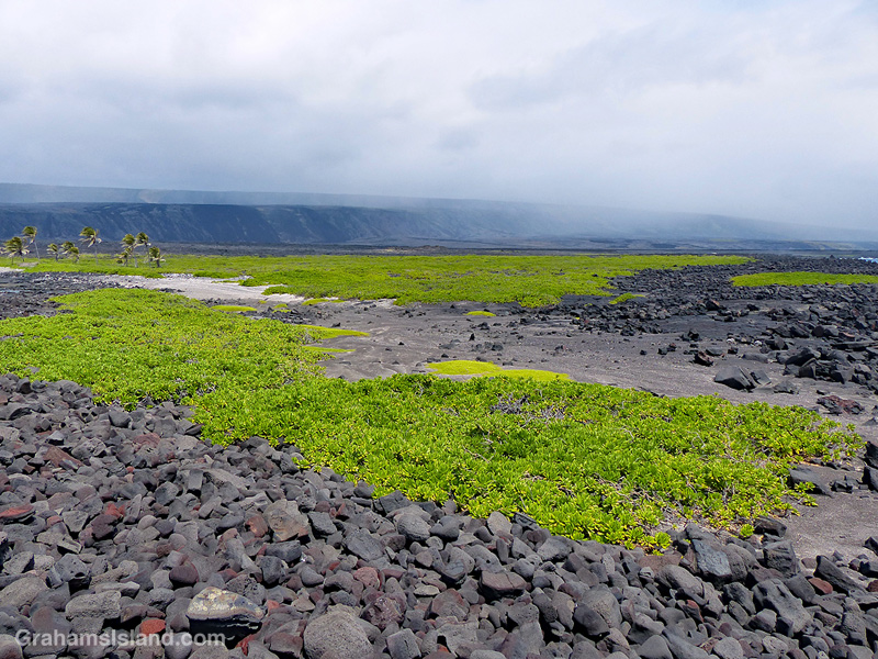
ʻĀpua Point is like a little oasis in a bleak landscape. Flows from the Mauna Ulu eruption reached the ocean on either side of the point, but the point itself was spared. The top photo is a panoramic view of the coast, stitched together (not well) from two photos, to show the view from ʻĀpua Point’s outhouse – actually a composting toilet. This toilet also represents the sum total of the facilities for anyone thinking of camping there.
ʻĀpua Point itself is a rocky coastline jutting into the ocean. But behind this wall of rock, a sandier area hosts fields of naupaka, sea purslane, and other plant life, as seen in the third photo. Also in the background of this photo, a passing shower runs along Hōlei Pali. As I mentioned in part one of this description, the trail can be hot, wet, and windy, but for my hike, I saw moderate breezes, some overcast skies, and just a few spritzing showers.
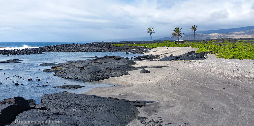
Swimming in the ocean along this coast is very dangerous because of high surf and strong currents. But at ʻĀpua Point there are shallow pools, suitable for soaking, that are protected from the surf by a border of rocks. There are also a few small sandy beaches such as the ones in the photo below.
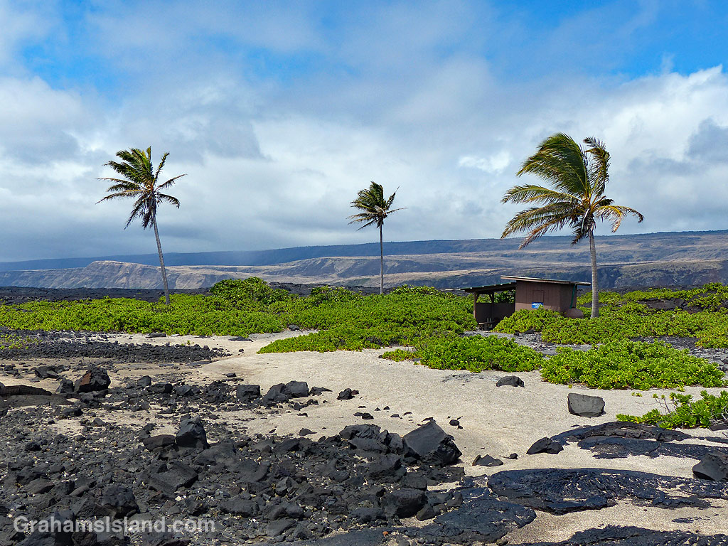
Besides the composting toilet, there is one other structure on ʻĀpua Point. It’s a small shed with an open covered area beside it, surrounded by naupaka and a few palm trees. This covered area represents pretty much the only shade to be found on the entire hike. The shed is used by the Hawksbill Sea Turtle Recovery Project, which monitors and protects endangered hawksbill turtles which use this area for nesting. I believe the nesting season runs from May to September, so I might have to return sometime after that.
And speaking of returning, from here it was time to turn around and hike the 6.6 miles back to the car. The hike took me about 3 hours each way with, of course, numerous stops for photography and just to enjoy the views.
This is the second part of a three-part description of a hike along the Puna Coast Trail in Hawaii Volcanoes National Park (See part 1 here).
As the trail reaches the coast, it passes over an older flow that has a fair amount of vegetation on it. The third photo shows the trail cutting through a swathe of naupaka, sourbush, and assorted grasses.
This area was, despite the threat of volcanic activity, well occupied by early Hawaiian people. Along the trail are several reminders of that including the structures below. The photo, below middle, shows the amazing abilities of plants to grow in even the most daunting locations. The roots are somewhere deep in the lava, from which the trunk of this noni snakes upward. The large, nobbly fruit can be seen on this plant. This fruit, when ripe, has a pungent aroma which supposedly smells like vomit!
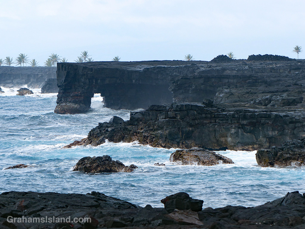
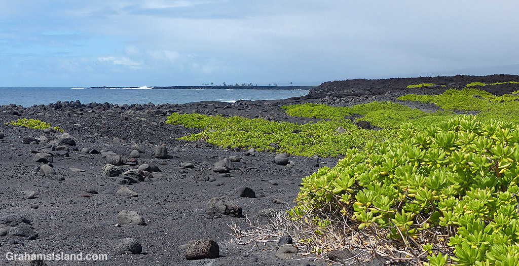
The bottom photo shows an area of rocks and black sand on the coast, backed by an extensive field of naupaka. Beyond that, the trail passes close to a pair of sea arches seen in the top photo and the one at top right. This is a rugged coastline and, when the weather is rough, huge waves can crash up and over the lava. It’s also an unstable coast with rocks and sections of cliff liable to tumble into the ocean.
In the background of the top and bottom photos are the palm trees of ʻĀpua Point, which will be the focus of the third and final post about this trail, tomorrow.