Tag Archives: On The Coast

Green turtle feeding

Green turtle and tidepool

Green turtle feedingGreen turtle feedsToward the end of a hike along the coast, I came across this turtle feeding in a shallow tidal area. There was good grazing to be had, but the problem was that the ledge was continually swept by incoming waves.

The turtle would swim in and access the ledge from the shore side (on the right in the top photo). Then he lumped forward to where the good grazing was and buried his head in it.

Waves would surge in and sluice over him (below). Sometimes, the receding wave had enough oomph that it would wash the turtle over the front edge of the ledge. Then he’d swim around and start over again.

Green turtle surge

Honokohau Harbor entrance

Honokohau Harbor entrance

Honokohau Harbor, just north of Kailua Kona, is the main small boat harbor on the west side of the Big Island. In addition to private pleasure craft, a lot of charter boats operate out of the harbor, taking guests out to fish, snorkel, dive, and whale watch.

While it looks placid in this photo, once outside this harbor entrance, boaters are in the Pacific Ocean and conditions can change dramatically in a very short time.

Kawaihae dirt storm

Kawaihae dirt storm

The winds were blowing here last week, 30+ mph on a consistent basis. But one afternoon the winds picked up even more and triggered dirt storms off the hills above Kawaihae.

The wind whistled down the slope from Kohala Mountain and dry dirt was gathered up, whirled around, and blasted down the slope toward the ocean. This happened for an hour or so. Sometimes, white sand from the beach in Kawaihae harbor was similarly stirred up.

The unfortunate aspect of this display was that it visibly demonstrated the problems with erosion when the ground is dry. If it’s not the wind, then any rainfall washes the soil down gullies and into the ocean. All this dirt being deposited in the relatively shallow waters off the coast degrades the water quality and can have a seriously adverse effect on corals in the area.

Hapuna resort decorations

Hapuna decorations

This is the lobby of the Westin Hapuna Beach Resort on the Kohala coast. Each of the Kohala resort hotels has a version of this look at this time of year.

To be honest, the tree decorations are a little over the top for my taste, not surprising considering I don’t have any decorations or a tree. However, these are minor details. Quibbling about festive decorations misses the point when there’s such a killer view, through the palm trees, over the white sand beach, to the blue Pacific.

Posted in response to this week’s Sunday Stills challenge on the theme of ‘Festive.’ See more offerings here.

Waipi’o Valley

Waipio Valley

Waipio Hi'ilawe Falls
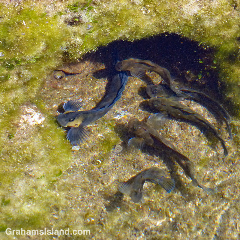
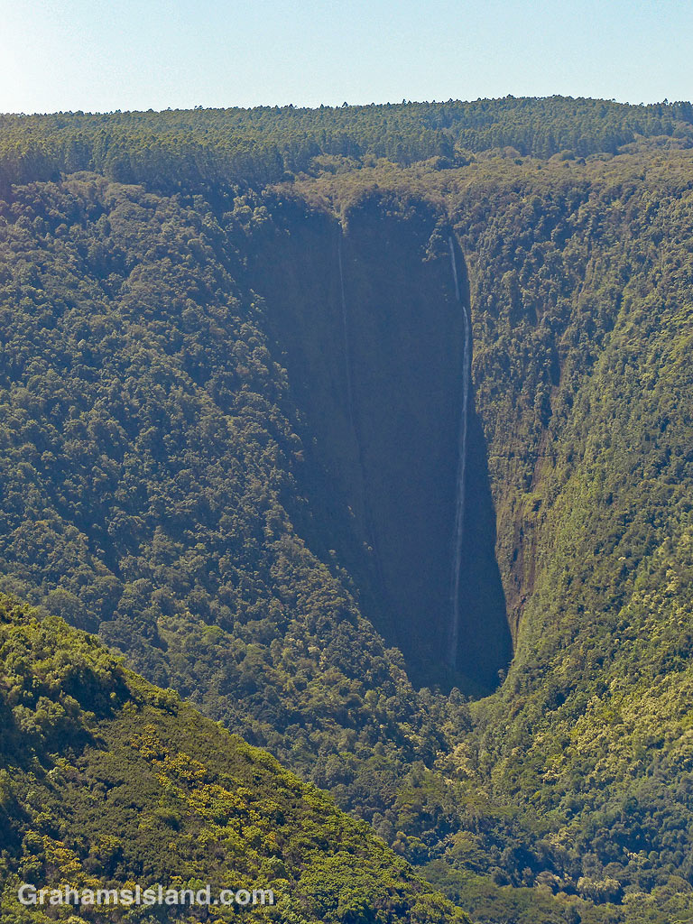
This week’s Sunday Stills challenge theme is ‘Bucket List Images.’ (See more responses here.) Since I don’t have a bucket list that posed something of a problem for me, so I plumped for this image of Waipi’o Valley, since I might never see this view again.

Waipi’o is a valley on the northeastern slopes of Kohala Mountain. The valley is about one mile wide at the mouth and about six miles deep with walls that are around 2,000 feet high. It’s accessed by a steep, one-lane road that’s for four-wheel-drive vehicles only. On the left of the top photo, and in the second photo, is Hi’ilawe Falls which tumbles almost 1,500 feet into the valley.

Waipi’o means ‘curved water’ in Hawaiian and the valley is known as the “Valley of Kings.” It was the home of Hawaiian royalty until the 15th century and was a stronghold of King Kamehameha, who united the Hawaiian islands under one leader. In its heyday, the valley was home to somewhere between 4,000 and 10,000 people.

Those numbers dropped over time, but the valley remained well-populated until 1946 when a magnitude 8.6 earthquake in the Aleutian Islands triggered a massive Pacific-wide tsunami with waves ranging from 45–130 ft. high. Waipi’o Valley was hit by this tsunami, and though no-one was killed, most of the structures in the valley were destroyed. Today, the population is around 50 residents, though many more visit on a daily basis.
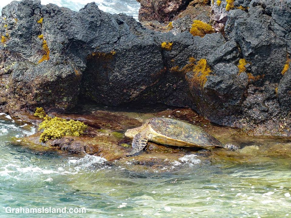
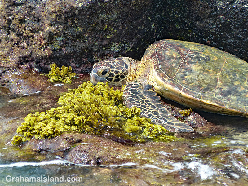
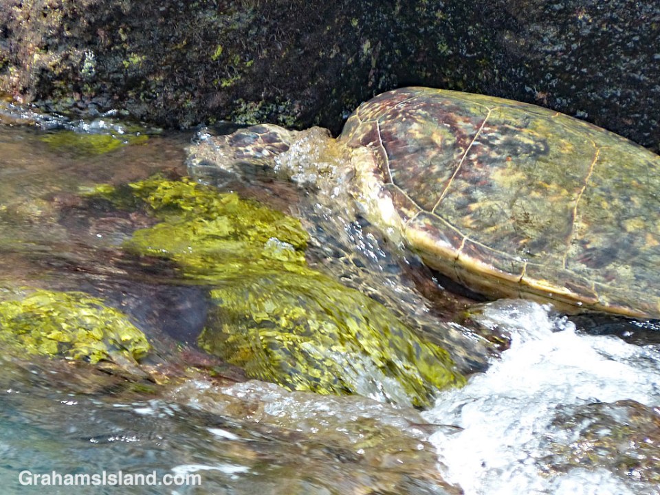
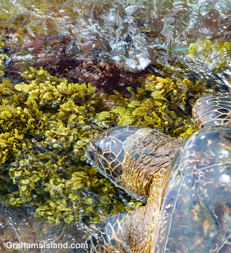
Propellor by South Point boat launch

Propellor by South Point boat launch

The South Point boat launch, on the southern tip of the island, is found in a small notch in the coastline. This old propeller marks one side of this small bay. Its size shows its not from a boat that would be able to use the ramp. More likely, it’s a souvenir from the wreck of a bigger boat that met its fate in these waters.