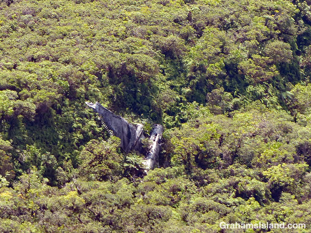
The idea of The Numbers Game is to enter a number into the search bar of your computer and then post a selection of the photos that turn up. This week’s number is 187. Captions are on the photos. You can see more responses here.

The idea of The Numbers Game is to enter a number into the search bar of your computer and then post a selection of the photos that turn up. This week’s number is 187. Captions are on the photos. You can see more responses here.
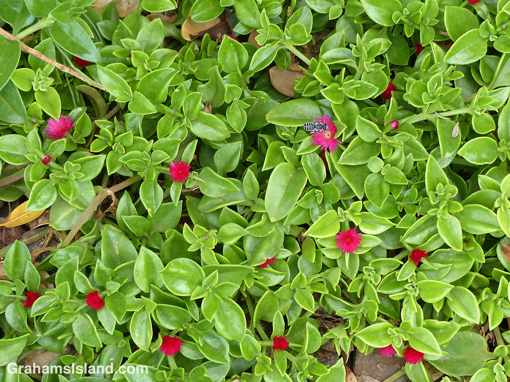
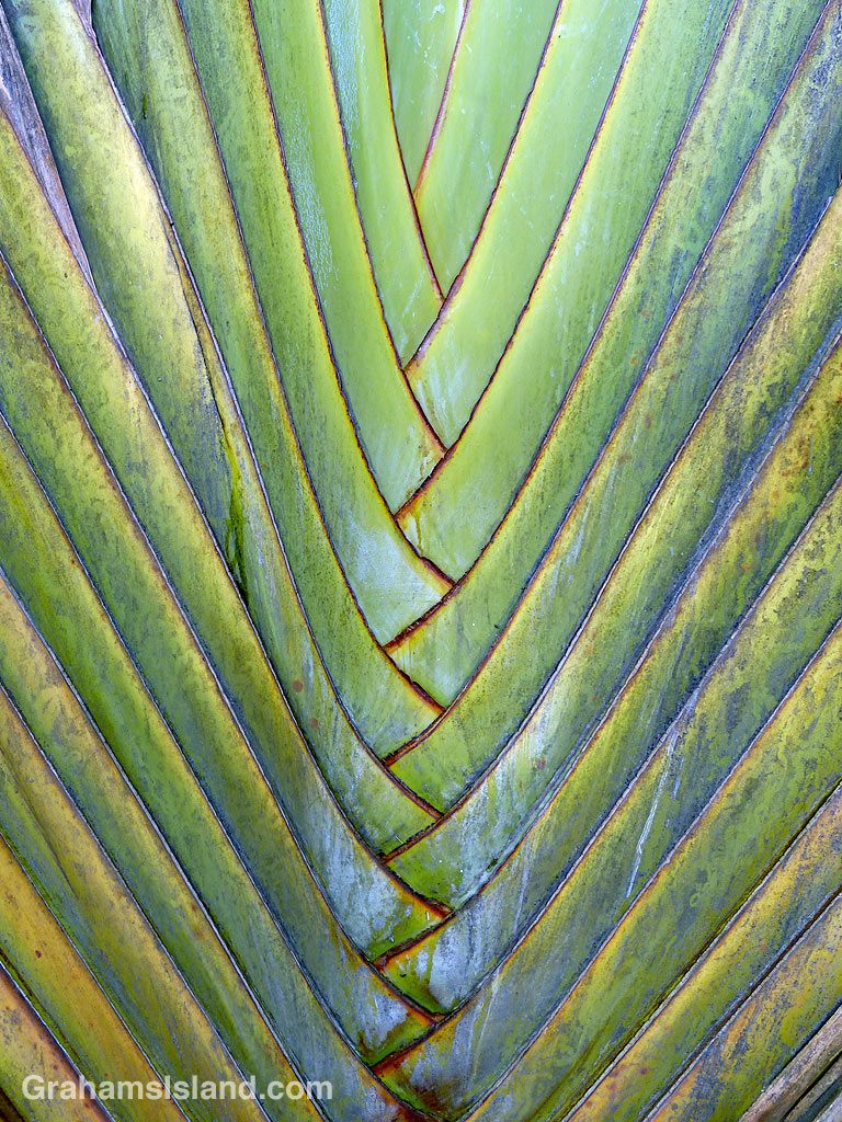
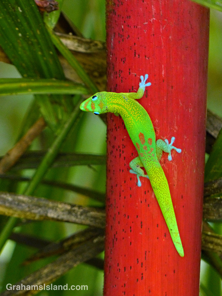
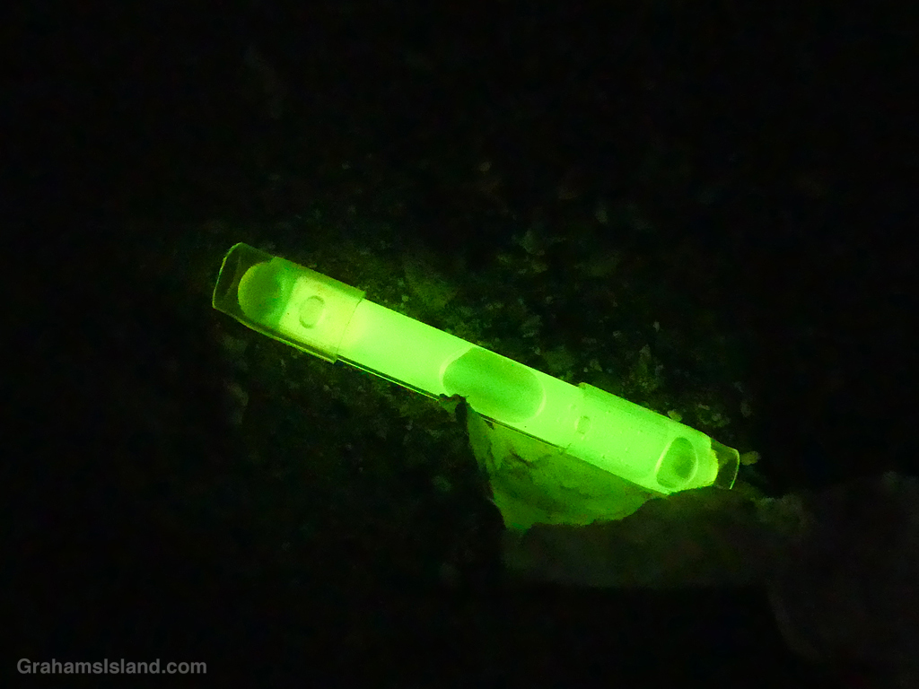
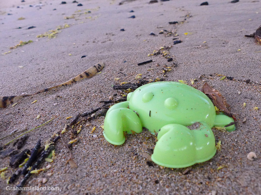
This week’s Sunday Stills color challenge theme is ‘Shades of Green.’ Captions are on the photos. See more responses here.

The idea of The Numbers Game is to enter a number into the search bar of your computer and then post a selection of the photos that turn up. This week’s number is 149. Captions are on the photos. You can see more responses here.


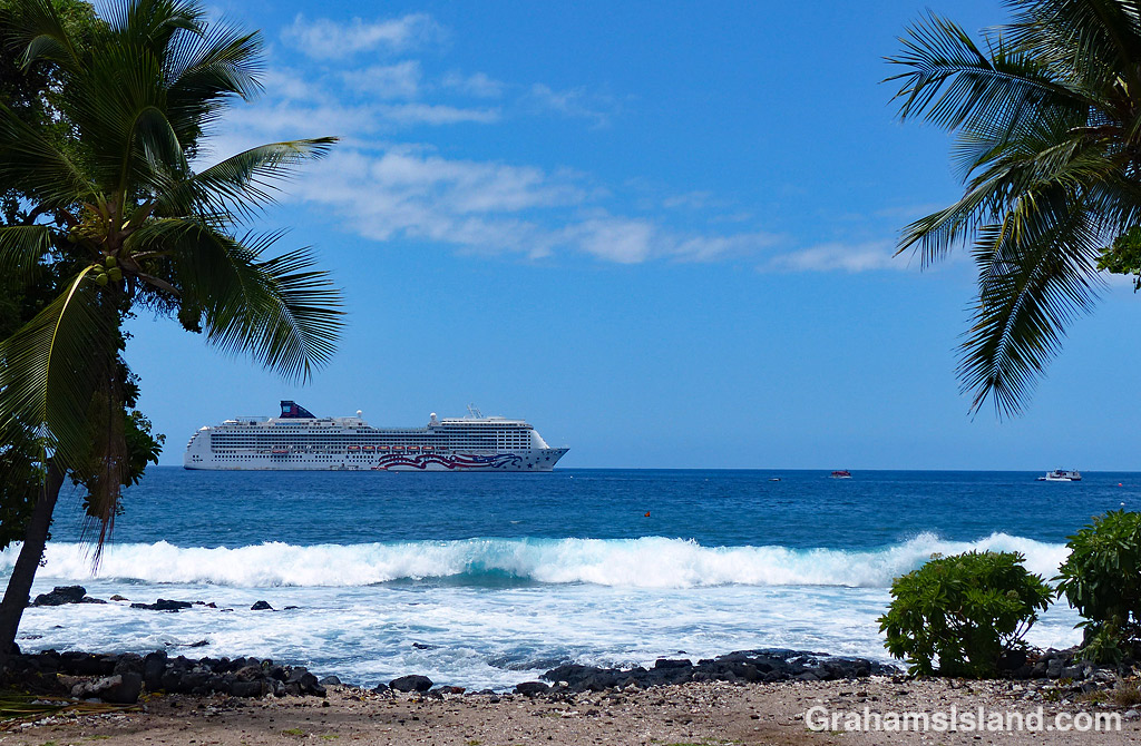

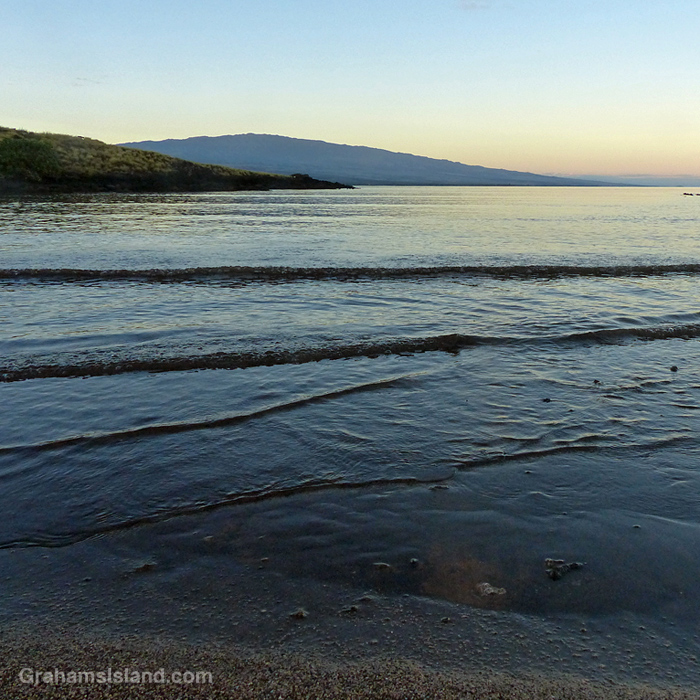
This week’s Sunday Stills challenge theme is ‘Water, Waterscapes and/or Water Safety.’ See more responses here. Captions on the photos.
Also posted for Becky’s Squares: Move Forward, Reconstruct, Renew, and/or are Burgeoning, because waves are always moving forward. See more responses here.


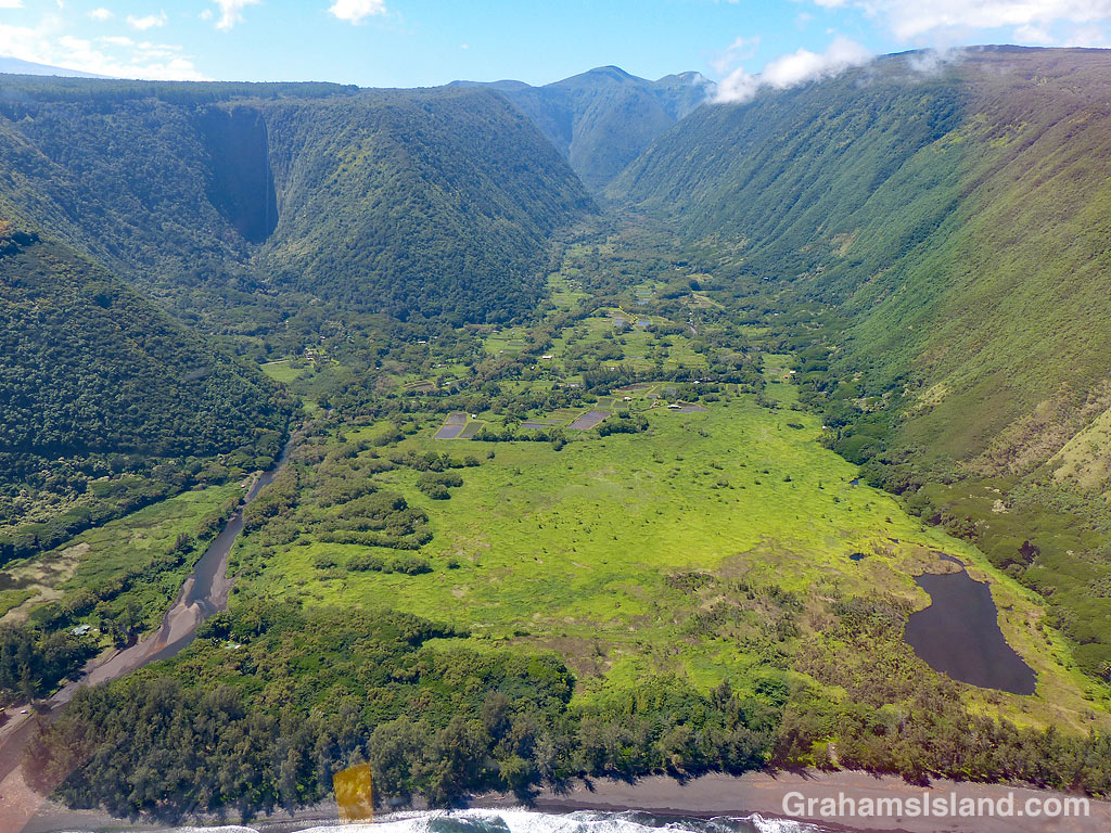
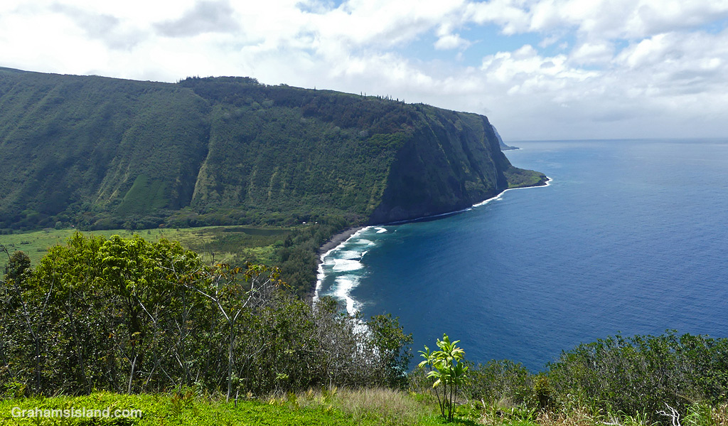
A view across Waipi’o Valley from the road into the valley. This road has been closed to visitors for some time, because of rockfalls from the steep slopes above it. A project to improve the road recently finished its first phase, but it’s likely to be a few years before the road is opened to anyone other than residents, licensed tour operators, and native Hawaiians exercising traditional rights. Even then, it’s not clear what access will be permitted.
One thing this means is that the (strenuous) Muliwai Trail, into the next door Waimanu Valley, is currently closed and is likely to be so for some time, if it ever reopens. That trail can be seen (very faintly) making a zigzag up the steep slope on the far side of the valley.

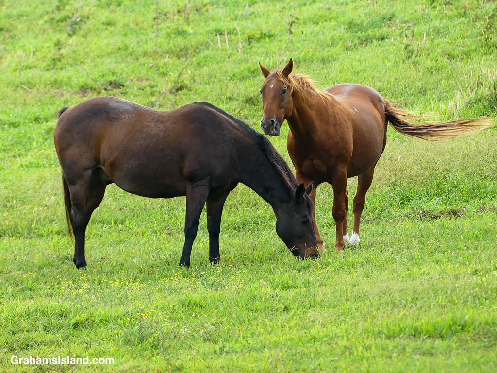
These are the same kind of trees surrounded by the same kind of ground cover and occupied by two of the same kind of horses. But, taken together, they make a one of a kind image that many people on the island would very quickly recognize as Waipi’o Valley.
Posted in response to Becky’s October Squares challenge theme of ‘Kind.’ See more responses here.
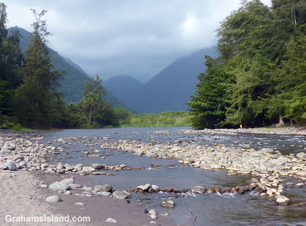
This week’s Sunday Stills challenge theme is ‘Bodies of Water.’ (See more responses here.) Last Sunday, I posted photos of the Kohala valleys. This week, I’m posting a bit about what goes on in them and elsewhere on the island.
The top photo is shows the mouth of the Waipi’o River looking back toward the cloud shrouded Kohala hills. The river, is fed by water passing over Hi’ilawe Falls and other waterfalls deep in the fingers of the valley. Like all water courses on the Big Island, its flow is greatly increased by the often heavy rainfall.
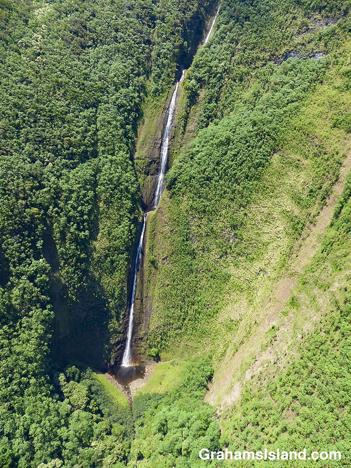
The second photo shows a waterfall, farther down the coast, cascading into a pool at the bottom before flowing out to the ocean. Some of these waterfalls drop more than a thousand feet. Some cascade into valleys, some directly into the ocean. During dry spells, the water flows are greatly reduced and many falls, those that are entirely rain fed, disappear for a while. When rains are heavy, the water flow is so great that some falls blend together to form a sheet of falling water.
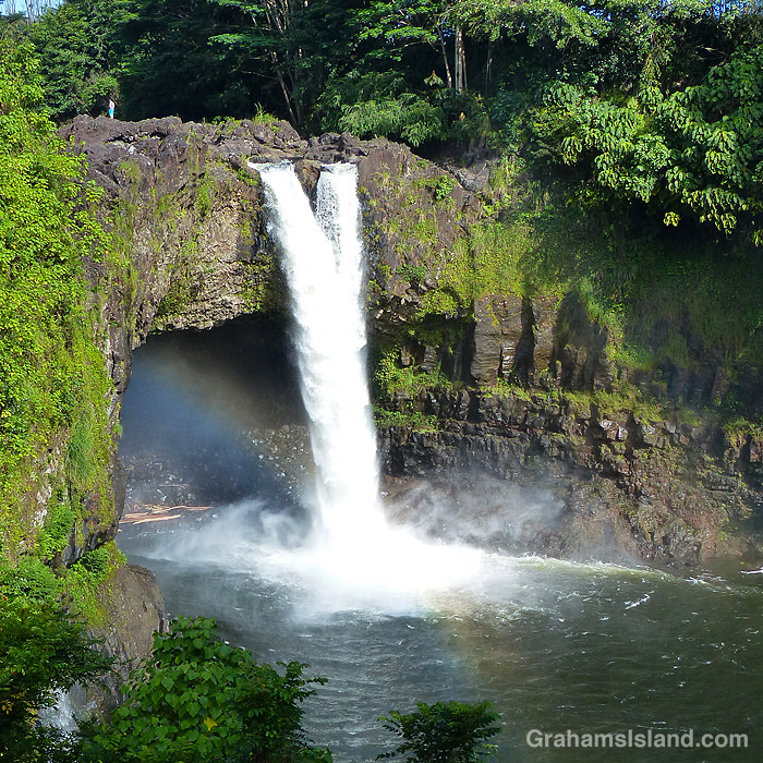
On the east side of the island is Wailuku River, the longest river on the island. This flows down to the ocean in Hilo, and on its way, tumbles over the aptly named Rainbow Falls (third photo). The falls and rainbows are best seen in the early morning. This stretch of the river is very dangerous with flash floods being common. People get swept away here every year.
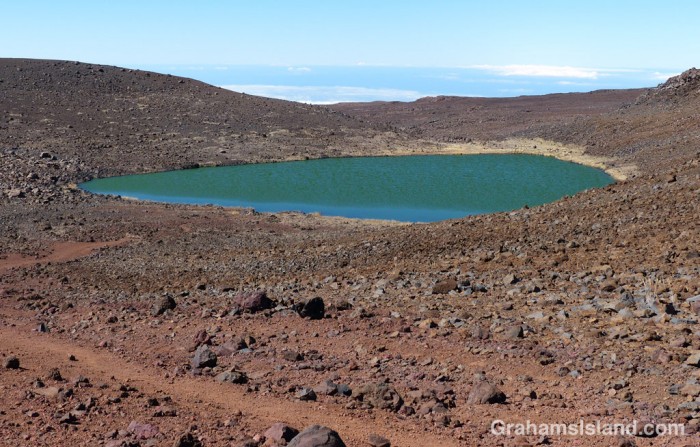
Finally, the bottom photo shows the biggest lake on the island, which can be found at the top of Mauna Kea! Lake Waiau is fed by rainwater and snow melt, mostly in the winter. That it exists at all is something of a mystery. The ground on Mauna Kea is highly permeable, and it’s not fully understood what the layer is beneath Lake Waiau that enables it to retain water. Lake Waiau is not just the biggest lake on the island, it’s the only one. Green Lake, the biggest lake previously, disappeared during Kilauea’s 2018 eruption (photos and story here).


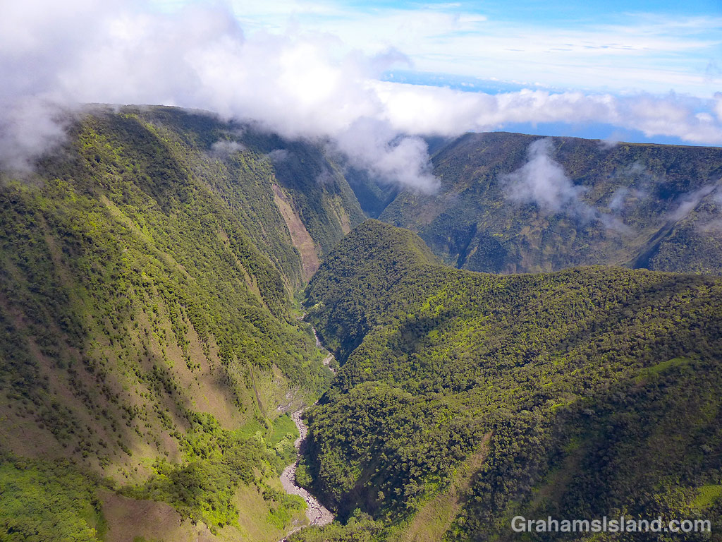
This week’s Sunday Stills challenge theme is ‘Mountains and Valleys.’ See more offerings here.
Kohala Volcano is the oldest volcano on the Big Island and has long been extinct, having last erupted around 120,000 years ago. Since then, the various processes of erosion, from rainfall to landslides, have carved deep valleys into the volcano. Waipio, the easternmost of these valleys, is accessible by vehicle (4-wheel drive only), horseback, or on foot. It has permanent inhabitants so access within the valley is restricted.
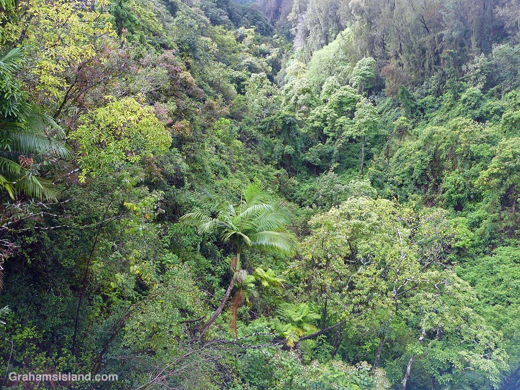
The other valleys are most easily seen from the air, along the Kohala coast. The top photo shows Waimanu Valley. This can be accessed by foot from Waipio, after a long and arduous hike, and permits are available for camping there. Waimanu River can be seen on the far side of the valley and is one last obstacle to be crossed to reach the camp site, which is in the strip of land between the river and the ocean. The steep sides are typical of these valleys and another consideration to keep in mind when thinking about hiking here.
The middle photo shows a fairly typical view directly into one of the valleys from the ocean. Again, notice the steep valley sides and the abundance of foliage, evidence that this is the wet side of the island.
The bottom photo shows valleys cutting through the mountain farther inland. There’s little or no water running in this view. A few valleys have spring-fed streams, but most depend on rain for water flow. However, when it does rain, it can rain long and hard. Flash floods are common. It’s not a shock when campers in Waimanu Valley are cut off and unable to make the return hike.
I’ll do another post about the water courses for next week’s Sunday Stills challenge.
For more information about Hawaii’s volcanoes, go to https://www.lovebigisland.com/hawaii-blog/hawaii-volcano-history/.