The ceiling in my dentist’s waiting room is illuminated with blue light, which always catches my eye when I walk in.

The ceiling in my dentist’s waiting room is illuminated with blue light, which always catches my eye when I walk in.

Hōkūʻula is the name of an old cinder cone, which is a backdrop to the west side of the town of Waimea.

I often see purple agapanthus around here, but I think this was the first time I’ve seen the white version, here in Waimea.
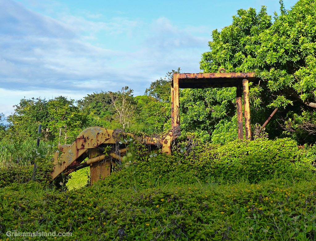
This weed-covered backhoe sits besides Hawi Hill, the road from Hawi that leads to Waimea. I’ve passed the spot numerous times and often thought I should get this photo. The problem is that the hill is steep and narrow here, with nowhere to pull off to take the photo. The closest obvious parking place meant a walk back up this busy road.
Finally, one day recently, I was heading home down the hill in the late afternoon. Traffic was light with nothing coming toward me or following close behind. So I stopped the car in the road, wound the window down, and snapped a couple of photos, including this one. Then it was off again, before someone careened into the back of me.

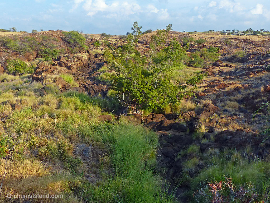
Keanuiomano Stream is one of many watercourses on the island that is rainfall dependent. When it rains, it runs. When it’s dry, it doesn’t. The stream starts high on Kohala Mountain, winds down through the western part of Waimea, and reaches the ocean on the northern edge of Mauna Kea Resort. These photos were taken where the stream passes under Highway 19, Queen Ka’ahumanu Highway or Queen K Highway as it is also known.
The top photo was taken as Tropical Storm Darby passed the island. The bottom photo is how the stream usually looks.
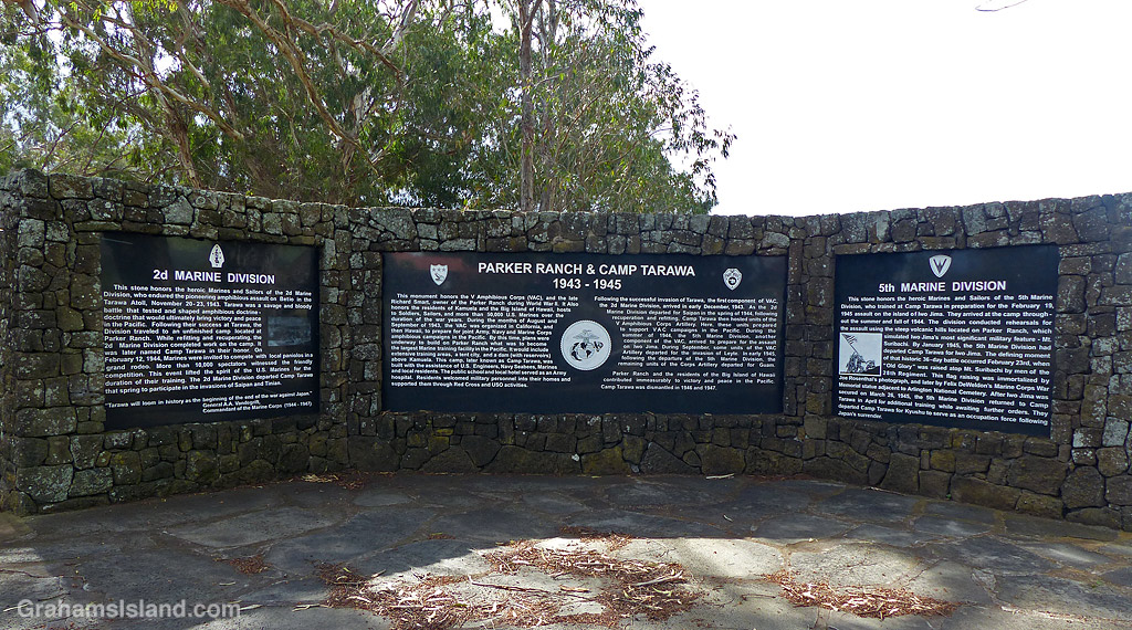
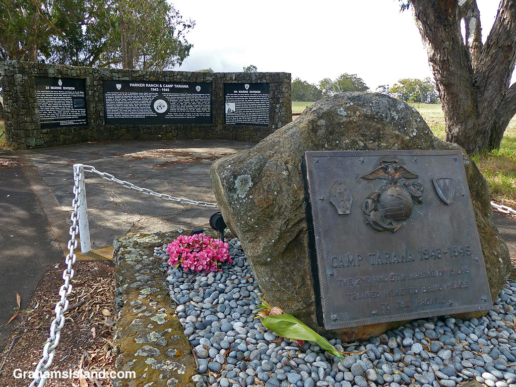
Waimea was the site of Camp Tarawa from 1943 to 1945. The camp was built by the 2nd Marine Division which had just fought the battle of Tarawa, hence the name of the camp. Those marines then trained there for their next campaigns before moving on in spring of 1944.
They were replaced by the 5th Marine Division, who used the area to train for the attack on Iwo Jima. After that campaign, those marines returned to the camp for further training, but the war ended before they were called into action again.
The camp was closed in November 1945 and returned to Parker Ranch, which had leased the land to the U.S. government for a nominal fee, with the proviso that it be returned to them in its original condition. This meant that few buildings from that time remain, but the land between Waimea and the South Kohala coast was littered with unexploded ordinance and shrapnel, some of which remains to this day.
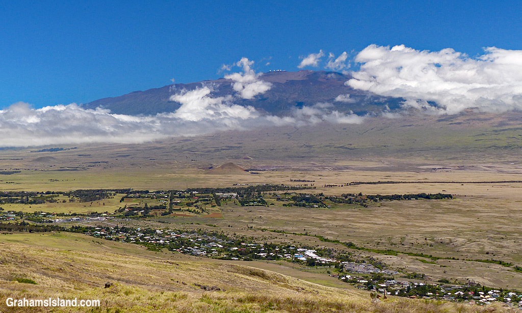
This view of Mauna Kea is interesting for a couple of reasons, neither of which have to do with Mauna Kea itself.
The first is that it shows the dry side of Waimea, which is to say some of the western part of the town. The dry side gets considerably less rain and more blue skies than the wet side though the separation is only a few miles.
The second point of interest is that this view looks nothing like this today. The area between the dark line of trees and the base of the clouds is where the recent brushfire went through. So it’s not currently green and pastoral. It’s more black and brown and apocalyptic.
The good news is the land will recover, assuming there are no more fires for a while.
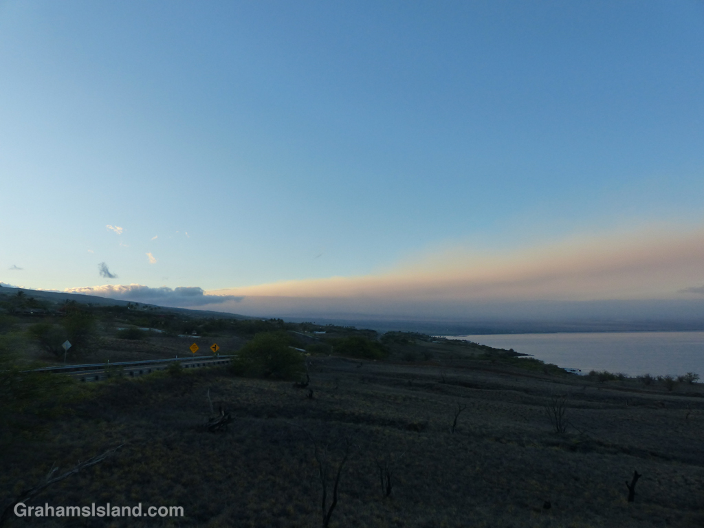
This is an early morning view of smoke from a brush fire burning south of Waimea. The fire started on Friday morning and high winds, up to 40 mph, caused it to grow rapidly. On Saturday, 8,000 acres were reported burned by noon and 12,000 acres at 5 pm. Sunday morning, at 11 am, that figure had jumped to 36,000 acres and by 1:30 pm was around 40,000 acres.
The fire jumped Highway 190 on Sunday afternoon, prompting an evacuation order for Waikoloa Village, a community with more than 6,000 residents. This order was later lifted as conditions changed and the immediate threat to the community eased.
As of Monday evening, the fire, while not fully contained, had at least been brought somewhat under control and its surge stopped, though a renewal of high winds could easily change all that.
Posted for Bushboy’s Last on the Card photo challenge. See more responses here.
