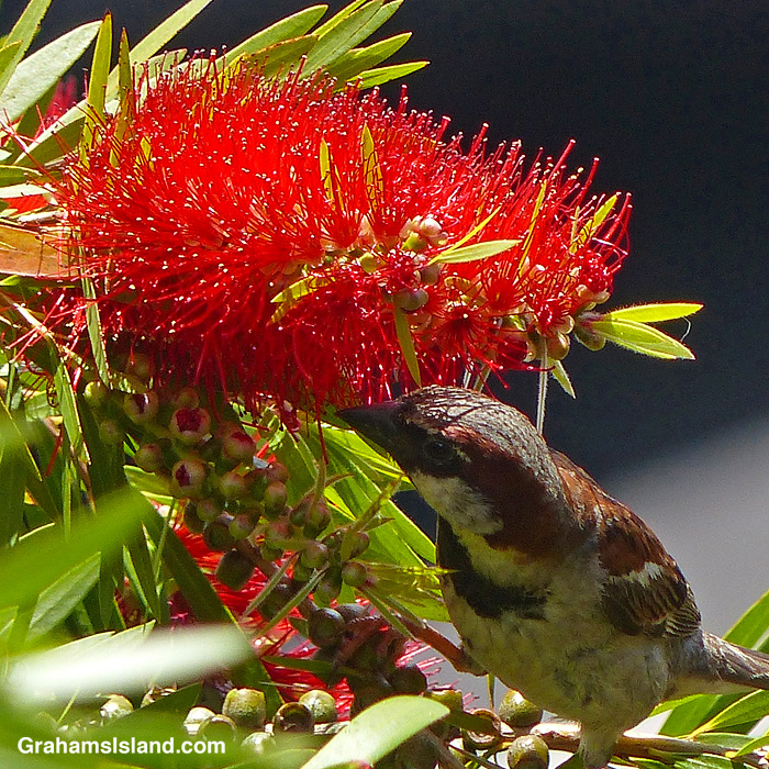
I was surprised to see this House Sparrow feeding on this bottlebrush flower. I usually see them snapping up fallen food at outdoor restaurants or squabbling over bird seed thrown out by sympathizers.

I was surprised to see this House Sparrow feeding on this bottlebrush flower. I usually see them snapping up fallen food at outdoor restaurants or squabbling over bird seed thrown out by sympathizers.

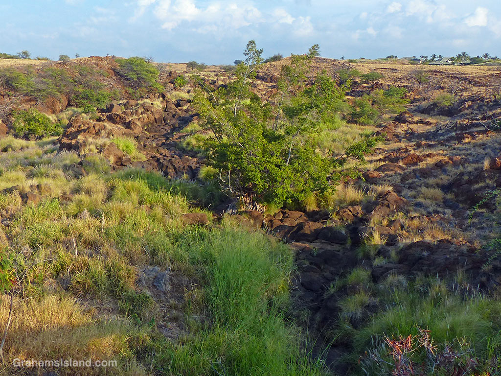
Keanuiomano Stream is one of many watercourses on the island that is rainfall dependent. When it rains, it runs. When it’s dry, it doesn’t. The stream starts high on Kohala Mountain, winds down through the western part of Waimea, and reaches the ocean on the northern edge of Mauna Kea Resort. These photos were taken where the stream passes under Highway 19, Queen Ka’ahumanu Highway or Queen K Highway as it is also known.
The top photo was taken as Tropical Storm Darby passed the island. The bottom photo is how the stream usually looks.

A photo taken while snorkeling, looking up toward the light. This one doesn’t look a whole lot different in black and white.


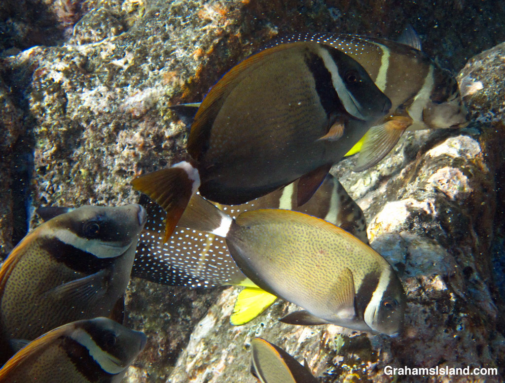
Schools of Whitebar Surgeonfishes are fairly common where I snorkel most. They cruise around rocky areas, feeding on algae. Often they can be seen with other reef fish such as Convict Tangs or Whitespotted Surgeonfish, seen in the background of the lower photo.
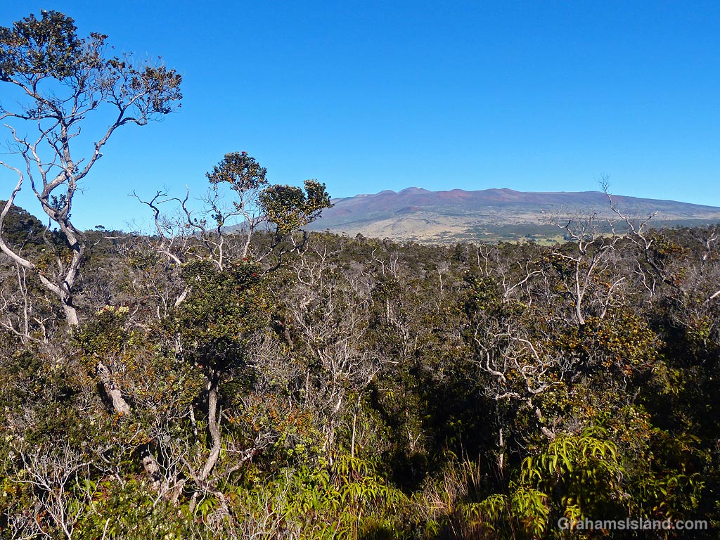
Kaulana Manu Nature Trail used to be known as Kipuka 21. A kipuka is an area of land that has been surrounded by lava and the 21 referred to the fact that this one was located at the 21 mile marker of the road across the middle of the island.
It has been renamed Kaulana Manu Nature Trail, presumably to reflect its new grandeur since the trail has been renovated, which is a good thing. However, a new toilet facility and parking lot, featuring space for three large buses, has also been built, which is not necessarily a good thing.
The trail is a one mile loop through a fragile environment, where native endangered birds can sometimes be seen. I’m not clear on how disgorging busloads of people into this area is going to help preserve things. If three buses did arrive, there would be gridlock on the trail, which is narrow and winding.
Fortunately, when I’ve visited, the place has been pretty much deserted. Long may that continue.
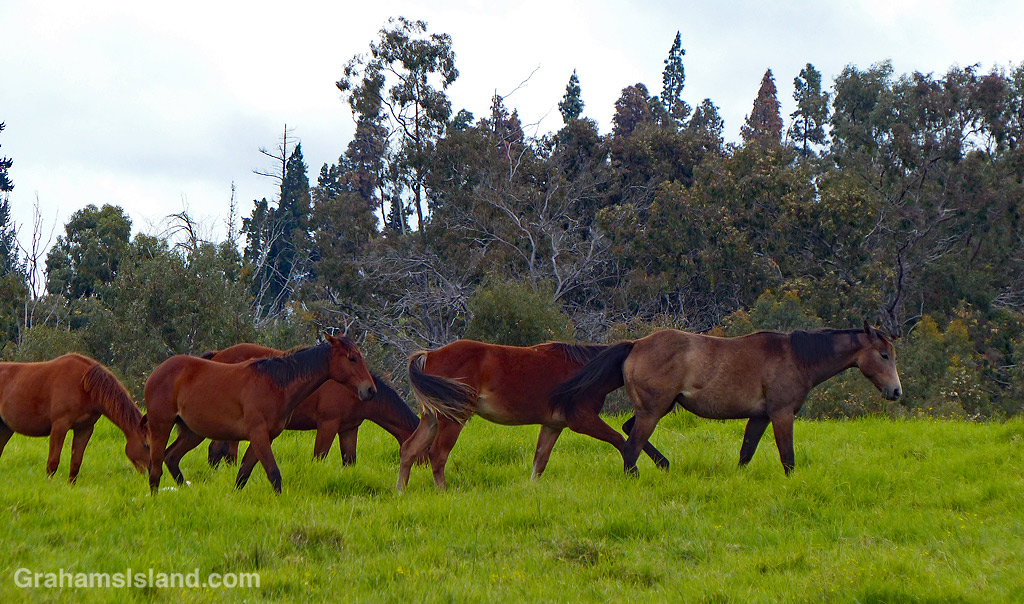
This week’s Sunday Stills challenge theme is ‘Road Trippin’.’ See more responses here. Since there aren’t any road trips, in the usual sense of the expression, here on the island, I thought I’d focus on a stretch of road that is one of my favorite drives here.
Old Saddle Road is an 11 mile stretch of the old highway that connected the west side of the island to the east side, through the saddle between Mauna Kea and Mauna Loa. These days, people take the new road, which is wide and smooth and allows drivers to zip along at 80 mph even though the speed limit is 60 mph. I like this highway, too, but the best part of any cross-island trip is always the old highway, which is up and down, winding, and dotted with one lane narrows where culverts pass under the highway (they’re not bridges) to channel the copious amounts of rain away from the road.
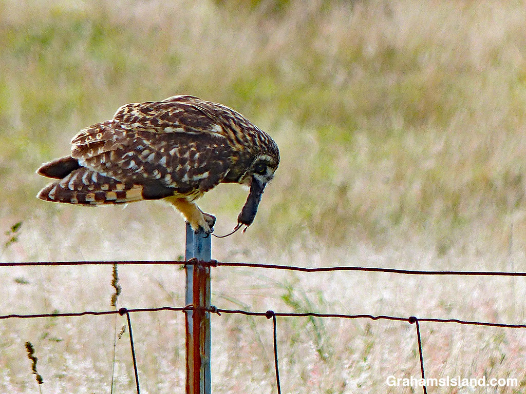
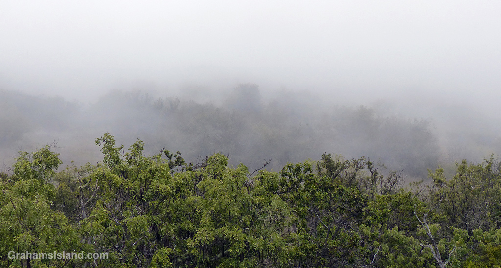
This stretch of road is bordered by ranch land, with horses, cattle, and sheep to the fore. There’s also a good variety of wildlife that can be seen in this area. And the weather can be anything from stunning to biblically awful, sometimes within the hour. So here are a few scenes that give an idea of that short, but special drive.


Another of the neon signs at the Harbor House restaurant in Kailua Kona. I like this one for the chair and the setting sun, but not for the beer I have to say!
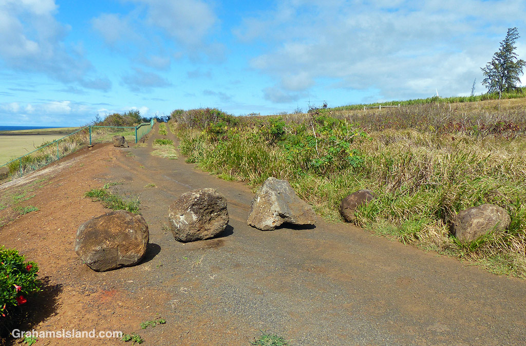
A while back I posted (here) about a trash cleanup at Upolu. As part of that process, the people responsible graded the dirt road down to the area, presumably so that trucks could more easily get in to haul away trash.
Paralleling that road, for a short stretch, is another road next to the airport fence. As part of the same operation, some large rocks bordering the road were moved across to block access. I think this was because the road has a low stretch which has become deeply rutted and where water and mud collects.
Shortly after the road was blocked someone moved one of the rocks to allow access. A few days later the rock was moved back. This process happened several times over the next few weeks. The rock that was getting moved back and forth is the one on the right, in the grass, in this photo.
In the latest development, another rock has been dragged across to block the road. The skid marks can be seen in the photo. I suspect this rock was chosen because it has a flat bottom and might be harder to move. I haven’t been down there since this latest development, but I’m keen to see if the game continues. I have no idea why someone has been moving these rocks out of the way, since this road joins the improved one just a quarter mile farther on. Perhaps someone is simply objecting to being prevented from driving where-ever the heck they want to. I expect that’s guaranteed in the constitution somewhere!
