Category Archives: Activities

First Big Island visit

Pololu beach

Turtle at PunuluuTropical foliageLava flowingThis week’s Friendly Friday challenge theme is ‘Turning point.’ (See more responses here.) Since this is a photo blog about the Big Island it seems appropriate to post some photos from my first visit here in 2010, a visit which was the catalyst for the move to the island. There was no ‘ah ha’ moment, but these photos give a general idea of some of the things that appealed.

The top photo is Pololu beach on the North Kohala coast. Second photo is a Hawaiian green turtle resting on the black sand beach at Punalu’u County Beach Park. Third photo is tropical foliage next to a small cascading stream. Fourth photo shows some small lava breakouts in the flow that was active at that time. Conveniently, that activity was about 100 yards from the parking area and only 10 feet or so beyond where I was standing. The bottom photo is a view of Two Step, a popular snorkeling spot, from Pu’uhonua o Hōnaunau National Historical Park.

Two Step from Place of Refuge

Kings’ Trail

kings trail ala loa

kings trail straight
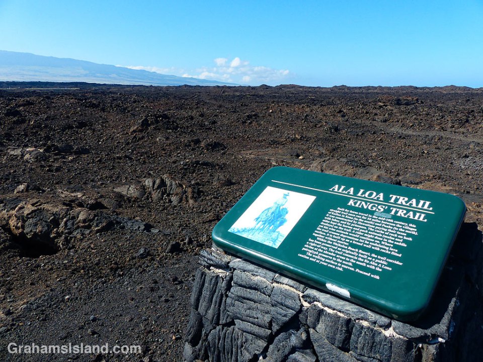
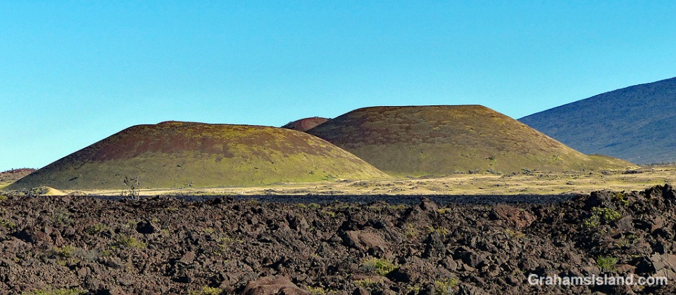
The Kings’ Trail, is more properly known as the Ala Kahakai Trail (shoreline trail) or the Ala Loa Trail (long trail). The trail was created in the 1800s and stretched 175 miles from Upolu, at the northern tip of the island, down the west coast and up the south coast, to Kalapana in the southeast corner.

It passed through 220 ahupuaʽa, which were land divisions stretching from the ocean to the mountains. This meant that each ahupuaʽa contained the necessary resources to sustain its inhabitants.

These days, some sections of the trail are open for hiking, but others cross private land. The goal is to reopen as much of the trail as possible to public use. These photos are of parts of the trail passing down the Kohala coast. In many places the trail is ramrod straight to make passage easier, though the surface is often uneven.

Posted in response to this week’s Friendly Friday challenge on the theme of ‘Pathways.’ See more responses here.

kings trail

The mouth of Honokāne Iki valley

The mouth of Honokane Iki Valley

At the end of Highway 270, on the northern tip of the island, is Pololu Valley. There’s a trail down to the beach there and, at the other end of the beach, another trail leading up to a bench that overlooks Honokāne Nui valley.

Not far beyond the bench, the trail was destroyed by an earthquake in 2006. It’s still possible to descend to the valley, but the trail goes straight down a steep slope and ropes are in place to make this possible. There are no guarantees that these ropes are in good condition and the slope certainly isn’t. If you do descend this section, the trail passes through varied vegetation and ultimately leads down to a rocky beach at the mouth of Honokāne Nui valley.

Beyond Honokāne Nui, there’s another trail that continues over the next hill and down into Honokāne Iki valley. That valley opens up to this beautiful little bay, which is quite protected and, at low tide, has a nice sandy beach. Be aware though that this is private land and in use on a regular basis.

Green turtle feeding

Green turtle and tidepool

Green turtle feedingGreen turtle feeds
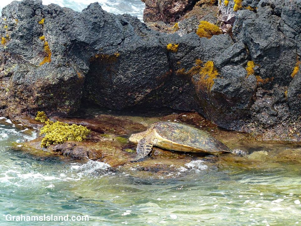
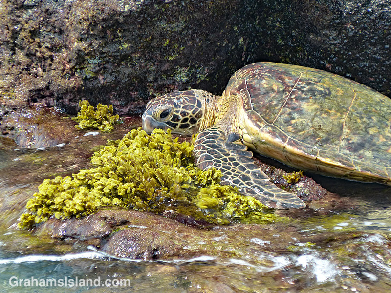
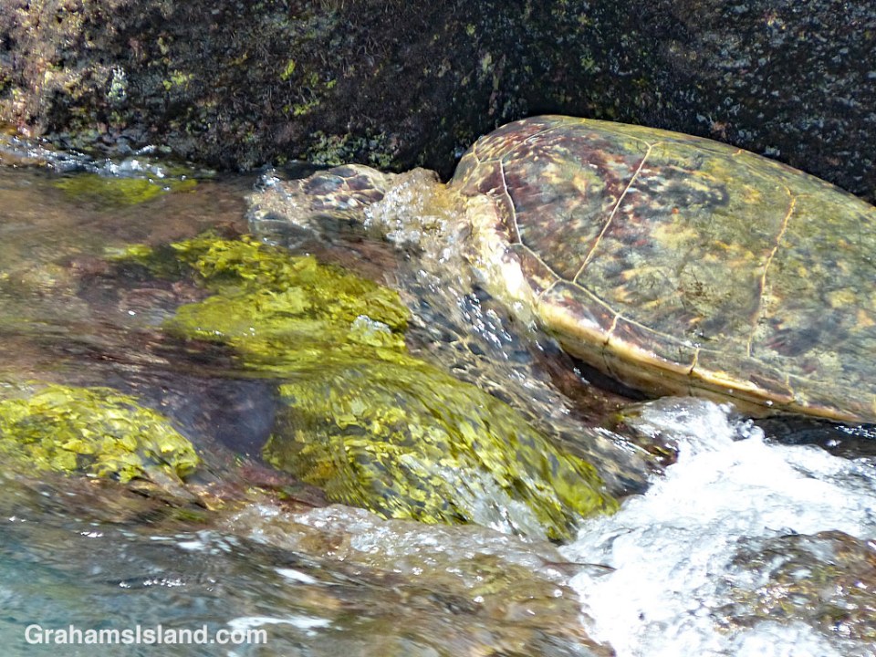
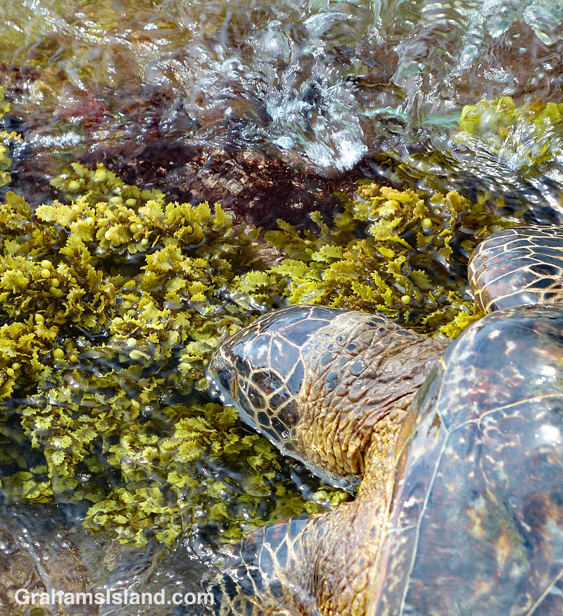
Toward the end of a hike along the coast, I came across this turtle feeding in a shallow tidal area. There was good grazing to be had, but the problem was that the ledge was continually swept by incoming waves.

The turtle would swim in and access the ledge from the shore side (on the right in the top photo). Then he lumped forward to where the good grazing was and buried his head in it.

Waves would surge in and sluice over him (below). Sometimes, the receding wave had enough oomph that it would wash the turtle over the front edge of the ledge. Then he’d swim around and start over again.

Green turtle surge

Honokohau Harbor entrance

Honokohau Harbor entrance

Honokohau Harbor, just north of Kailua Kona, is the main small boat harbor on the west side of the Big Island. In addition to private pleasure craft, a lot of charter boats operate out of the harbor, taking guests out to fish, snorkel, dive, and whale watch.

While it looks placid in this photo, once outside this harbor entrance, boaters are in the Pacific Ocean and conditions can change dramatically in a very short time.

Pu’us

Pu'us on Mauna Kea

In Hawaii, one meaning of the word ‘pu’u’ is ‘a protuberance of some kind.’ This can be anything from a pimple to a hill, but ‘hill’ is the most common usage I encounter, as a general reference or in place names.

Pu’u O’o is the cinder cone that is home to the vent on Kilauea Volcano that was active from 1983 until earlier this year. Pu’u Wa’awa’a is an old cinder cone that is now managed by the Division of Forestry & Wildlife. A common thread is that, in Hawaii, a hill is a cinder cone because all of Hawaii is volcanic and the landscape is liberally dotted with cinder cones.

The top photo shows Mauna Kea and the large array of pu’us on its southern slopes. In the foreground is Pu’u Huluhulu, which means hairy hill. There’s a trail to the top of this pu’u which offers good views of Mauna Kea and Mauna Loa.

The bottom photo shows grassed over pu’us in Pōhakuloa Training Area, which is a military base located in the region between Mauna Loa, Mauna Kea and Hualālai volcanoes.

On the Big Island, several pu’us are accessible to hikers, usually with a trail curving up to the top and then around the rim of the pu’u. Even if the pu’u isn’t that high, it invariably stands out from its surroundings and offers good views.

Pu'us between Mauna Kea and Mauna Loa