This week’s posts are in response to the WordPress photo challenge on the theme of ‘evanescent.’
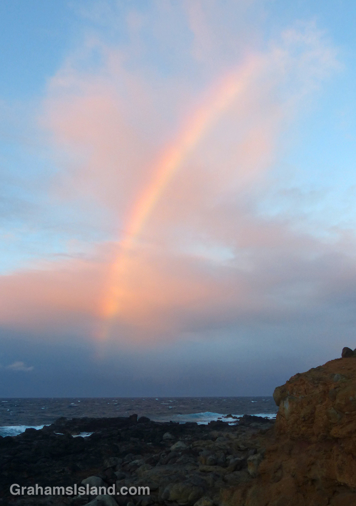
This slice of rainbow, backed by pink clouds, fits the bill, I think. Fueled by an approaching shower of rain, it shone briefly bright, then quickly faded.
Most weeks I post something in response to the WordPress photo challenge. This week’s theme is ‘evanescent,’ a word I wasn’t familiar with. The definition provided is “soon passing out of sight, memory, or existence; quickly fading or disappearing,” or, put simply, ‘a moment in time.’
To me, this is what any photo is, a snapshot of a given moment. Even the look of a fixed object, a landscape, a building, a monument, is always changing. It could be the light, weather, activity around the subject. Everything is in constant flux, sometimes in obvious ways, sometimes only in the detail. With birds, animals, bugs, even plants – blowing in the wind – those changes of passing moments are more obvious.
So I thought I’d take this week’s challenge as my theme for the week (or at least the remaining six days of the challenge). I start off with this photo of a manta ray. One of the great joys of snorkeling is never knowing what I’ll see that day. It could be a common fish engaged in some activity I’ve never seen before. It could be a glimpse of something unexpected. It could be something seen only at a certain time of year. Whatever it is, it almost always gives me a little jolt of ‘wow.’
While out snorkeling, I got a jolt of ‘wow’ when I saw this manta ray gliding along in the opposite direction. I turned and followed its effortless progress for several minutes until it headed into deeper water and disappeared. An evanescent experience? I think so, though it won’t soon disappear from my memory.
The small mirror in the Cassegrain cabin of the James Clerk Maxwell Telescope on Mauna Kea, can be rotated to direct information to a variety of instruments. Here, it reflects about the only empty spot in the crowded space.
I met Yogi on the trail just before entering the forest. Here, he makes his way through the dense growth.
Huge Hapu’u ferns line the forested section of the Nāpau Trail.
The old Pulu factory.
Yesterday, I posted about the first part of the Nāpau Trail in Hawaii Volcanoes National Park, which crosses extensive lava fields. Today’s post picks up from there, on the rim of Makaopuhi Crater, where the trail slips into dense forest on its way to the Nāpau Crater overlook.
Puʻu ʻŌʻō from the Nāpau Crater overlook.
It’s a remarkable contrast between the stark lava and thriving forest. Birdsong is continuous. Ferns of every kind grow in abundance. Bamboo orchids pop out here and there. And above it all, tall Ohia trees provide the backbone of the forest. This forested trail is clear, but somewhat overgrown. I was hiking in shorts and, at the end of the day, my legs were generously scratched.
Early on in this section, it’s possible to get views of Makaopuhi Crater. Also in this area is the junction with the Nāulu Trail, which starts out at the Kealakomo Overlook, farther down Chain of Craters Road.
The forested part of the trail is about 2.5 miles and towards the end of it is an old Pulu factory. The sign there reads: “Between 1851 and 1884 great quantities of pulu, the soft, reddish-brown fiber covering the coiled fronds of the tree fern (hāpuʻu), were harvested on Hawaii. Much of it was processed within these walls, later to be shipped from Keauhou Landing to foreign markets for use as stuffing in pillows and mattresses.” Unfortunately, in drier climates, pulu quickly breaks down so the industry collapsed.
A little farther along is another junction. To the left is the very basic Nāpau campsite, a few open flat areas and an outhouse. To the right, the trail continues to the overlook, where I was lucky enough to have a wonderful, clear view of Puʻu ʻŌʻō, busily pumping out sulphur dioxide and other gases, and of course, million upon millions of gallons of lava, currently entering the ocean on the southeast coast.
Picking the right day for the hike is not always obvious and weather changes quickly around here. At the visitor center, on the way in, it was completely overcast and drizzling, but by the time I got to the trailhead the sun was out and a nice breeze blew. The wind direction is also important. On this day, the northeast trades were blowing and the vog trailed away to the southwest, which is fine for this hike. But if the wind blows more easterly or south of east, then this trail would be downwind of emissions from the volcano, which could potentially be a dangerous situation.
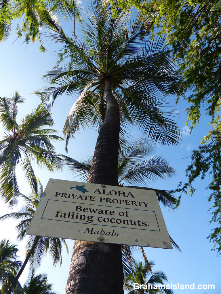
This view is the best for determining if any coconuts are falling. A roundish object getting rapidly larger is a good sign that they are indeed earthbound. Getting such a photo is not without danger, but that’s all part of life in the tropics.
One of the things I like about the Big Island is that there’s so much variety in a relatively small area. It boasts 8 out of 13 possible climate zones (depending on whose definitions are used). It goes from sea level to almost 14,000 feet.
I’m happy to satiate my wanderlust right here on the island, traveling to see the outpourings of our most active volcano, climbing to the windswept summits of Mauna Loa and Mauna Kea, and of course, sweating it out on the coast.
The beaches and surf are hugely popular with tourists, but it’s almost always possible to find a sparsely populated, or even empty beach with a bit of walking. Makalawena, on the Kona coast, is one such spot. It requires a hike in, half an hour or so, but offers golden sand and a number of smaller pockets of sand where a person can soak up some sun and take a dip. Paradise indeed.
More recent lava flows have yet to be reclaimed by vegetation. The greenery is a kipuka on the trail with Mauna Kea in the background.
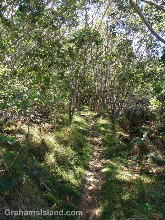
When the trail passes though a kipuka it offers shade and abundant bird calls.
An older lava flow has been softened by vegetation.
It took me a while to discover the various trails off Saddle Road. That’s because, from the road, they look like they’re mostly lava with some scrubby vegetation, but this is misleading. The kipukas (areas of land where lava has flowed around leaving it relatively untouched) are full of plants and a haven for wildlife including many endemic species. The whole area is an example of the cycle of destruction and regeneration that shapes this island and, indeed, the Earth.
The Pu’u O’o Trail, off of Saddle Road, has nothing to do with Kilauea’s Pu’u O’o vent. It refers to the Pu’u O’o Ranch on Mauna Loa. The trail was used for moving cattle from one grazing area to another.
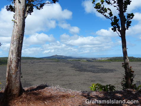
The trail alternates between crossing lava flows and passing through kipukas. Depending on the age of the flow, it might have a good deal of greenery on it, but more recent flows are stark lava fields. While the open lava flows offer great views of Mauna Loa and Mauna Kea (assuming it’s a clear day), the kipukas offer shade and are alive with bird calls, most of which I don’t recognize.
After about 4 miles the trail intersects with the Powerline trail and a loop can be made back to the start, or simply retrace your steps. Bear in mind that if the clouds roll in, which they do on a regular basis, the trail is a good deal harder to follow.
For more information about this, and other hikes on the Big Island, go to bigislandhikes.com.