This week’s posts are in response to the WordPress photo challenge on the theme of ‘transient.’
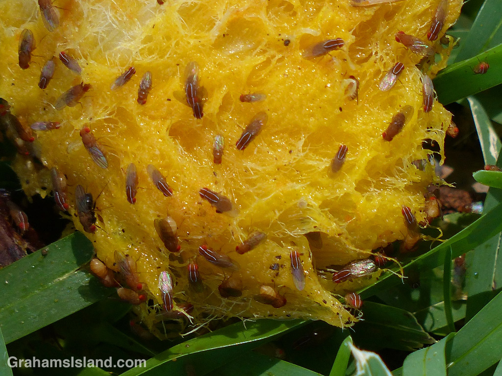
This little scene could be considered transient on three counts. First is the fact that this is a mango that has fallen from the tree. In the life cycle of a mango, it’s a very short interval between ripening on the tree and rotting on the ground. Second, this mango has clearly been chewed over by one of the transient wild pigs that pass through from time to time, more so during mango season. And third, these fruit flies won’t be around long either, having a lifespan in the region of 30 days.
This fruit fly, also called the vinegar fly, is probably Zaprionus ghesquierei, an invasive species known to have reached Hawaii. Zaprionus indianus also looks like this, but hasn’t been seen in Hawaii yet, as far as I know.
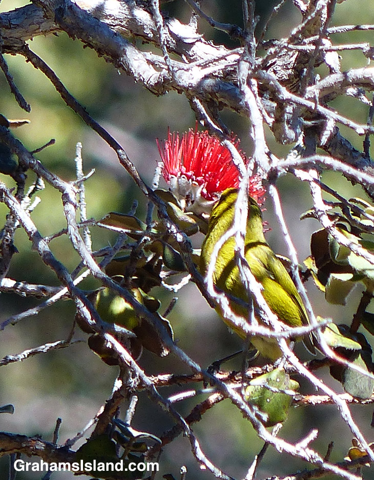
‘Amakihi are endemic honeycreepers and the different islands have slightly different versions of the bird. The Hawai‘i ‘amakihi is very similar to the Maui ‘amakihi, but the O‘ahu and Kaua‘i birds have more noticeable differences. They’re one native bird that has adapted relatively well to changing habitat and introduced diseases including avian malaria.
This one was feeding from bright yellow māmane flowers at the Palila Forest Discovery Trail on the southwest slope of Mauna Kea.
I met Yogi on the trail just before entering the forest. Here, he makes his way through the dense growth.
Huge Hapu’u ferns line the forested section of the Nāpau Trail.
The old Pulu factory.
Yesterday, I posted about the first part of the Nāpau Trail in Hawaii Volcanoes National Park, which crosses extensive lava fields. Today’s post picks up from there, on the rim of Makaopuhi Crater, where the trail slips into dense forest on its way to the Nāpau Crater overlook.
Puʻu ʻŌʻō from the Nāpau Crater overlook.
It’s a remarkable contrast between the stark lava and thriving forest. Birdsong is continuous. Ferns of every kind grow in abundance. Bamboo orchids pop out here and there. And above it all, tall Ohia trees provide the backbone of the forest. This forested trail is clear, but somewhat overgrown. I was hiking in shorts and, at the end of the day, my legs were generously scratched.
Early on in this section, it’s possible to get views of Makaopuhi Crater. Also in this area is the junction with the Nāulu Trail, which starts out at the Kealakomo Overlook, farther down Chain of Craters Road.
The forested part of the trail is about 2.5 miles and towards the end of it is an old Pulu factory. The sign there reads: “Between 1851 and 1884 great quantities of pulu, the soft, reddish-brown fiber covering the coiled fronds of the tree fern (hāpuʻu), were harvested on Hawaii. Much of it was processed within these walls, later to be shipped from Keauhou Landing to foreign markets for use as stuffing in pillows and mattresses.” Unfortunately, in drier climates, pulu quickly breaks down so the industry collapsed.
A little farther along is another junction. To the left is the very basic Nāpau campsite, a few open flat areas and an outhouse. To the right, the trail continues to the overlook, where I was lucky enough to have a wonderful, clear view of Puʻu ʻŌʻō, busily pumping out sulphur dioxide and other gases, and of course, million upon millions of gallons of lava, currently entering the ocean on the southeast coast.
Picking the right day for the hike is not always obvious and weather changes quickly around here. At the visitor center, on the way in, it was completely overcast and drizzling, but by the time I got to the trailhead the sun was out and a nice breeze blew. The wind direction is also important. On this day, the northeast trades were blowing and the vog trailed away to the southwest, which is fine for this hike. But if the wind blows more easterly or south of east, then this trail would be downwind of emissions from the volcano, which could potentially be a dangerous situation.
An early part of the trail follows a surface flow down the side of a hill with a small ohia tree toughing it out in the lava.
In a couple of places the trail goes through sunken areas that channeled the lava.
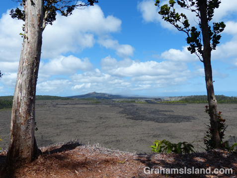
The Nāpau Trail in Hawaii Volcanoes National Park, is a 13-mile round trip. It passes over extensive lava fields, plunges into dense forest, and ends at the Nāpau Crater overlook. The overlook offers a terrific view (weather permitting) of Puʻu ʻŌʻō, one of two active vents on Kilauea Volcano. In today’s post I’m going to cover the lava fields portion of the hike with the second part coming tomorrow.
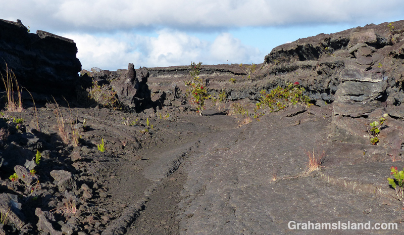
From the Mauna Ulu parking area, the first mile or so is a well-trodden trail to Pu’u Huluhulu (hairy hill) cinder cone. The foot of Pu’u Huluhulu is where the Nāpau Trail branches off across the lava. It’s a stark landscape, but with lots of interest. The trail passes over surface flows and through channels where lava rivers ran.
The Park’s website notes that the Nāpau Trail “follows the path that magma takes as it makes its way underground from its source at the summit to the point where it comes to the surface near Puʻu ʻŌʻō.” The many steam vents around Mauna Ulu are testament to this.
And in this hostile landscape, nature is at work. The lava fields are dotted with tenacious plants establishing a toehold. Ohia trees and ferns are most frequently seen, but grasses and other plants lend color to this sea of gray and black.
It’s 2.2 miles of unbroken lava from the Pu’u Huluhulu junction to the rim of Makaopuhi Crater, but at that point the trail changes in an almost surreal way. I’ll post that section tomorrow.
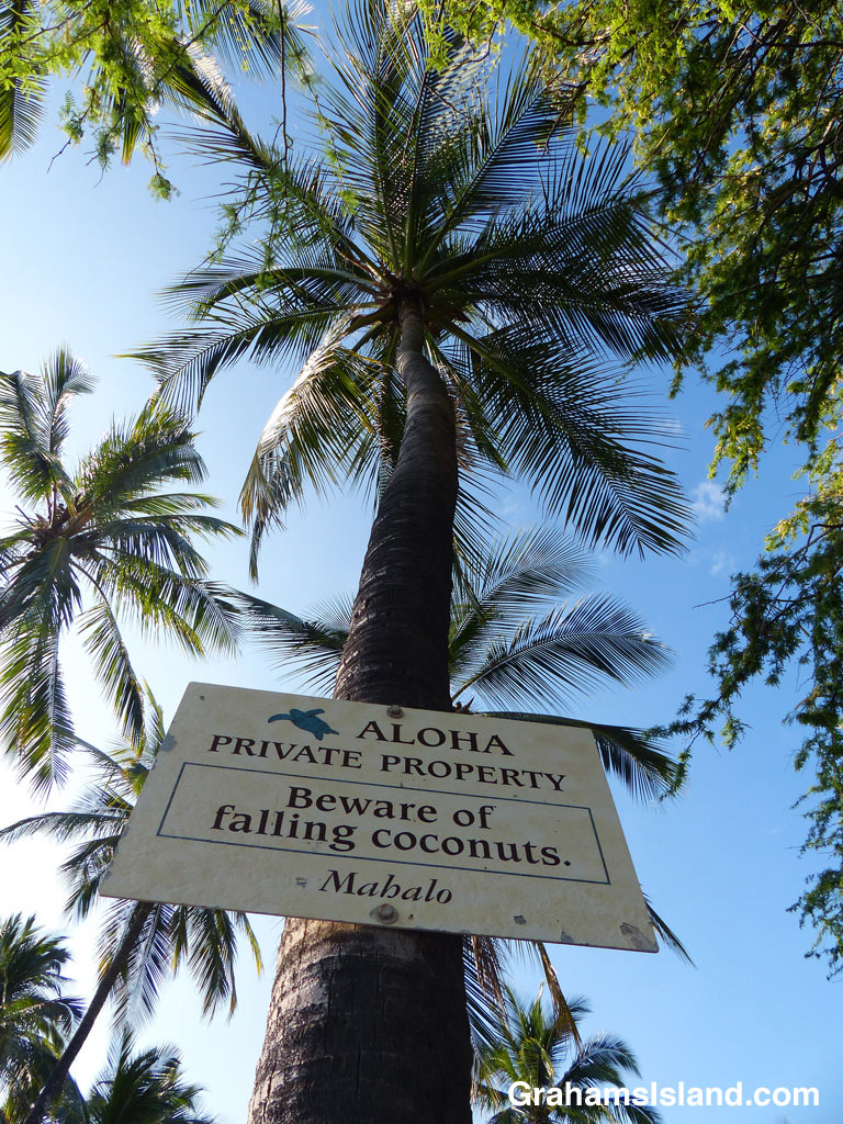
This view is the best for determining if any coconuts are falling. A roundish object getting rapidly larger is a good sign that they are indeed earthbound. Getting such a photo is not without danger, but that’s all part of life in the tropics.
May 1 has been celebrated as Lei Day in Hawaii since 1929 and is a celebration of Hawaiian culture. Each island has a different lei. The Island of Hawaii (the Big Island) features the Ohia blossom.
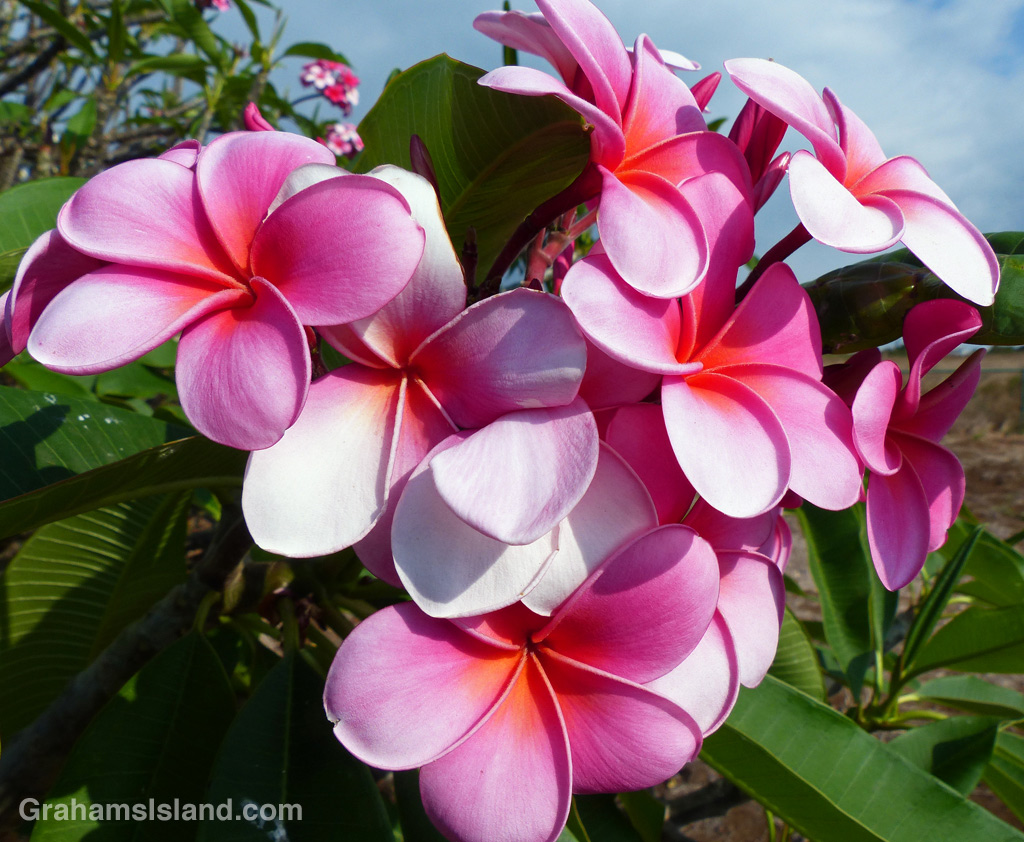
Plumeria flowers such as these, still attached to the tree, are often used in leis because of their fragrance and rich colors.