The golden pools at Keawaiki, on the North Kona Coast, get their color from a unique algae that lives in the pools. The pools are actually a little way inland from Pueo Bay, just north of Keawaiki Bay. If you visit, please refrain from taking a dip in the pools so that you don’t disturb or destroy the delicate ecosystem there.
This pair of nene was hanging around at Upolu airport as if waiting for the pilot of this plane to show up. Probably not a bad idea since it was pretty windy that day.
This week’s Sunday Stills challenge theme is ‘Texture.’ See more responses here.
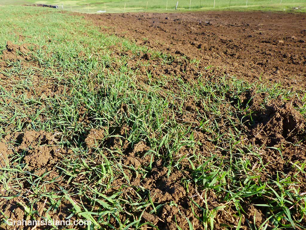
We had a lot of rain here last week, not tropical downpours, but steady, continuous rain. Along the coast, this turned parts of the dirt road into mud baths. Areas to be avoided, right? Not if you’re a mudder, someone for whom heavy rain is an excuse, a calling even, to drive their 4×4 trucks to the area and carve figure eights into the morass.
The top photo shows an area where this activity is particularly popular. The original grassless patch was about half the size of that in the photo. For walkers, it’s not quite so inviting. It’s easy to lose footing in the slick, squishy mud. And if the rain continues, this mud will wash down into the ocean affecting coastal habitat for fish and other marine life.
Fast forward past a couple of days of sunnier weather and the ground is very different. Most of the mud has dried. Those spatters sprayed around the edges of the mud bath are now nubbly, crunchy lumps in the grass. Anyone driving or walking in this area will crush those lumps into dust and when the wind blows, as it does here most of the time, that dust will blow into the ocean, etc., etc..
But it might rain again before it all blows away, except … well, you get the picture.
This week’s Friendly Friday challenge theme is ‘Unique.’ See more responses here.
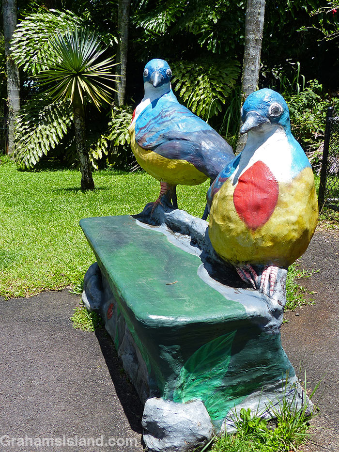
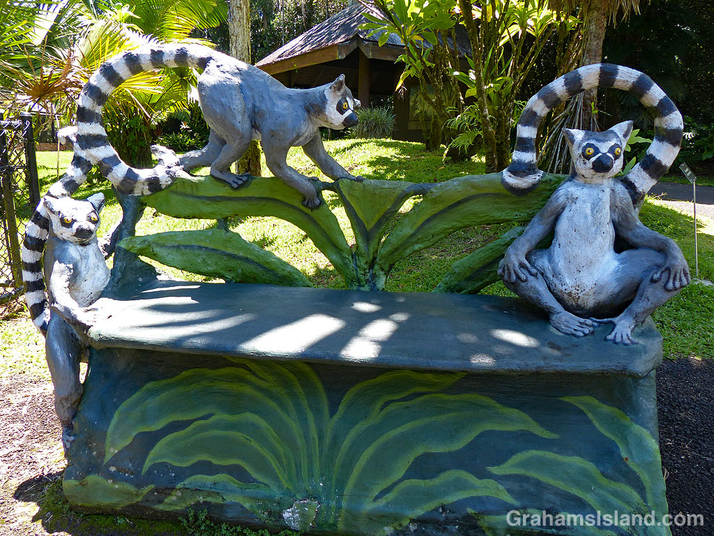
I’ve posted photos of the benches at Pana’ewa Rainforest Zoo before (here and here), but realized I had some others available, so here they are. I don’t know whether they’re unique or not, but I’ve never seen anything like them elsewhere.
Top photo is the Namaste bench, Namaste being a white Bengal tiger, the zoo’s star attraction, who died in 2014. The middle photo shows a couple of birds, though I hesitate to say what kind! The bottom photo represents the zoo’s ring-tailed lemurs.
The zoo is currently closed, in part because of the Covid virus, but also for construction required to make the zoo compliant with the Americans with Disabilities Act. It’s scheduled to reopen in early 2021. For more information about Pana‘ewa Rainforest Zoo & Gardens, go to hilozoo.org.
This shell necklace was draped over the sign at King Kamehameha’s birthplace on the North Kohala coast. It was probably left there as an offering, a not unusual occurrence at such sites.
I was driving home along the mountain road when I saw this line of red dust blowing around down on the coast. When it’s dry, this part of the coast is prone to these dust storms, usually driven by gusty winds. Ironically, since I took this photo, we’ve been inundated with rain, some of which might have reached even this arid part of the island.
This week’s Sunday Stills challenge theme is ‘Thankful.’ See more responses here.
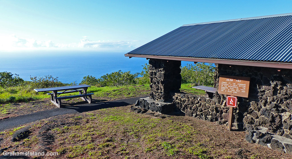
This theme seemed an appropriate time to feature my most recent hike in Hawaii Volcanoes National Park. I’d been wanting to try some backcountry trails for some time, but the road to Hilina Pali Overlook had been closed since the 2018 eruption. A month or so ago it reopened so off I went.
I hadn’t hiked the backcountry there before so, to get a feel for the area, I decided to do the hike marked on the map. (For an overview map of the park click here. Ka’aha Campground is the westernmost campground on the coast.) From the overlook I’d go down the pali (Hawaiian for cliff) to the coast at Ka’aha, then take a connecting trail to the east to link up with the Hilina Pali trail again, and back up to the overlook. At somewhere around 8.5 or 9 miles it sounded simple enough.
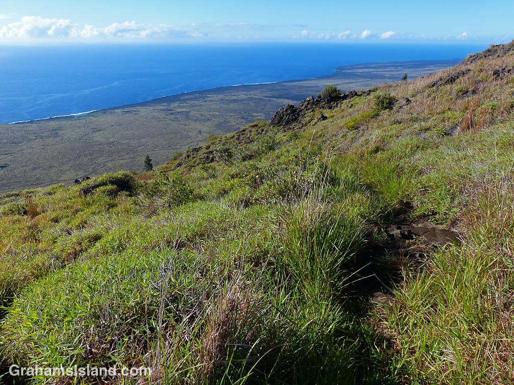
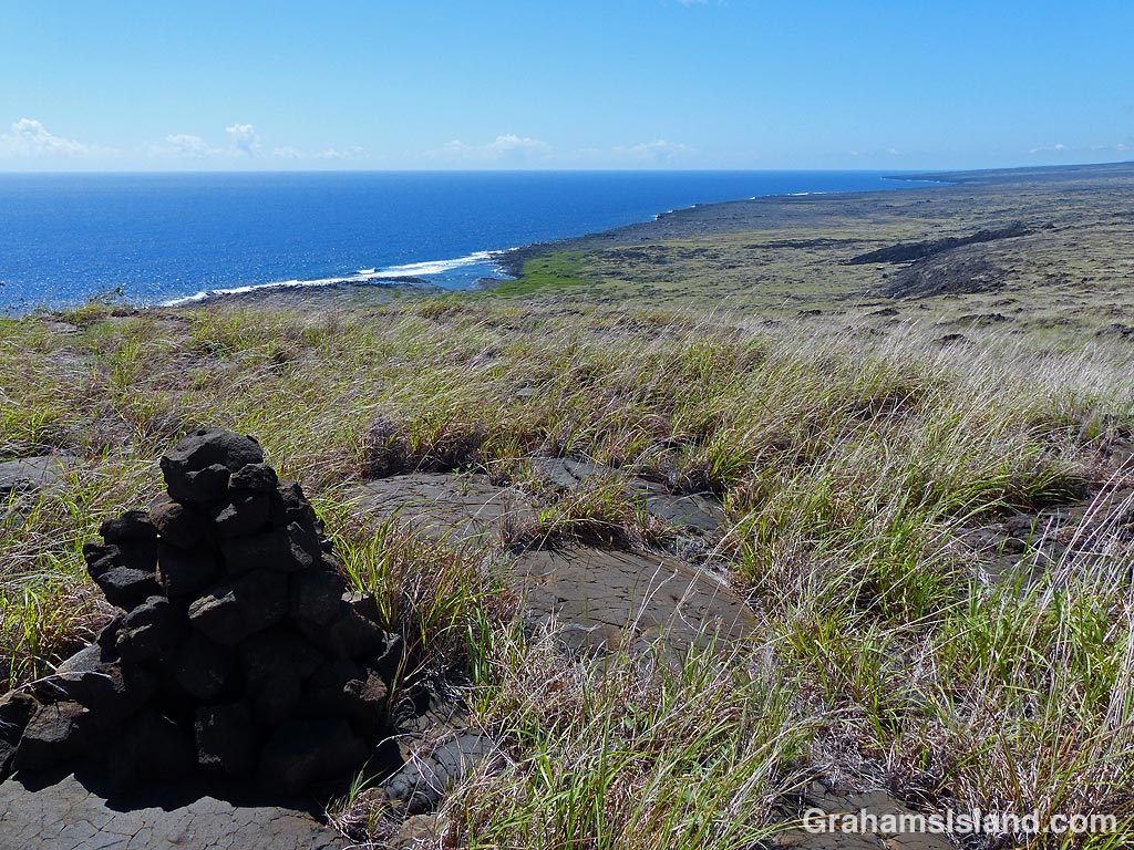
View to the west from Hilina Pali.
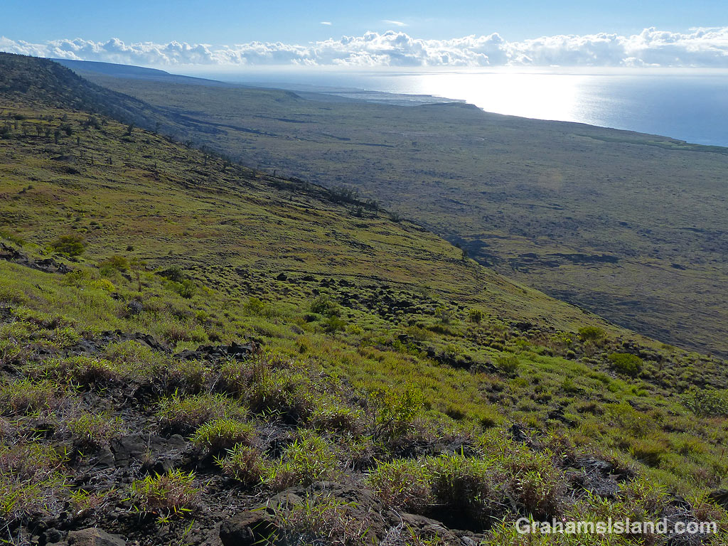
View to the east from Hilina Pali.
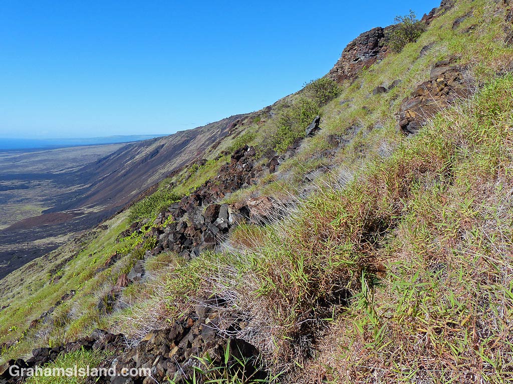
The trail down Hilina Pali is barely visible in places.
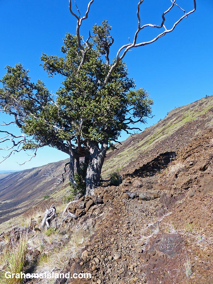
First shade tree on Hilina Pali.
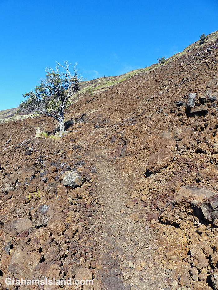
Second shade tree on Hilina Pali.
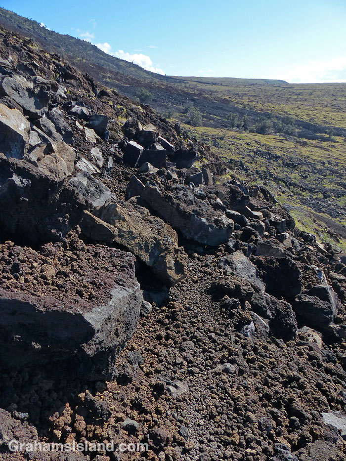
Rock slide on the Hilina Pali Trail.
The first section of trail switchbacked down the very steep, 1,500-foot high pali. It looked like it doesn’t get a lot of use and recent rains had caused the grass to flourish. Following the trail became an exercise in spotting cairns to see which way the trail headed, and then carefully making my way in that direction. Underfoot, it was rocky and uneven; an easy place to turn an ankle. On the plus side, the views were wonderful, up and down the coast.
After a while, the grass thinned out and the trail became clearer, though still steep and rocky. A couple of brave trees clung to the side of the hill and I thought, ‘those will give me a bit of nice shade on the way back up.’
As I got toward the lower part of the pali, the trail angled into an area of tumbled rocks, big and small. A landslide, this one from Kilauea’s 2018 eruption. Traversing this section involved clambering over whatever rocks were in my path. I kept hoping I wouldn’t step on a loose rock, causing it to slip and trigger another slide. It was a bit depressing to get through the area only to see the trail zag back into the danger zone. However, soon enough I was through the rocks, down at the foot of the pali, and on to the first trail junction.
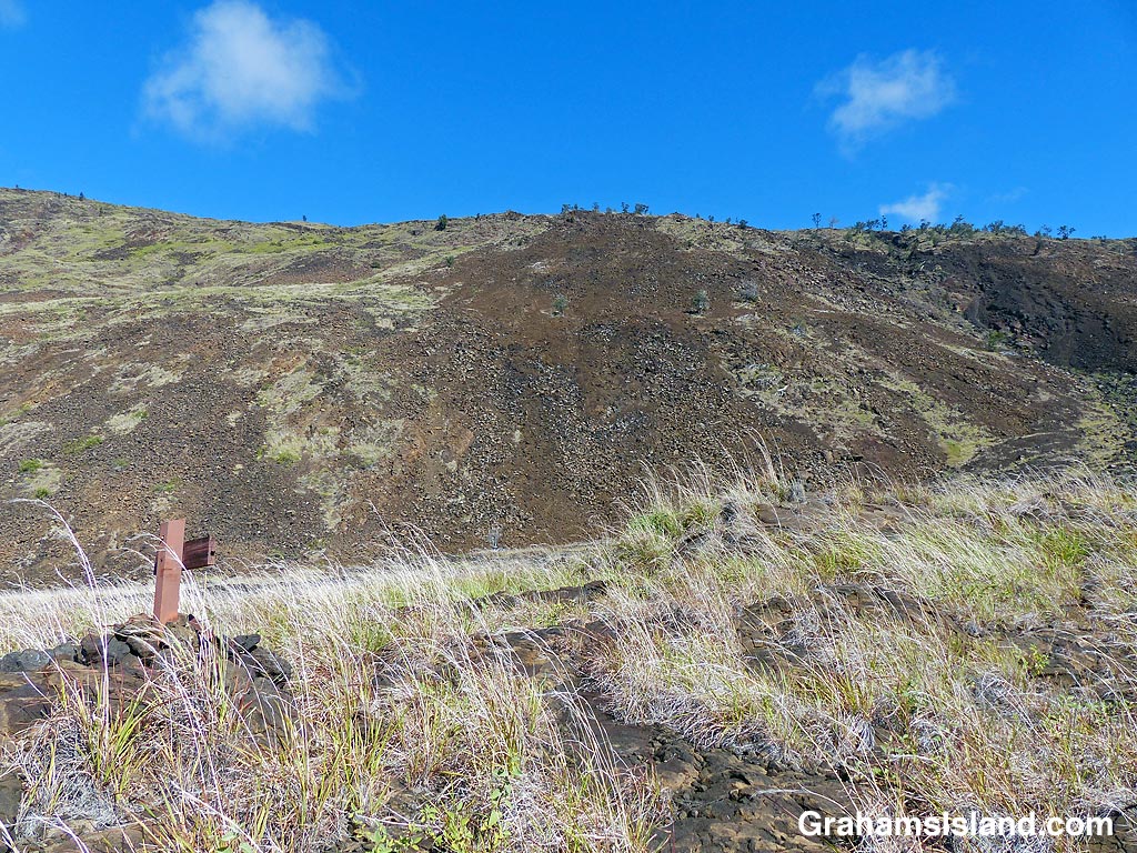
Hilina Pali from the junction of the Ka’aha and HIlina Pali Trails.
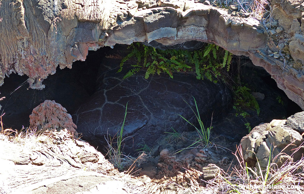
A collapsed lava tube with spider web on the left.
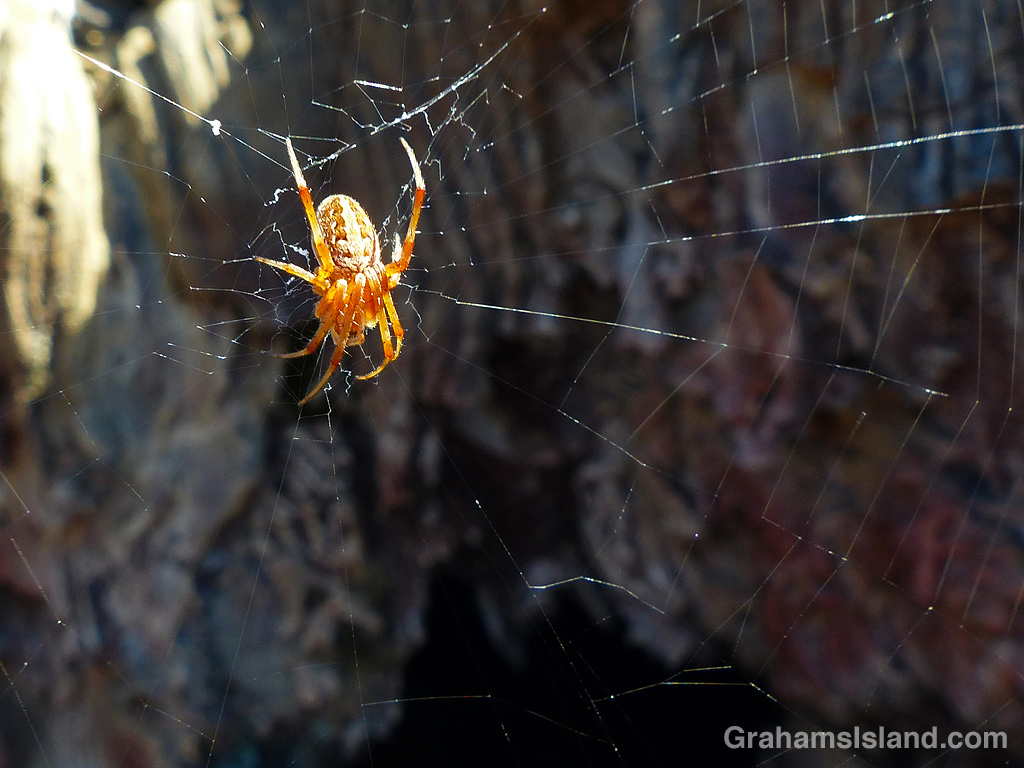
A spider at the entrance to a lava tube.
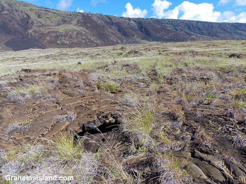
Collapsed lava tube next to Ka’aha Tail.
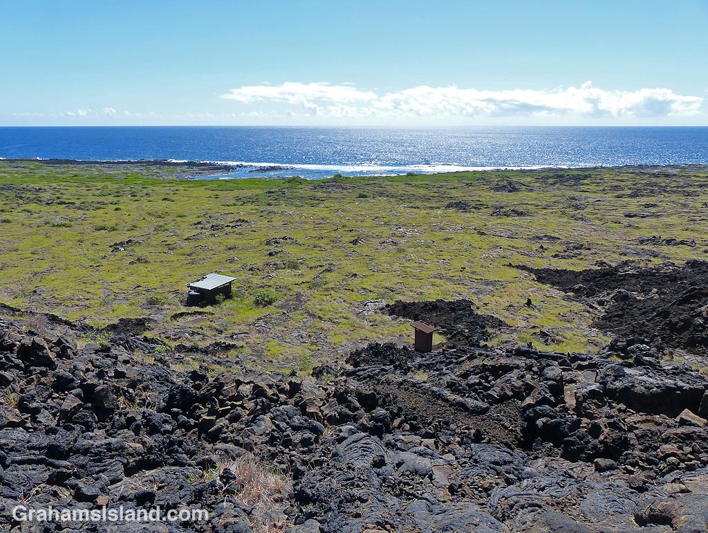
Ka’aha campground and the coast.
The coast at Ka’aha.
Thus far, I’d been following the Hilina Pali Trail, but now that trail bore away to the southeast. I took the right fork, going south to the coast on the Ka’aha Trail. The area between the pali and the coast is all lava and scrubby grass and the trail was again hit and miss, but well marked by cairns. The most interesting feature was how close the trail passed by several caves, which are lava tubes where the roof of the tube has collapsed. These collapses are an illustration of why it’s a good idea to stay on trails. Lava fields are riddled with tubes and the roofs can be quite thin and fragile. One wrong step and you could be lying in a dark hole with a broken ankle or worse!
The caves tend to be shady, cool, and relatively damp. Ferns and other plants grow there, sometimes including trees. Birds and insects also frequent them for the moisture, so it was no surprise to see an abundance of spiders waiting in webs across the entrances.
I reached the second trail junction and headed down the slope to Ka’aha Campground and the coast. The campground, which consists of a covered shelter and a composting toilet, sits inland from the coast. Down by the ocean there’s more vegetation including some trees so people often camp in their shade. I didn’t see any sandy beaches on this part of the coast, but there were areas of protected water for taking a dip. Since I had the long, uphill haul back still to go, I didn’t linger.
Back at the second trail junction, half a mile inland from the coast, I was roughly halfway through my hike. From here, I walked east on a little used trail that would link up again with the Hilina Pali Trail. This was the start up the uphill return and when things started to go downhill for me. This part of the island is often cloudy, wet and windy, but this day was a scorcher with the sun out and only the occasional hint of a breeze. Now, in the middle of the day, it had become very hot.
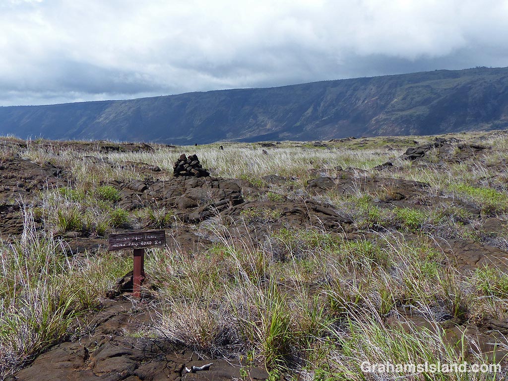
The trail was rough and the cairns not so evident, so it was slow going. I made the mistake of thinking this leg, to the third trail junction, was a shorter one, but it wasn’t. Consequently, this section took longer than expected and, the longer it went, the more I wondered if I’d missed the next trail junction. Trail junctions in the park are usually pretty well marked, but it was always possible that in this less-traveled area one might have been knocked down so that I missed it. I could see cairns ahead and hadn’t seen any off to my left, but my stopping and starting and looking for the next trail was getting wearing.
Eventually, I spotted little wooden signs ahead and reached the junction with the Hilina Pali Trail. By this time I was pretty hot. I had water, but I was frying in the sun. Still, the next section of trail was largely on the level and I hoped to make steady progress back to the foot of the pali. I was also encouraged to see clouds building up over the pali. Tackling the hill back up would be much easier in the shade.
Looking west toward Ka’aha.
View of Hilina Pali from the trail junction.
Alas, it was not to be. I slogged my way over the rough ground toward the pali and, as I did so, saw the clouds recede. By the time I got to the foot of the trail up the pali, I was fried. Had there been any shade in the area, I might have hunkered down and waited until either the clouds came back or the sun became less ferocious. But there was no shade so I decided I had to just take it steady up the trail until I reached the lower of the two shade trees. It was around this time I started singing “Put One Foot in Front of the Other” from the old Christmas special, Santa Claus is Comin’ to Town!
One positive was that I was now back on territory I’d been on earlier so I wasn’t worried about where the heck the trail was. Perhaps I should have been. I was trudging through the jumble of rocks marking the landslide area, putting one foot in front of the other, and when I looked up I realized I couldn’t see the trail ahead of me. Turning around I couldn’t see it behind me either. Obviously, I’d missed a switchback in the slide area, but I wasn’t sure how far back that might be. I really didn’t want to go down again, giving up precious elevation I’d gained, so I decided instead to angle across the slide until I found the trail again or reached the shade tree. The downside of this plan was that it meant scrambling over all these loose rocks in the worst possible spot for it – the slide area I’d hoped to traverse as quickly as possible.
It seemed like forever before I found the trail, just above the shade tree. I trudged down to it and slumped onto a rock, finally out of the sun. I had a drink, dumped some water on my head and rested for a while. I don’t know how long I stayed there, probably 10 minutes or so, but it was a huge relief. Finally, feeling somewhat refreshed, I got to my feet again and clumped on up the trail. I repeated this process at the second shade tree, before tackling the last stretch to the top. Luckily, the clouds did return and this last stretch was a bit cooler. Even a light, but steady onshore breeze filled in.
It was still a haul up the final slopes, and I was happy and relieved to see the shelter at the overlook. I sat at the picnic table and enjoyed a cold drink from the cooler in the car. This was the closest I’ve ever come to getting heatstroke while out hiking and I was very thankful to have made it back in one piece. When I changed out of my hiking shoes, I realized my feet were in bad shape with a couple of huge blisters and several blackened nails. With all that was going on, I hadn’t even noticed my feet were hurting.
I certainly got the feel for the area that I’d been looking for, but I doubt I’ll do that hike again. The views were great and the coast quite lovely, but in between – not so much. It was a grind. As we say in this household, a learning experience!
Also posted in response to this week’s Friendly Friday challenge theme of ‘Whilst Walking.’ See more responses here. Also Jo’s Monday Walk.
For more information about Hawaii Volcanoes National Park, go to nps.gov/havo/.
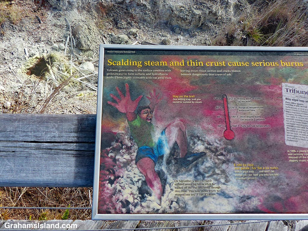
I was rather taken by the vivid graphic on this sign alongside the Sulphur Banks Trail in Hawaii Volcanoes National Park. But it illustrates an incident from 1996 when a 10-year-old boy wandered off the trail and his foot went through the crust into a steaming vent leaving him with serious burns. That small, dark hole in the upper left of the photo is one such vent and it was busily steaming away while I read the gory details.
For more information about Hawaii Volcanoes National Park, go to nps.gov/havo/.