This week’s Sunday Stills challenge theme is ‘Wild Animal or Bird of the Month.’ See more responses here.
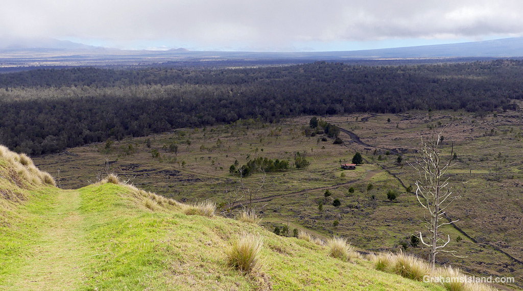
Pu’u O’o Trail is a few miles east of the saddle between Mauna Loa and Mauna Kea, on the south side of the main cross-island highway. It’s all above 5,000 feet and can be cold, wet, and windy, but I’ve had good luck picking warm, sunny days. These photos are from a couple of recent hikes I took up there. Captions on the photos.
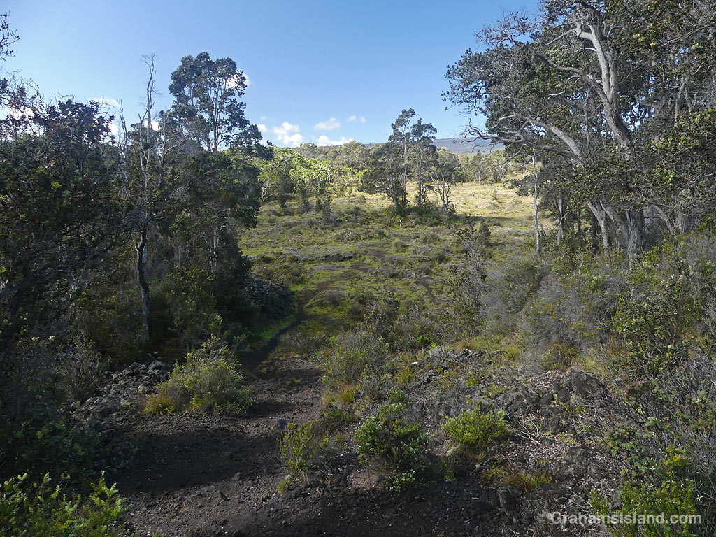
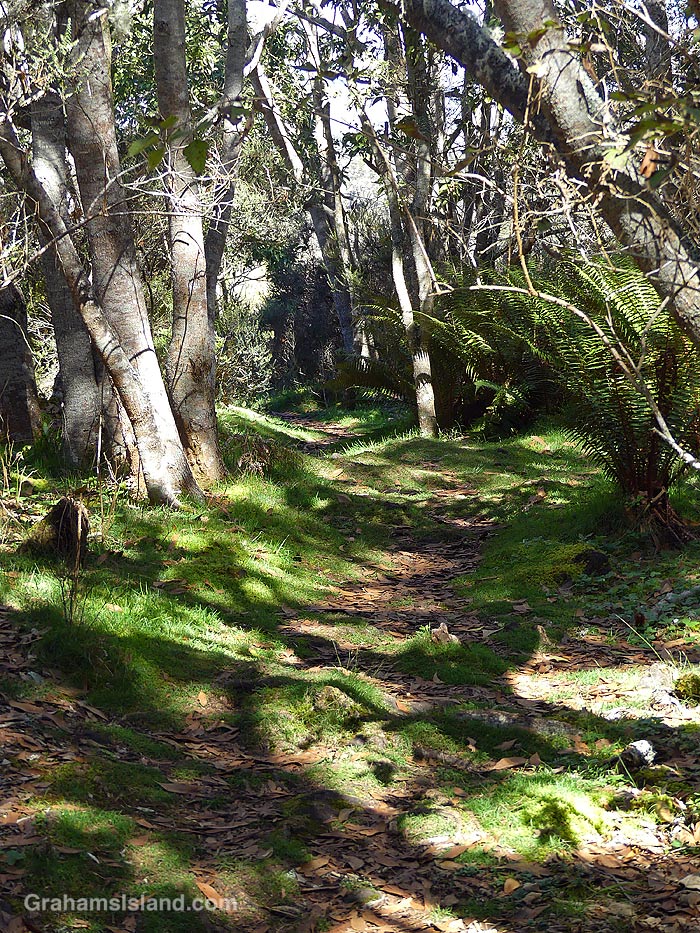
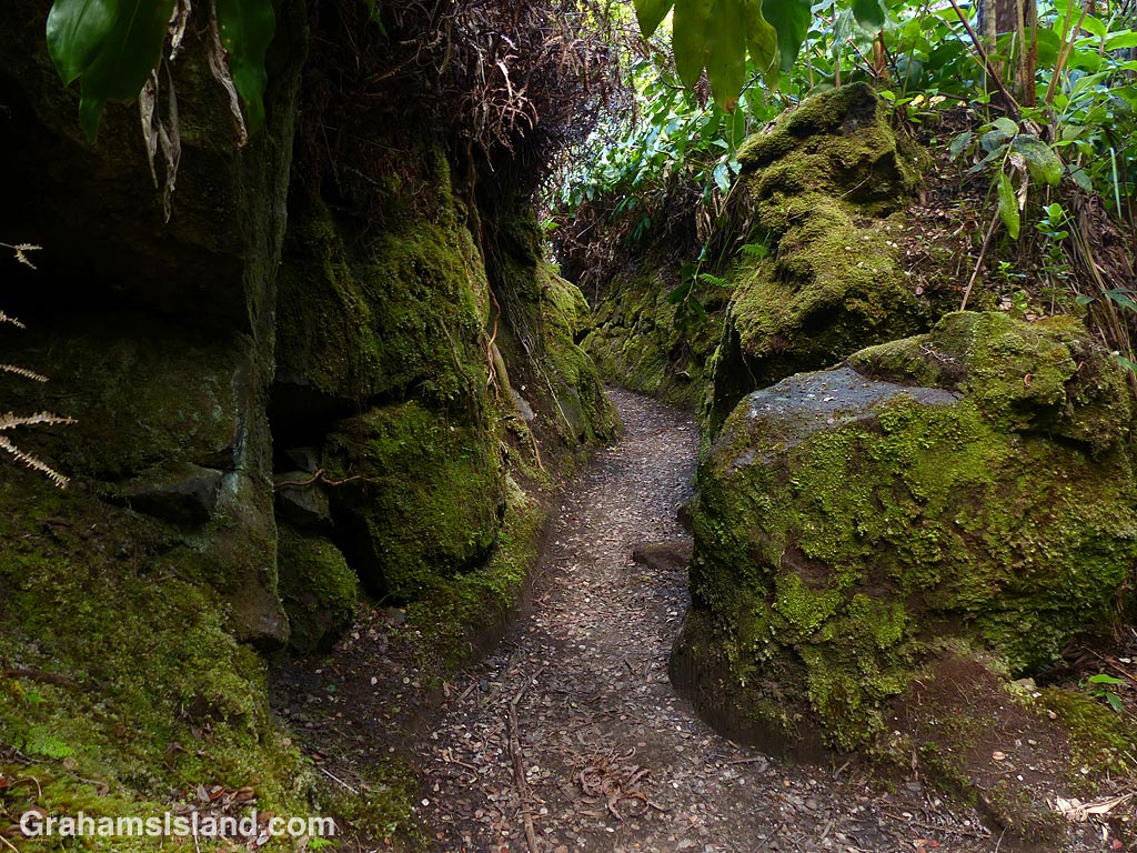
The trail enters a kīpuka.There are open, grassy areas.A view of Mauna Kea.
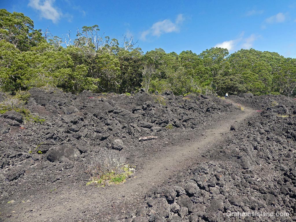
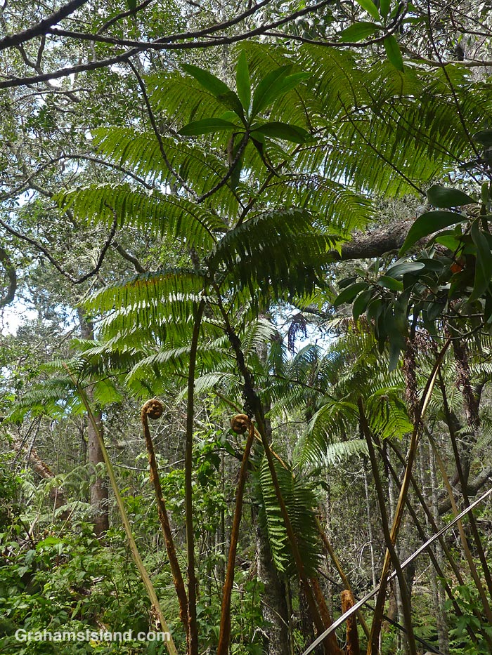
The trail crosses old lava flows from Mauna Loa, but there are kīpukas, areas of old-growth forest missed by the lava, which are home to several kinds of native birds.
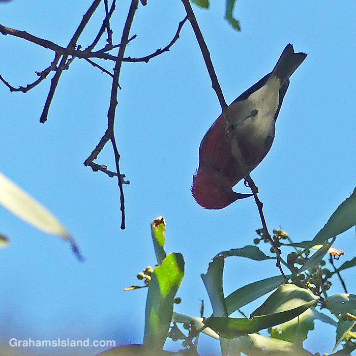
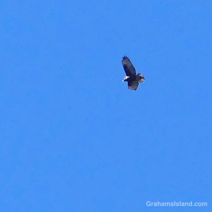
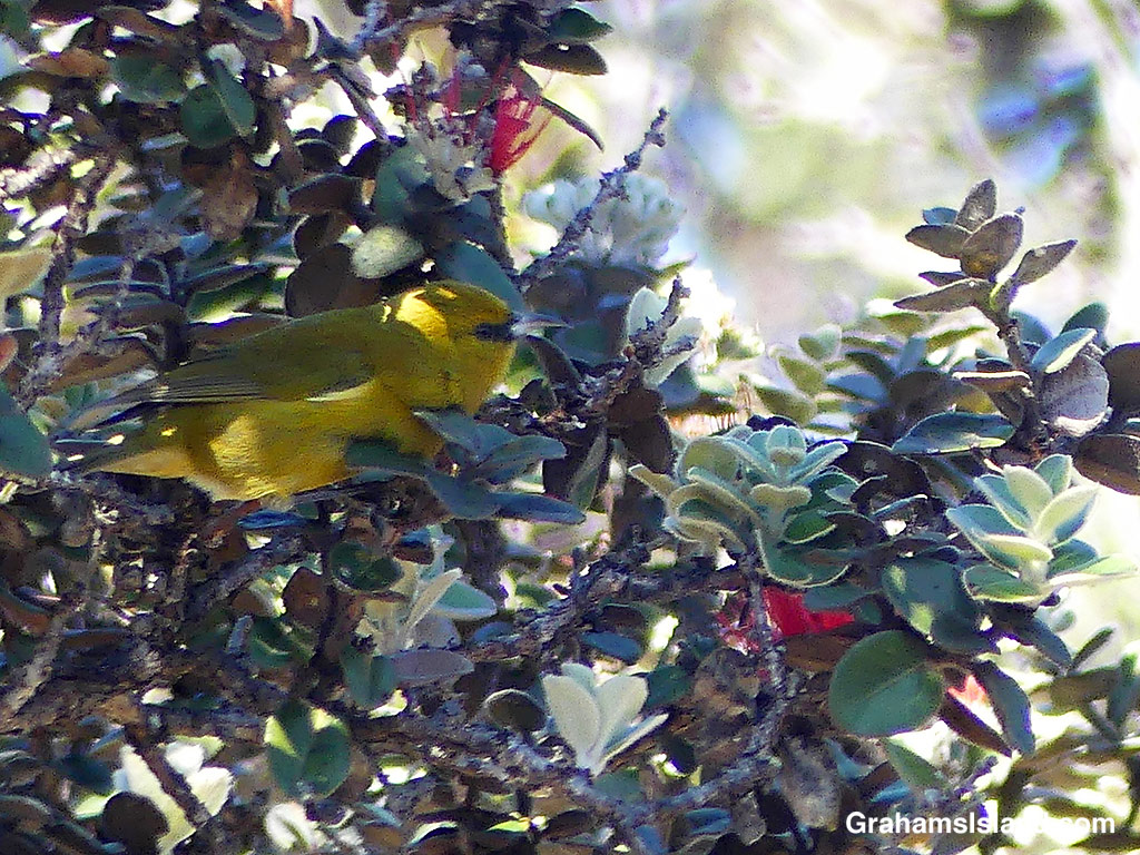
An ‘Apapane.An ‘Io, the native Hawaiian hawk, glides overhead.An Hawaii ‘Amakihi.
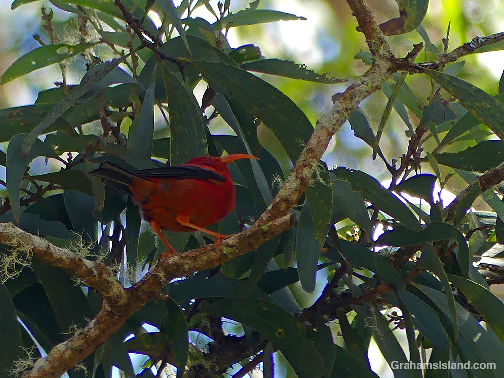
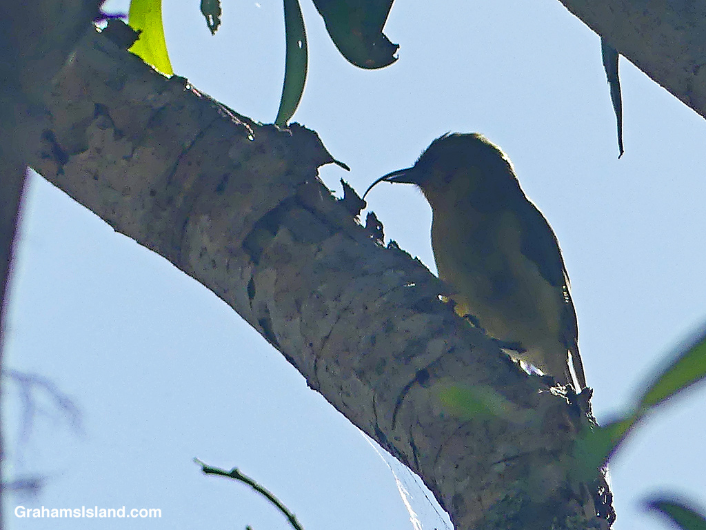
On my last visit, I was lucky enough to see an ‘Akiapola’au, an endangered native species, which is only found on this island these days. This one was high up in the trees with the sun behind it. While my photos weren’t great, I was still able to see this industrious bird foraging for a meal. The shorter lower mandible is used to drill into branches and then the curved upper mandible digs out the grubs hiding within.
An ‘Akiapola’au.
These native birds make this trail popular with birders, but it’s a good hike for anyone. A 9-mile loop is possible, but I usually do an out-and-back hike through the first two or three kipukas, which totals about five miles.
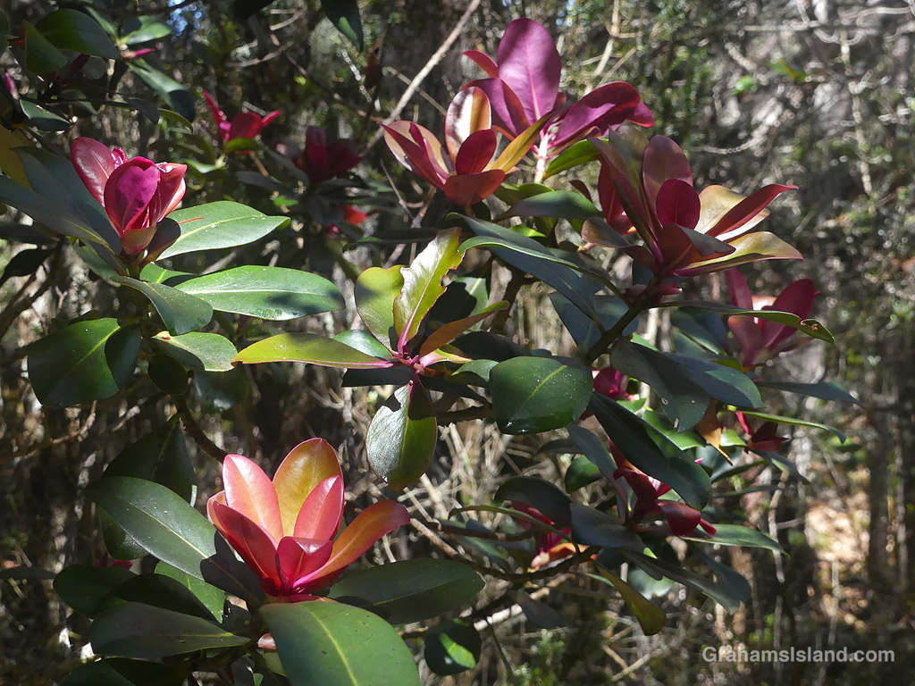
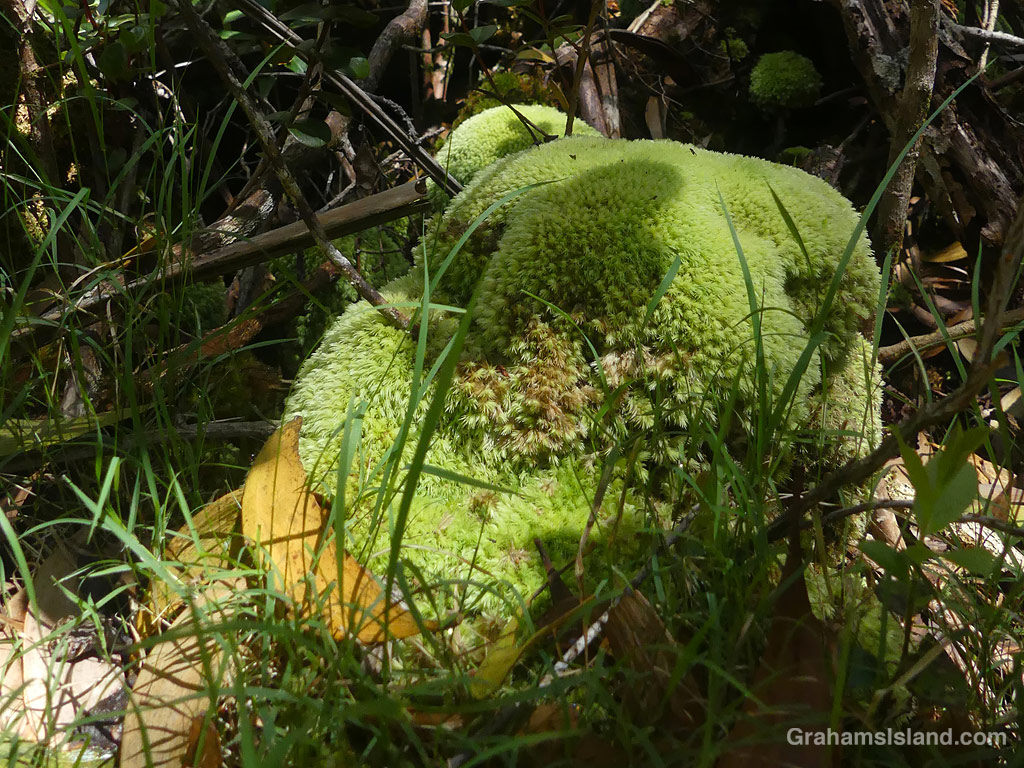
Hāpu’u tree ferns (Cibotium menziesii) grow alongside the trail.The trail winds through a kīpuka.Not flowers, but new leaves on Kōlea lau nui (Myrsine lessertiana).It’s cool and wet enough for moss to take over.
Also posted for Jo’s Monday Walk. See more responses here.
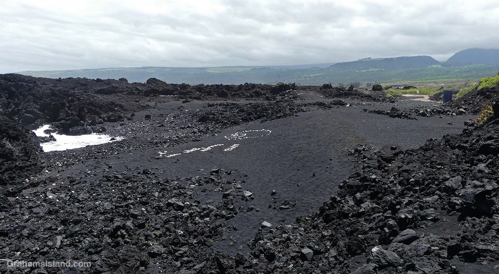
A lava breakout in a flow from Pu’u O’o covers the old coast road, which is now a trail (here).
This week’s Sunday Stills challenge theme is ‘Parks.’ See more responses here.
Hawai‘i Volcanoes National Park is the best known park on the island. It covers 354,461 acres, which includes, not just the Kilauea area, but up to the summit of Mauna Loa and down the southwest rift zone of that volcano. The park contains 106 miles of roads and 155 miles of marked trails, many of them well off the beaten track.
I’ve hiked a lot in the park, though I doubt I’ll ever cover all the trails, but these photos are from ones I’ve done with links to the original posts for those interested.
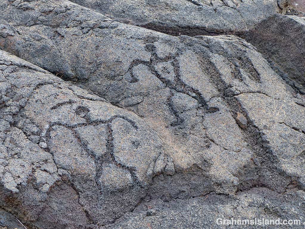
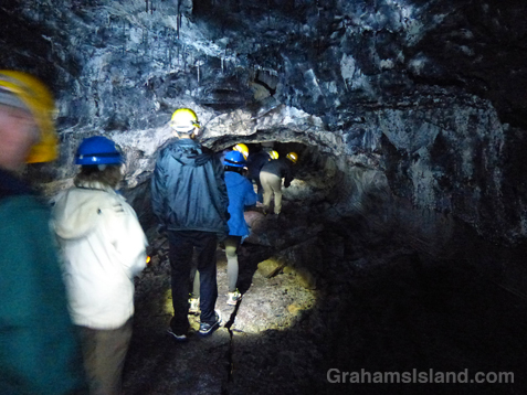
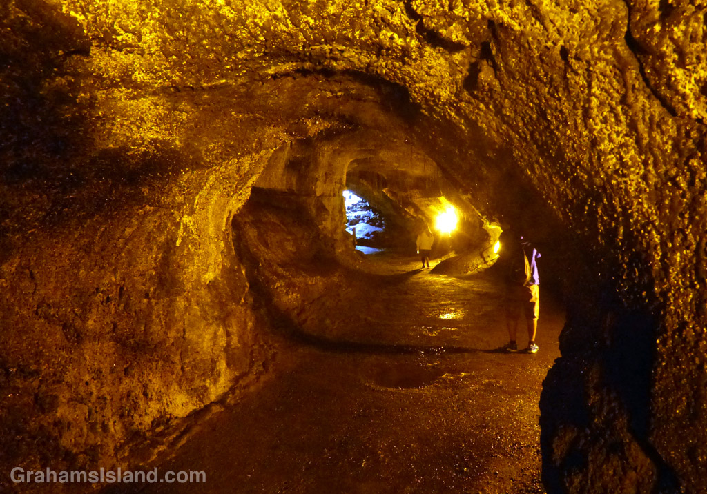
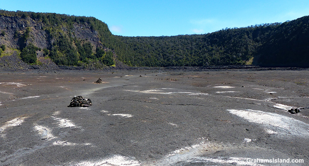
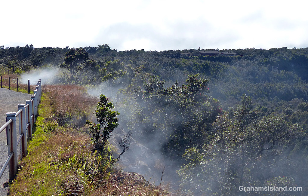
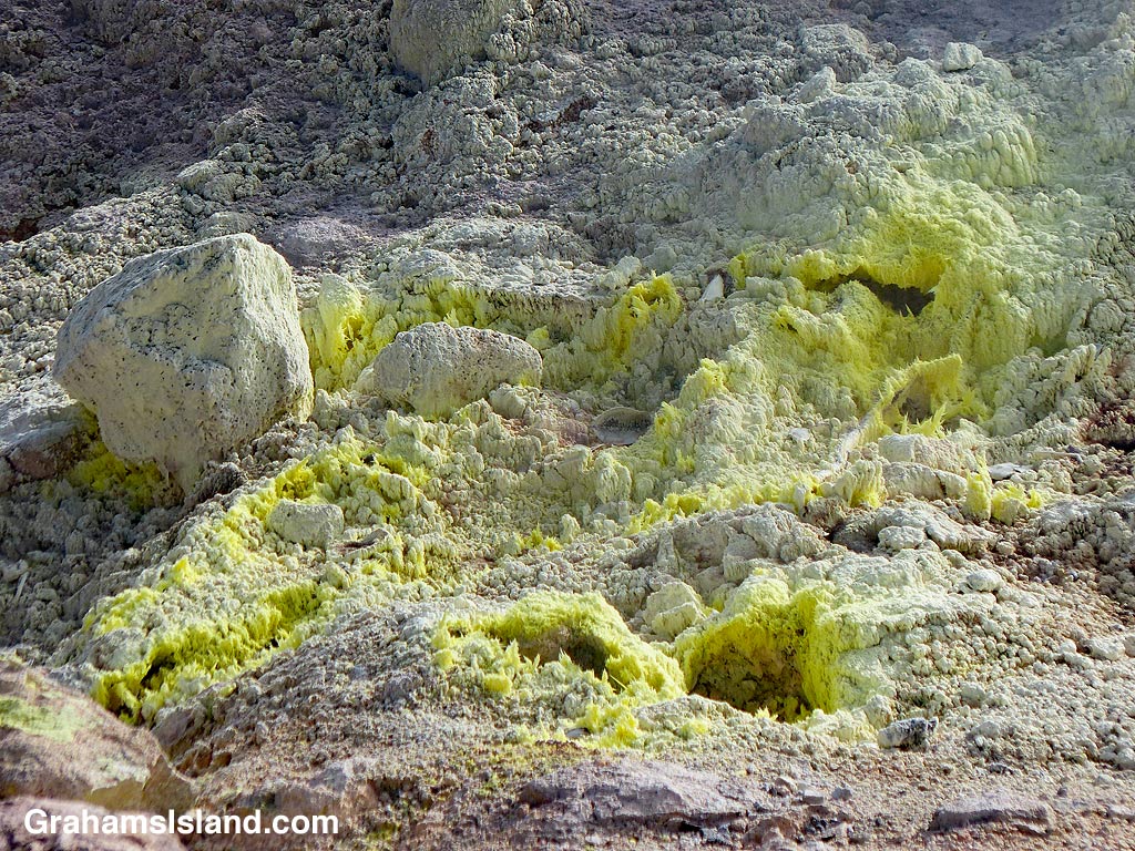
On the Pu‘u Loa Petroglyphs Trail (here).Great views on the Hilina Pali Trail, but this one nearly did me in! (here).Puʻu ʻŌʻō from the end of the Nāpau Trail (here and here).Puapo’o lava tube is only accessible on a guided tour (here).Nahuku lava tube is one of the most popular stops in the park (here).Kilauea Iki is another popular trail, across the floor of an old vent (here).Steaming Bluff on the Crater Rim Trail (here).The Jaggar Museum viewing point. The museum has gone but the viewing point just reopened (here).Sulphur Banks Trail (here).Halemauma Trail passes through the woods (here).The Puna Coast Trail features colorful lava (here)……As does the Ka’u Desert Trail (here).A lush valley in the Kahuku section of the park (here).
Also posted for Jo’s Monday Walk. See more responses here.
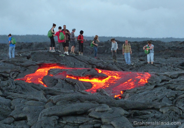
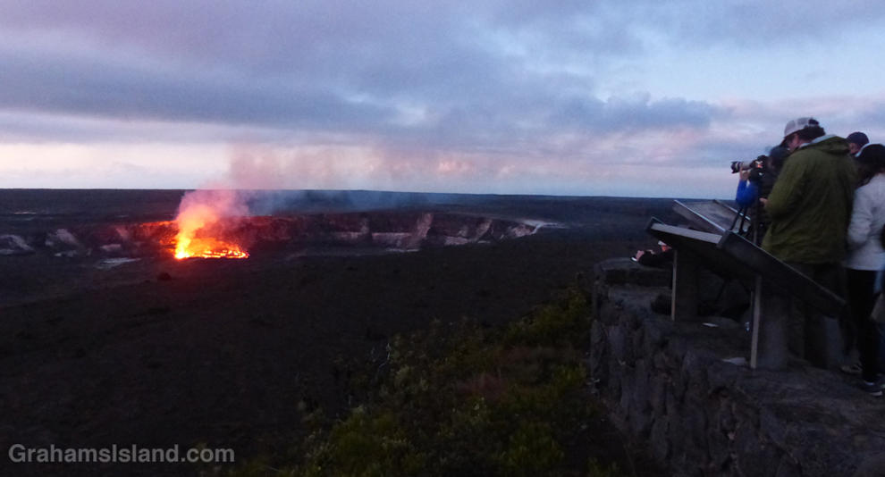
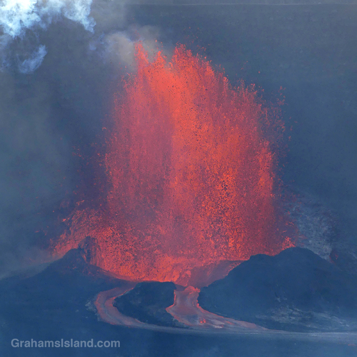
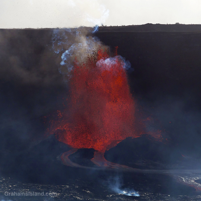
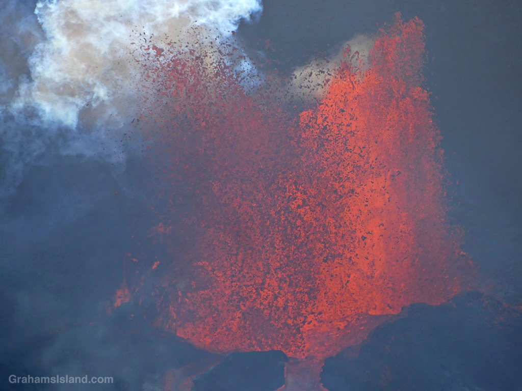
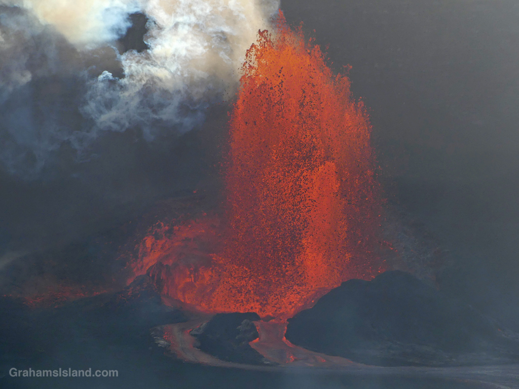
The current eruption at Kilauea has been marked by a succession of eruptive events followed by pauses. The more recent of these events have consisted of the volcano putting out some small flows, succeeded by fountaining events with the fountains reaching up to 1,000 feet. I’ve been itching to go down and see this, but the fountaining often hasn’t lasted long. My challenge has been to hear about the activity early and at a time when I can go down. This has not been going well!
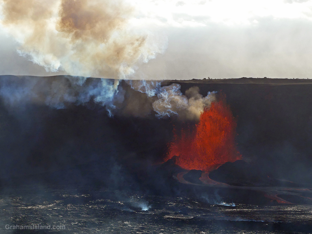
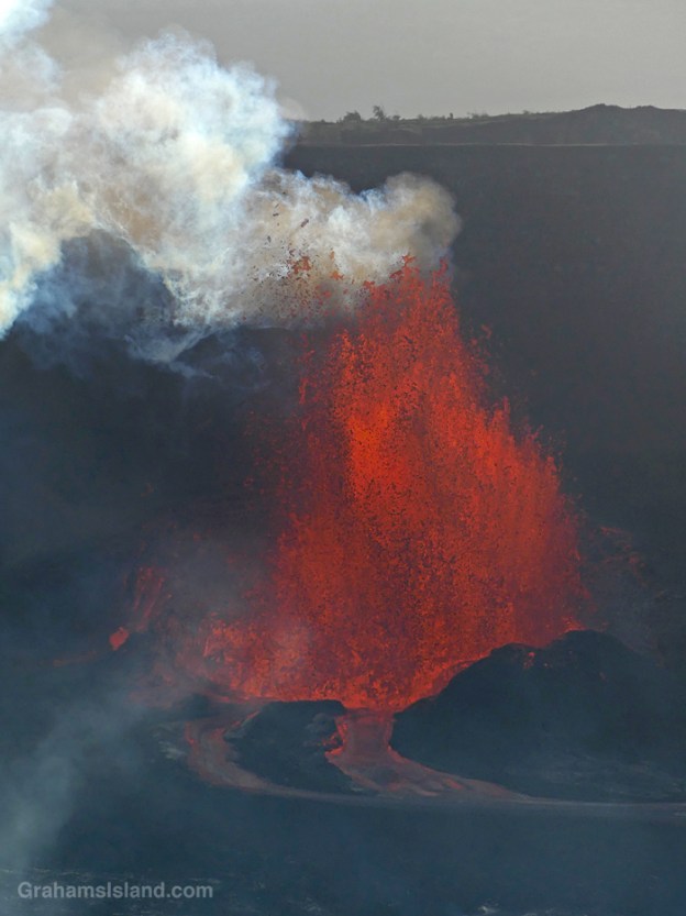
Last Sunday, after lunch, I sat down to check my emails and saw the daily USGS update for Kilauea. Apparently, it was stirring again, the 21st episode of the current eruption. I went to the video webcam and saw that it was doing more than stirring. It was launching fountains of lava into the air. Scrolling back on the webcam I discovered that the fountaining had started only 20 minutes earlier.
The 20th episode had been the shortest so far, at 4.5 hours of fountaining. My drive to Kilauea is more than 100 miles, but I figured that even if this was another short one, I’d have an hour or two to see the activity, so I jumped in the car and headed over. I left at 1:30 p.m. and got to the park around 3:45 p.m., finding it under a layer of cloud. The weather had gone downhill since I left and the park was a zoo, cars everywhere, edging around or parked in improbable spots.
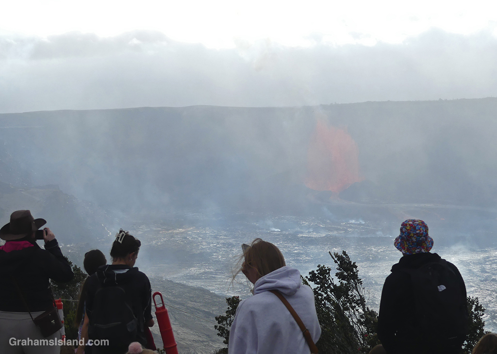
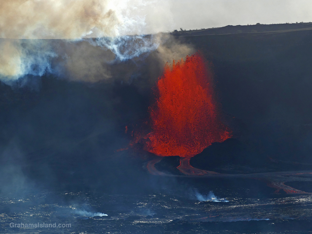
Miraculously, I found a parking spot on the north rim of the crater and walked out to see what I could see. The answer was, not much. The weather wasn’t helpful, but the problem, which I suspected might be the case, was that the active vent was close to the north rim and so the activity was largely obscured. The prime viewing area would be a spot on the south rim, but one that was farther away, and low clouds were scudding through the crater. Would anything be visible? There was only one way to find out.
I drove around the crater rim to the other side and found a similarly chaotic parking situation. The park isn’t designed to accommodate parking demands on the scale it was experiencing. Luckily, I found a spot, not that far from the trail I had to take. The trail is actually a road that’s been closed since the summit crater became active in 2008. It’s definitely not usable by vehicles, especially since 2018 when a section of it slid into the crater. The road is still visible on its little island, just a few hundred feet below the rest of it!
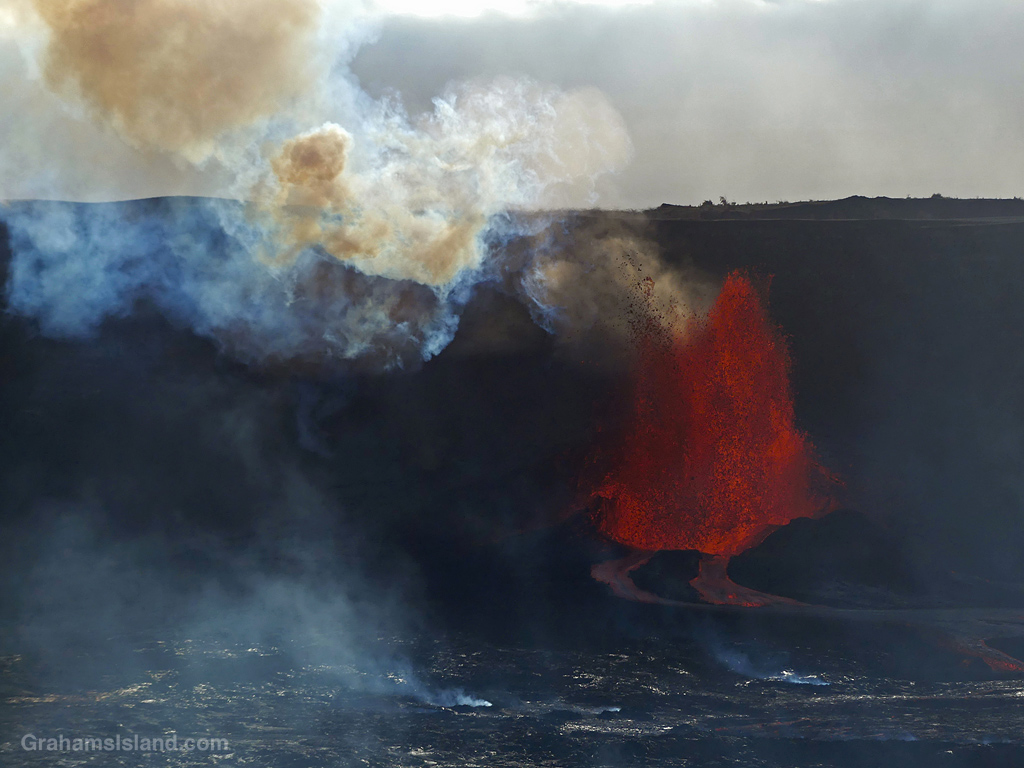
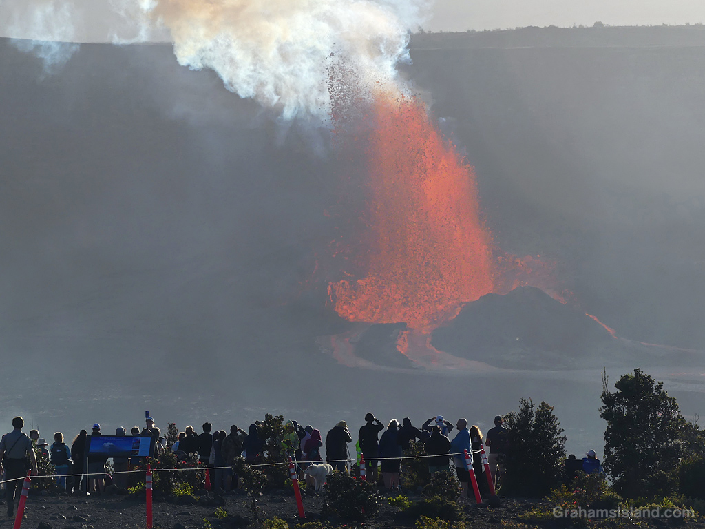
The walk in isn’t far, about a mile or so. There was a fair amount of foot traffic, both coming and going. When I got to the viewing area, even though there were quite a few people there, it didn’t feel too crowded. There was a decent view of the erupting vent, a little over a mile away, but it was sadly affected by mist blowing through the crater.
I found a spot, took photos, watched the weather. It looked like it was clearing, then looked like it was getting worse. I was keenly aware of the drive home and that I had to go to work the next day. At one point I decided I’d give it another 15 minutes and if it didn’t improve, I’d head for home. 10 minutes later the clouds had blown through, the sky brightened, and the active vent was clearly visible. The only downside was that the sun was slowly sinking behind the active vent, so the lighting wasn’t the greatest. But I wasn’t complaining.
The visual treat of seeing the activity was wonderful, but there’s also the noise of the eruption, like being next to a busy airport. The fountains of lava in the photos are probably around 400 feet high.
I left the viewing area a little after 6 p.m. and headed for home, getting there around 9 p.m., by which time the activity had already ceased at Kilauea. It ended around 8:30 p.m.. Currently, the eruption is again paused, though the USGS expects the next episode to begin within a few days.
Also posted for Jo’s Monday Walk. A short walk, but well worth doing! See more responses here.
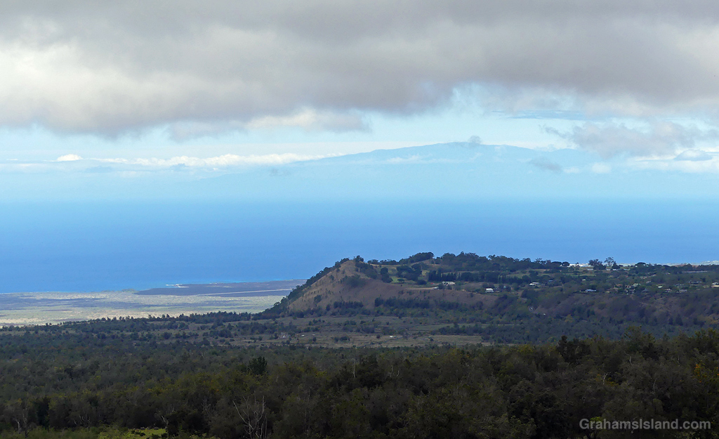
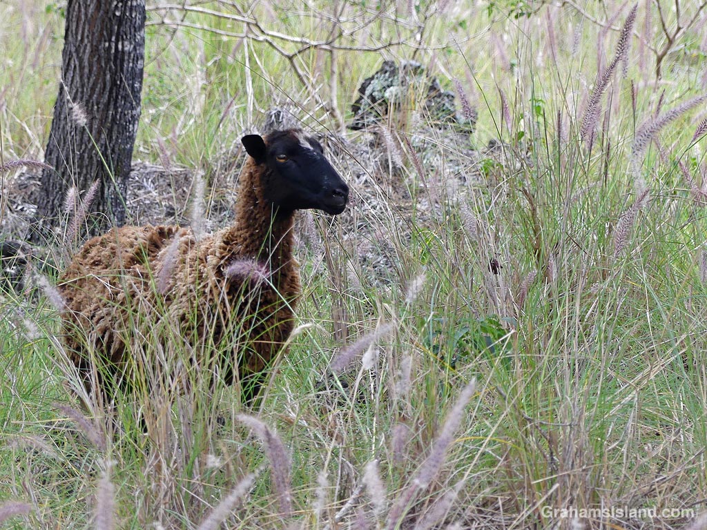
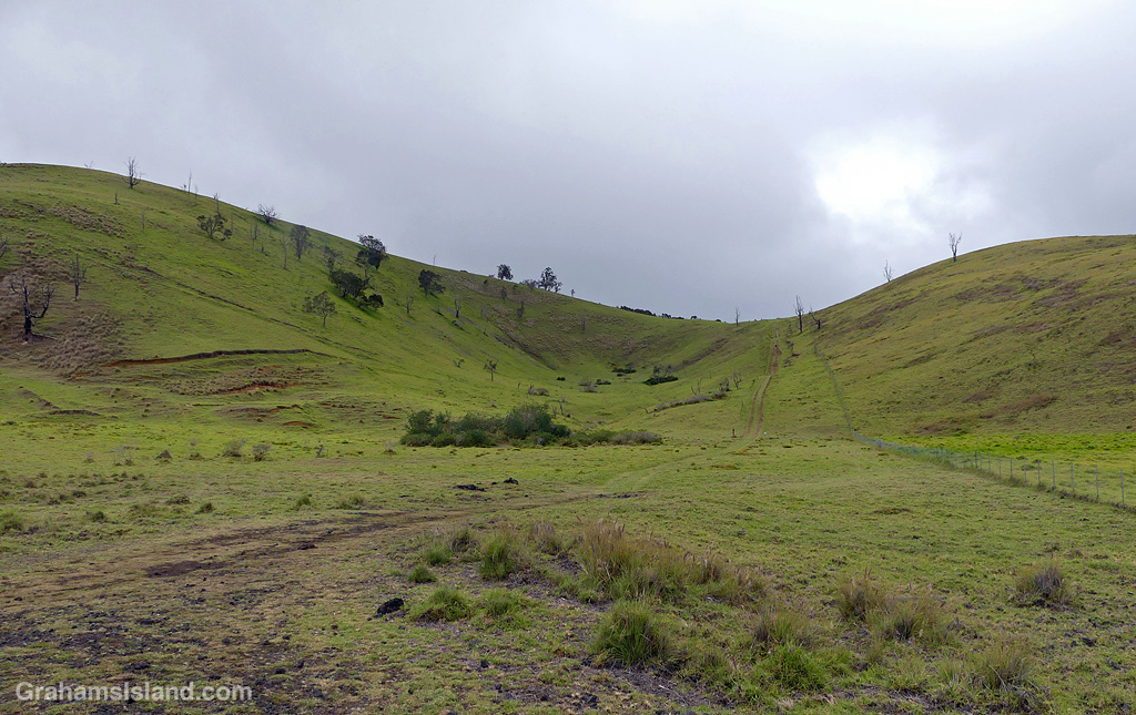
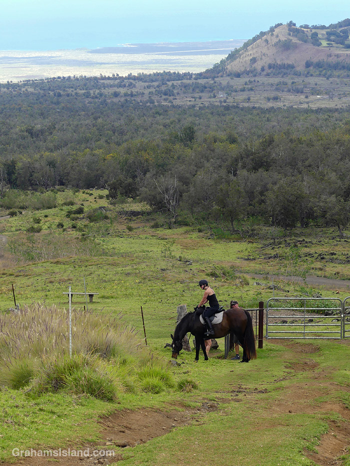
This week’s Sunday Stills challenge theme is ‘Walk in the Park.’ See more responses here. These photos are from my last hike at what is officially known as Pu’u Wa’awa’a Cinder Cone State Park. The hike took place under heavy skies, but the clouds hovered just above the top of the hill and the rain held off until late in the walk.
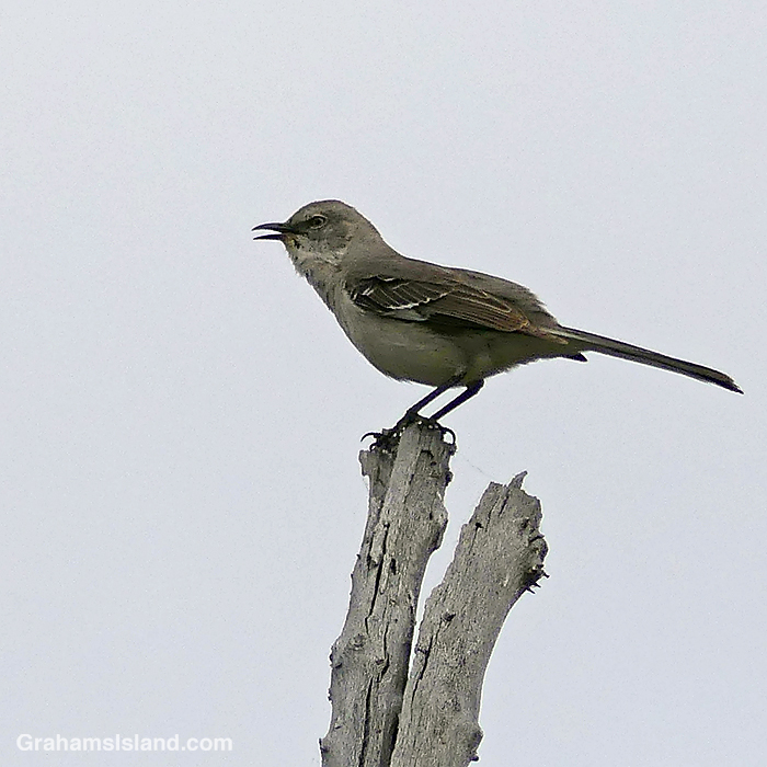
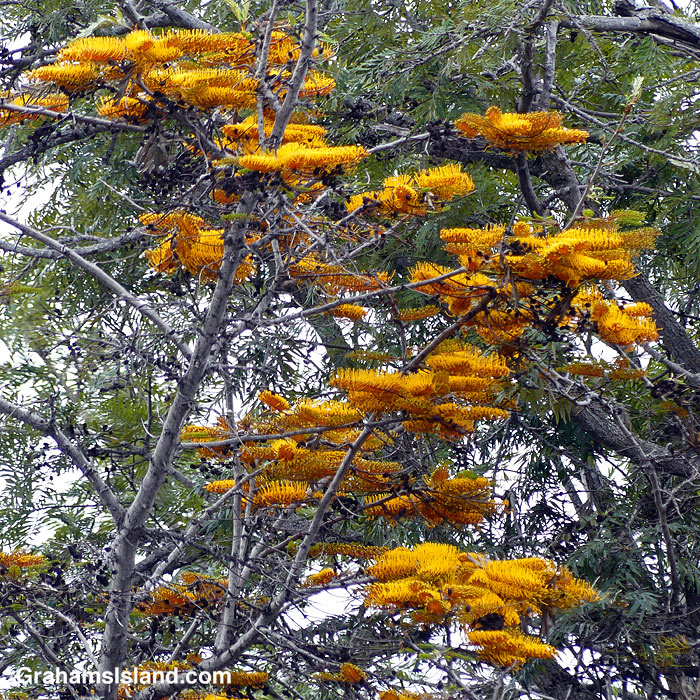
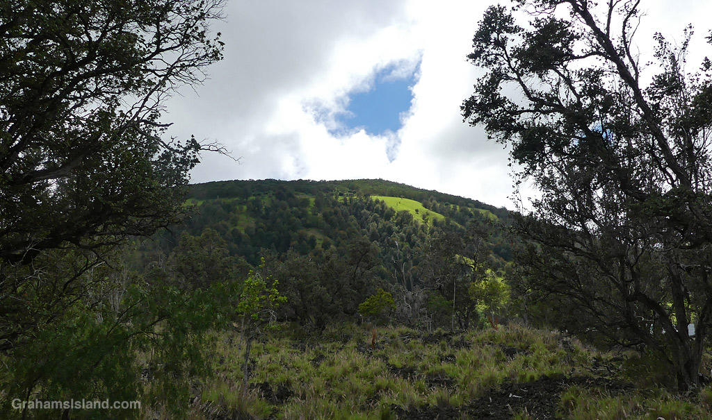
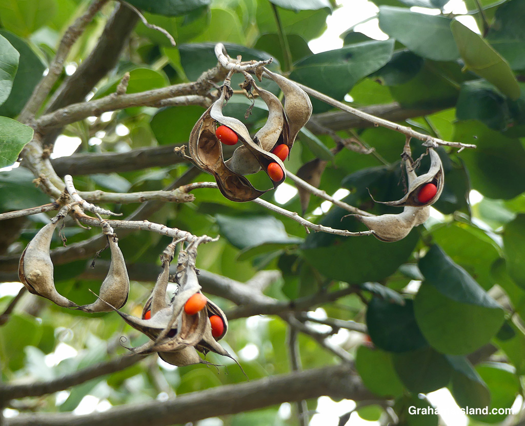
A Northern Mockingbird announces its presence.Silk Oak flowers.A view of Pu’u Wa’awa’a from a new section of trail.Sheep and cattle are often seen on the trail.Seeds on an endemic Wiliwili tree.The trail up through the center of the pu’u, pu’u being Hawaiian for cinder cone.Tree roots snake across the trail in places.A horse and rider enjoying the walk, too.A view from near the top, looking towards the saddle between Mauna Loa and Mauna Kea.
Also posted for Jo’s Monday Walk. See more responses here.
This week’s Sunday Stills challenge theme is ‘Stark.’ See more responses here.
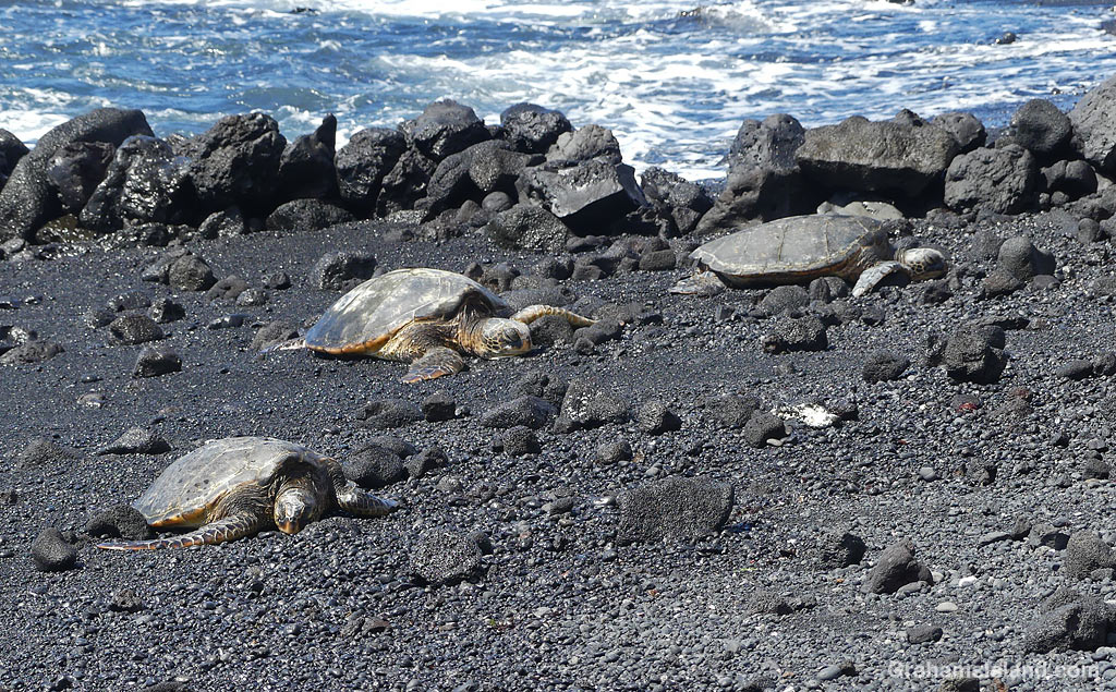
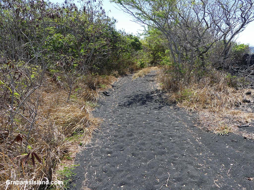
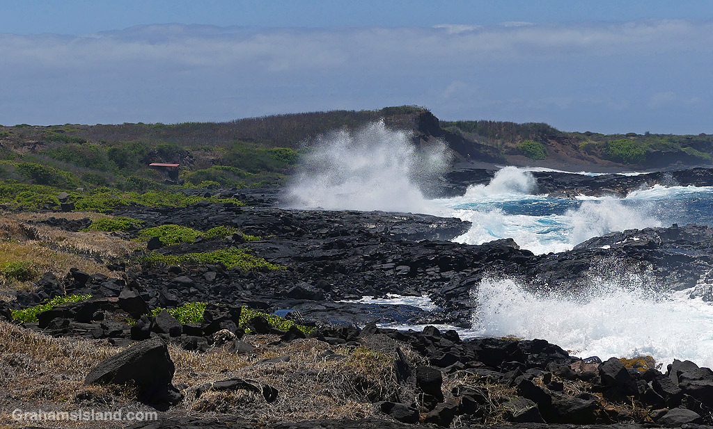
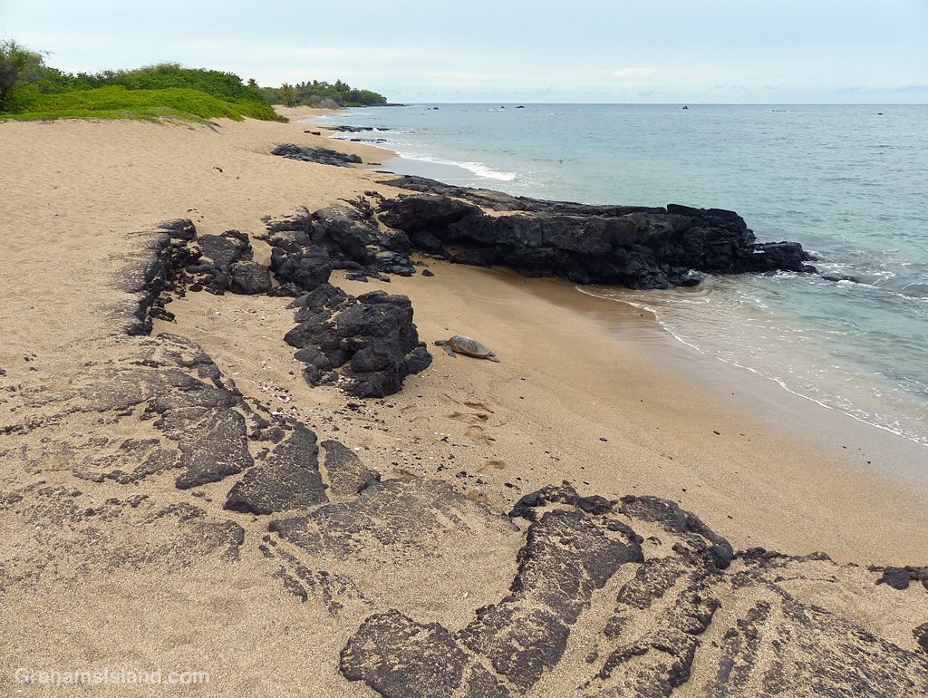
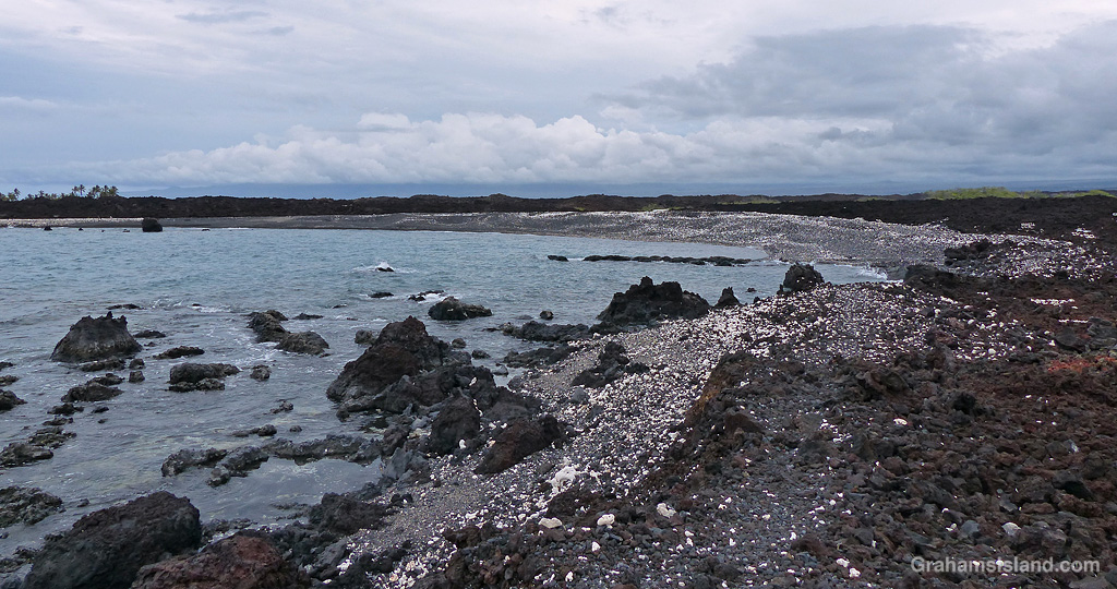
This seemed a good opportunity to recap a hike I did last year, but have failed to get organized into a post! The hike started at Punulu’u Black Sand Beach Park, home of the island’s most famous black sand beach.
As usual, there were a few Green Turtles resting on the beach. The trailhead, at the east end of the beach, isn’t marked, but hike up through a narrow band of trees and it opens out onto a lava bench. On this bench is Kāne’ele’ele Heaiu, an ancient Hawaiian heiau where human sacrifices were carried out.
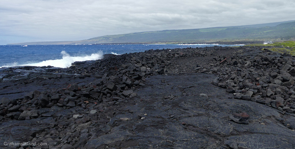
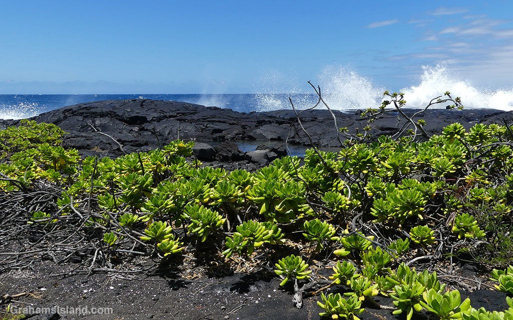
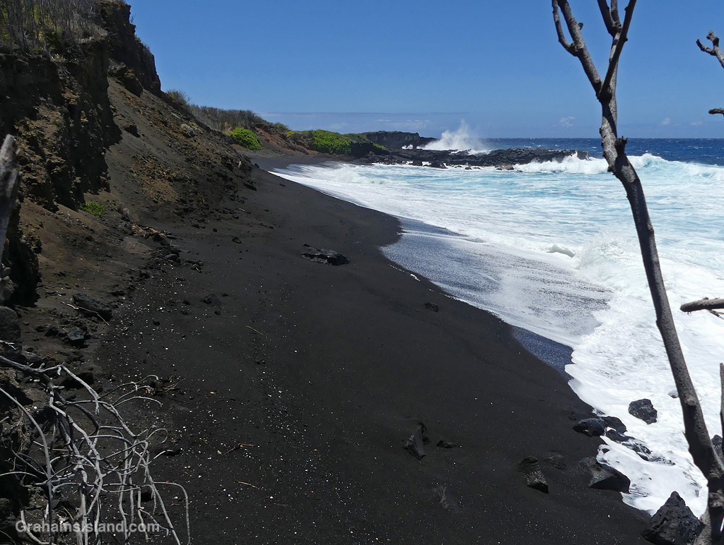
Beyond the heiau, the trail is marked by flat stones. This is the ancient Ala Kahakai trail, which followed the coast from the northern tip of the island all the way down and around the west and south coasts, to the southeastern corner of the island. The hike follows the coast, passing through scrubby vegetation and across stark lava fields.
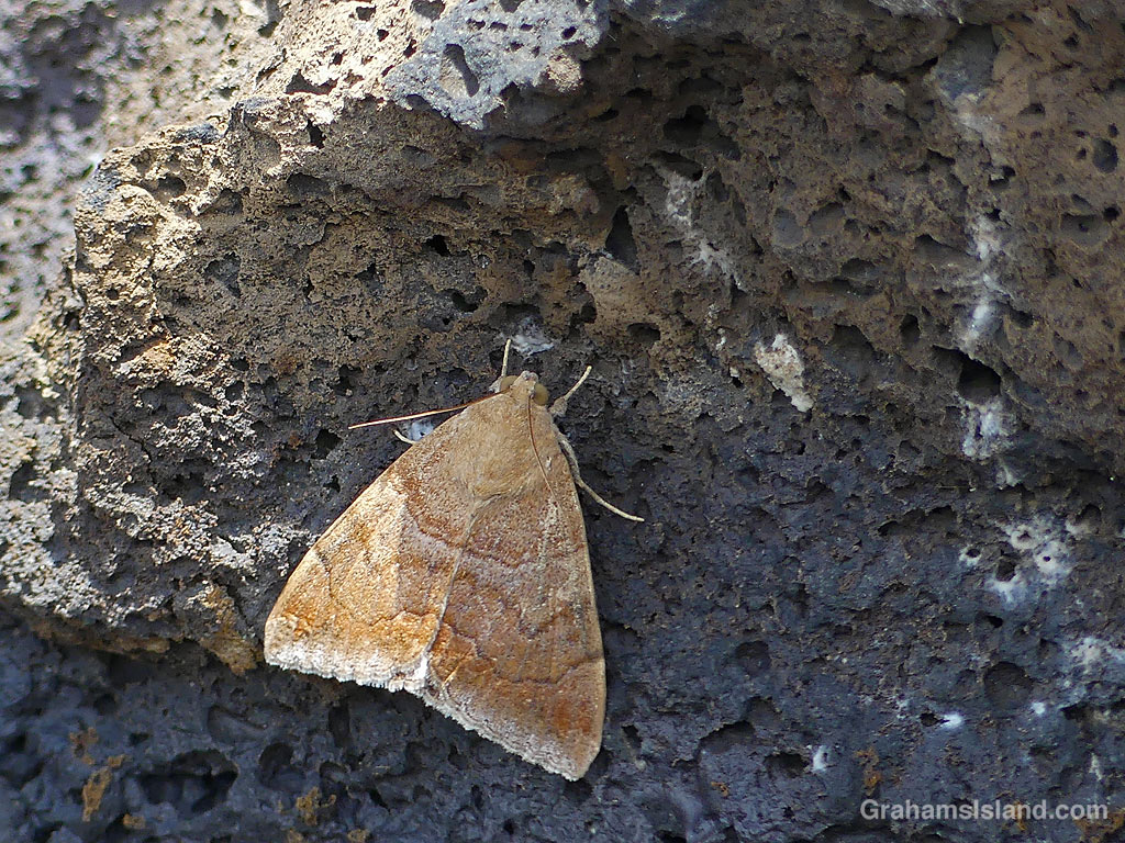
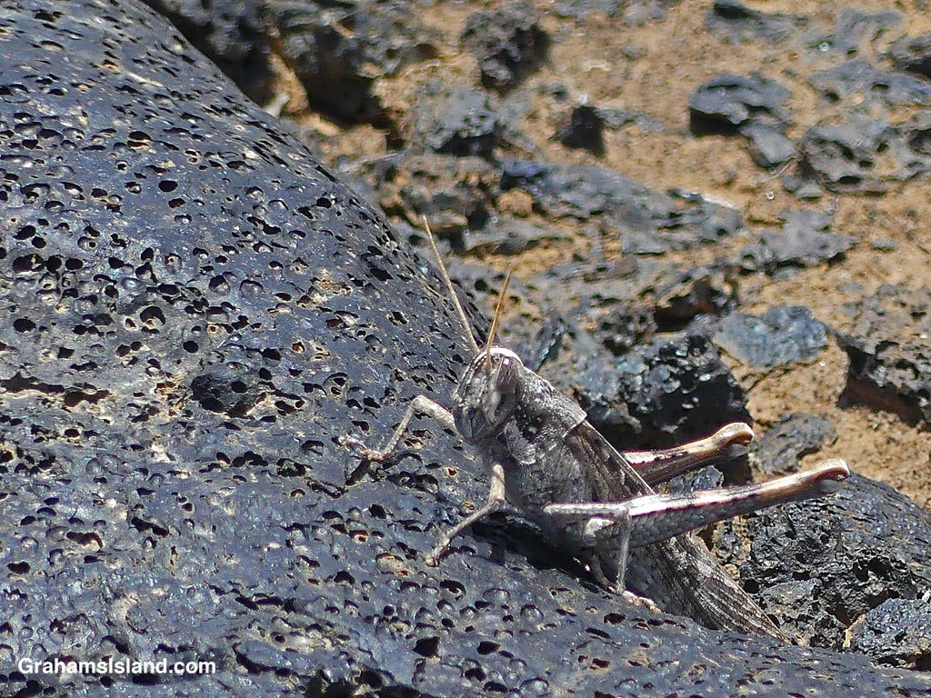
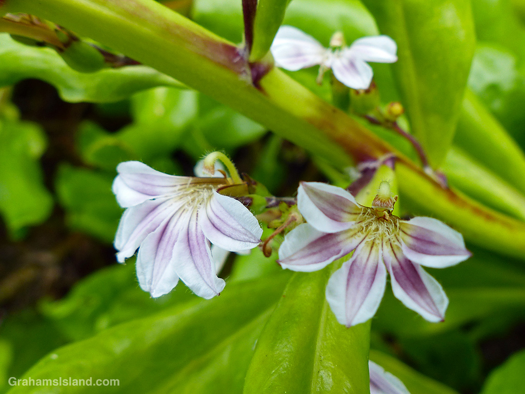
There are some tenacious plants growing along the way, notably Beach Naupaka, which tolerates rocky terrain and salt spray. There’s also a variety of birds and other wildlife to be seen.
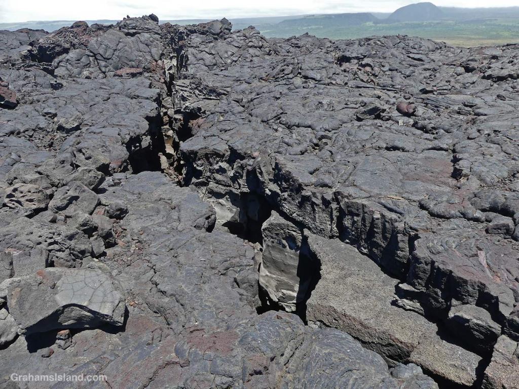
Cairns mark the trail, though they’re not always easy to spot. It’s easy to wander off the trail, which is not a good thing given the large cracks in the lava and potential thin spots that one could fall into.
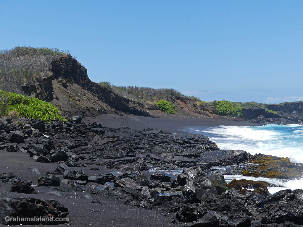
But if you don’t get lost or fall into a lava tube, eventually Kamehame Beach will come into view. This beach is important as a nesting place for both Green Turtles and Hawksbill Turtles. The nesting season runs from June to November, which was when I was there, so I knew I wouldn’t be walking on the beach for fear of disturbing anything. In fact, I thought I hadn’t seen anyone on this hike once I left Punulu’u, but when I looked at my photos, I saw someone at the far end of the beach. This was undoubtedly one of the researchers who monitor these spots for turtle activity.
The beach itself is quite steep and, even if it wasn’t turtle nesting season, I’d have been reluctant to walk it given the high surf on this particular day. The round trip hike is around 6 miles unless you get lost!
Also posted for Jo’s Monday Walk. See more responses here.
This week’s Sunday Stills challenge theme is ‘Great Outdoors Month.’ See more responses here.
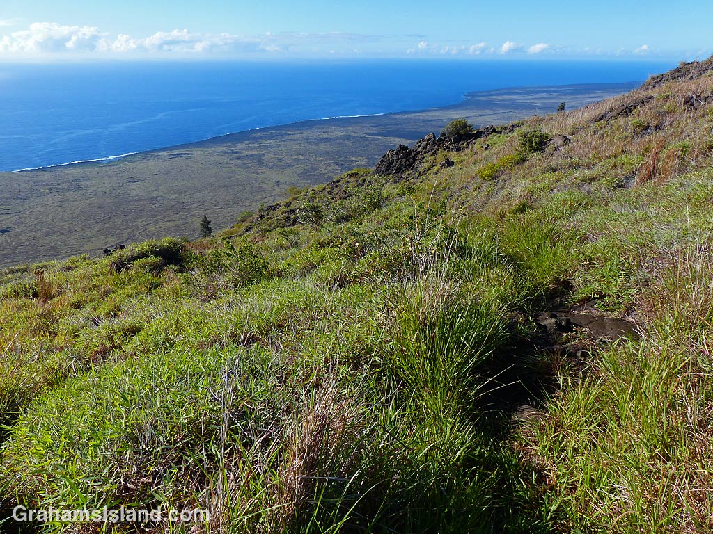
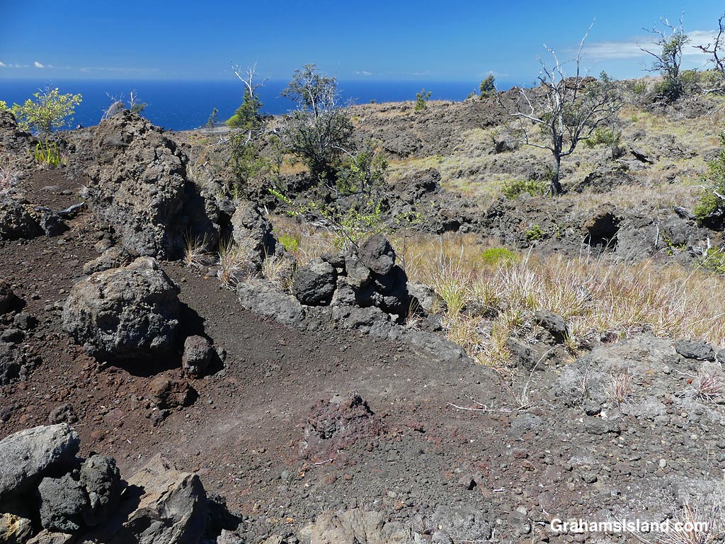
I did this hike, at Hawaiʻi Volcanoes National Park, quite a while ago, but for one reason or another the post never came together and then went missing in my files! This hike started from the lookout at the end of Hilina Pali Road. A few years back, I did a different hike from this starting point that almost did me in (here). This time, having learned from that experience, I stayed on top of the pali (Hawaiian for cliff). My destination was Pepeiao Cabin (pronounced ‘pay-pay-ow’), about five miles away, though the trail is the Ka’u Desert Trail, part of which I’ve hiked from the other end (here).
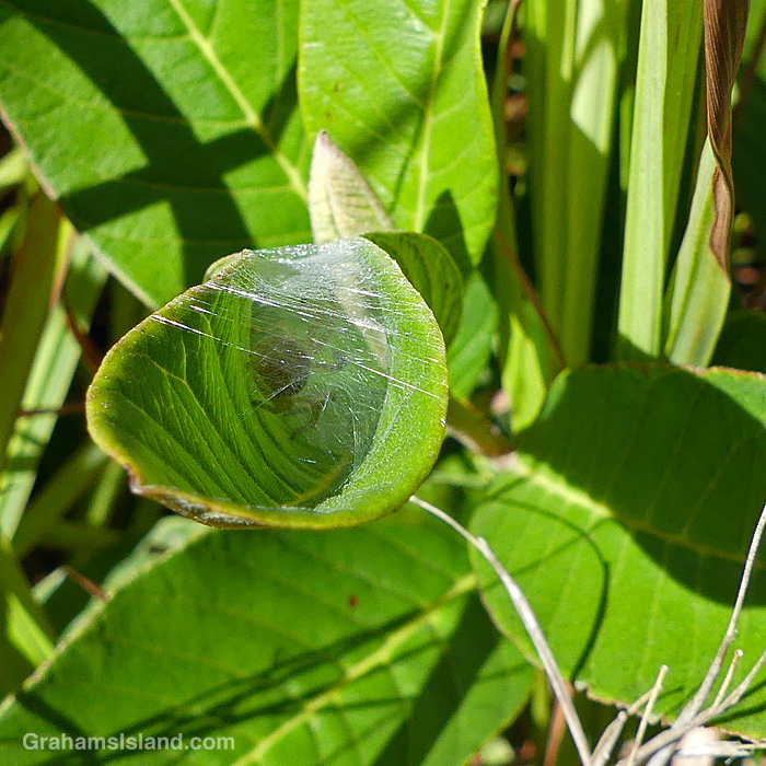
Ohia trees on the trail.A spider sheltering in a leaf.The Ka’u Desert Trail.The Ka’u Desert Trail marked by cairns.View from The Ka’u Desert Trail.
The day was sunny, but not too hot, and with a nice breeze for the most part. The elevation drop (and gain on the return) is only around 500 feet so it wasn’t too strenuous, and the trail was fairly easy to follow. It passes through grassy areas and across lava flows, and is well-marked with cairns. Ohia trees dot the landscape, along with a variety of shrubs and other flowers. I didn’t see too many birds, but there was a decent show of butterflies and bugs. The views were splendid, down to the coast or upslope towards Mauna Loa.
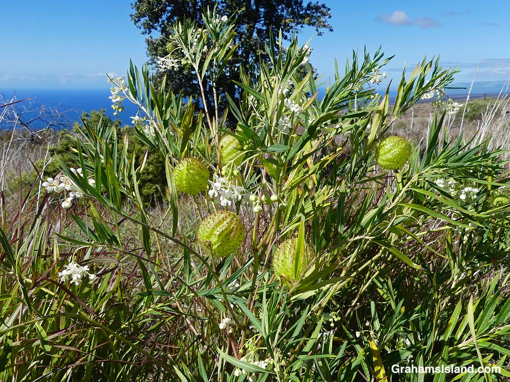
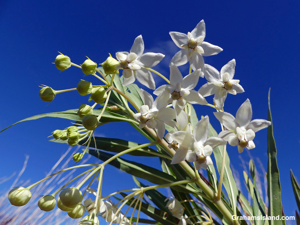
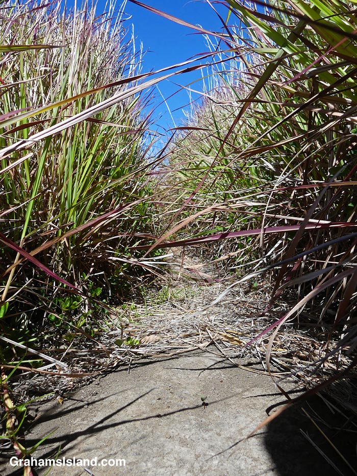
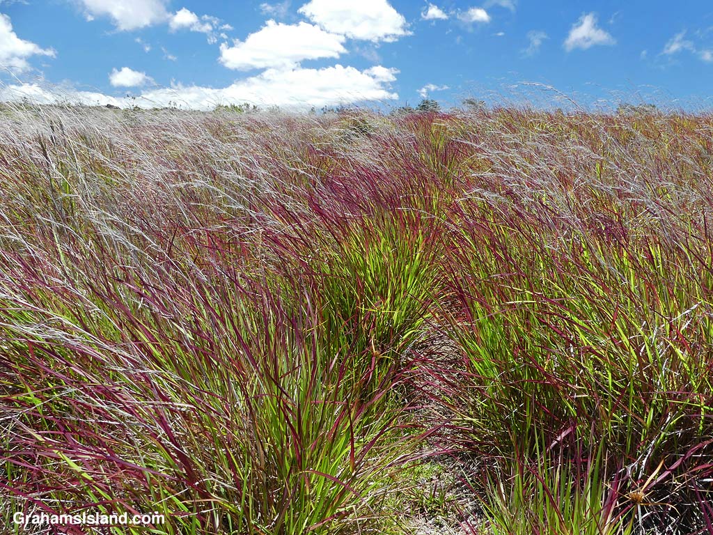
A Balloon plant on the Ka’u Desert Trail.Balloon plant flowers on the Ka’u Desert Trail.Common Guava on the Ka’u Desert Trail.Grasses alongside the Ka’u Desert Trail.Grasses alongside the Ka’u Desert Trail.
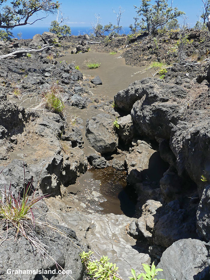
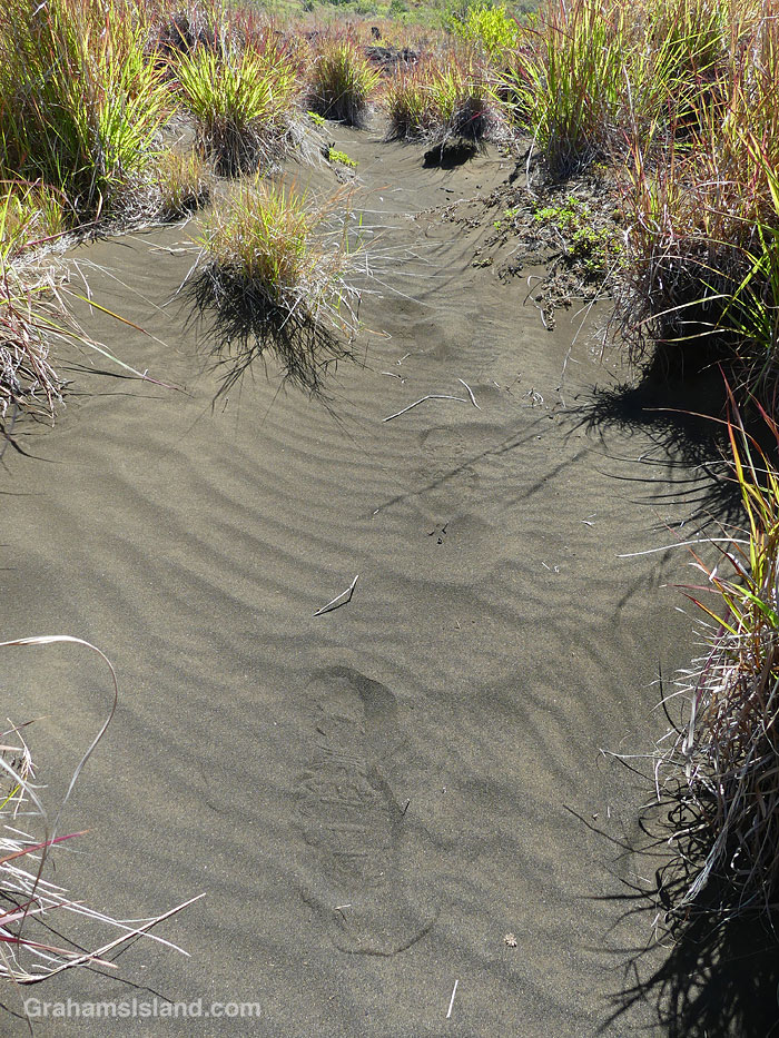
All the backcountry trails I’ve hiked in the park have featured something particularly unusual and interesting. On this hike, I was amazed by the substantial areas of sand on the trail or alongside it. This certainly didn’t get there from the beach, since the elevation is around 2,000 feet. My assumption is that it’s just volcanic rock broken down by rainfall, but just not washed down to the coast. Some of the sand was grassed over and it was like walking through dunes on the coast!
Sand on the Ka’u Desert Trail.Footprints in the sand on the Ka’u Desert Trail.Tracks in the sand on the Ka’u Desert Trail.Sand on the Ka’u Desert Trail.Sand in the lava on the Ka’u Desert Trail.
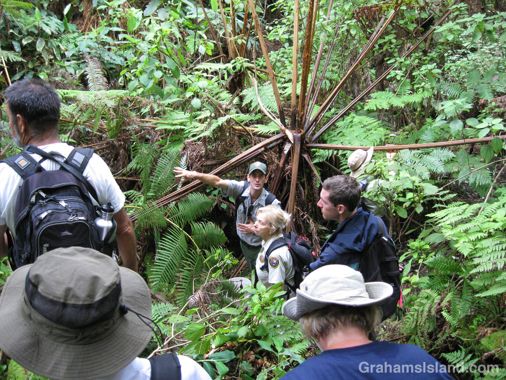
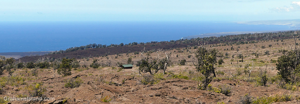
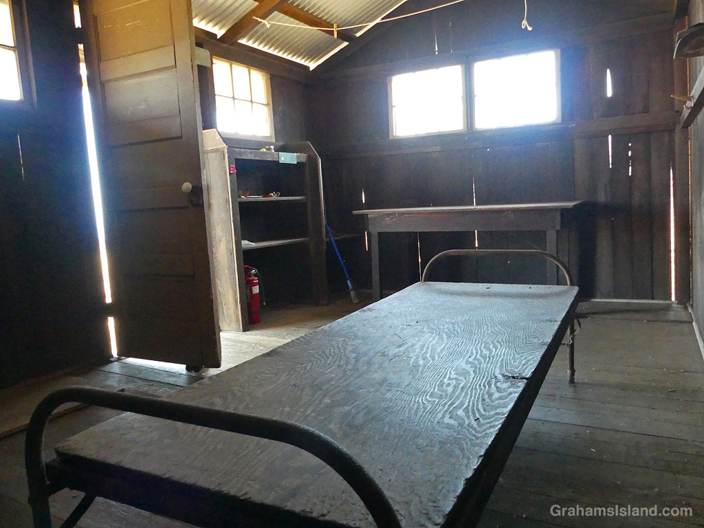
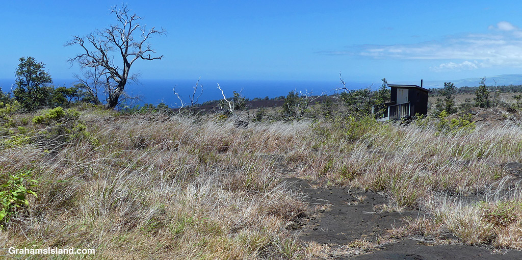
Eventually, I reached Pepeiao Cabin. There are several of these backcountry cabins in the park, and they require a permit to stay at them. This one was typically rustic, with a catchment water tank that may or may not contain water, depending on the weather and use. There’s also an outhouse with a splendid view. Inside, the cabin was basic, but the kind of place I’d be happy to stay in if it was raining outside.
Pepeiao Cabin on the Ka’u Desert Trail.Pepeiao Cabin on the Ka’u Desert Trail.The interior of Pepeiao Cabin on the Ka’u Desert Trail.The outhouse by Pepeiao Cabin on the Ka’u Desert Trail.
After I got back, I saw that the park website says “Pepeiao is in the southwestern reaches of Hawaiʻi Volcanoes National Park backcountry. The cabin is no longer safe for use and visitors should plan on tent camping.” I was a bit surprised because I’ve certainly stayed in plenty of less salubrious accommodations in my day!
Also posted for Jo’s Monday Walk. See more responses here.
This week’s Sunday Stills challenge theme is ‘The Great Outdoors.’ See more responses here.
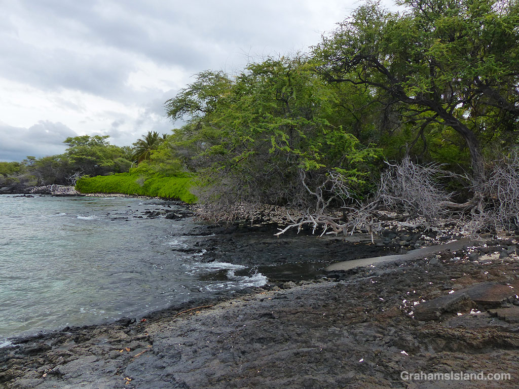
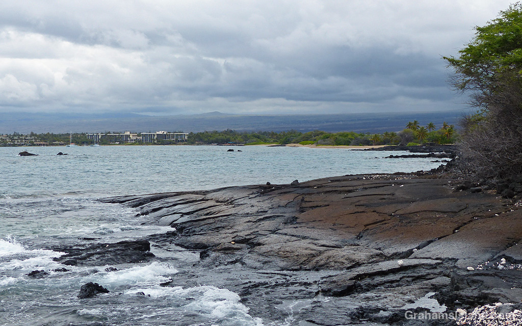
Recently, I took a hike along the South Kohala Coast, starting out at ʻAnaehoʻomalu Bay in Waikoloa Resort, and heading south to Keawaiki Beach, before returning the same way. This is a hike I’ve done before, but not for some time.
ʻAnaehoʻomalu Bay is often referred to as A Bay because it’s a tad easier to pronounce. It’s one of the more popular beaches on the island, but head south, around the corner from the main beach area, and the golden sands are largely deserted. Well, except for the odd green sea turtle taking a nap.
There are a few rustic structures behind the beach along here, but it’s a far cry from the resort developments less than a mile to the north. When the sands end, there’s a short stretch where high tides wash up against a wall of greenery. Hiking at those times, which I did, involves nimble footwork or getting your feet wet. I’m not nimble!
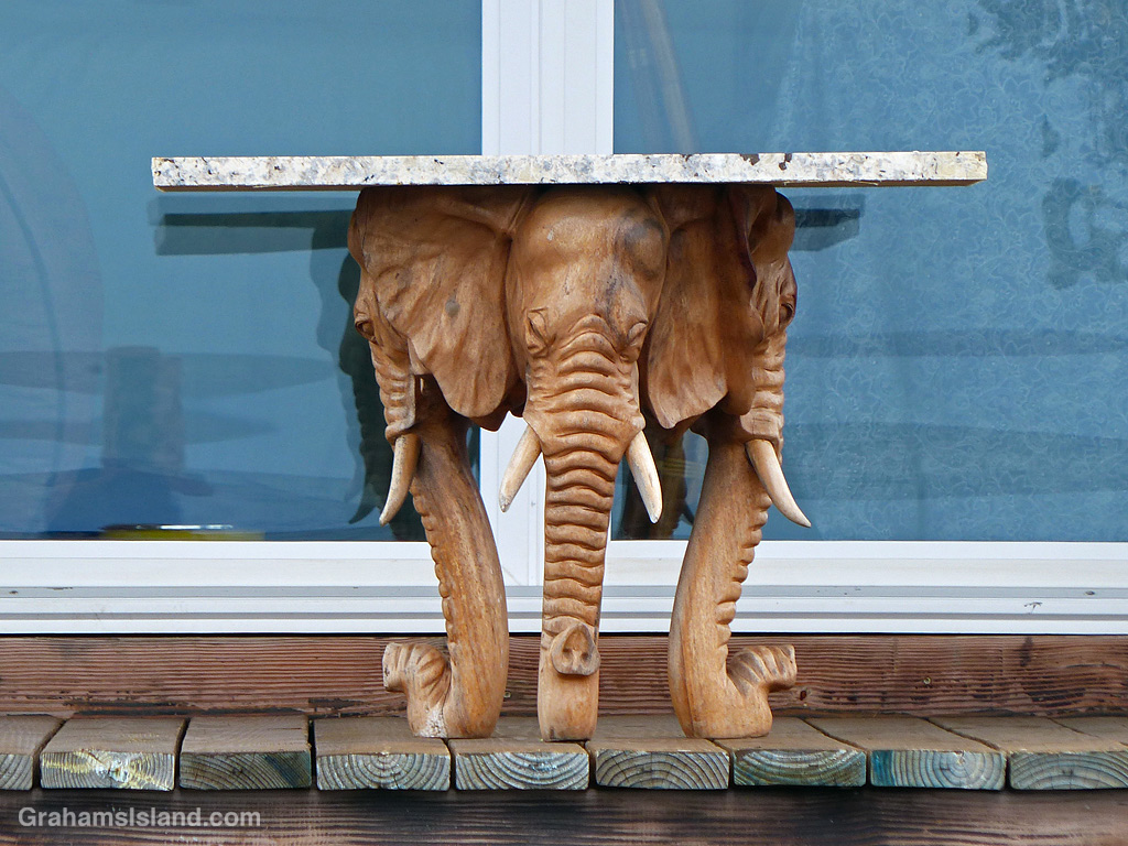
A table supported by elephant heads!The trail can be underwater at high tide.Looking back towards A Bay.This turtle found a quiet rocky beach to rest on.
Beyond this point the coast becomes rocky lava, where flows from Mauna Loa have tumbled into the ocean in bygone days. The trail is mostly over a’a lava, which is irregular and rough. The trail itself is not hard to walk, but straying into the lava fields is another matter entirely.
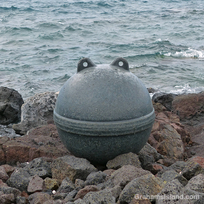
I found this sad looking buoy banging around in a tide pool, so carried it higher on shore where it looked much happier.
The first marker on this part of the trail is the lone palm tree at Akahu Kaimu Bay. Just inland from this palm is a pool, which is mostly freshwater and deep enough to swim in. This is a welcome option on a hot day, but since it was mostly overcast with a nice onshore breeze, I didn’t take a dip this time.
The lone palm tree at Akahu Kaimu Bay from the north.The lone palm tree at Akahu Kaimu Bay from the south.The lone palm tree and pool at Akahu Kaimu Bay.
The trail continues over the lava field to the next bay and it was here I got lost. The coast trail often passes over the lava rather than follow the coast around points and the only trail I could see appeared to be doing just that. But when I followed it for a while I saw that it continued inland. However, I could also see that where it headed was to the Golden Pools of Keawaiki, which was I planned on visiting anyway, so I carried on until I came to familiar ground. The golden pools owe their color to a unique algae that grows here. These are not pools for swimming in since that could alter the conditions and destroy the algae.
The trail to the Golden Pools of Keawaiki.The highway, less than a mile away, is seldom seen and never heard. The Golden Pools of Keawaiki.The Golden Pools of Keawaiki.
Heading back to the coast, the trail comes out at Pueo Bay where I found an abandoned kayak, not in great condition. Keawaiki beach, just beyond, is another bay marked by a sole palm tree, but this poor tree has been badly damaged by storms and is no longer much of a tree.
Abandoned kayak at Pueo Bay.Keawaiki Beach.The beach at Pueo Bay.The house near Weliweli Point.
Heading back north, I passed the sole house on this part of the coast, just beyond Weliweli Point. I have yet to see anyone at this spot, though someone obviously maintains the property. I got back to the bay where I had strayed off the track and realized where I’d gone wrong. The coast trail zigzags up from the beach and is marked only by a couple of pieces of bleached coral, which don’t stand out much on a beach strewn with the same kinds of coral pieces.
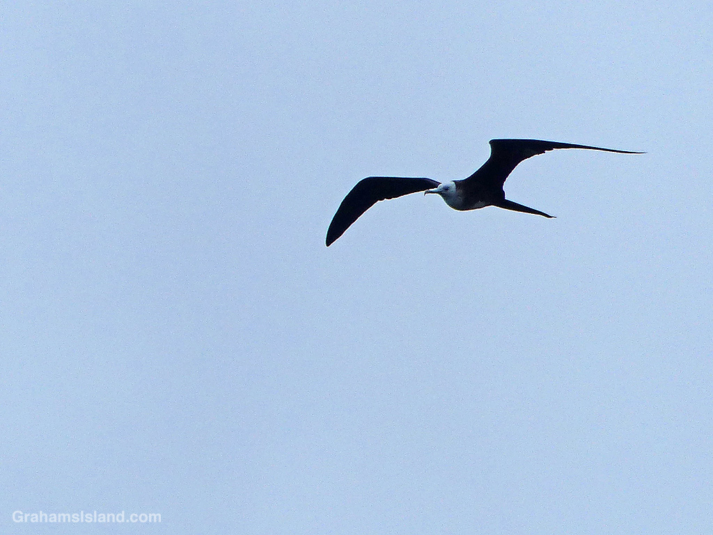
This trail isn’t a great one for birds, but I did see a Great Frigatebird wheeling overhead, which is always nice. And though this coast appears unforgiving, there are hardy plants to be found including native Hau trees and swathes of Beach Naupaka.
A Hau flower.Beach Naupaka flowers.A great frigatebird.
By the time I got back to A Bay, the Lava Lava Beach Club was busy with dinner patrons, enjoying their meals at tables set up on the sand and close to the water.
Lava Lava Beach Club.
Also posted for Jo’s Monday Walk. See more responses here.
My lunch spot with a view of the Kamakai’a Hills and various kinds and colors of lava.
This week’s Sunday Stills challenge theme is ‘I’d Rather Be…’ See more responses here.
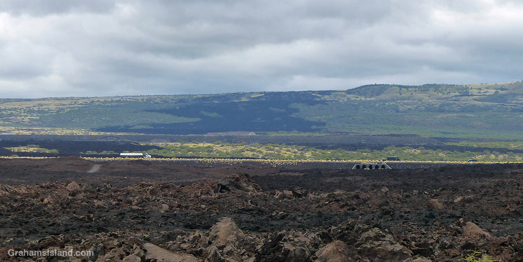
It had been a while since I went hiking, for various reasons, and it’s something I was missing, something I’d rather be doing. So last week, I headed down to Hawaii Volcanoes National Park to try the Ka’u Desert Trail. This backcountry trail has been on my list for a long time, but I had never done it before. For one thing, it’s about as far from my house as one can get on the island. For another, it’s directly downwind from Kilauea Volcano, so when the volcano is active and the trade winds are blowing, gasses blow across the length of the trail.
The latest eruption of Kilauea is currently either paused or over, so gas emissions are much reduced, and last week, the trade winds had given way to winds from the southwest. So off I went.
Signs explain the rich history and geology of the area.Tenacious Ohia trees grow in the lava.Ohia flowers are a magnet for bees……as are the native Ulei flowers.
The trailhead is several miles west of the main entrance to the park, with a strip of parking along the highway. The first mile of the hike is also known at the Footprints Trail. It’s a sort of paved path that threads through ohias to a small building that houses footprints left by early Hawaiians in volcanic mud and ash. Alas, I couldn’t identify any footprints in the display. Shortly after the footprints, the path breaks out of the vegetation into open lava fields. This isn’t a tropical Hawaii walk, this a bleak hellscape Hawaii walk. Or is it?
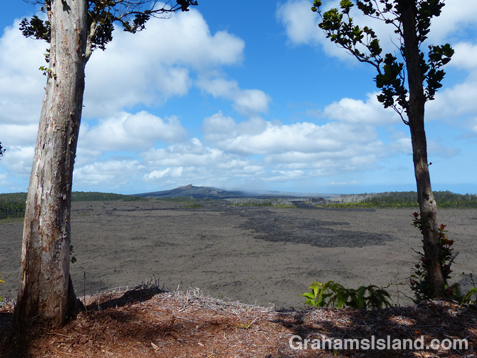
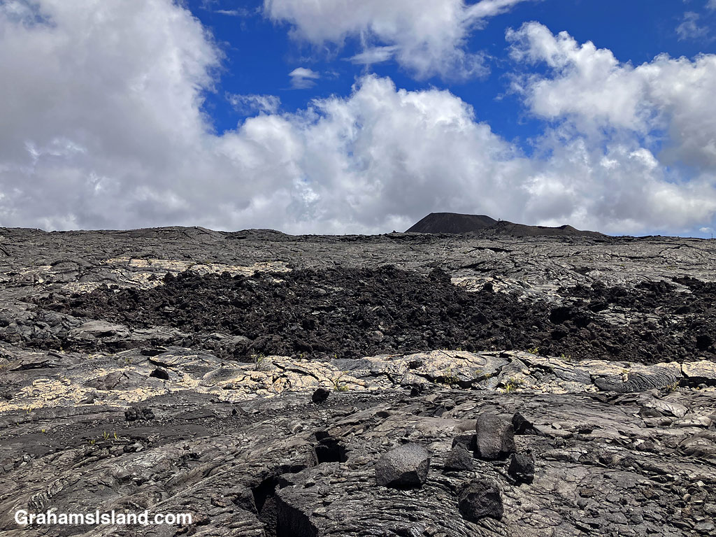
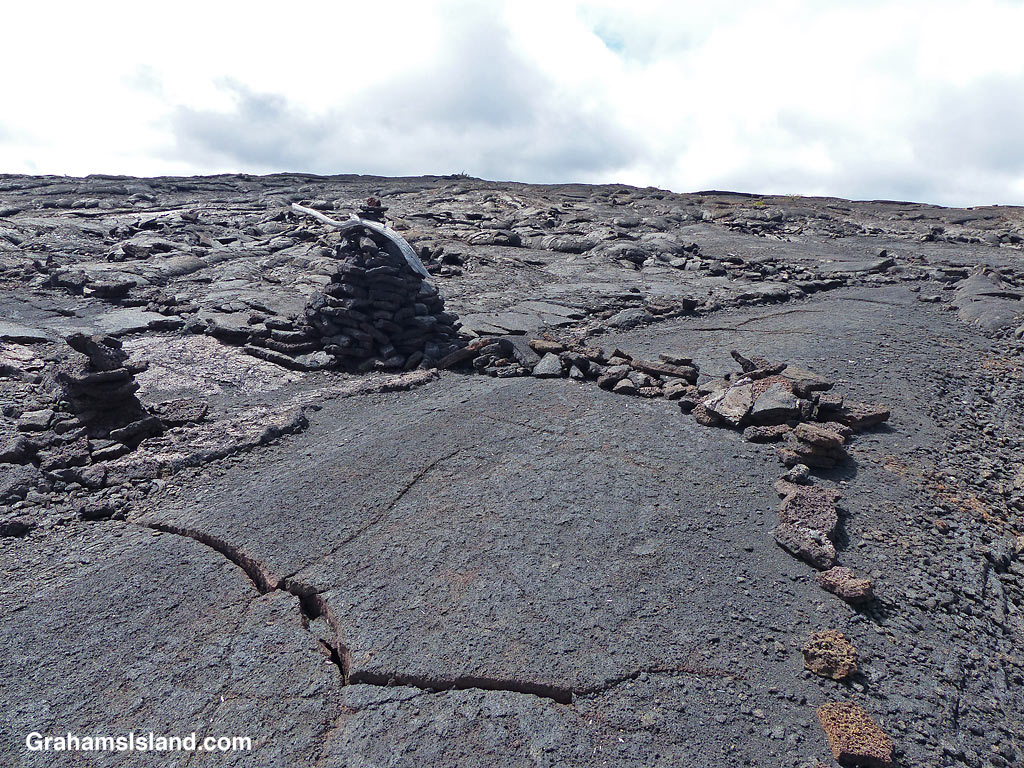
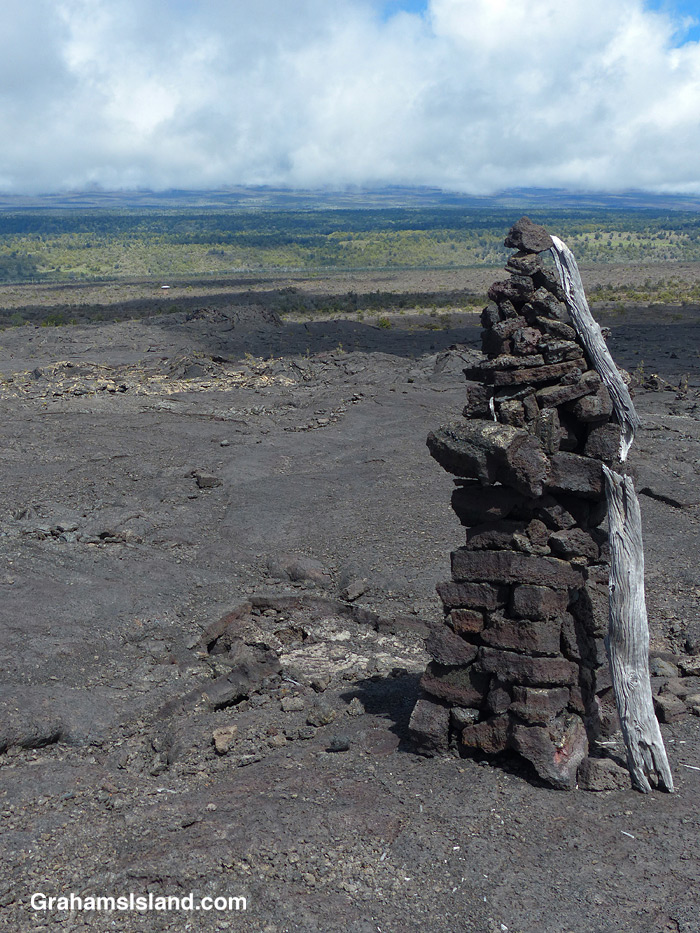
A view of the Kamakai’a Hills from the trail junction.The trail was rerouted here, from its previous path, for reasons unknown.Cairns mark the trail, some bigger than others.Walking on the trail removes the top, crumbly layer of pahoehoe lava.
The trail ascends gently to the only junction for miles around, at Mauna Iki. To the left is a trail back towards the heart of the park. The Ka’u Desert Trail heads to the right and into backcountry wilderness. Mauna Iki was the site of an eruption in 1919 and the trail traverses the lava fields from this eruption.
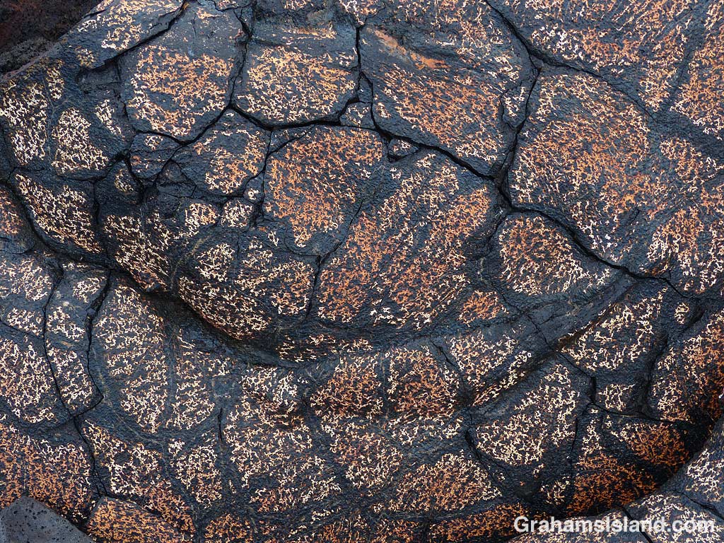
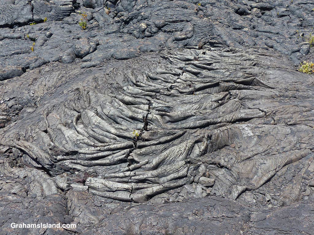
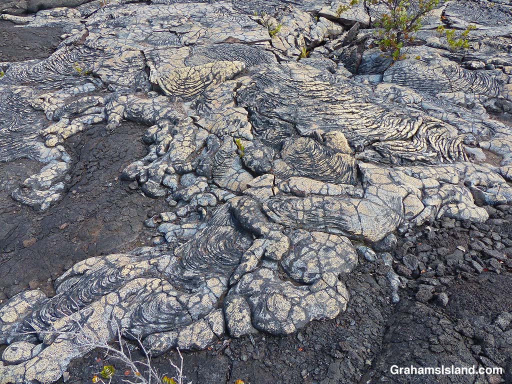
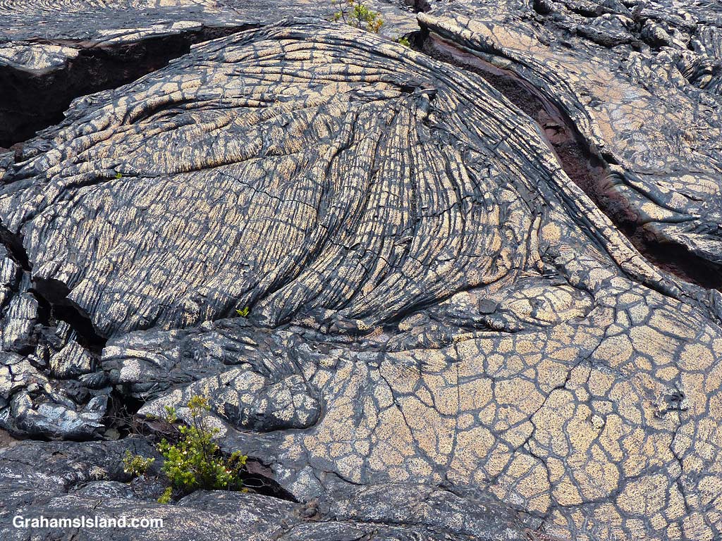
A’a and pahoehoe lava flows can be seen side by side.Gold colored ropey pahoehoe lava makes it look even more like ropes!The lava has many weird and wonderful folds and shapes.
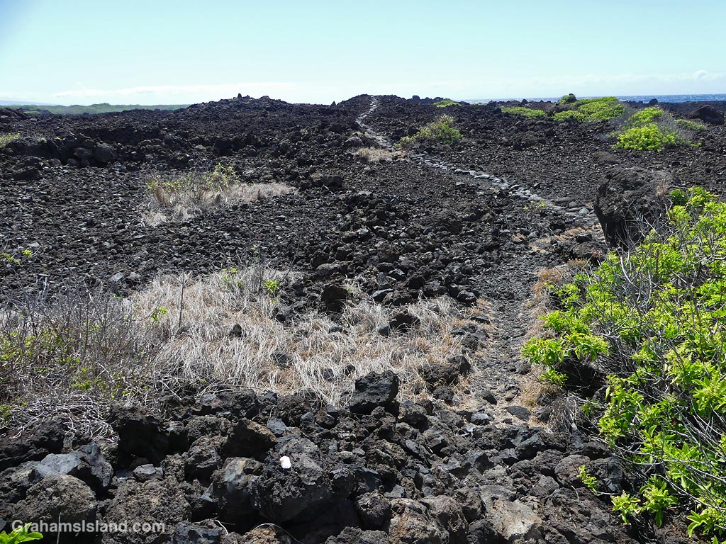
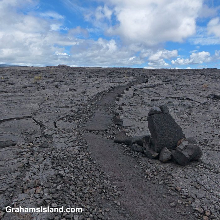
Much of the trail is over pahoehoe lava, which is rounded and much easier to walk on than jagged a’a lava. The trail is marked by cairns and single rocks placed alongside it. It’s pretty easy to follow with just one or two parts where attention has to be paid to make sure one doesn’t stray.
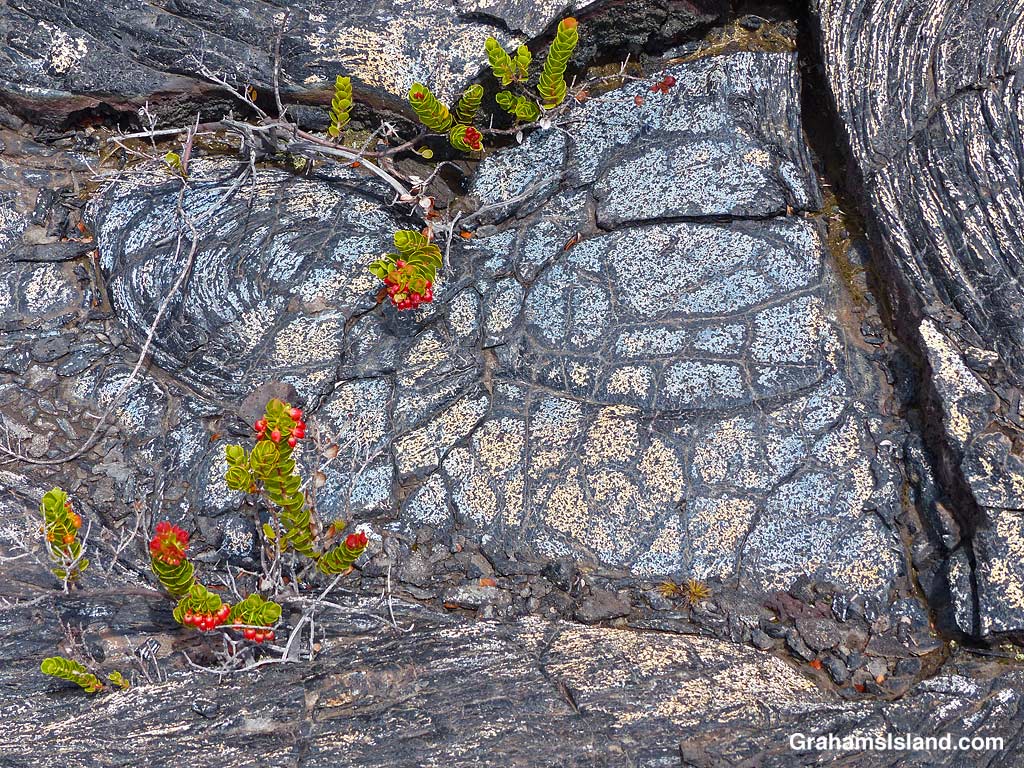
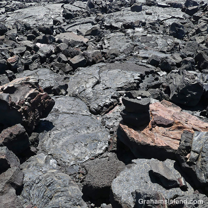
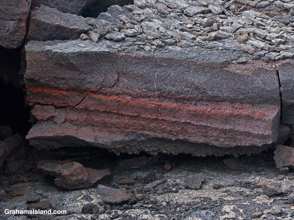
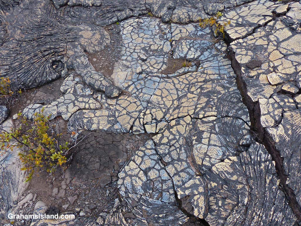
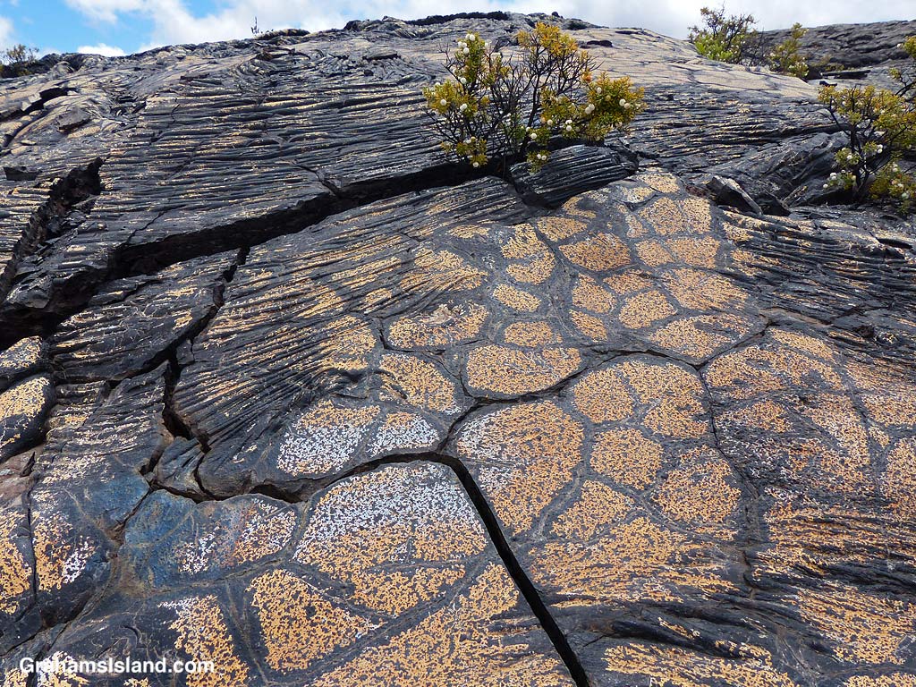
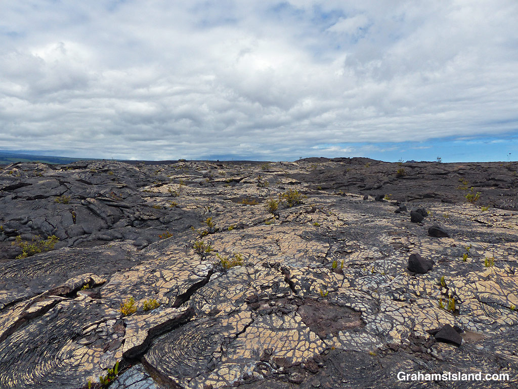
Bronze colored lava.Bands of red in the lava.A crack in the trail……revels shades of orange within.Blue and gold lava flow.Colorful and dramatic, but slowly nature returns.Colorful ropey pahoehoe lava next to smooth.Blue lava!The patterns and colors reminded me of Roman mosaic floors.Bold color and markings.Plants gain a toehold in the cracks and provide a splash of different colors.Don’t stray off the trail. There are holes and thin spots everywhere.Bright colors and bold shapes can be seen along a lot of the trail.
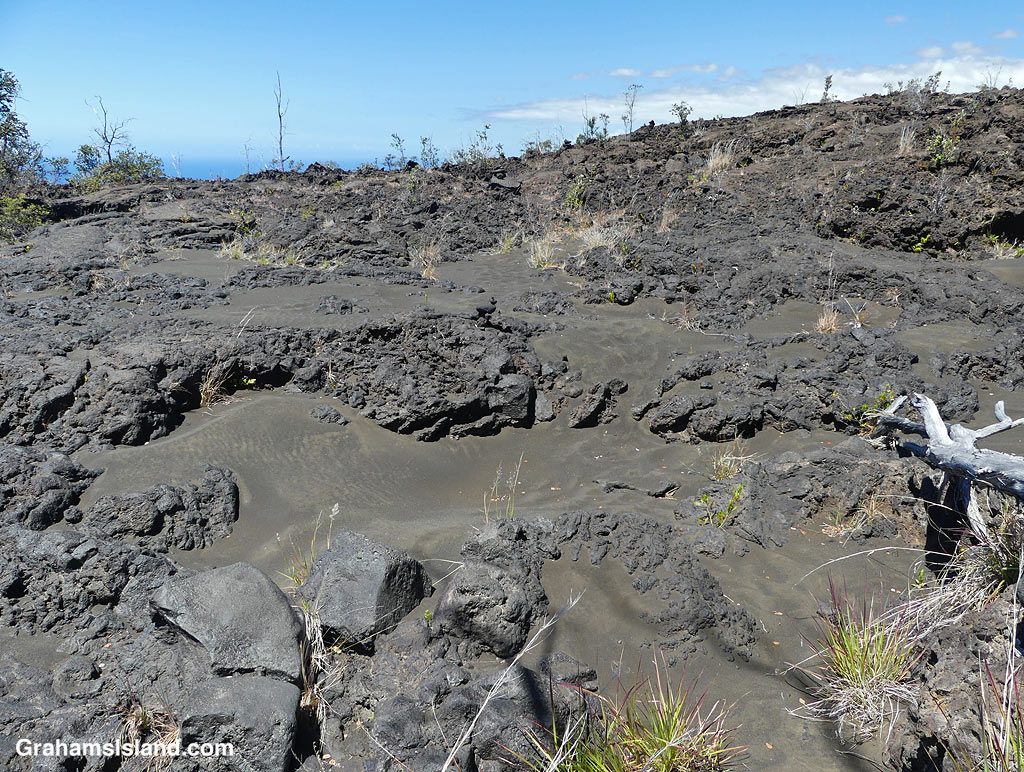
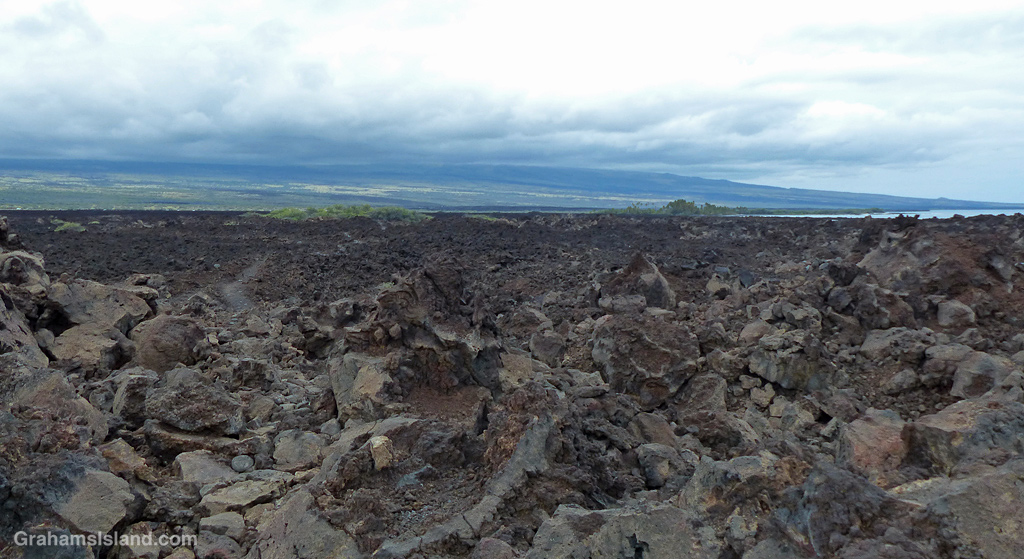
It wasn’t far along this part of the trail that I first encountered blue lava. That’s right, blue lava. Who knew? But not just blue. There’s bronze, pink, red, orange, gold, and who knows what. I’ve seen colorful lava on the Puna Coast Trail, but this was more varied and quite wonderful. In places the trail crossed this colorful lava and I felt bad for walking on it, though as I hiked I could see many more patches of color out in the lava fields. It’s not wise to leave the trail since there are many lava tubes, some with very thin ceilings.
This is an out and back trail and I turned around once I reached the Kamakai’a Hills, after about 5 miles. It’s another 2 or 3 miles to the next junction where there is a small cabin.
Also posted for Jo’s Monday Walk. See more responses here.
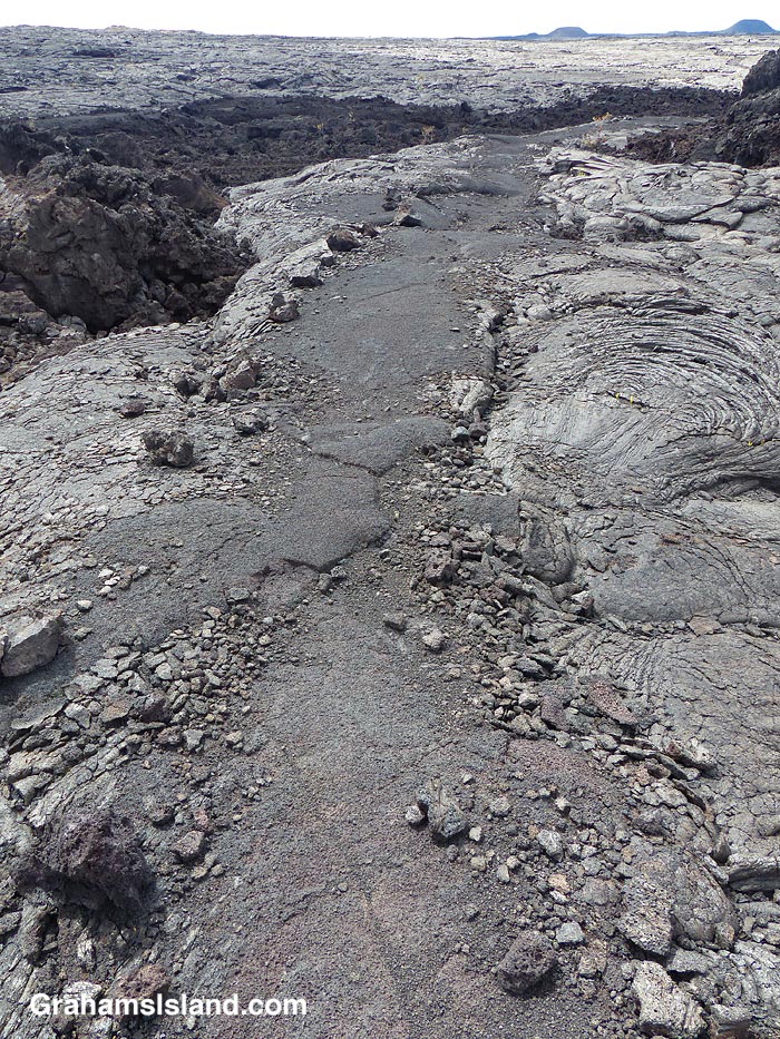
The trail crosses one of the fields of colorful lava.