
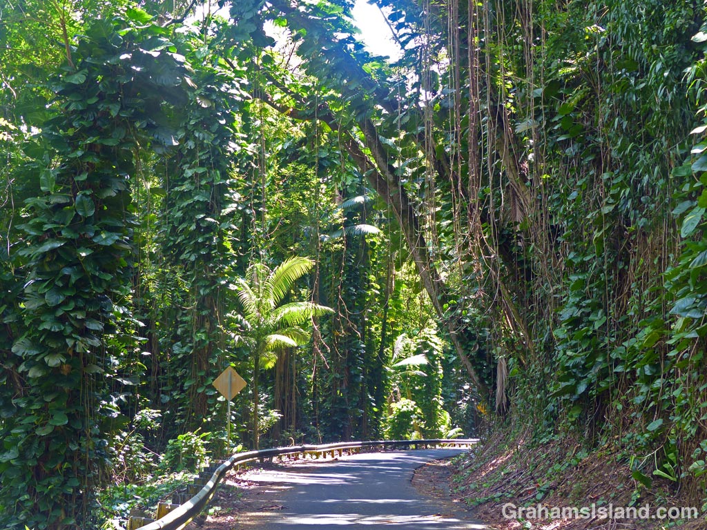
One of the things I enjoy about driving on the east side of the Big Island is coming across roads like this one, winding through a profusion of tropical foliage.
Category Archives: Places
Reclaiming the lava

Lava flows make for a stark landscape, but I always find it fascinating to see how, even in such barren ground, nature regains a foothold. Here, a small shrub has taken hold in a crack in the lava. Just below and to the left of it, a fern grows under a ledge.
If there’s enough rainfall, as there is in this spot of the southeast coast of the Big Island, vegetation will begin to take hold in a fairly short while. That’s assuming that a new flow doesn’t happen along and put paid to the process.
Sea purslane
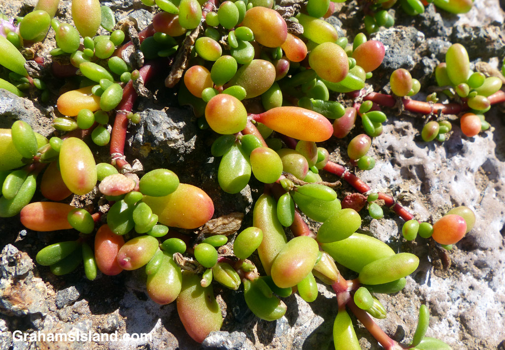
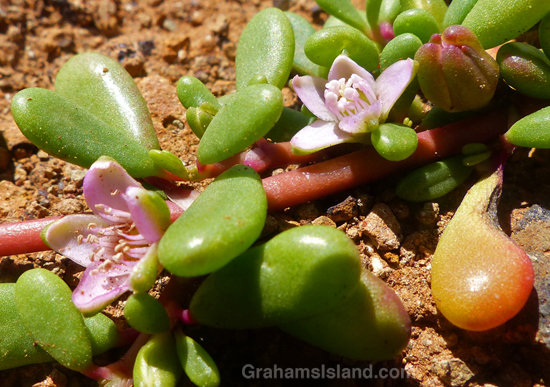
This groundcover (Sesuvium portulacastrum), known in Hawaii as ‘Ākulikuli, is common on the coast. It tolerates wind, heat, salt and drought, which means it does well on the coast. The flowers are a pale pink or purple. The green leaves become red or yellow with age, and often look like little fruit drops. Not sure eating them would be a good idea though.
For more information about sea purslane, go to nativeplants.hawaii.edu/plant/view/Sesuvium_portulacastrum.

You can lead a horse to water …
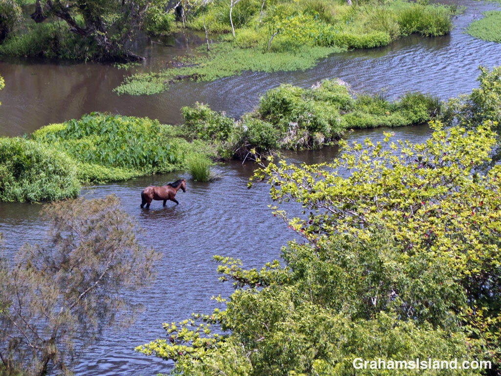
A horse wades through the sluggish waters of the Waipi’o River in Waipi’o Valley.
Pu’u Wa’a Wa’a hike
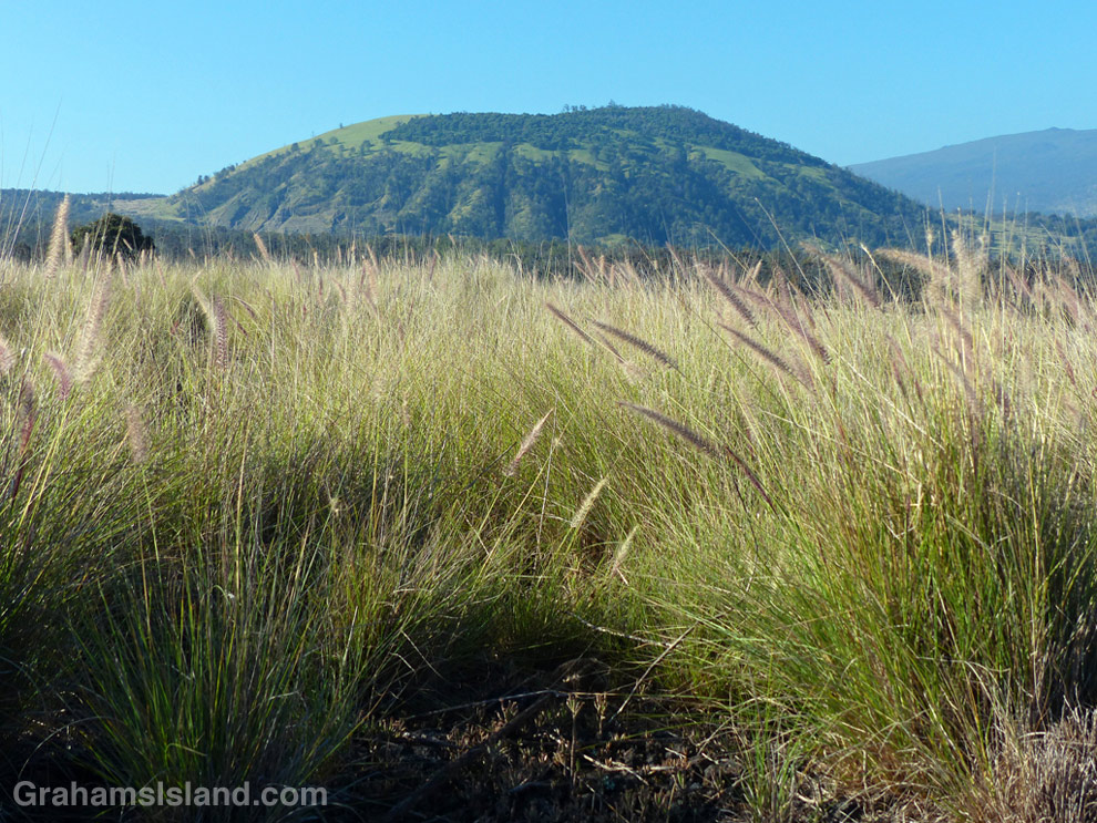
Pu’u Wa’awa’a seen from the trailhead over a sea of fountain grass.

This old quonset hut, at the foot of Pu’u Wa’awa’a, was probably an old ranch building.

Tamaki Corral was used by the old Pu’u Wa’awa’a Ranch. Hualalai is visible in the background, before clouds rolled in.
Pu’u Wa’a Wa’a means “many-furrowed hill.” It’s popularly known as ‘jello mold,’ and is the biggest of several cinder cones on the slopes of Hualalai volcano.
The land is a State Forest Reserve with about 8 miles of hiking trails. The main trail leads to the top of the cone and is about 3 miles each way. The first half follows an old road that passes through a mostly forested area. There’s a good deal of bird life here, more often heard than seen in my experience. The trail then heads up the side of the cone itself in open country, passing old ranch buildings and likely some cattle, horses, sheep and goats.
Once at the top, the views can be tremendous, but an early start is needed. Clouds build up on the slopes during the morning and by midday the view can be fading or gone.
For more information about Pu’u Wa’a Wa’a and its trails, go to puuwaawaa.org.

The smaller Pu’u Iki cone seen from the top.
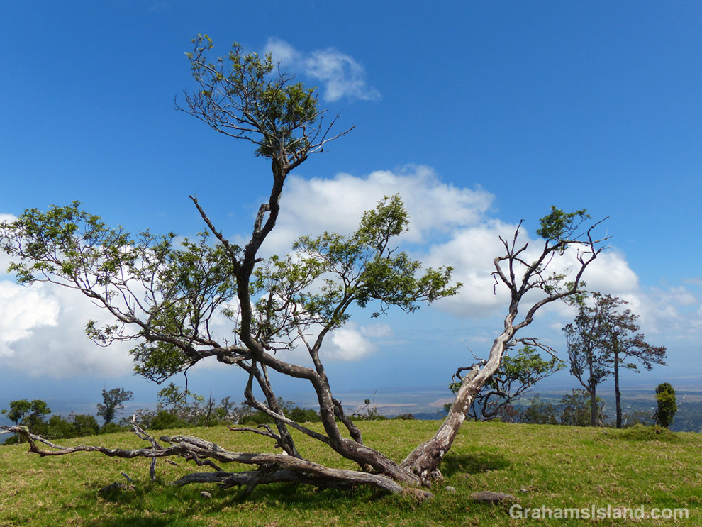
A Mamane tree atop Pu’u Wa’awa’a, with the coast in the distance.
Signs: Muliwai trail advice
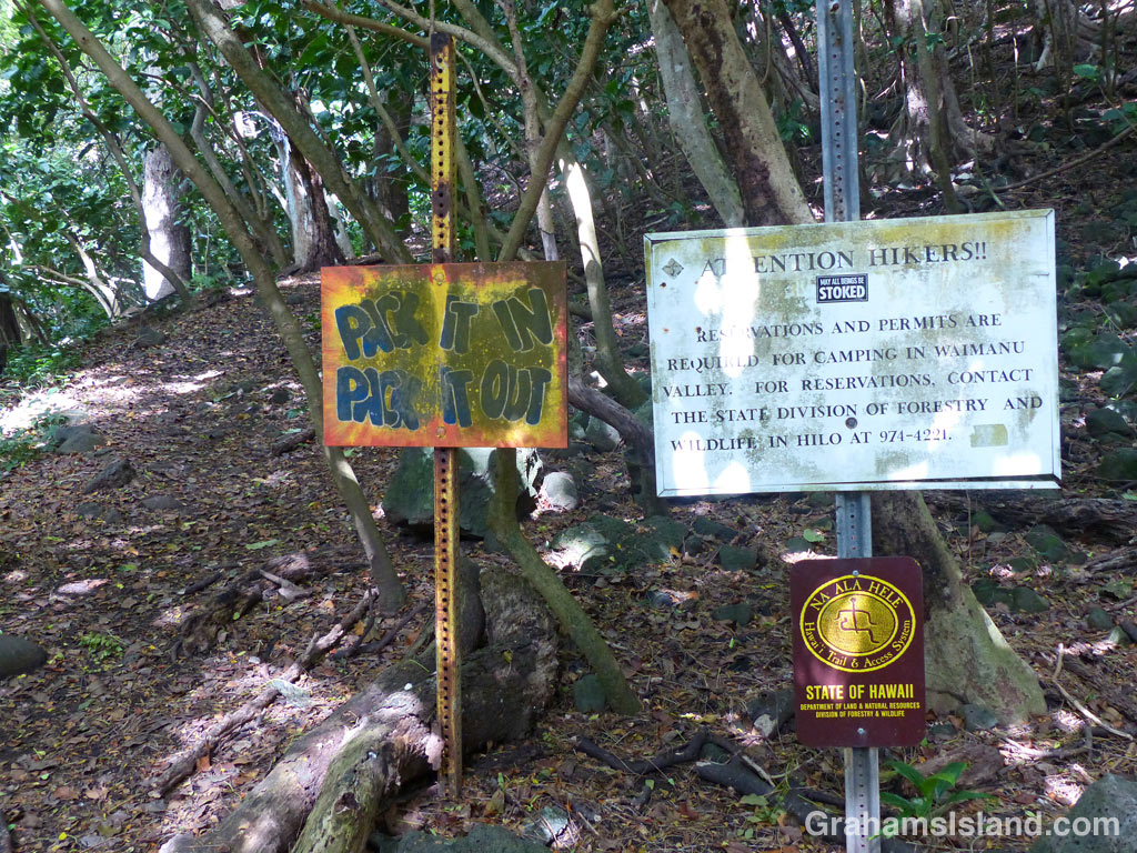
Words of wisdom and instructions for hikers at the start of the Muliwai Trail in Waipi’o Valley. I’m surprised no one has used a finger to scrawl ‘Wash me’ on the signs.
Wandering tattler
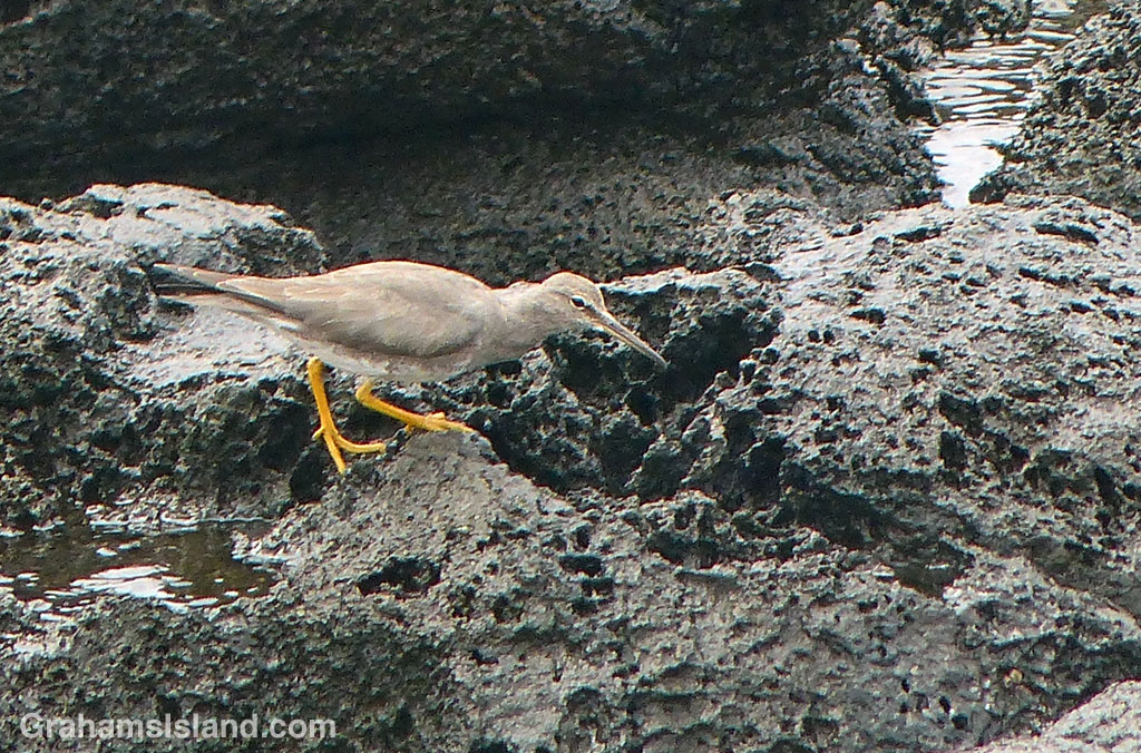
This wandering tattler was probing cracks and holes in the rocks, searching for a snack. Periodically, a larger wave than usual would send the bird into the air where it looped around before settling back in the same general area.
I joined the Navy to see the world …

The military has a significant presence in Hawaii – think Pearl Harbor on Oahu – and the Big Island sees its share of the action. Naval exercises take place offshore and the saddle between Mauna Loa and Mauna Kea is home to the Army’s Pohakuloa Training Area. Troops and equipment are landed at the harbor at Kawaihae and the driven the 30 odd miles to the base.
I’ve seen this ship, and ones like it, off the northern tip of the island where they make a course change and head off to Oahu.
