Category Archives: Places

Waipi’o Valley hike

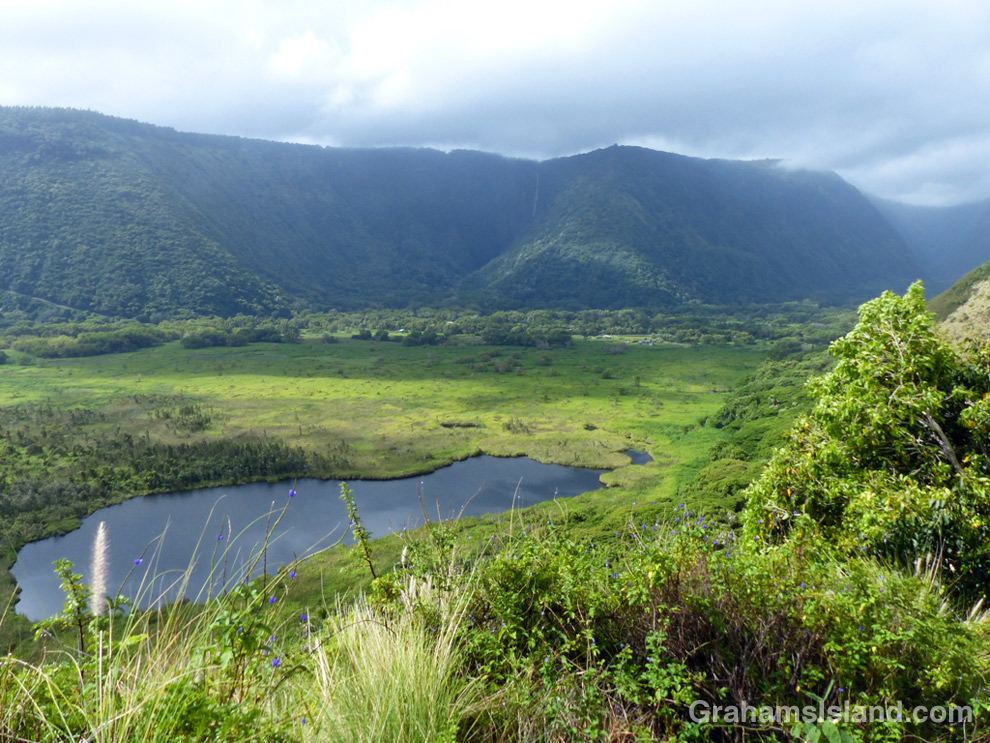
Waipi’o Valley with Hi’ilawe Falls in the distance, seen from a viewpoint on the Muliwai Trail which leads to Waimanu Valley.
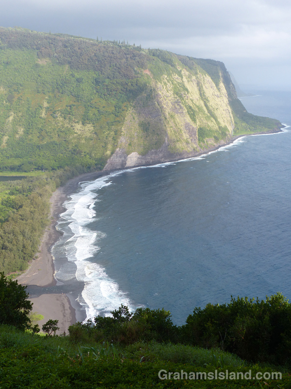
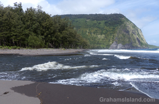
Waipi’o beach seen from the overlook near the parking area.
The stream crossing to reach the far end of the beach and the Muliwai Trail.
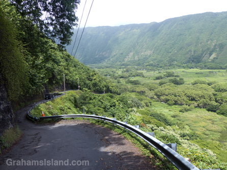
The road down into Waipi’o Valley is rough, winding, and very steep.

There’s a 22 miles stretch of the northern Big Island coast, from Pololu to Waipi’o Valley, that isn’t accessible by car. At the southeast end of that stretch, the road ends at the Waipi’o Valley overlook. From there, a paved road descends into the valley. It’s rough, winding, and very steep. The average grade is 25%, steeper in places. Four-wheel drive and healthy brakes are a must.

The alternative is to hike into the valley, which is what I did. The road drops about 800 feet in just over half a mile. It’s hard on the knees, but easy on the eyes. There’s a gradual unfolding of details that aren’t visible from the overlook – fields, dwellings, horses. The valley, which is important in Hawaiian history, was wiped out in a 1946 tsunami. Now it’s populated by taro farmers and people who tend to shy from society. It’s a bit of a clash for it to be a popular tourist stop.

At the foot of the hill is a junction. The road continues straight on into the valley, but the public access soon ends. In the opposite direction the road heads to the sea. After a little under half a mile, the sandy, lake-filled road breaks out to the beach. There’s lots of parking under the trees. On the other side of them is the beach, a long, curved stretch of smooth sand, interrupted only by the ‘stream’ that has to be crossed to access the far end.

I can’t say where it’s best to cross this stream; conditions vary from day to day depending on the state of the tide and the flow of water. I waded out just inland of the furthest reaching waves. I felt my way across the rounded rocks underfoot, feeling reasonably pleased with my progress. But about three-quarters of the way across, I reached the fastest flow of water, which had also cut the deepest channel. It was probably only a couple of feet deep, but it required great care not to lose my footing. This fast-flowing channel was soon crossed and I hauled myself out, somewhat relieved, on the sand at the other side.

A deserted beach stretched out ahead. I strolled along the water’s edge and, at the far end, cut inland to find the Muliwai Trail, which leads to Waimanu Valley eight miles farther on. The trail is steep and narrow as it zigzags up the cliff. After a short while it breaks into the open and lovely views emerge, back the way I’d come and up the valley where there’s a good view of Hi’ilawe Falls. This was my turnaround point. The return across the stream was easier, knowing what was involved. The hike back up the road to the overlook a steady, sweaty haul, though I was surprised it only took me 10 minutes longer than the descent.

For more information about the Waipi’o Valley trail, go to bigislandhikes.com/waipio-valley/.
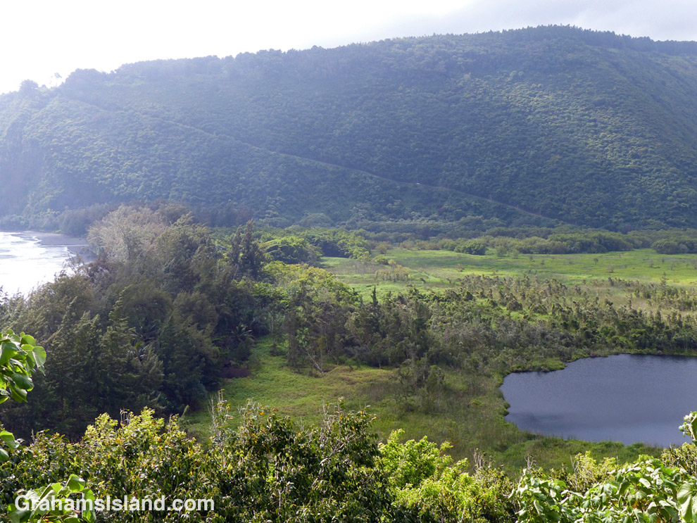
From the Muliwai Trail, a view back toward the road leading into Waipi’o Valley

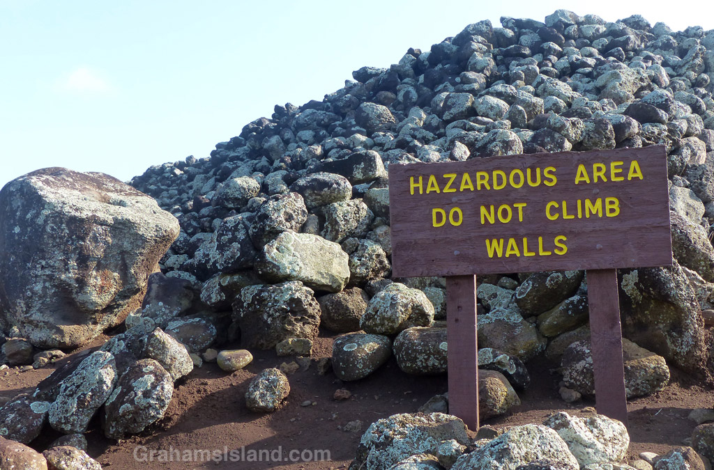
Signs: Hazardous Area

A sign at Mo'okini Heiau

This sign greets visitors to Mo’okini heiau. The heiau dates back to the 11th or 12th Century when it was an important religious site where thousands of human sacrifices were carried out. A hazardous area indeed. I imagine there were many who would happily have risked climbing the walls in those days.

For more information about the Mo’okini heiau, go to bigislandhikes.com/mookini-heiau/.


Mauna Loa silverswords bloom and die

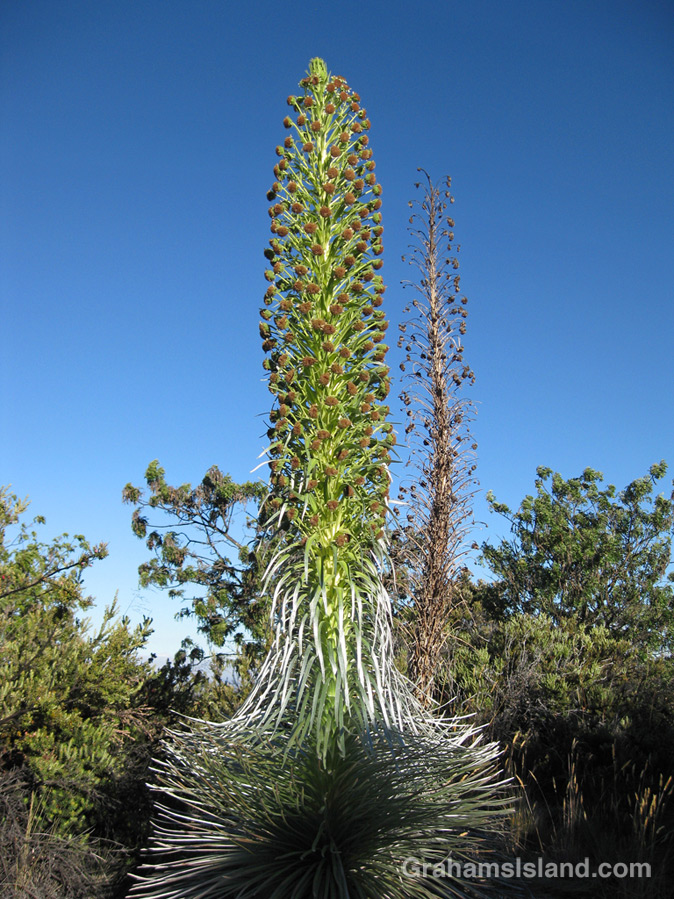
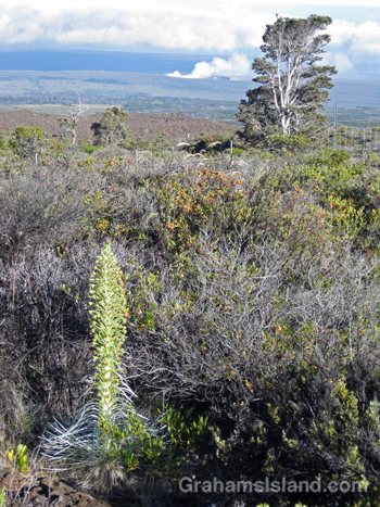
A silversword blooms on Mauna Loa.

This is the time of year when silverswords bloom. These plants, members of the sunflower family, are endemic to Hawaii. There are slightly different silverswords growing on Mauna Loa, Mauna Kea and Haleakala on Maui. The plants are very susceptible to root disturbance and the activities of goats, pigs and humans has led to their decline. They’re making a comeback now thanks to fenced enclosures and careful management.

These photos were taken on Mauna Loa a few years back. The flower stalks were about 6 to 8 feet tall. The plants live for up to 30 years, but once they bloom, they die (like the one in the background of the top photo).

In the second photo, the ongoing eruption of Kilauea’s Pu’u O’o vent can be seen.

For more information about Mauna Loa silverswords, go to nps.gov/havo/learn/nature/endangered_ahinahina.htm.

A silversword blooming on Mauna Loa with Pu'u O'o vent erupting in the background.

Flowing to the ocean

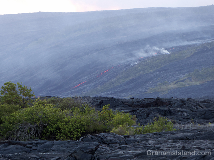
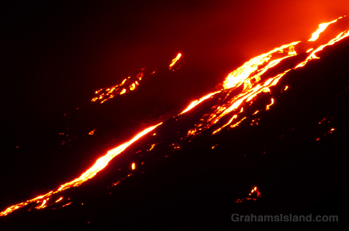
Lava from Kilauea's Pu'u O'o flow.
At twilight, lava flows down Pūlama pali while, at the top of the hill, a smaller breakout can be seen. In the center are two onlookers, illuminated by the glow of flashlights.
Lava from Kilauea's Pu'u O'o flow sets fire to shrubs and trees.
In the early evening, the flow descends the pali, starting fires in surviving stands of trees and shrubs.
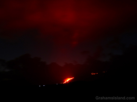
The glow of lava from Kilauea's Pu'u O'o flow reflects off the clouds.
As the light fades, the glow from the flow reflects off passing clouds. The white lights are the flashlights of people hiking to or from the flow.
Kilauea's Pu'u O'o flow glows brightly as darkness falls.
The lava flow burns brightly as darkness falls.

In April, I posted here about a trip last year to see lava bubbling up at Kilauea Volcano. That activity was in the Overlook vent of Halema’uma’u Crater. On May 24, Kilauea’s other active vent, Pu’u O’o, began a new breakout of lava toward the southeast. This is a path that flows have taken many times before. The first active lava I saw was back in 2010 when such a flow reached the sea and put on a spectacular show.

This May 24 flow is also headed to the sea. By June 28 it had reached Pūlama pali, a steep slope leading down to the coastal plain. On July 7 it was less than three-quarters of a mile from the ocean, and creeping slowly over previous flows that have taken this path. That’s when I went down to take a look and took these photos.

At its current rate of progress, the flow will reach the ocean in a week. But it could speed up or stop, so it’s really a case of wait and see.

There is one note of irony. I have a map from 1975 showing the road that ran along this coast before being covered by various flows from the volcano. In 2014, a flow from the Pu’u O’o vent headed east, threatening the town of Pahoa and the main highway into that corner of the island. One response to that situation was to bulldoze an emergency highway along the coast, at a cost of $10 million or so, following the route of the old road. It was never used as that flow stopped short of Pahoa. If the current flow travels another a half mile or so, the emergency highway will be covered again without ever being used. Such is life.

For more information about Kilauea Volcano and it current eruption, go to hvo.wr.usgs.gov/activity/kilaueastatus.php.

Better Days: Farm cottage

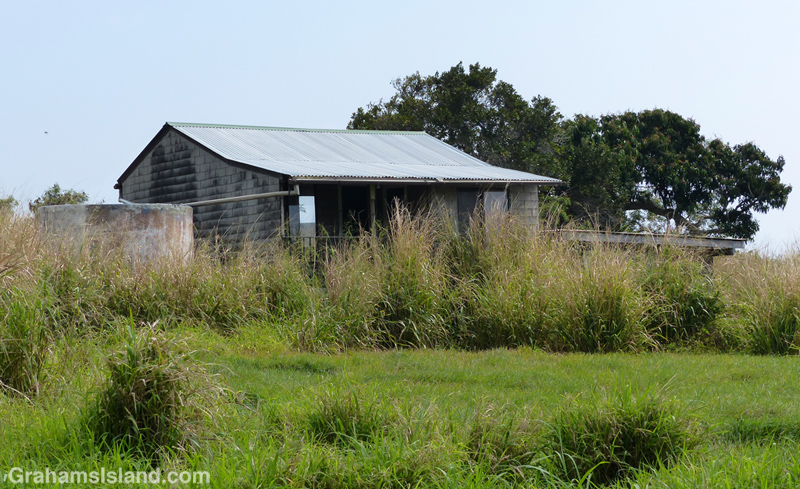
An old farm cottage on the Big Island.An old farm cottage on the Big Island
When I last was up this way, a considerable while ago, this old farm cottage and its surrounds looked reasonably well kept. My most recent visit found it mostly hidden behind tall grass. When I drove up the dirt road that runs past this place, I wasn’t sure I was going to be able to turn around. The road obviously hadn’t had much use and the vegetation was taking over.