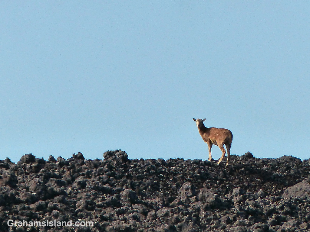
A goat scrambles over the lava alongside the Pu’u O’o trail. Here, it’s probably transiting between kipukas, where there’s a good deal of forage growing, but goats seem to do fine in even the most inhospitable places on the island.

A goat scrambles over the lava alongside the Pu’u O’o trail. Here, it’s probably transiting between kipukas, where there’s a good deal of forage growing, but goats seem to do fine in even the most inhospitable places on the island.

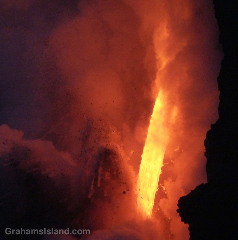

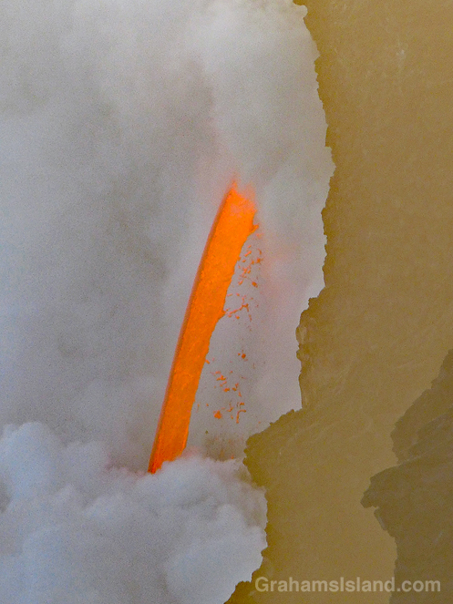
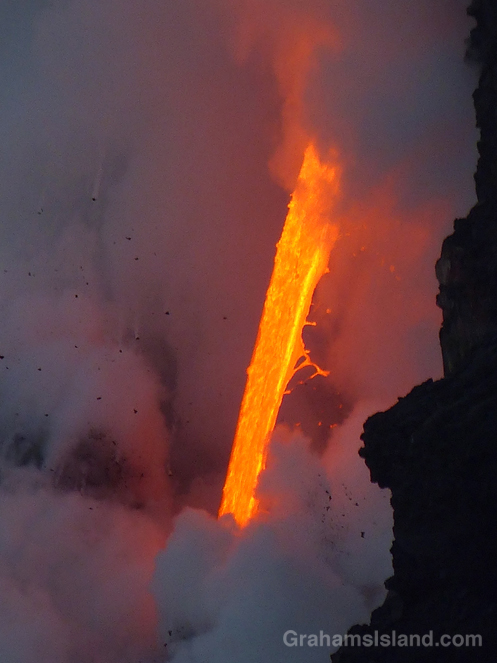
Since the theme of this week’s WordPress photo challenge is elemental, I thought I’d pull out a few more photos from my visit, earlier this year, to the lava flow from Kilauea’s Pu’u O’o vent.
This is the closest we get to seeing fire from the earth’s core, a roaring torrent of molten lava. Since I took these photos there have been cliff collapses that have ended this firehose effect. But the lava continues to flow and has formed a good-sized delta at the foot of the cliff. This delta is crossed by several large cracks, which run parallel to the coast. This means the whole delta is likely to collapse into the ocean in the near future, probably in explosive fashion.
Could be time for another visit!
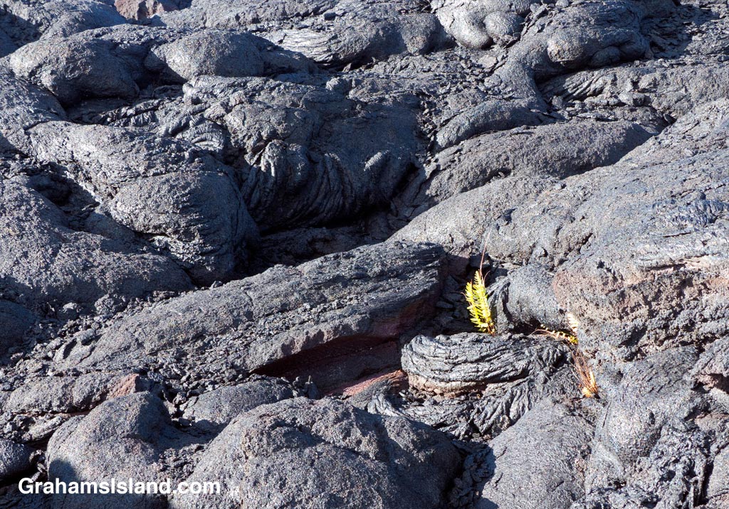
A fern gets a toehold in a field of lava. I like the resilience of the fern, daring to grow in such a hostile place. I also like the texture of the lava, a hard rock and yet crumbly as well. I can almost hear it crunching underfoot.

Mauna Kea is a mecca for astronomers because it boasts clear skies more than 300 days a year. That doesn’t mean Mauna Kea doesn’t get rain, just that it falls more on the lower slopes.
This photo shows the access road, a little way below the summit, socked in with clouds and steady rain. It was a little better at the top, but still very cloudy and not a day for seeing stars.

This week’s posts are in response to the WordPress photo challenge on the theme of ‘transient.’
Despite the tropical latitude of the Big Island, Mauna Kea can get snow at any time of year. It’s always fun to see the mountain with a white coating. In the winter it sometimes sticks around for a while. At other times of the year it’s usually here today, gone tomorrow.

During a recent hike on the Nāpau Trail in Hawaii Volcanoes National Park, one accompaniment was the throb of helicopter engines. The active flow from Pu’u O’o vent, and its ultimate outpouring into the ocean, is a great attraction for visitors and locals alike.
One way of seeing these events is on a helicopter tour and, as I sat at the Nāpau overlook, I noticed there was a clear order to those helicopter visits. A pair would arrive from the west, one a bit behind the other. One would circle the vent, the other visit the ocean entry. Then they’d switch. After 10 or 15 minutes, the two helicopters would head off to the northeast and soon after, the next pair would arrive.
For more information about Hawaii Volcanoes National Park, go to nps.gov/havo/. For more information about Kilauea Volcano and it’s eruptions, go to hvo.wr.usgs.gov/kilauea/history/main.html.
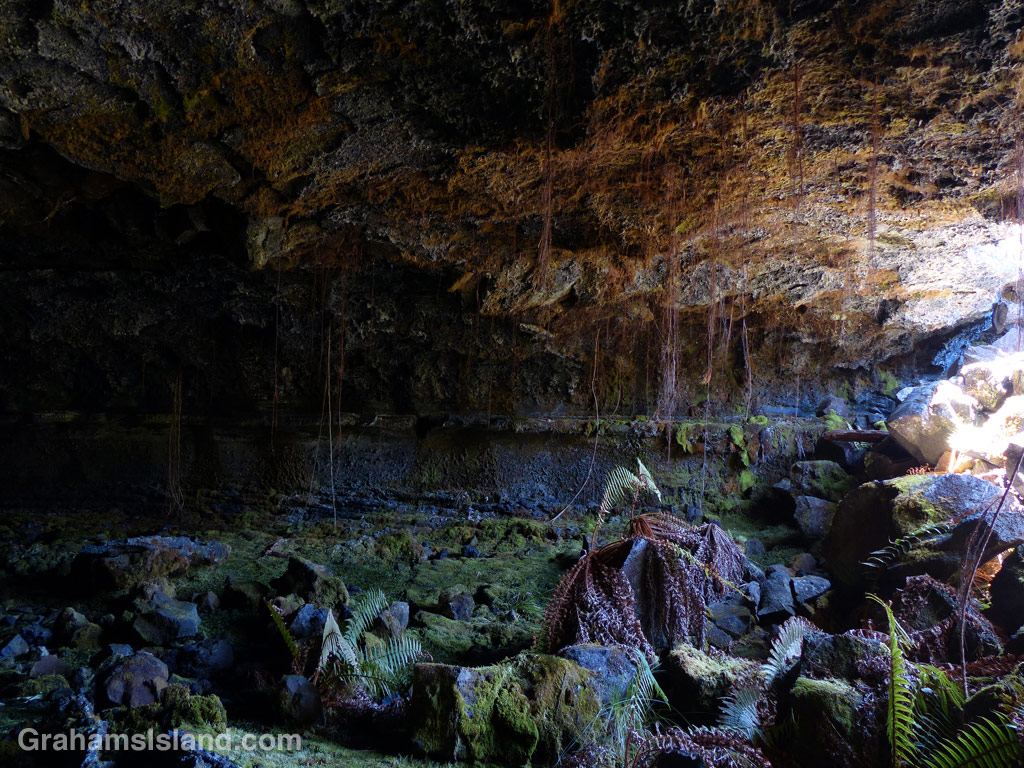
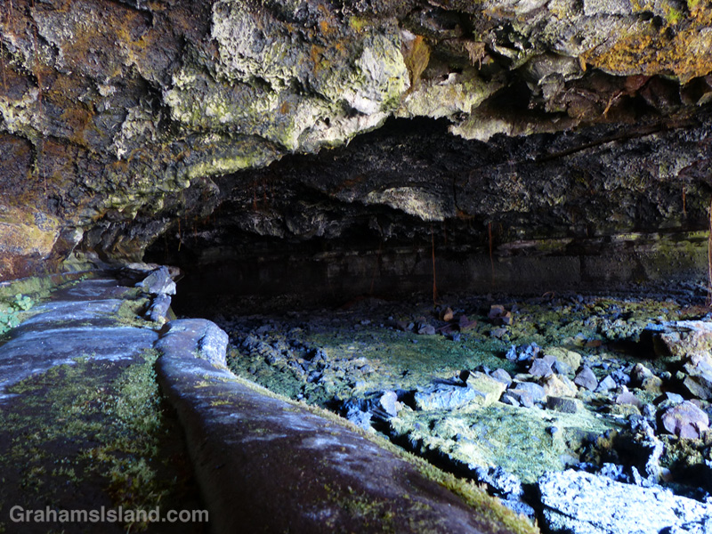
One of the things to look out for on the Powerline Trail, off of Saddle Road, is Emesine lava tube. There’s a sign right next to the trail, though it could be missed if you happened to be looking the other way while walking that stretch. Bear in mind that if you want to explore the lave tube, the sign indicates that you should first get a permit from the State Department of Land and Natural Resources (Division of Forestry and Wildlife).
These photos are from the entrance of the eastern part of the tube, which is the most accessible. The ceiling here is about 4 feet so it’s not for the claustrophobic. Not sure whether it opens up further along, but be sure to take plenty of good lights.
For more information about Emesine lava tube, go to darkerview.com/wordpress/?p=3781.
For more information about the Powerline Trail, go to bigislandhikes.com/puu-oo-trail/.

The Powerline Trail heads south off of Saddle Road around the 22 mile marker. This trail used to be, as the name suggests, where power lines ran, but only the stumps of poles remain. It’s a very straight trail, which used to run all the way to Kilauea until lava flows disrupted it.
This trail is about 3.5 miles long to the point where it meets the Pu’u O’o trail. The southern part of the trail is dotted with kipukas and is shady and alive with birds. However, the northern two miles or so are exposed as the photo shows. The main feature of interest in this stretch is the Emesine Lava Tube about which, more tomorrow.
For more information about this, and other hikes on the Big Island, go to bigislandhikes.com.
