Tag Archives: Lava

Kona lava tube

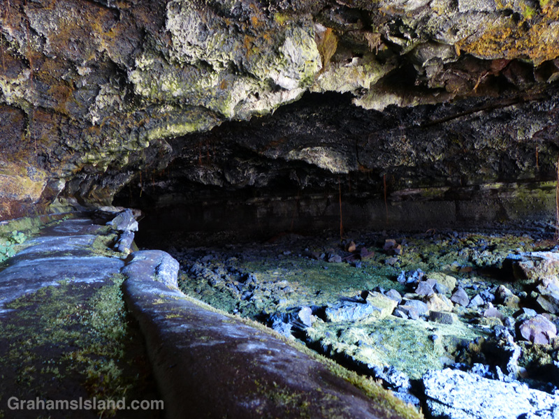
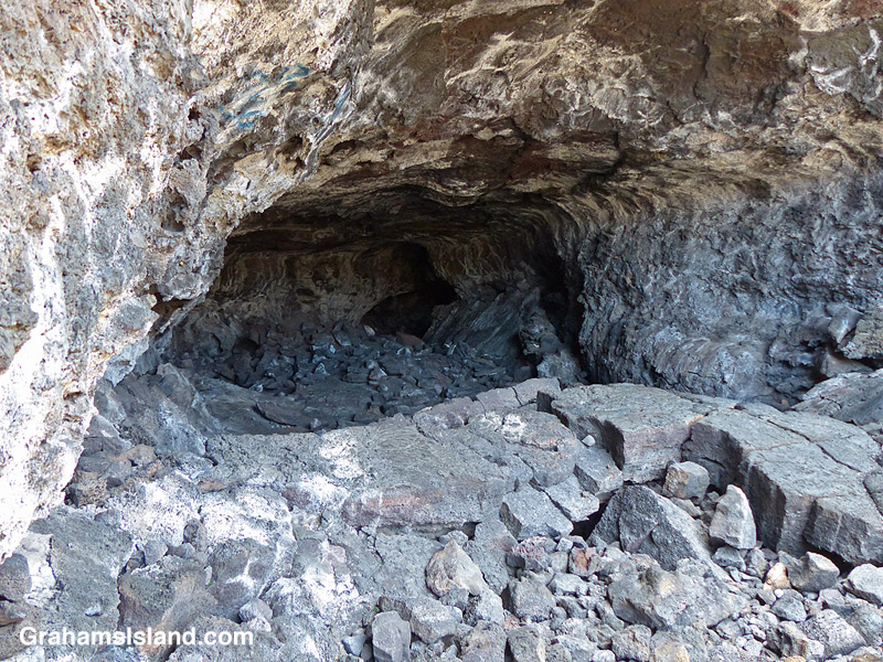
The lava tube north of Kailua Kona Airport.The lava tube north of Kailua Kona Airport.

Probably the most visited lava tube on the Big Island is Thurston Lava Tube in Hawaii Volcanoes National Park. However, the most easily accessible might be one just a couple of miles north of the airport at Kailua Kona.

Just off the main highway, it’s not unusual to see a line of vehicles pulled over and people scrambling over the lava. There’s a well worn path leading down to the entrance of the tube and enough headroom to make access easy. However, it’s worth noting that there are piles of rock strewn around from ceiling collapses and the whole area looks crumbly. I certainly wouldn’t want to be down there during an earthquake. Enter at your own risk!

Fire from the volcano

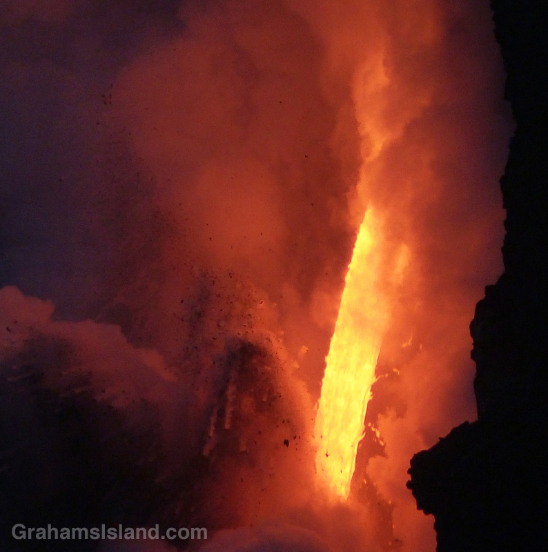
Lava from Kilauea’s Pu’u O’o vent pours into the ocean.Lava from Kilauea’s Pu’u O’o vent pours into the ocean.Lava from Kilauea’s Pu’u O’o vent pours into the ocean.

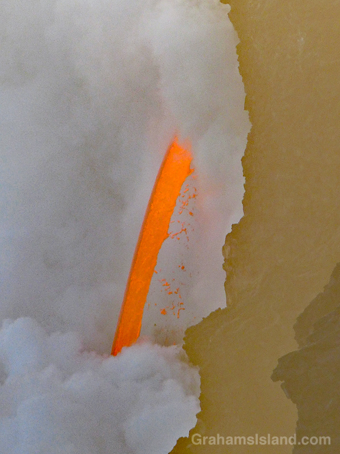
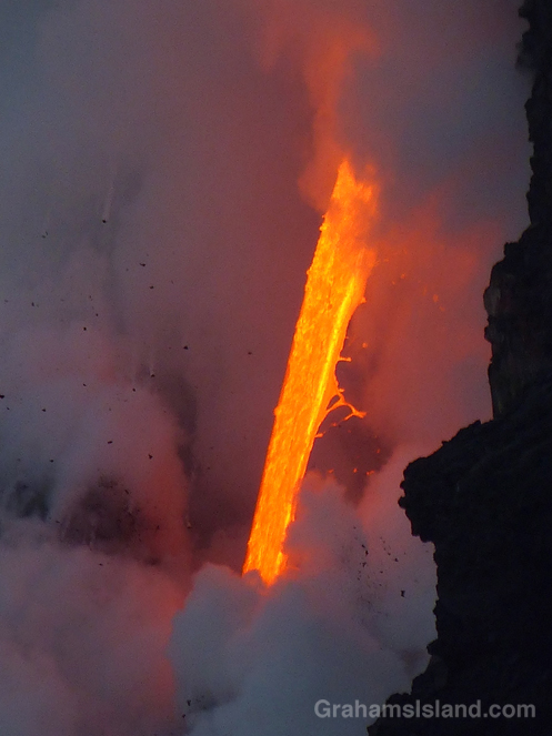
Since the theme of this week’s WordPress photo challenge is elemental, I thought I’d pull out a few more photos from my visit, earlier this year, to the lava flow from Kilauea’s Pu’u O’o vent.

This is the closest we get to seeing fire from the earth’s core, a roaring torrent of molten lava. Since I took these photos there have been cliff collapses that have ended this firehose effect. But the lava continues to flow and has formed a good-sized delta at the foot of the cliff. This delta is crossed by several large cracks, which run parallel to the coast. This means the whole delta is likely to collapse into the ocean in the near future, probably in explosive fashion.

Could be time for another visit!

Lava from Kilauea’s Pu’u O’o vent pours into the ocean.Lava from Kilauea’s Pu’u O’o vent pours into the ocean.

Helicopters circle Pu’u O’o vent

Tour helicopters circle Pu'u O'o vent on the Big Island of Hawaii

During a recent hike on the Nāpau Trail in Hawaii Volcanoes National Park, one accompaniment was the throb of helicopter engines. The active flow from Pu’u O’o vent, and its ultimate outpouring into the ocean, is a great attraction for visitors and locals alike.

One way of seeing these events is on a helicopter tour and, as I sat at the Nāpau overlook, I noticed there was a clear order to those helicopter visits. A pair would arrive from the west, one a bit behind the other. One would circle the vent, the other visit the ocean entry. Then they’d switch. After 10 or 15 minutes, the two helicopters would head off to the northeast and soon after, the next pair would arrive.

For more information about Hawaii Volcanoes National Park, go to nps.gov/havo/.
 For more information about Kilauea Volcano and it’s eruptions, go to hvo.wr.usgs.gov/kilauea/history/main.html.



Emesine lava tube

The entrance to Emesine Lava Tube on the Powerline Trail off Saddle Road.The entrance to Emesine Lava Tube on the Powerline Trail off Saddle Road.

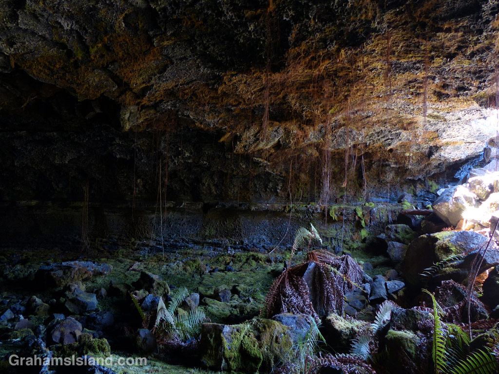
One of the things to look out for on the Powerline Trail, off of Saddle Road, is Emesine lava tube. There’s a sign right next to the trail, though it could be missed if you happened to be looking the other way while walking that stretch. Bear in mind that if you want to explore the lave tube, the sign indicates that you should first get a permit from the State Department of Land and Natural Resources (Division of Forestry and Wildlife).

These photos are from the entrance of the eastern part of the tube, which is the most accessible. The ceiling here is about 4 feet so it’s not for the claustrophobic. Not sure whether it opens up further along, but be sure to take plenty of good lights.

For more information about Emesine lava tube, go to darkerview.com/wordpress/?p=3781.
For more information about the Powerline Trail, go to bigislandhikes.com/puu-oo-trail/.


Powerline trail

The very straight Powerline Trail heads south off of Saddle Road on the Big Island of Hawaii
The Powerline Trail heads south off of Saddle Road around the 22 mile marker. This trail used to be, as the name suggests, where power lines ran, but only the stumps of poles remain. It’s a very straight trail, which used to run all the way to Kilauea until lava flows disrupted it.

This trail is about 3.5 miles long to the point where it meets the Pu’u O’o trail. The southern part of the trail is dotted with kipukas and is shady and alive with birds. However, the northern two miles or so are exposed as the photo shows. The main feature of interest in this stretch is the Emesine Lava Tube about which, more tomorrow.

For more information about this, and other hikes on the Big Island, go to bigislandhikes.com.

The Nāpau Trail – Through the woods

A close up of the Puʻu ʻŌʻō vent of Kilauea Volcano.
A close up of the Puʻu ʻŌʻō vent.
The Napau Trail passes through dense forest.
I met Yogi on the trail just before entering the forest. Here, he makes his way through the dense growth.
Huge Hapu’u ferns line the forested section of the Nāpau Trail.
The old Pulu Factory on Napau Trail.
The old Pulu factory.

Yesterday, I posted about the first part of the Nāpau Trail in Hawaii Volcanoes National Park, which crosses extensive lava fields. Today’s post picks up from there, on the rim of Makaopuhi Crater, where the trail slips into dense forest on its way to the Nāpau Crater overlook.

The Puʻu ʻŌʻō vent from the Nāpau Crater overlook.
Puʻu ʻŌʻō from the Nāpau Crater overlook.

It’s a remarkable contrast between the stark lava and thriving forest. Birdsong is continuous. Ferns of every kind grow in abundance. Bamboo orchids pop out here and there. And above it all, tall Ohia trees provide the backbone of the forest. This forested trail is clear, but somewhat overgrown. I was hiking in shorts and, at the end of the day, my legs were generously scratched.

Early on in this section, it’s possible to get views of Makaopuhi Crater. Also in this area is the junction with the Nāulu Trail, which starts out at the Kealakomo Overlook, farther down Chain of Craters Road.

The forested part of the trail is about 2.5 miles and towards the end of it is an old Pulu factory. The sign there reads: “Between 1851 and 1884 great quantities of pulu, the soft, reddish-brown fiber covering the coiled fronds of the tree fern (hāpuʻu), were harvested on Hawaii. Much of it was processed within these walls, later to be shipped from Keauhou Landing to foreign markets for use as stuffing in pillows and mattresses.” Unfortunately, in drier climates, pulu quickly breaks down so the industry collapsed.

A little farther along is another junction. To the left is the very basic Nāpau campsite, a few open flat areas and an outhouse. To the right, the trail continues to the overlook, where I was lucky enough to have a wonderful, clear view of Puʻu ʻŌʻō, busily pumping out sulphur dioxide and other gases, and of course, million upon millions of gallons of lava, currently entering the ocean on the southeast coast.

Picking the right day for the hike is not always obvious and weather changes quickly around here. At the visitor center, on the way in, it was completely overcast and drizzling, but by the time I got to the trailhead the sun was out and a nice breeze blew. The wind direction is also important. On this day, the northeast trades were blowing and the vog trailed away to the southwest, which is fine for this hike. But if the wind blows more easterly or south of east, then this trail would be downwind of emissions from the volcano, which could potentially be a dangerous situation.

For more information about this, and other hikes on the Big Island, go to bigislandhikes.com.
For more information about Hawaii Volcanoes National Park, go to nps.gov/havo/.
For more information about Kilauea Volcano and it’s eruptions, go to hvo.wr.usgs.gov/kilauea/history/main.html.