Tag Archives: Lava

The Nāpau Trail – Over the lava

A surface lava flow on Napau trail.
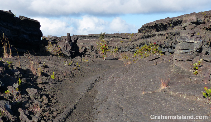
An early part of the trail follows a surface flow down the side of a hill with a small ohia tree toughing it out in the lava.
A lava channel on Napau trail.
In a couple of places the trail goes through sunken areas that channeled the lava.

The Nāpau Trail in Hawaii Volcanoes National Park, is a 13-mile round trip. It passes over extensive lava fields, plunges into dense forest, and ends at the Nāpau Crater overlook. The overlook offers a terrific view (weather permitting) of Puʻu ʻŌʻō, one of two active vents on Kilauea Volcano. In today’s post I’m going to cover the lava fields portion of the hike with the second part coming tomorrow.

From the Mauna Ulu parking area, the first mile or so is a well-trodden trail to Pu’u Huluhulu (hairy hill) cinder cone. The foot of Pu’u Huluhulu is where the Nāpau Trail branches off across the lava. It’s a stark landscape, but with lots of interest. The trail passes over surface flows and through channels where lava rivers ran.

The Park’s website notes that the Nāpau Trail “follows the path that magma takes as it makes its way underground from its source at the summit to the point where it comes to the surface near Puʻu ʻŌʻō.” The many steam vents around Mauna Ulu are testament to this.

And in this hostile landscape, nature is at work. The lava fields are dotted with tenacious plants establishing a toehold.  Ohia trees and ferns are most frequently seen, but grasses and other plants lend color to this sea of gray and black.

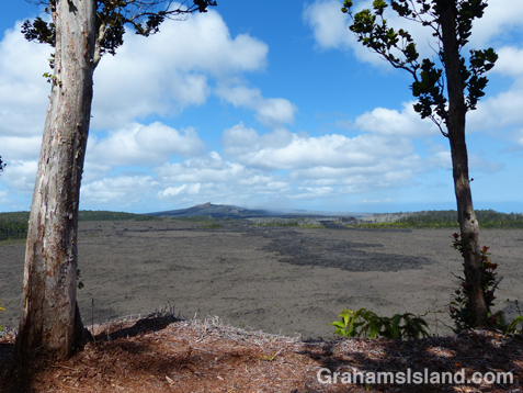
It’s 2.2 miles of unbroken lava from the Pu’u Huluhulu junction to the rim of Makaopuhi Crater, but at that point the trail changes in an almost surreal way. I’ll post that section tomorrow.

For more information about this, and other hikes on the Big Island, go to bigislandhikes.com.
For more information about Hawaii Volcanoes National Park, go to nps.gov/havo/.
For more information about Kilauea Volcano and it’s eruptions, go to hvo.wr.usgs.gov/kilauea/history/main.html.

Steam vents on the eastern side of Mauna Ulu.
Cairns mark the route across an ocean of lava toward Makaopuhi Crater.
Looking down into Makaopuhi Crater.
Looking down into Makaopuhi Crater, which most recently erupted in 1972.

I’iwi

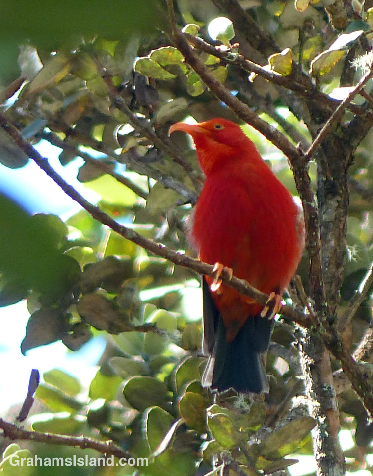
The I’iwi (vestiaria coccinea) is a native Hawaiian honeycreeper
The I’iwi (vestiaria coccinea) is a native Hawaiian honeycreeper, which is still quite common on the Big Island, as well as on Kaua’i and Maui. I saw several while hiking the Pu’u O’o Trail, off of Saddle Road. The fact that they’re bright red and they have a quite distinctive call makes spotting them a bit easier for a non-birder like me.

For more information about the Pu’u O’o Trail, go to bigislandhikes.com/puu-oo-trail/.

Pu’u O’o trail

A kipuka on the Pu'u O'o trail off Saddle Road on the Big Island of Hawaii.
More recent lava flows have yet to be reclaimed by vegetation. The greenery is a kipuka on the trail with Mauna Kea in the background.
A kipuka on the Pu'u O'o trail off Saddle Road on the Big Island of Hawaii.
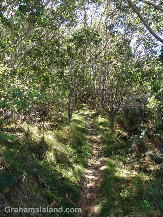
When the trail passes though a kipuka it offers shade and abundant bird calls.
A kipuka on the Pu'u O'o trail off Saddle Road on the Big Island of Hawaii.
An older lava flow has been softened by vegetation.

It took me a while to discover the various trails off Saddle Road. That’s because, from the road, they look like they’re mostly lava with some scrubby vegetation, but this is misleading. The kipukas (areas of land where lava has flowed around leaving it relatively untouched) are full of plants and a haven for wildlife including many endemic species. The whole area is an example of the cycle of destruction and regeneration that shapes this island and, indeed, the Earth.

The Pu’u O’o Trail, off of Saddle Road, has nothing to do with Kilauea’s Pu’u O’o vent. It refers to the Pu’u O’o Ranch on Mauna Loa. The trail was used for moving cattle from one grazing area to another.

The trail alternates between crossing lava flows and passing through kipukas. Depending on the age of the flow, it might have a good deal of greenery on it, but more recent flows are stark lava fields. While the open lava flows offer great views of Mauna Loa and Mauna Kea (assuming it’s a clear day), the kipukas offer shade and are alive with bird calls, most of which I don’t recognize.

After about 4 miles the trail intersects with the Powerline trail and a loop can be made back to the start, or simply retrace your steps. Bear in mind that if the clouds roll in, which they do on a regular basis, the trail is a good deal harder to follow.

For more information about this, and other hikes on the Big Island, go to bigislandhikes.com.

Abstracts: A softer, gentler firehose of lava

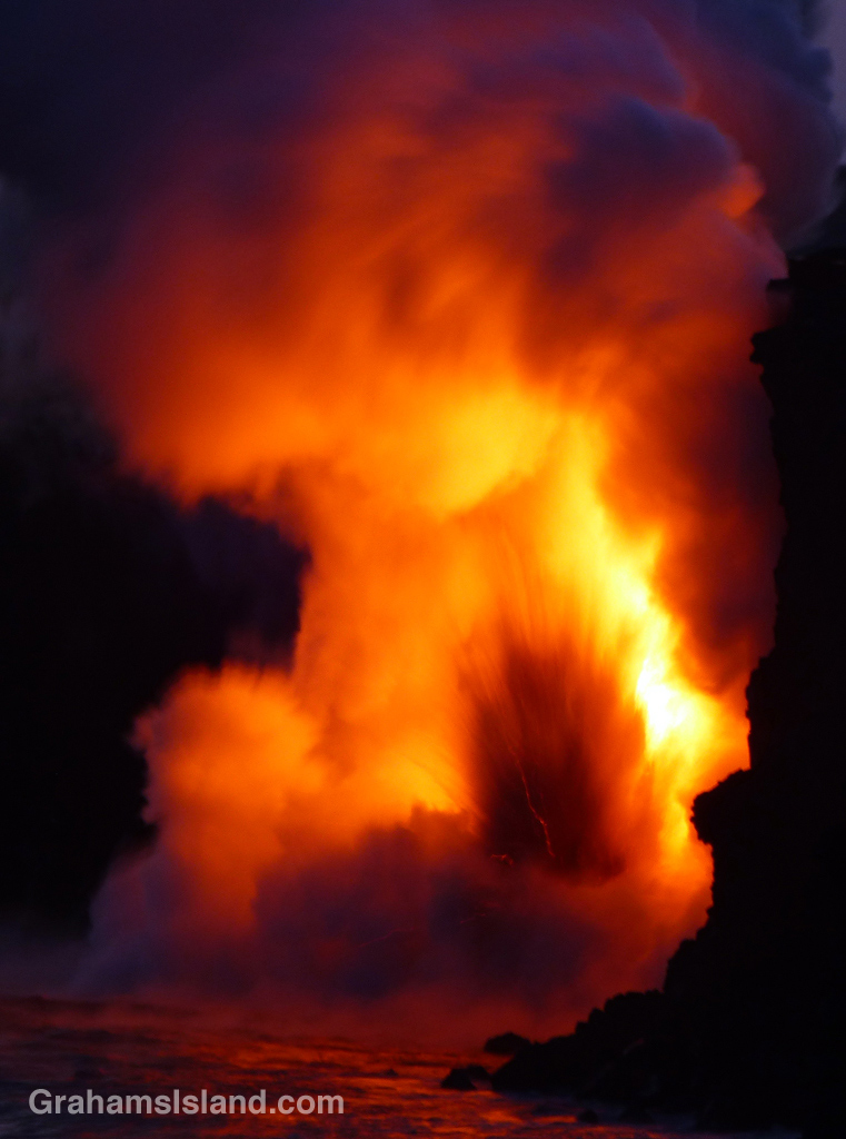
The firehose of lava entering the sea from Kilauea Volcano
One last photo from my trip to see the firehose of lava from Kilauea Volcano gushing into the sea. I tried a few longer exposures and I particularly like the effect of this one. More lava photos here.

For more information about Kilauea Volcano and it current eruption, go to hvo.wr.usgs.gov/activity/kilaueastatus.php.

Firehose of lava at sunset

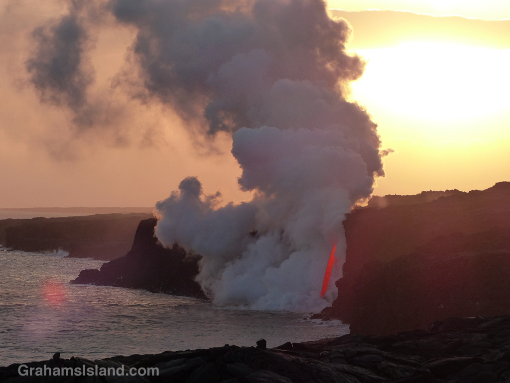
As the sun sinks slowly in the west, a firehose of lava from Kilauea Volcano gushes into the sea.
As the sun sinks slowly in the west, a firehose of lava from Kilauea Volcano gushes into the sea. More photos here. A good video of the firehose, since the cliff collapse, can be found here.

For more information about Kilauea Volcano and it current eruption, go to hvo.wr.usgs.gov/activity/kilaueastatus.php.

Going to the flow

Cyclists head to the Kilauea lava flow where it enters the sea.
I posted here about the current flow from Kilauea Volcano entering the sea, in a dramatic, firehose-like outpouring. In that post, I mentioned that the day after my visit, a cliff collapse caused the firehose to disappear from view. Things have settled down again and the firehose is once more visible, though another large crack not far back from the cliff is expected to cause another collapse soon.

From the Kalapana side, it’s about four miles to the viewing area and a thriving trade in bike rentals has sprung up. When I was down that way last July there were a few bikes available for rent. Now there are maybe 200 or 300 available from a large number of vendors in the parking lot. At the viewing area, bikes were piled alongside the road, and locked in clumps.

I preferred to walk, seeing the towering column of smoke and steam getting gradually larger on the way out, and enjoying a star-studded night sky on my return.

For more information about Kilauea Volcano and it current eruption, go to hvo.wr.usgs.gov/activity/kilaueastatus.php.

Kilauea Volcano’s firehose of lava

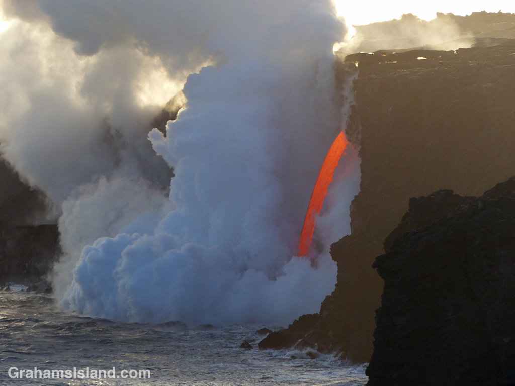
Lava from Kilauea Volcano’s Pu’u O’o vent enters the ocean as if from a firehose.Lava from Kilauea Volcano’s Pu’u O’o vent enters the ocean as if from a firehose.
I’ve posted before (here, here, here and here) about trips I’ve made to see the current lava flow from Kilauea Volcano’s Pu’u O’o vent. Lava first reached the coast on July 26, 2016 and has been pouring into the ocean ever since. However, on New Year’s Eve, much of the newly formed delta collapsed into the ocean taking with it a chunk of the older cliff. As a result, the lava tube carrying the active flow was suddenly left exposed and lava gushed out into the ocean as if from a firehose.

I was aware this was going on, but hadn’t really appreciated what it meant until this past Wednesday. Then, I read a report about the phenomenon, saw some photos, and realized this was something I had to see. Since the weather was favorable and it was early enough, I set out the same day.

After a three-hour drive and brisk hike I got to the viewing area, from the Kalapana side, around 5 p.m. These photos are from that trip. The top photo shows the firehose, lava gushing into the ocean in a constant, unwavering stream. When it hit the water, it generated a series of explosive reactions. The second photo shows the Lava Ocean tour boat nudging in toward the action as one of these explosions occurred. Below is a closer look at the stream with chunks of hot lava being hurled out into the water.

I stuck around until it got dark and then headed home – another hour-long hike and long drive – but it was so worth the effort. This was emphasized when, the next day, another cliff collapse caused the firehose to disappear from view. It might return, since the whole area is unstable, but it might also be gone for good.

I guess timing really is everything and I feel very fortunate that I was able to experience this phenomenon before it was gone.

For more information about Kilauea Volcano and it current eruption, go to hvo.wr.usgs.gov/activity/kilaueastatus.php.
Lava from Kilauea Volcano’s Pu’u O’o vent enters the ocean as if from a firehose.

Growth in the lava

Vegetation has reclaimed a section of the original 1969 fissure of the Mauna Ulu eruption of 1969.
In May of 1969, a series of earthquakes opened a large fissure alongside Chain of Craters Road in Hawaii Volcanoes National Park. This was the beginning of what is known as the Mauna Ulu eruption. For five years, lava poured forth in a series of eruptions. Chain of Craters Road, completed only a few years earlier, was buried for several miles. Landmarks along the road were destroyed or irrevocably altered. A swathe of forest disappeared in flame.

When the eruptions finally ceased, life soon began to reappear on the barren lava landscape. In this photo, vegetation has reclaimed a section of the original 1969 fissure. Roots are anchored in cool, moist cracks in the lava. The tree on the left is particularly striking. Having started out in a crack on a vertical face, it has reached up to the light and is going strong. I like to think it shows how resilient nature can be.

For more information about Hawaii Volcanoes National Park, go to nps.gov/havo/. For more information about Kilauea Volcano and it’s eruptions, go to hvo.wr.usgs.gov/kilauea/history/main.html.