Tag Archives: Mauna Kea

Pu’us

Pu'us on Mauna Kea

In Hawaii, one meaning of the word ‘pu’u’ is ‘a protuberance of some kind.’ This can be anything from a pimple to a hill, but ‘hill’ is the most common usage I encounter, as a general reference or in place names.

Pu’u O’o is the cinder cone that is home to the vent on Kilauea Volcano that was active from 1983 until earlier this year. Pu’u Wa’awa’a is an old cinder cone that is now managed by the Division of Forestry & Wildlife. A common thread is that, in Hawaii, a hill is a cinder cone because all of Hawaii is volcanic and the landscape is liberally dotted with cinder cones.

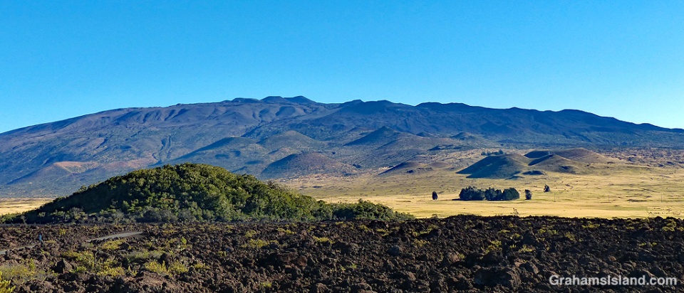
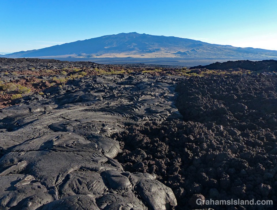
The top photo shows Mauna Kea and the large array of pu’us on its southern slopes. In the foreground is Pu’u Huluhulu, which means hairy hill. There’s a trail to the top of this pu’u which offers good views of Mauna Kea and Mauna Loa.

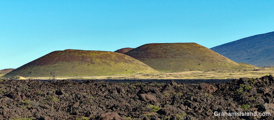
The bottom photo shows grassed over pu’us in Pōhakuloa Training Area, which is a military base located in the region between Mauna Loa, Mauna Kea and Hualālai volcanoes.

On the Big Island, several pu’us are accessible to hikers, usually with a trail curving up to the top and then around the rim of the pu’u. Even if the pu’u isn’t that high, it invariably stands out from its surroundings and offers good views.

Pu'us between Mauna Kea and Mauna Loa

Civilian Conservation Corps Cabin on Mauna Kea

CCC Cabin and water tank Mauna Kea

This Civilian Conservation Corps (CCC) Cabin is one of seven that were built around Mauna Kea in the 1930s. The CCC was a public work relief program to create jobs during the Great Depression. It focused on the conservation of resources on government-owned lands.

The seven cabins on Mauna Kea were used by crews working on the construction of sheep-proof fencing. The goal was to remove sheep from parts of Mauna Kea in order to protect the high-elevation dry forest which was rapidly being destroyed.

This cabin is just above the Palila Forest Discovery Trail on the southwest slopes of Mauna Kea.

Posted in response to this week’s Sunday Stills challenge on the theme of ‘Work.’ See more responses here.

CCC Cabin Mauna Kea

A’a and pahoehoe lava

A'a and pahoehoe lava

This photo shows the two main types of lava found on the Big Island. On the left is pahoehoe lava and to the right, a’a lava. They’re noticeably different. Pahoehoe lava is typically rounded and smoother, and the height of the flow is quite modest. A’a flows are characterized by a rough, clinker surface and the flow height is greater. Both types of lava can be produced by the same eruption and even in the same flow, depending on conditions.

Pahoehoe flows occur when lava is hot and fluid. Typically, pahoehoe flows result from an eruption that outputs lava at a lower rate, has a lower flow rate and a slower moving flow front. The slower movement of the flow allows a skin to form on the surface and this insulates the lava within. The flow is actually made up of a large number of ‘toes.’ Each toe flows for a short time, a matter of minutes. When it stops, the lava inside causes the toe to expand until the skin cracks and releases a new toe.

A’a flows are more viscous, but with a higher flow rate and faster flow front. The lava in the center of the flow is very dense with a layer of rough clinker on top. As the flow advances, the front tumbles over itself breaking into more rough pieces.

It’s easy to see from the photo that walking is much easier over pahoehoe lava than a’a lava. That’s when it’s cooled of course. When it’s red hot and flowing, it’s best not to get too close.

This flow was on the north side of Mauna Loa, looking across to Mauna Kea.

For a more thorough description of the difference between a’a and pahoehoe lava, go to http://volcano.oregonstate.edu/book/export/html/131

Wind turbines crank out the power

Wind turbines Hawi and Mauna Kea

This week’s Sunday Stills challenge is ‘Drunk with .…’ I thought about a photo of my liquor cabinet, but settled instead for ‘Drunk with Power,’ a reasonable choice in these turbulent times.

Hawi Wind Farm began operations in 2006 and has 16 turbines churning out 10.56 MW. This power is supplied to Hawaii Electric Light Company, which runs the power grid on the island.

My interest in the wind farm is mostly visual. I like the patterns that the turbines make, and every once in a while the telescopes of Mauna Kea can be seen in the distance.

See more Sunday Stills responses here.

Wind turbines Hawi

Smithsonian Submillimeter Array

Smithsonian Submillimeter array

Smithsonian Submillimeter array dishesSmithsonian Submillimeter array dishes with textAnother response to the last edition of the WordPress photo challenge with a theme of ‘All time favorites.’

I post this for two reasons. The first is that recently I had an exchange on this blog with the wife of the Director of the Submillimeter Array (SMA). The second is that Mauna Kea is a favorite place of mine to visit.

So here are a couple of photos of the SMA taken a few years back. The dishes are mounted on those little round pads in the photos, and they can be moved to different pads to produce different configurations. In my ignorance of most things scientific, I marvel at the idea of moving a dish a few meters makes a big difference in observations of things way the heck out there in space. That’s not an official measurement there.

The top photo shows seven of the eight dishes that make up the array.
The other photos, of three dishes and what immediately popped into my head when I saw them, show why I never made it as a scientist.

For more information about the Submillimeter Array, go to https://www.cfa.harvard.edu/sma/.

Hawaii ‘elepaio

Hawaii Elepaio

Hawaii Elepaio on a branch
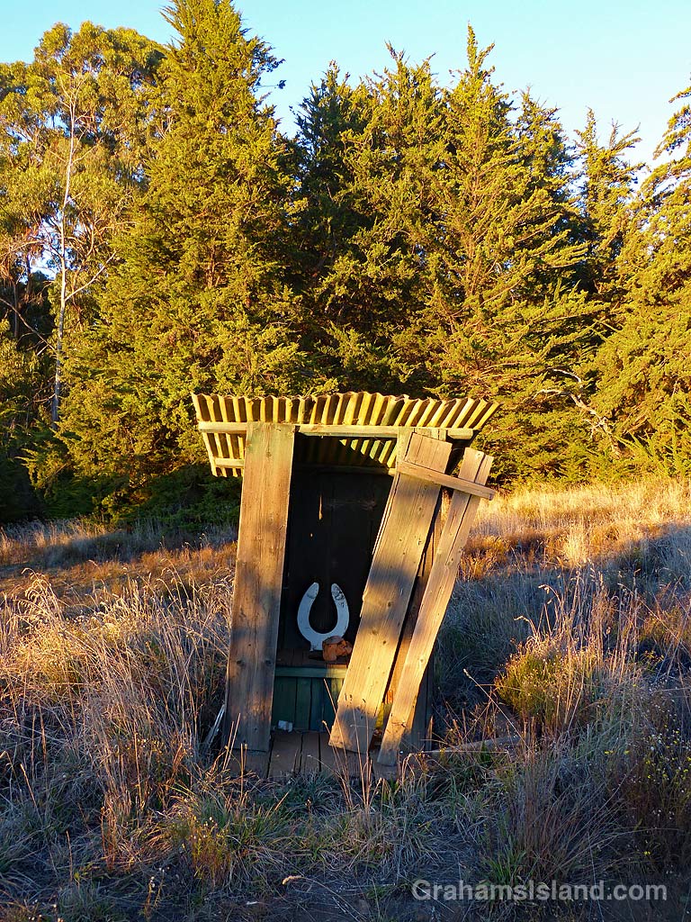
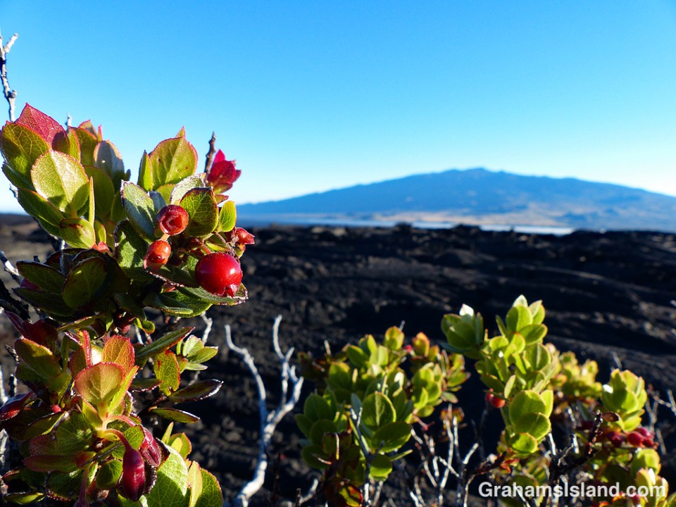
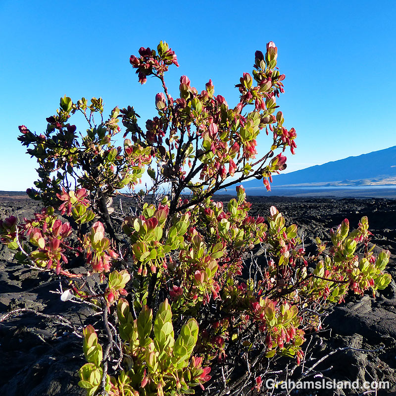
On the first decent day after a long spell of grey, wet weather, I headed up to the Palila Forest Discovery Trail, just off Saddle Road on the lower slopes of Mauna Kea. I figured that even if the weather let me down, it’s a drive that I enjoy, so it would be OK regardless.

However, the closer I got to my destination, the less promising it looked. When I got to the junction, where a 4-mile dirt road leads to the trailhead, I almost turned around since it seemed unlikely there would be anything to see. The mountain looked shrouded in cloud, but since it’s only a 15-minute drive and the road didn’t look too muddy or washed out, I thought I’d give it a go.

When I pulled into the deserted parking area, the sky was grey, the air was damp, but it wasn’t actively raining and the visibility was OK, so I set out on the mile-long loop trail. As usual, I could hear a fair number of birds. It’s just spotting them that’s the trick there. But there are a couple of places on the trail that seem to get a lot of action and this day was no exception, including my first photos of a Hawaii ‘elepaio (Chasiempis sandwichensis sandwichensis).

Oahu, Kauai, and Hawaii Island each have their own species of the endemic ‘elepaio, which is a member of the flycatcher family. The Big Island version is more boldly marked than the other two and this one obligingly set down in a mamane tree not too far away, affording me a decent view and the opportunity to take photos.

One tidbit that I found interesting about the bird is that when ‘elepaio were seen to frequent a given koa tree, this was a sign to canoe makers that the tree was likely insect infested and unsuitable for making a canoe.

For more information about Palila Forest Discovery Trail, go to dlnr.hawaii.gov/restoremaunakea/palila-forest-discovery-trail/.

Posted in response to this week’s WordPress Photo Challenge ‘Unlikely.’