When I’m out walking, I rarely see praying mantis egg sacs. They’re no more than an inch long and they can blend in with the trees and branches where they tend to be found. However, on a recent walk on the coast, I saw these three sacs in the space of 20 minutes, the top two on branches and the third on a tree trunk.
I’m not sure why they caught my eye, though this is the time of year when they’re typically seen. Perhaps it was because I was watching for butterflies and dragonflies, so was paying a bit more attention to details than usual.
Each sac can contain up to 300 eggs. The eggs are encased in foam, called ootheca, which hardens into the sacs seen here. The sac in the middle photo was crawling with ants, which I suspect is not good news for the would-be mantises inside.
Chain of Craters Road is the route down to the coast in Hawaii Volcanoes National Park. As the name implies, it passes a variety of volcanic craters, which were the scenes of eruptions in years gone by. But as it gets close to Hilina Pali, a series of great views open up. This one looks to the west and southwest, the backcountry part of the park.
For more information about Hawaii Volcanoes National Park, go to nps.gov/havo/.
The current Friendly Friday challenge theme is ‘Something Different.’ See more responses here.
I think in my 6+ years of doing this blog, I’ve posted exactly one black and white photo. So a selection of black and white scenes seemed like a suitable response for this challenge.
The top photo is of morning clouds scudding over Mauna Kea as seen from the top of Pu’u Wa’awa’a. Second is a shot of surf crashing against an old wharf in North Kohala and, yes, I was secretly hoping the man on the wharf would get soaked! Third is a tenacious tree on the coast near Kawaihae. The bottom photo shows a small fishing boat in the ʻAlenuihāhā Channel, as seen from the North Kohala coast.
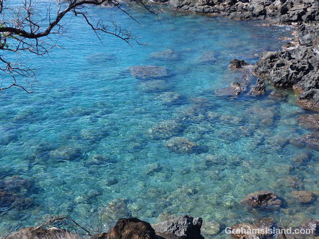
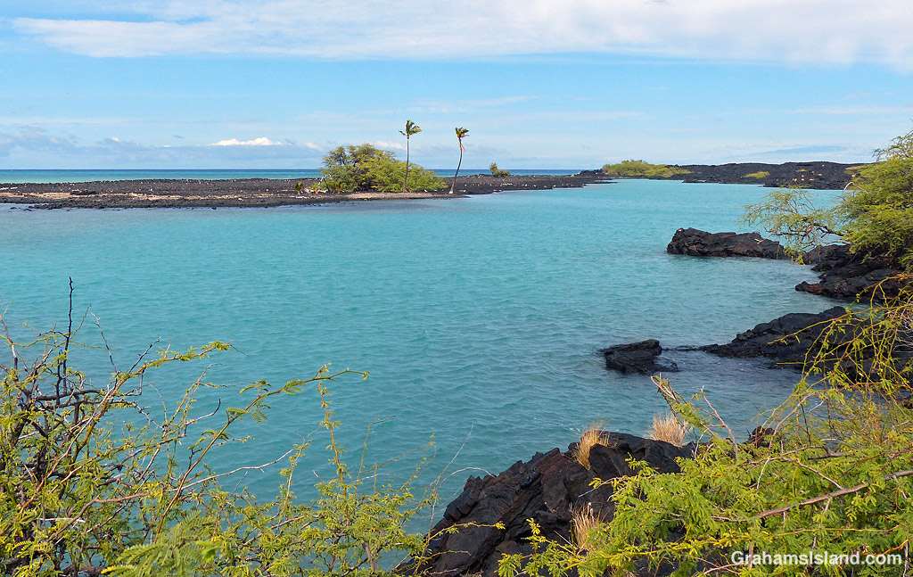
That isn’t the name of this little bay, but it could be. The wind was howling offshore and it was spritzing with rain from clouds that were several miles away. But the bay was calm and blue and inviting.
Posted for Bushboy’s Last on the Card photo challenge. See more responses here.
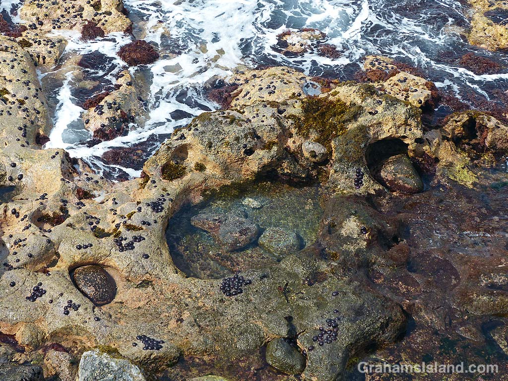
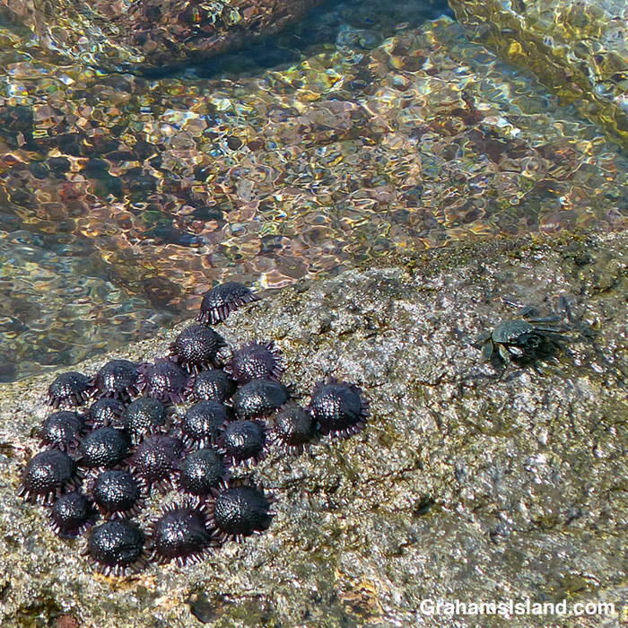
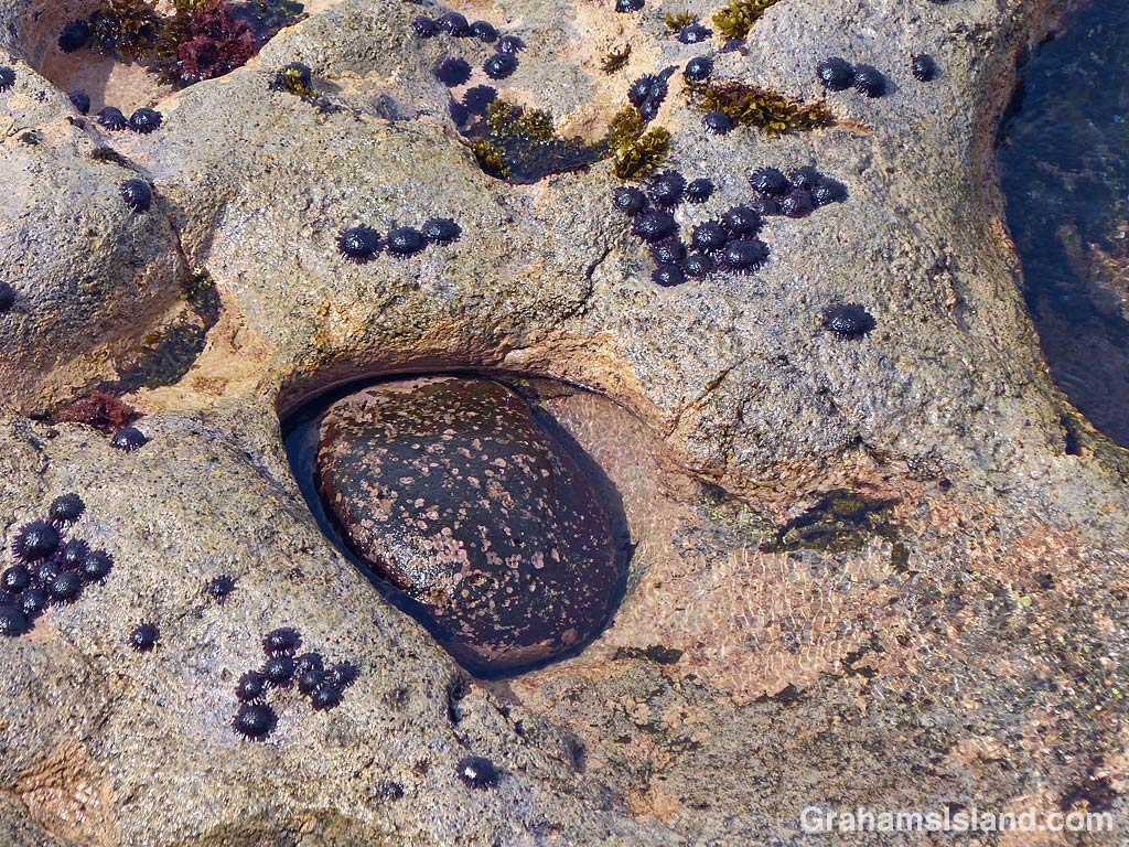
This scene drew my attention because of the smooth, round rock nestled into a matching recess in the shore (bottom left in the top photo). It was when I zoomed in (bottom photo) that I noticed the large number of helmet urchins stuck to the shoreline. These cheerful-looking purple blobs live in the harsh tidal zone, and area of crashing waves and surging water. They feed on algae that grows there.
In the middle photo, an a’ama crab skirts a colony of urchins. When the tide comes in, the crab will move to higher ground, but the urchins will stay put, tenaciously defying everything the ocean throws at them.
Kiholo Bay sits midway between Kailua Kona and Kawaihae on the west side of the Big Island. There are two main access points to the bay. One is via a gravel road south of the Kiholo Scenic Overlook on the main highway. This road takes you down to Kiholo State Park Reserve where there’s a campground and access to the beaches. I usually go that way, but on my last visit I wanted to try the hike from the main road.
There’s an unmarked parking area north of the scenic overlook. From there it’s about a mile to the coast, along a dirt and gravel road. This passes through scrubby trees where it’s likely goats will be encountered. They’re abundant in this area. The private property alongside the road is well marked, as is the public trail through to the beach. This trail comes out near a funky building decorated with things the tide washed in.
I headed to the right, along the beach towards Wainanali’i lagoon. There are a couple of houses along here, a palm-circled pool, and usually a canoe or two under the trees. Beyond the houses, a small bridge traverses a channel which connects the ocean to Wainanali’i fish pond. This is believed to have been built by King Kamehameha I, as part of an extensive fish collection and farming operation in the bay.
A bit farther along, a blue Kiholo Bay Fisheries Management Area sign marks where the trail forks. To the right, inland, it follows the old King’s Trail to Keawaiki. To the left, it hugs the shoreline heading north alongside Wainanali’i lagoon (top photo). The trail is loosely marked with white coral and/or cairns, but it’s not vital to follow them. I stick to the shoreline.
The lagoon is the remnant of a much larger fishpond, which was around 2 miles across and protected by a 20-foot wide lava rock wall. Much of it was destroyed by a lava flow from Mauna Loa’s 1859 eruption. Today, the lagoon is a prime area for seeing green turtles. They haul out on a rocky island marking the mouth of the lagoon and on the spit that separates it from the ocean. This is where they rest so it’s important not to get too close and disturb them. I also usually see turtles in the water. They putter along the edge in blue-green water, which can give them a wavy appearance. Small fish are abundant here and are often seen.
Once at the head of the lagoon I watched humpback whales splashing and slapping offshore. It’s possible to walk down the spit (not disturbing the turtles), and if it’s calm you can wade or swim across the lagoon entrance back to the trail. Following the coast northwards will take you to Keawaiki, but I retraced my steps until I got back to where I first reached the coast. Then I carried on along the beach.
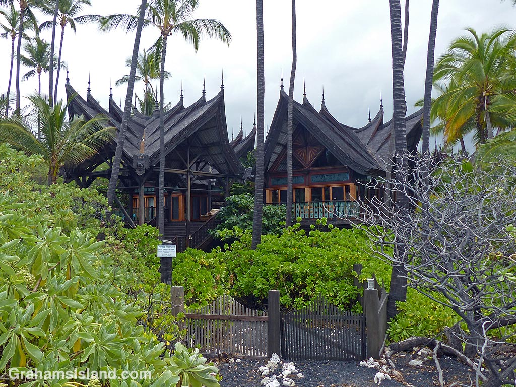
The waves were rolling in, good news for surfers. The beach here is sandy and vegetation borders it. If the tide’s in a bit of paddling is required. On the other side of this, some private houses border the beach including the Bali House and a sprawling, yellow structure. Farther along is the parking area for Kiholo State Park Reserve, back in the trees, followed by the Loretta Lynn house and the campground.
Here, along with several places along the walk, a fair number of birds can be seen including black-crowned night herons, wandering tattlers, Pacific golden plovers, yellow-billed cardinals, and northern mockingbirds.
The southern end of the park is marked by Waia’elepi anchialine pool. Anchialine pools form in volcanic rock and are connected underground to the ocean. The water is brackish, but the pools can be home to a wide variety of species. I saw goats drinking here as well as a variety of birds and insects flying about.
From there, I headed back to the car on the gravel road which parallels the coast and connects to the trail I came down on. My walk was about 5 or 6 miles, but I took more than 4 hours to cover that distance since I do tend to stop a lot!
For more walks worldwide, see Jo’s Monday Walks. Also posted in response to the current Friendly Friday challenge theme of ‘On The Way.’ See more responses here.
When I was down at Kiholo recently, I saw this wandering tattler at the shoreline, hunting around for a bite to eat. I followed it for a while, from a distance.
It snagged a katydid at one point (second photo), but I didn’t see it catch anything else. It spent a fair amount of time around one particular rock (third photo), which caused a good deal of consternation for the a’ama crab that was there. I think the crab was a bit too big to fall into the category of prey for this particular bird.