Category Archives: Volcanoes

Canada-France-Hawaii-Telescope on Mauna Kea

A view from the Canada-France- Hawaii Telescope on Mauna Kea
From the CFHT catwalk, some of the other telescopes atop Mauna Kea. From left: CalTech Submillimeter Telescope, James Clerk Maxwell Telescope, Smithsonian Submillimeter Array, Suburu Telescope, W. M. Keck Observatory (I and II), and the NASA Infrared Telescope Facility.
The interior of the Canada-France- Hawaii Telescope
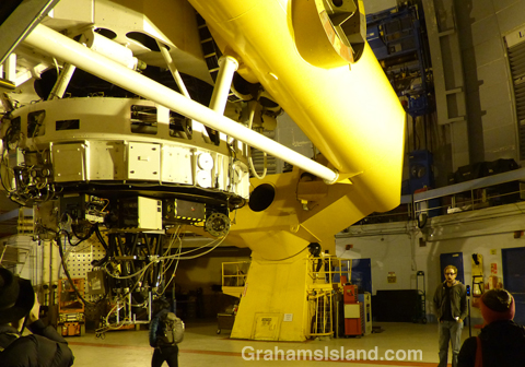
The steel arms attached to the giant horseshoe, which enable the telescope to pivot. The telescope itself is in the vertical plane, with the mirror in the circular enclosure at the bottom, surrounded by instruments.
The interior of the Canada-France- Hawaii Telescope
The huge steel arms which support the telescope.
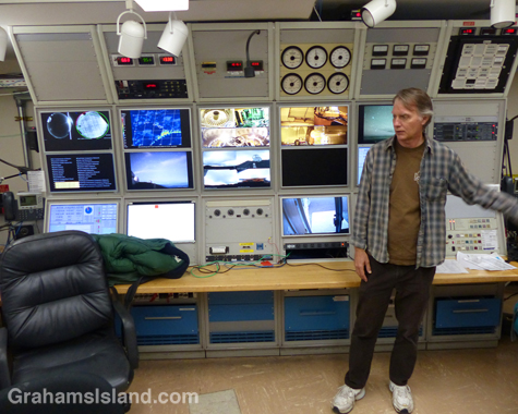
Doug Simons, Executive Director of the CFHT, explains details of the telescope’s control room. Note the analog instruments, above and to the left of his head, which register conditions outside the building, a reflection the telescope’s late 1970’s roots.

The Kama‘āina Observatory Experience was introduced by President Obama at the White House Astronomy Night in October 2015. The idea is for people who live on the Big Island and elsewhere in the state, to have an opportunity to visit the telescopes and learn a bit about what they do, as well as learn about the natural history and cultural significance of Mauna Kea.

Last weekend, I got the opportunity to take part and the Canada-France-Hawaii-Telescope (CFHT) was the first telescope visited. The telescope dates back to 1979 as is seen in the massive steel arms of the telescope and some of the instrumentation in the control room – love those analog weather instruments in the top row.

The age of the telescope doesn’t mean it’s unsuitable for the modern era. CHFT is a 3.6 meter optical/infrared telescope, but while the mirror and its housing is old school, the supporting instruments are the latest in high tech. And nowadays, like most of the telescopes on the mountain, no one needs to be there overnight; they’re operated remotely.

While a good deal of the information went over my head, and out toward the stars, it was a thoroughly worthwhile experience. I’d recommend it to anyone, but you have to be kama‘āina, a Hawaii resident.

For more information on the Canada-France-Hawaii-Telescope, go to cfht.hawaii.edu/
For more information on the Kama’āina Observatory Experience, go to kamaainaobservatory
experience.org/

Reclaiming the lava

A shrub grows in a lava field
Lava flows make for a stark landscape, but I always find it fascinating to see how, even in such barren ground, nature regains a foothold. Here, a small shrub has taken hold in a crack in the lava. Just below and to the left of it, a fern grows under a ledge.

If there’s enough rainfall, as there is in this spot of the southeast coast of the Big Island, vegetation will begin to take hold in a fairly short while. That’s assuming that a new flow doesn’t happen along and put paid to the process.

Pu’u Wa’a Wa’a hike

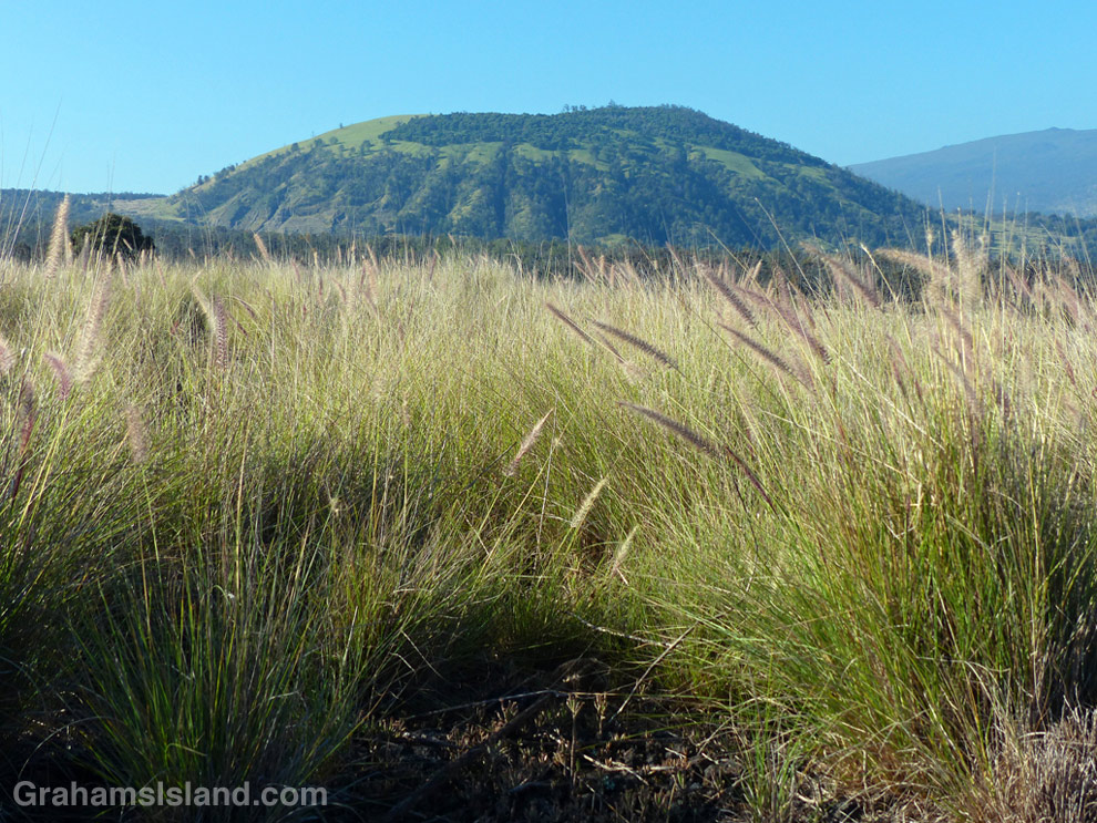
Pu'u Wa'awa'a seen from the trailhead.

Pu’u Wa’awa’a seen from the trailhead over a sea of fountain grass.

This old quonset hut, at the foot of Pu'u Wa'awa'a, was probably an old ranch building.

This old quonset hut, at the foot of Pu’u Wa’awa’a, was probably an old ranch building.

Tamaki Corral was used by the old Pu'u Wa'awa'a Ranch.

Tamaki Corral was used by the old Pu’u Wa’awa’a Ranch. Hualalai is visible in the background, before clouds rolled in.

Pu’u Wa’a Wa’a means “many-furrowed hill.” It’s popularly known as ‘jello mold,’ and is the biggest of several cinder cones on the slopes of Hualalai volcano.

The land is a State Forest Reserve with about 8 miles of hiking trails. The main trail leads to the top of the cone and is about 3 miles each way. The first half follows an old road that passes through a mostly forested area. There’s a good deal of bird life here, more often heard than seen in my experience. The trail then heads up the side of the cone itself in open country, passing old ranch buildings and likely some cattle, horses, sheep and goats.

Once at the top, the views can be tremendous, but an early start is needed. Clouds build up on the slopes during the morning and by midday the view can be fading or gone.

For more information about Pu’u Wa’a Wa’a and its trails, go to puuwaawaa.org.

The smaller Pu'u Iki cone seem from the top of Pu'u Wa'awa'a.

The smaller Pu’u Iki cone seen from the top.

A Mamane tree atop Pu'u Wa'awa'a, with the coast in the distance.

A Mamane tree atop Pu’u Wa’awa’a, with the coast in the distance.

Hike to Kilauea’s lava flow

The Lava Ocean tour boat edges up to the new bench in the ocean, created by the flow from Kilauea volcano.

The Lava Ocean tour boat edges up to the new bench in the ocean, created by the flow.
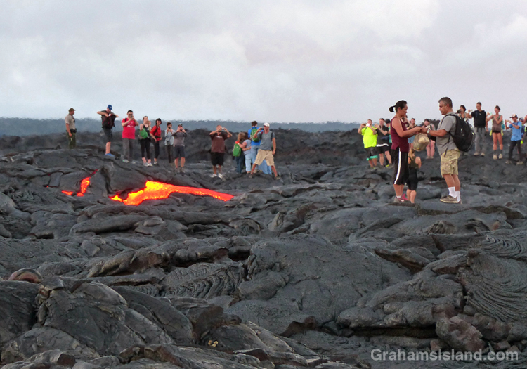
A lava breakout from the Kilauea lava flow.

This photo was taken within a few seconds of this lava breakout beginning. The couple on the right hadn’t yet noticed it.
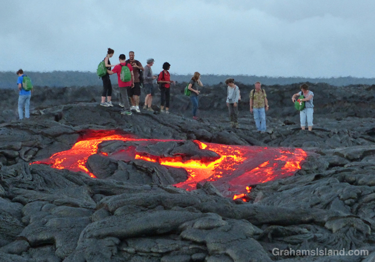
A lava breakout from the Kilauea lava flow.

The breakout spreads …

A lava breakout from the Kilauea lava flow.

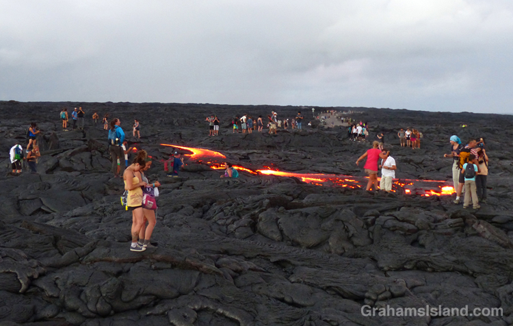
… and extends toward the water. This was about as far as it got while I was there. All these people are standing on the active flow.

Last week, I posted twice (here and here) about a boat trip to see lava entering the ocean from Kilauea Volcano’s Pu’u O’o vent. Since then the ocean entry widened dramatically to more than 700 feet. With all that activity, I thought another hike to the flow was in order. This time, instead of hiking from the viewing area at Kalapana, I decided to go through Hawaii Volcanoes National Park.

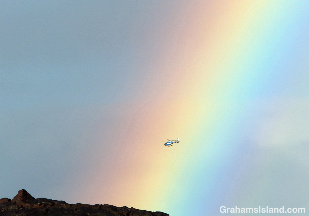
The hike starts on the coast, at the end of Chain of Craters Road. It’s about an 8.5 mile round trip, and follows the emergency gravel road constructed in 2014. While the whole area is a stark covering of old lava flows, I liked seeing ferns and the occasional shrub getting a toe hold in cracks and under ledges. And then, with late afternoon light slanting from behind and rain showers approaching from ahead, a brilliant rainbow lit up the sky.

Regarding the current flow, the USGS website notes that “the entire area presents a significant hazard to visitors.” It goes on to list dangers from toxic gasses, explosive events, and unstable ground. So it was with some surprise that when I arrived, I found the flow crawling with people. This wasn’t because it had suddenly stopped and cooled. At the edge, where it crossed the road, the red glow of active lava could be seen. I talked to one of the park rangers keeping an eye on things. He said all they could do was post signs and try and make people understand the dangers. They had roped off some areas and people just stepped over the ropes. It gave me a warm glow to know that, if someone was injured here, that person would understand it was their own fault and wouldn’t turn around and try to sue the park service for millions.

I wandered down the edge of the flow to the cliff where the new bench being formed by the lava could be seen. Then back to the road and I figured, if everyone else is doing it, it must be safe, right? Ha, ha. The thing is, standing next to the flow, the heat was significant, and stepping on to it, it got hotter still. My feet got distinctly toasty, so I took a couple of photos and turned around. A few minutes later, I happened to be looking in the direction of one of the clumps of people standing on a lump of lava. Suddenly, a river a red burst from near the base of the lump. A breakout, and a decent-sized one at that.

Naturally, the people nearest to the breakout quickly moved away from the danger. Ha, just kidding. People rushed toward the lava because, though the surface was obviously unstable and could turn to deadly, molten liquid at any moment, it probably wasn’t going to happen to the lump they stood on. Frankly, it was all a bit surreal.

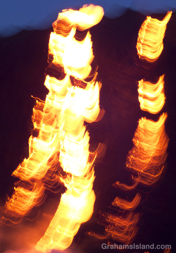
Later, I saw the ranger I’d talked to earlier doing a brisk trade in fixing the detached soles of shoes – flat tires, he called them – where heat from the flow had melted the glue. As the light dimmed, numerous glowing red patches of lava showed up, speckled with white and yellow flashlights as people meandered through the dark.

It was time to go before someone out there misstepped. I had a three hour drive ahead of me and I didn’t want their screams ringing in my ears.

For more information about Kilauea Volcano and it current eruption, go to hvo.wr.usgs.gov/activity/kilaueastatus.php.
For more information about boat trips to see the lava, go to lavaocean.com.

A rainbow rises over the road to the flow from Kilauea Volcano.

A rainbow rises over the road to the flow.

Kilauea lava reaches the ocean – part 2

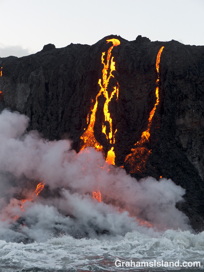
Kilauea lava reaches the ocean in the pre-dawn light.

The lava flow lights up the pre-dawn sky.

A photographer gets close to the flow as Kilauea lava reaches the ocean.

Apparently, you can never be too close to get a good photo of the action.

Kilauea lava reaches the ocean with a surge of steam.

The bottom of the flow, where the lava meets the sea. To the right is the beginning of a new black sand beach created by the activity.

Yesterday, I posted about the background to the trip my wife and I made to see lava entering the ocean from Kilauea Volcano’s Pu’u O’o vent. Today, I have a few more photos from the trip.

The Lava Ocean boat was a good-sized double-hulled aluminum boat and we were on the water around 4:30 a.m.. The trip out, in the dark, was uneventful and we arrived at the flow in dim, pre-dawn light. The bright lava glow cut through the darkness. Tiny figures materialized on the cliff top near the flow.

Once at the flow, the boat slowed and made passes back and forth. A couple of smaller boats were also around. Ashore, figures could be seen perched dangerously close to both the flow and the cliff edge. Several had gathered, with their cameras, on a raised knob of lava to one side of the flow. I hoped those photographers knew the risks they were taking. From their standpoint, they’d know they were near the edge, but from our vantage we could see that the knob they stood on was sharply undercut, a prime candidate to crash down at any time.

Our boat moved about, sharing time near the flow with the other boats, and providing views from different angles. It edged in close to shore, then away again. We could feel the heat from the lava. As daylight filled in, the drama of the glow ebbed, but more detail emerged – clumps of glowing lava tumbling down the slope, waves rushing ashore to explode into steam, and a steady river of lava flowing down the slope to the sea.

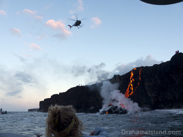
A helicopter from the United States Geological Survey (USGS) joined the scene, making close passes over the area. The USGS surveys Kilauea’s activity regularly and posts daily updates of the situation at the website below.

We were there an hour or so before heading back. The experience was everything we’d hoped, well worth the cost of the excursion. We were lucky that conditions had been good – not too windy and a quiet sea for that area. To top off the trip, on the way back we were joined, for a while, by a pod of spinner dolphins.

Today, the flow has widened and is putting on an even better show, but I’m happy to have seen what we saw, knowing I could check the situation tomorrow or the next day and find out that the flow has stalled, never to resume.

For more information about Kilauea Volcano and it current eruption, go to hvo.wr.usgs.gov/activity/kilaueastatus.php.
For more information about boat trips to see the lava, go to lavaocean.com.

The top of the cliff where Kilauea lava falls to the ocean.

The top of the flow with lava running over the edge. A couple more steps and the man on the right will be one with the flow. Ouch!

A small boat is on hand to see Kilauea lava reaching the ocean.

A couple of smaller boats were at the scene while we were there.

A USGS helicopter checks the progress of Kilauea lava reaching the ocean.

A USGS helicopter joined the scene for a while to monitor the state of the activity.

Kilauea lava reaches the ocean – part 1

Kilauea lava pours into ocean as people watch from the cliffKilauea lava pours into the ocean
On July 9, I posted about a visit to see the latest lava flow (exotically named the 61g flow) from Kilauea Volcano’s Pu’u O’o vent. At that time the lava was less than three-quarters of a mile from the ocean and I figured I’d go back when it got closer to the emergency road (about a tenth of a mile inland) and the water.

That, of course, was the cue for forward progress to cease. The flow was still active, but mostly in breakouts to the side. Day after day the lava was noted as being about half a mile short of the water. I checked again on Sunday, still no change. Monday, I forgot to look. So naturally, Tuesday’s lava report, not seen until the late afternoon, reported that the lava had reached the ocean at 1:15 that morning. Scratch the idea of being present when that happened.

However, my wife and I really wanted to see the lava’s ocean entry from the water and it sounded as though at least one boat tour company, Lava Ocean Guided Tours, was already running trips. A phone call later, we were booked on the sunrise trip the next morning. Check-in time was 4 a.m.. Current time was 5:30 p.m.. Drive time to the launch place is three hours – it’s the far corner of the island. That left seven and a half hours for getting organized and, oh yes, sleep.

Today’s photos show we made it. At the top is the view from the sea, and people ashore perilously close to the flow. Second photo is a frontal view. Below, the morning scene looking toward the sunrise. Tomorrow I’ll post more photos and details, but first, a good night’s sleep is in order.

For more information about Kilauea Volcano and it current eruption, go to hvo.wr.usgs.gov/activity/kilaueastatus.php.
For more information about boat trips to see the lava, go to lavaocean.com.

Kilauea lava pours into the ocean at sunrise