
Kohala by the Sea is an upscale gated community on the northern edge of Kawaihae. What appeals to me in this image is the curvy roads terminating in little asphalt blobs. It gives it an organic feel, which I suppose it is in a way.

Kohala by the Sea is an upscale gated community on the northern edge of Kawaihae. What appeals to me in this image is the curvy roads terminating in little asphalt blobs. It gives it an organic feel, which I suppose it is in a way.

The Kohala Ditch was built in the early 1900s to carry water from the wet slopes of Kohala Mountain, to the sometimes drought-prone sugar cane fields of Kohala. A series of tunnels, flumes and ditches channeled water through ridges and over gullies for a distance of 14 miles.
After the sugar cane industry folded, ditch water continued to be used by other agricultural activities. But this valuable resource was always beset by difficulties. The challenging landscape was prone to landslides and flooding. Flumes were washed away, tunnels blocked. Increasingly expensive and time-consuming repairs did not provide the same economic benefit they once did.
After one such event, a few years ago, the operator of the ditch said it would no longer be repaired and maintained.
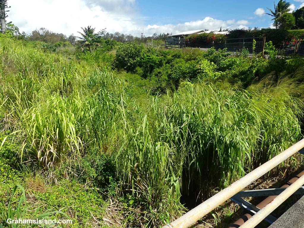

The top photo shows a section of the ditch in 2016. The others show how it looks today, in places, overgrown with weeds and even trees. In some areas it’s more manicured by those living next to it. In the meantime, access to water is a considerable problem, especially as dry weather is increasingly common in the area.
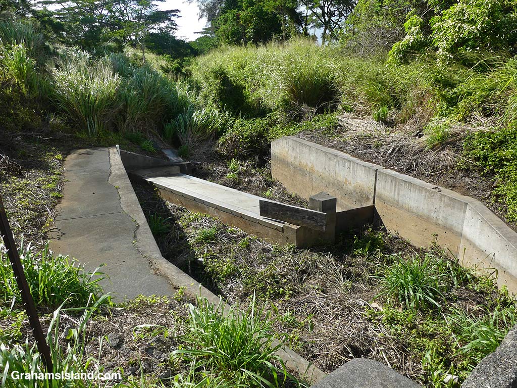


The current Governor of Hawaii knows this region well and money has been earmarked for finding a solution to the area’s water shortage, but when and how that happens is still very much in the pipeline!
For more information about the history of the Kohala Ditch, go to fluminkohala.com/the-kohala-ditch.

This week’s Sunday Stills challenge theme is ‘Fences.’ See more responses here.
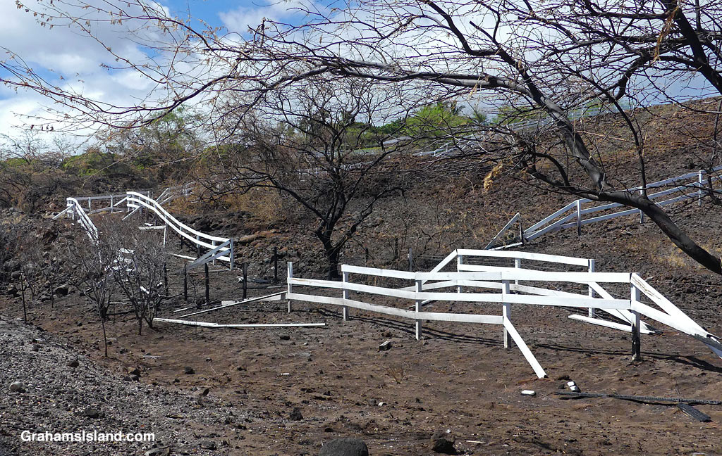
Here on the Big Island, fences tend to be of two kinds – chainlink and painted wood. Walls and hedges are possibly more popular. Walls don’t need as much maintenance and hedges fill in easily all by themselves, though they do require trimming if they’re not to take over.
These fences are ones that have seen hard times. The top photo is the chainlink fence around Upolu Airport. Someone managed to take out a section of this recently. Not sure whether they got distracted or were going too fast and lost control, but several sections of fence got destroyed. Judging from the trail of damage, the vehicle can’t have fared well either.

The other two photos are of fences around Kohala Ranch, a subdivision in Kawaihae. These photos were taken after August’s big brush fire. The tidy white fences surrounding the property have been rather battered. Fixing the damage will be a significant task, though I think most of the folks living there were probably happy to have been spared more than this largely aesthetical issue.
This week’s Sunday Stills challenge theme is ‘Bridges.’ See more responses here.
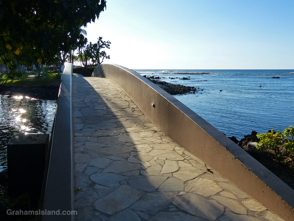
The top image is an elegant bridge on the coast, in the Hilton Resort at Waikoloa. It spans an inlet from the ocean into a lagoon. This bridge is part of the coast path, which is open for anyone to walk.


The Big Island’s main use of bridges is to span the numerous gullies that run from the mountains down to the ocean. On the east side, some of these bridges are quite long and high, with vertigo-inducing views over the edge. These three bridges cross gullies in North Kohala on the winding road from Kapaau to Pololu. The third has several houses nearby, so a walkway has been added. This is surely safer than walking on the road, though not by much judging from its appearance!
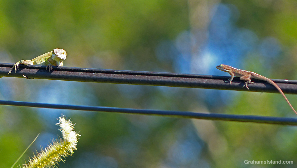
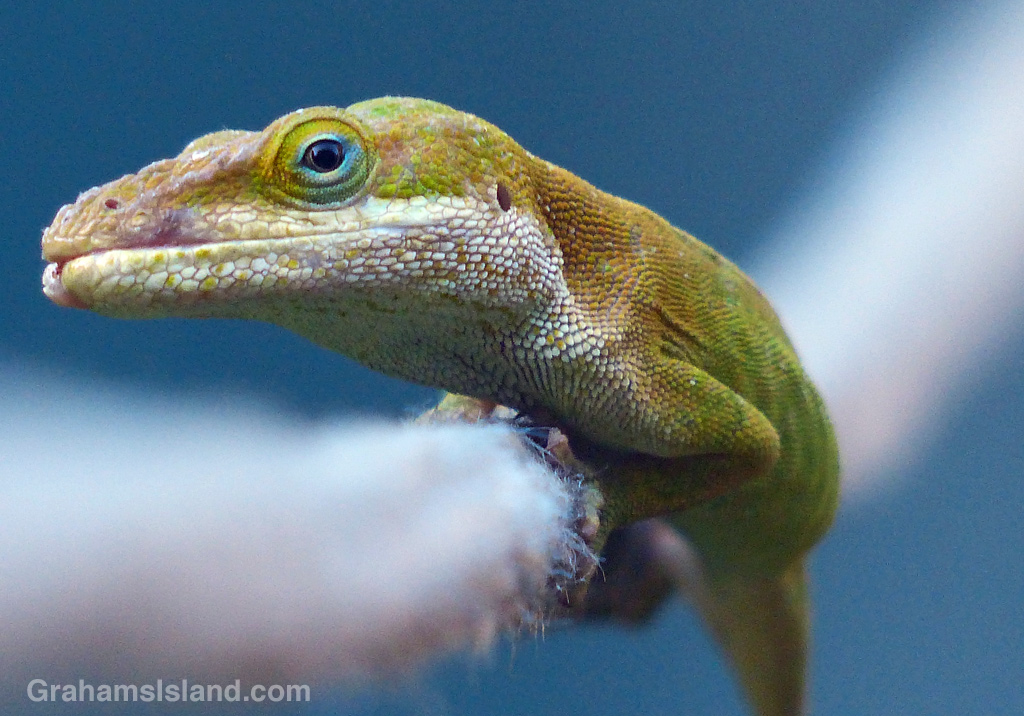
Finally, bridges of a different kind. Anoles and geckos use lines, attached to the house, to get around. Sometimes these one-lane bridges lead to encounters with fellow travelers. In this case the smaller anole leapt off into the cane grass, but that was its intended destination anyway. In the second photo, this anole was using the washing line to bridge the space from the house to a hedge.

This Albizia tree leans precariously over a narrow road in North Kohala. The bottom photo shows the view from below it. I don’t tend to spend much time in that spot in case it chooses that moment to topple over, though the tree hasn’t budged in the 10 years I’ve lived here.

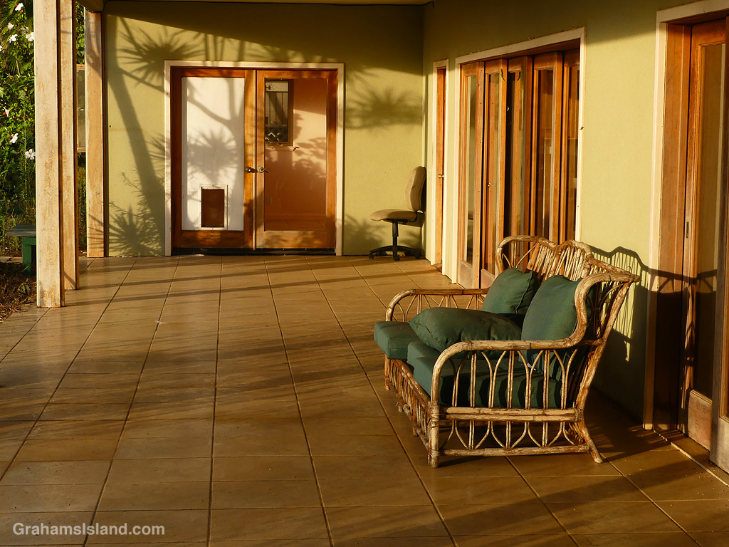
Looks very inviting, doesn’t it? A covered lanai in the late afternoon sun with a comfy, rattan sofa to relax on. The lanai above this is even more inviting, with a view toward Maui, currently blocked by trees.
But this is my neighbor’s old house, currently unoccupied and falling further into disrepair, with broken windows and a floor collapsing. I’d be leery of sitting on this sofa for fear of what’s living in it or that it might collapse. There’s also a chance that the hot tub on the upper lanai, could end up dropping on your head.
So perhaps, like many things these days, this is an invitation best experienced virtually.


Cattle Egrets are usually seen flying or on the ground, in the company of cattle, horses, goats, and lawnmowers, as they forage for food. I saw this one perched on an old snag, and it remained there for some time, looking this way and that, before taking to the air and disappearing.

I was driving home yesterday and I was struck by a contrasting view. The top photo shows the Keanuiomano Stream running down towards the Queen Ka’ahumanu Highway, the main road along the coast from Kailua Kona to the north.
I posted (here) about the river running high a few weeks ago, following the passage of Tropical Storm Calvin. Since then, there’s been a gradual decline in volume, but there’s still a trickle of water and the stream bed is full of pools. This area is popular with the goats, because it’s a good source of water and fodder after rainfall.
Crossing the road, the view is starkly different. The passage of Hurricane Dora triggered strong, dry trade winds. When fires broke out, they spread quickly (here). This view shows the aftermath of one of the relatively small fires, which burned about 500 acres next door to Mauna Kea Resort. The palm trees and houses on the left of the bottom image are part of the resort.
Ironically, when I took river running high photos, I checked out the other side of the highway for possible photos. I didn’t bother taking any, as I couldn’t see much because of the thick vegetation. Now it’s wide open down to the ocean.

