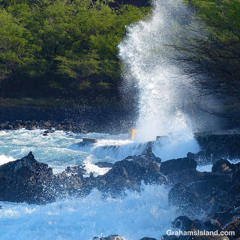
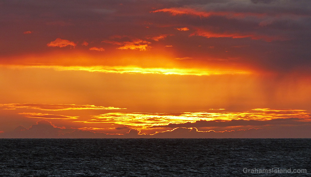
I like to go snorkeling whenever I get the opportunity, but there are some days when that’s not possible. This is a photo of my local snorkeling spot. That’s the parking area on the right, and the place where I generally park my car is right where that tower of spray is.
In other words, this was the kind of day to find something else to do, such as take photos from the shore.
Posted in response to Becky’s October Squares challenge theme of ‘Kind.’ See more responses here.
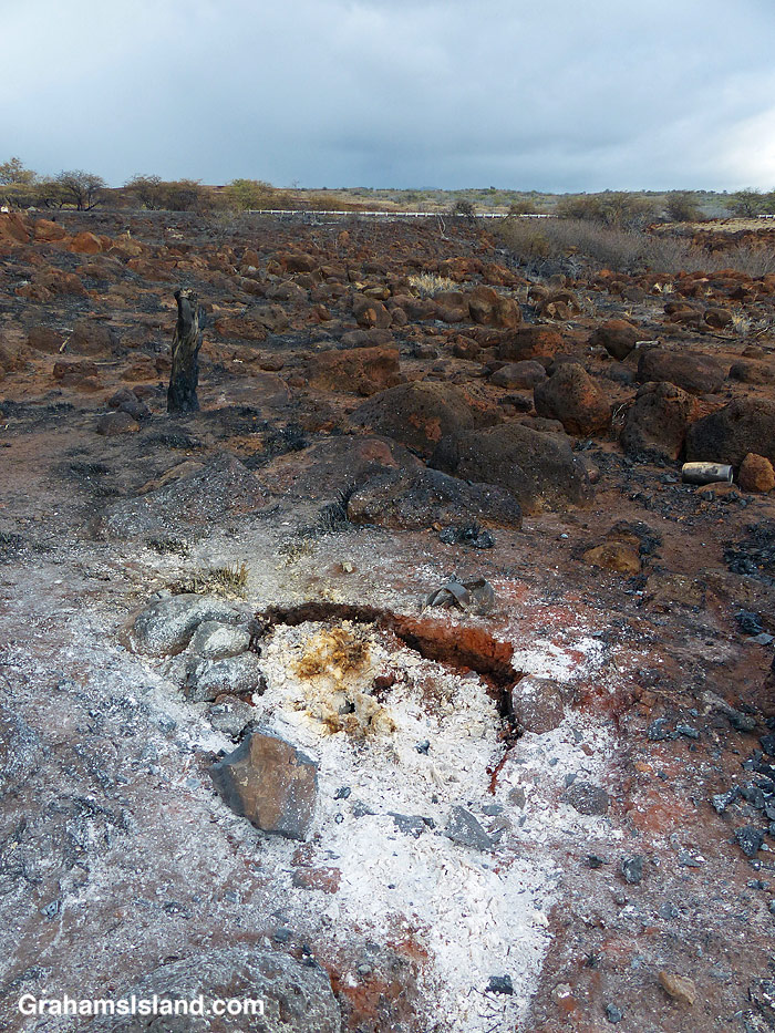
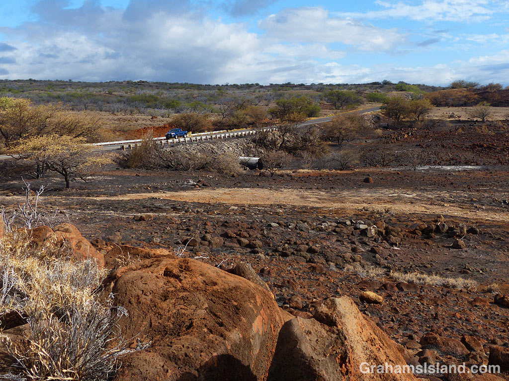
This week’s Sunday Stills challenge theme is ‘Dry.’ (See more responses here.) I posted a photo of one of the local cow pastures yesterday (here), which would have been fine for this topic, but this is another aspect of these unusually dry conditions. It makes the land susceptible to fires.
There have been a couple of fires in the area recently. The first of these was caused by someone setting fire to an abandoned vehicle, which is something of a local sport. These photos were from the aftermath of the second fire. The cause is currently unknown, but about 40 acres were burned. I took these photos a couple of days after the fire happened and there were still some small areas emitting smoke.
The top photo shows burned areas and lighter brown unburned grass. When I walked on this grass it crunched beneath my feet, it’s so dry. The second photo shows a hotspot that was still putting out puffs of smoke. The bottom photo shows burned land next to the highway. In the center of this photo, that large metal pipe is there to channel water beneath the highway. If this seems redundant in this very dry scene, bear in mind that rains in the Kohala Mountains can send flash floods down these gullies and, without pipes like this one, the road could easily be washed out.
This fisherman was waiting for the sea to settle before finding a spot to cast his line. It pays to be careful. People do get washed of the shoreline rocks, but though this photo makes it look like the fisherman is surrounded by breaking waves, he’s actually in a safe spot.
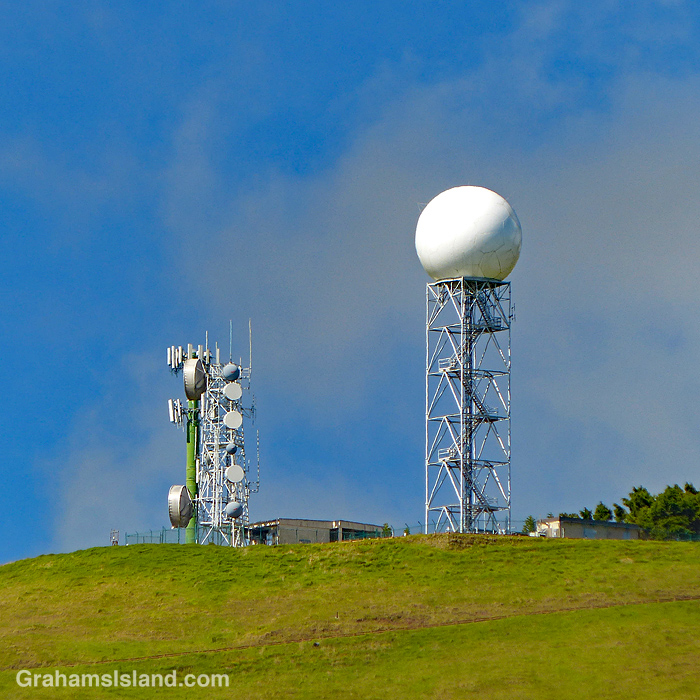
This week’s Sunday Stills challenge theme is ‘Towering.’ See more responses here.
Up near the top of Kohala Mountain is this array of towers. They sit in the middle of pastureland, surrounded by cattle and horses. The one with the large white ball on top is NEXRAD, the Next Generation Weather Radar, which provides current time information showing where clouds and rain are moving through the area. It’s also a navigation aid to local pilots who refer to it as the golfball.
The cattle don’t have access to the information from the golfball, but they know that when they’re wet, it’s raining, and when they’re dry, it’s not, and really that’s all anyone needs to know.
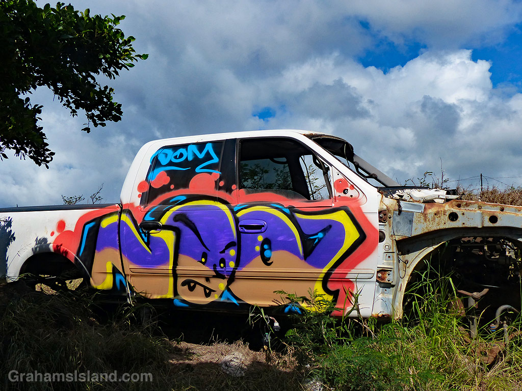
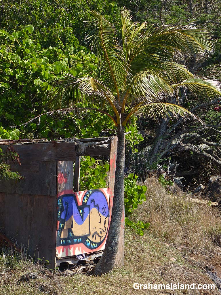
Places and things that have seen better days are likely to be vandalized or tagged with graffiti. On the North Kohala coast, there’s an old fishing shack with a couple of derelict vehicles nearby. At some time in the fairly recent past, the scene has been accessorized with a paint job. I think Noak Dom is the name of the graffiti artist who painted these.
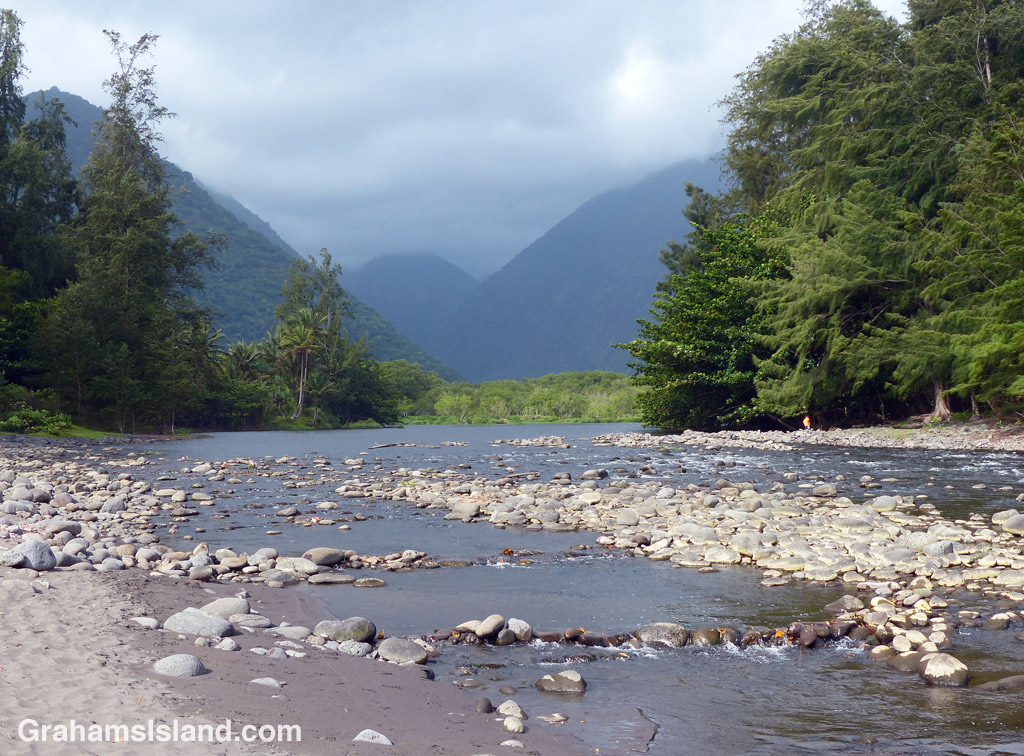
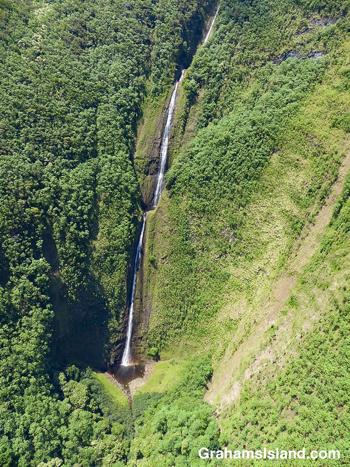
This week’s Sunday Stills challenge theme is ‘Bodies of Water.’ (See more responses here.) Last Sunday, I posted photos of the Kohala valleys. This week, I’m posting a bit about what goes on in them and elsewhere on the island.
The top photo is shows the mouth of the Waipi’o River looking back toward the cloud shrouded Kohala hills. The river, is fed by water passing over Hi’ilawe Falls and other waterfalls deep in the fingers of the valley. Like all water courses on the Big Island, its flow is greatly increased by the often heavy rainfall.
The second photo shows a waterfall, farther down the coast, cascading into a pool at the bottom before flowing out to the ocean. Some of these waterfalls drop more than a thousand feet. Some cascade into valleys, some directly into the ocean. During dry spells, the water flows are greatly reduced and many falls, those that are entirely rain fed, disappear for a while. When rains are heavy, the water flow is so great that some falls blend together to form a sheet of falling water.
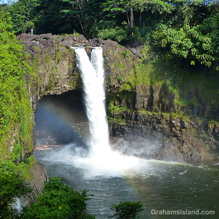
On the east side of the island is Wailuku River, the longest river on the island. This flows down to the ocean in Hilo, and on its way, tumbles over the aptly named Rainbow Falls (third photo). The falls and rainbows are best seen in the early morning. This stretch of the river is very dangerous with flash floods being common. People get swept away here every year.
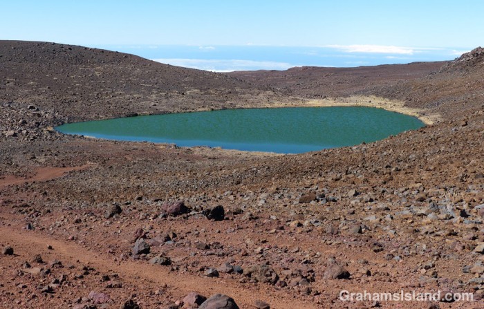
Finally, the bottom photo shows the biggest lake on the island, which can be found at the top of Mauna Kea! Lake Waiau is fed by rainwater and snow melt, mostly in the winter. That it exists at all is something of a mystery. The ground on Mauna Kea is highly permeable, and it’s not fully understood what the layer is beneath Lake Waiau that enables it to retain water. Lake Waiau is not just the biggest lake on the island, it’s the only one. Green Lake, the biggest lake previously, disappeared during Kilauea’s 2018 eruption (photos and story here).
Recently, I stopped to take photos along Kohala Mountain Road. I was leaning against a gate when I glanced to the right and saw this rather large bull lying down in the enclosure. I took some photos, looked over again, and saw the bull stand up. It stared at me. I glanced down at the gate, wondering just how stout it was.
I finished my photo taking, snapped a couple of the bull, and retreated to my car. There’s no doubt in my mind that, should the bull feel like it, neither the fencing, nor the gate would keep it contained. Probably my car wouldn’t fare that well either.