This week’s Sunday Stills challenge theme is ‘Mountains and Valleys.’ See more offerings here.
Kohala Volcano is the oldest volcano on the Big Island and has long been extinct, having last erupted around 120,000 years ago. Since then, the various processes of erosion, from rainfall to landslides, have carved deep valleys into the volcano. Waipio, the easternmost of these valleys, is accessible by vehicle (4-wheel drive only), horseback, or on foot. It has permanent inhabitants so access within the valley is restricted.
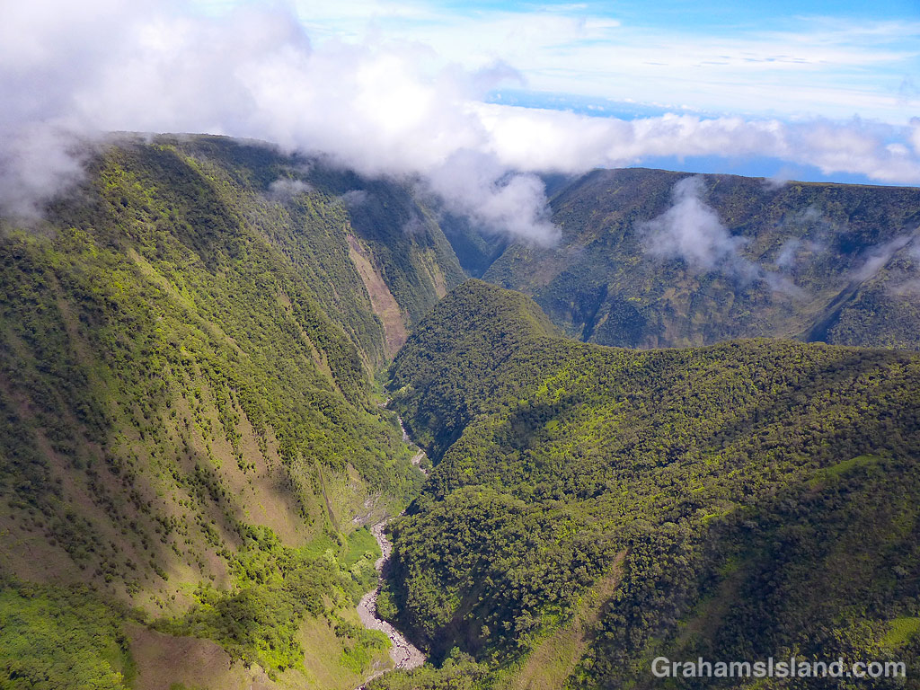
The other valleys are most easily seen from the air, along the Kohala coast. The top photo shows Waimanu Valley. This can be accessed by foot from Waipio, after a long and arduous hike, and permits are available for camping there. Waimanu River can be seen on the far side of the valley and is one last obstacle to be crossed to reach the camp site, which is in the strip of land between the river and the ocean. The steep sides are typical of these valleys and another consideration to keep in mind when thinking about hiking here.
The middle photo shows a fairly typical view directly into one of the valleys from the ocean. Again, notice the steep valley sides and the abundance of foliage, evidence that this is the wet side of the island.
The bottom photo shows valleys cutting through the mountain farther inland. There’s little or no water running in this view. A few valleys have spring-fed streams, but most depend on rain for water flow. However, when it does rain, it can rain long and hard. Flash floods are common. It’s not a shock when campers in Waimanu Valley are cut off and unable to make the return hike.
I’ll do another post about the water courses for next week’s Sunday Stills challenge.
For more information about Hawaii’s volcanoes, go to https://www.lovebigisland.com/hawaii-blog/hawaii-volcano-history/.