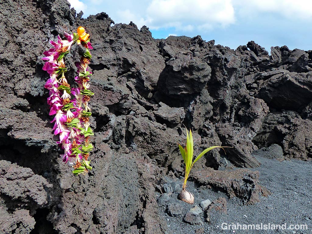
This week’s Friendly Friday challenge theme is ‘Dramatic.’ See more responses here.
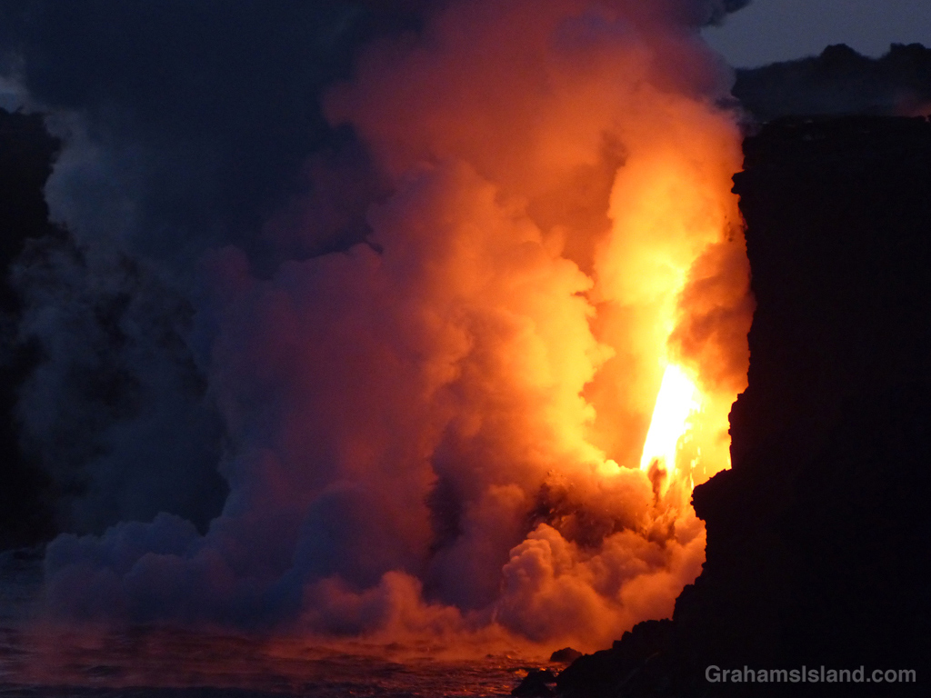
I’ve opted for a dip into the archives for this challenge. Two years ago, lava from Kilauea Volcano’s Pu’u O’o vent reached the ocean, tumbling down a cliff into the water. One day, the cliff collapsed, leaving the lava shooting out of a hole high up in the new cliff. This was called the firehose of lava because that’s what it looked like.
I first learned about it when I saw a video of the lava firehose on one of the news channels. What impressed me was that it was really hard to to see that it was a video. The flow was so strong and so consistent that it looked like a photograph. It was only by looking closely at the edges of the firehose that I could make out spatters of moving lava.
I headed down to the volcano, to take at look at this phenomenon, the day after I saw the video and was duly impressed by the dramatic scene. It was well worth the trip and well worth my quick visit. The following day another cliff collapse moved the firehose back and out of sight from the observation areas.
These are two photos from that visit. More photos can be seen in previous posts here, here, here, and here.
This week’s Sunday Stills challenge theme is ‘Lines and Squares.’ See more offerings here.
This is one of the roads in Isaac Hale Beach Park at Pohoiki. This park is where last year’s lava activity came to a halt leaving a wall of lava making a border to the public area of the park. Walking beyond the ‘No Trespassing’ sign won’t result in your immediate arrest, but the powers that be don’t want people walking on the flow itself.
But this is a road after all and the sign makes it seem likely that someone driving here might continue on and run into the flow. Actually, this is entirely possible, given how some people drive around here.
Regardless of the intent, I like how the lines on the road disappear into the lava and the red squares are warning signs.
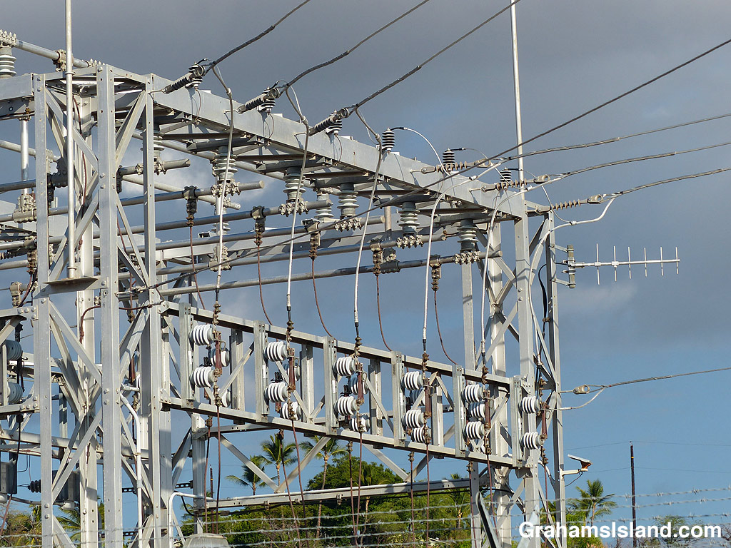
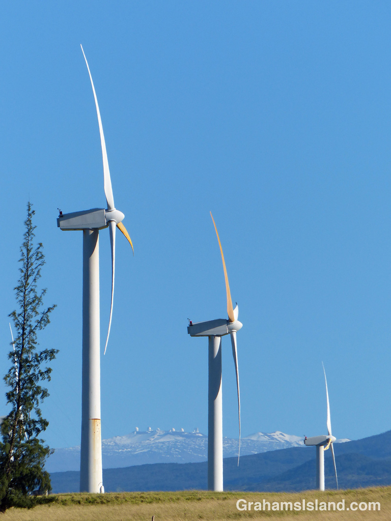
This week’s Friendly Friday challenge theme is ‘Electric.’ See more responses here. These three photos are quite different, but linked by this theme.
The top photo shows a view of an electric substation. I like the lines and shapes such facilities offer. But where does this power come from? A good deal is from oil fired plants, but Hawaii is working to get more of its electricity from locally sustainable sources.
In the middle is a view of Hawi wind farm, with Mauna Kea in the background. There are several wind farms of varying sizes in Hawaii including a few on the Big Island. Their contribution to the power grid is small, but growing. Solar power is also a big contributor, on an individual house basis or for whole communities (here).
One source that provided around 25% of the Big Island’s electricity was the Puna Geothermal Venture (PGV). Last year’s eruption shut them down, though, as the bottom photo shows, the flows mostly missed the plant itself. I think a couple of their wells were covered by lava, but most were spared. Currently, they’re in the process of restarting power production. Not everyone here is a fan of this power source. The same can be said about the Honua Ola bioenergy plant, which will generate electricity from burning eucalyptus chips, but which is still to become operational.
This time last year, the newest eruption of Kilauea Volcano was still going strong in the Puna district of the Big Island. The previously active vents, in Halemaumau Crater and at Pu’u O’o, drained of lava at the end of April. Lava then moved underground, down the east rift zone, toward the southeast tip of the island. It resurfaced in May in Leilani Estates.
By the end of May, 24 fissures had discharged lava. Two of those sent flows down to the coast, but at the end of May the main eruption settled on Fissure 8. A river of lava flowed northeast, inundating Highway 132 and reaching the ocean at Kapoho Bay in early June. This flow continued into August, but by the end of that month all activity had more or less ceased. In all, more than 700 homes were destroyed during the eruption, but more than 800 acres of new land had been formed.
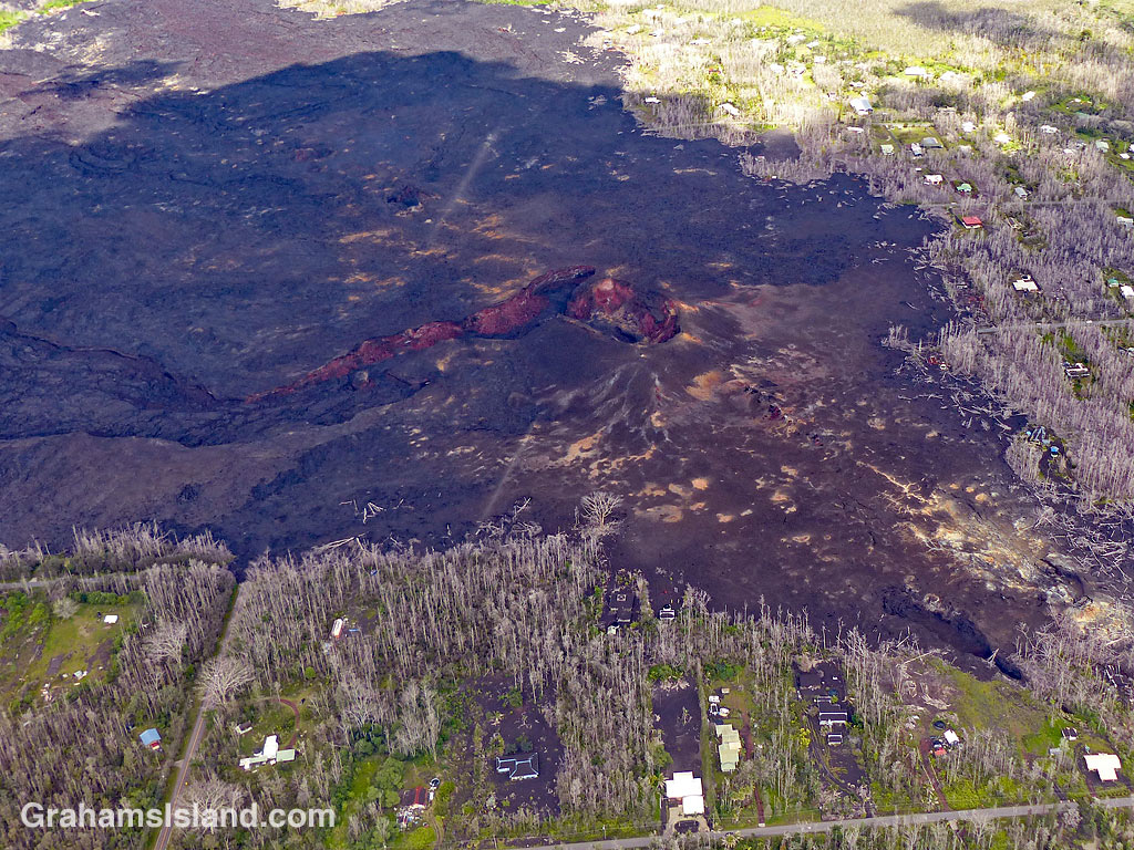
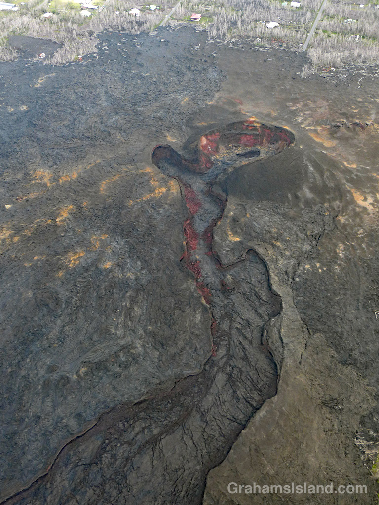
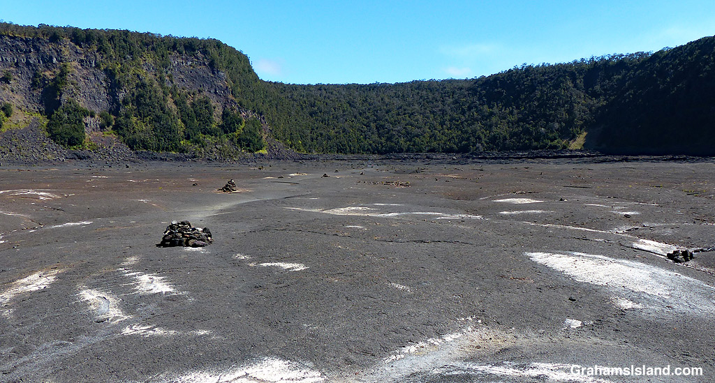
These photos show Fissure 8, the source of the main flow. The top photo shows Fissure 8’s location, bordered by houses in Leilani Estates that escaped destruction during the eruption. In the middle, the main crater and the ‘canal’ that channeled the flow toward the coast. Below, another view of Fissure 8 and the wasteland of destruction surrounding it.
PBS’s NOVA put out a show about the eruption earlier this year with some great information about what was actually going on during the eruption. It might be accessible on their site, PBS.org, or search online for the title of the show: PBS Nova Kīlauea: Hawaiʻi on Fire.
A red-billed leiothrix perched on a branch in a kipuka on the Pu’u O’o trail off Saddle Road. A kipuka is an area of land that has been surrounded by a lava flow. Kipukas often contain older trees and other plants that are a haven for native and non-native birds and other creatures.
This leiothrix had an exceptionally red bill because it was carrying a bit of ripe thimbleberry, presumably to young birds in a nest nearby.
This week’s Sunday Stills challenge theme is ‘Paths.’ (See more offerings here.)
Kilauea Iki Trail is one of the more popular trails in Hawaii Volcanoes National Park. But last year’s volcanic activity, with numerous earthquakes, resulted in the park being closed for several months. Even after it reopened in September 2018, many parts of the park remained closed because the areas were too unstable to be opened to the public.
The Kilauea Iki Trail was one of those areas along with Thurston Lava Tube and Jaggar Museum. The latter two locations are still closed and Jagger Museum may never be reopened, but the Kilauea Iki Trail is currently listed as mostly open. Given that this is a loop trail, it would be wise to check ahead and find out what ‘mostly open’ means.
These photos were taken during a hike I took a couple of years back. The top photo shows the view from the part of the trail that follows the rim of the crater before it descends to the crater floor. The second photo shows two hikers heading out across the crater floor. The dark hill in the background is Pu‘u Pua‘i where a 1959 eruption poured lava out into the crater. The third photo shows hikers near the center of the crater where the path winds through broken areas of the crater floor. Below, cairns mark the trail across a flat area of the crater that leads to the switchback trail which takes hikers back up to the crater rim.
For more information about Hawaii Volcanoes National Park, go to nps.gov/havo/.
Green Lake was, until June 2 last year, Hawaii’s biggest freshwater lake. This isn’t a dramatic claim since freshwater lakes are in short supply in Hawaii. There are only two freshwater lakes on the Big Island, the other being Lake Waiau, near the summit of Mauna Kea. Green Lake had a surface area of about 2 acres and was no more than 20 feet deep in the center, but it was a popular spot with both locals and tourists who liked to swim and picnic there.
The lava flow from last year’s eruption in lower Puna at first curled around the pu’u, the center of which was Green Lake. But on June 2, the flow breeched the surrounds, boiled away the water and filled it with lava.
The top photo shows that pu’u that contained Green lake, now filled with lava. The bottom photo shows Green Lake in relation to the flow and the area around it. The lava came from the upper left of the photo. It flowed around the pu’u and entered the lake from the southeast. The photo also shows how the flow reached the coast. The area in the top right of the photo used to be Kapoho Bay and its surrounding housing. A white speck is visible on the edge of this flow, which is one of only three houses there that survived the flow’s destructive progress.
At the bottom of the lower photo is untouched land, including a road that runs into, and now terminates, at the flow’s edge.
This week’s Sunday Stills challenge theme is ‘Danger.’ (See more offerings here.) It seemed a suitable opportunity to post some photos reviewing on Kilauea Volcano’s last eruption, which began in May of last year.
The bottom photo, taken from the Jaggar Museum overlook, shows the scene on the morning of April 25, 2018. Lava in the active vent in Halema’uma’u Crater, at Kilauea’s summit, was just below the crater floor and had been overflowing into the crater in previous days. The overflow is the large dark area to the right of the glowing lava.
By early May, the lava level in the vent had dropped around 1,000 feet. This drop occurred at the same time that lava disappeared from Pu’u O’o vent. Not long afterwards, cracks opened in the ground at Leilani Estates, a housing subdivision in the southeastern part of the island. By the end of May, 24 fissures had opened in the area. The most prolific lava flow emanated from Fissure 8, which flowed to the ocean and created more than 800 acres of new land. However, more than 700 homes were destroyed by this eruption.
Meanwhile, back at the summit, the absence of lava in the vent in Halema’uma’u Crater resulted in a series of collapses of the crater floor. Each collapse triggered earthquakes and shot clouds of ash and toxic gas thousands of feet into the air.
The top photo shows Halema’uma’u Crater as it looks today. The crater is twice the size it was the year before and the floor, which was mostly flat, is now a huge cascading pit. In the upper left of the photo, the Jaggar Museum, where I stood to take the bottom photo, can just be seen. It was heavily damaged by the earthquakes, as were the parking lot and access road. It’s also much closer to the crater edge than it was. (Technically the crater edge is closer to it, since the museum hasn’t moved!)
The museum, along with the rest of the park, closed in May 2018, because of the eruption. While much of the rest of the park reopened in September, Jaggar Museum did not. There’s a good possibility it never will and that its fate will be the same as the portion of Crater Rim Drive in the middle photo. A significant length of that road, which used to encircle the whole summit caldera, was destroyed, including the section in the photo which slid, intact, into the crater.
Things have settled down since September 2018 and there has been no volcanic activity anywhere on the island since then. But Kilauea remains an active volcano and will undoubtedly erupt again. It’s just that no one knows exactly when or where that will happen.