Sunday Stills challenge theme this week and last week is ‘Your 2023 Year-in-Review.’ See more responses here. As before, I’m going with a favorite photo from each month of 2023, with a caption and link to the post the photo first appeared in. Last week, I posted favorites from January through June. This week, it’s July through December.
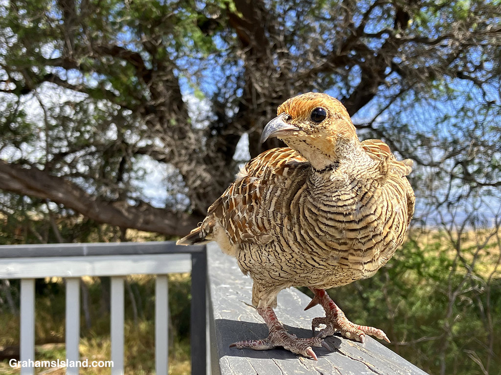
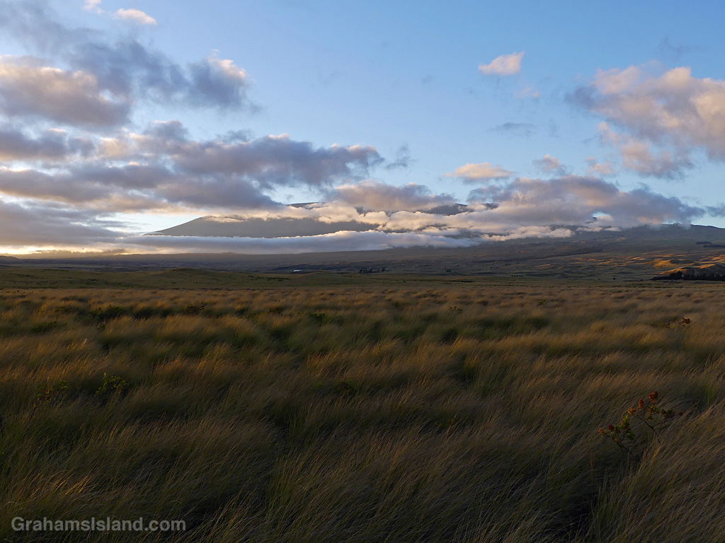
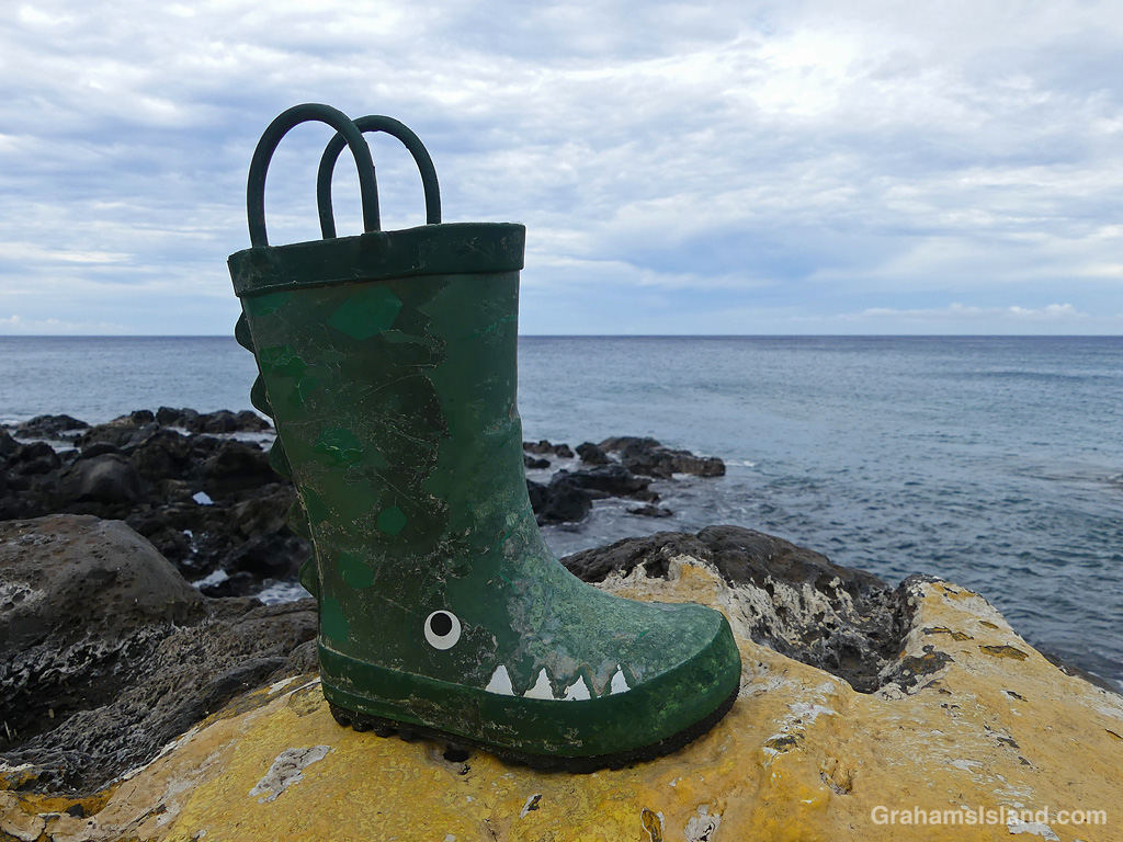
September: Mr. Chompers on the move (link).October: Wood you believe it (link)?November: Mauna Kea around sunrise (link).December: The boot’s not on the other foot (link).
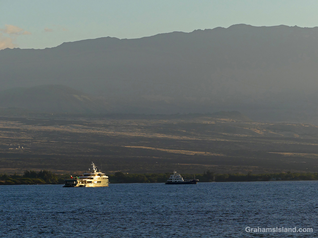
Recently, these two yachts were anchored off Mauna Kea Resort. I couldn’t make out the name of the blue boat but the other one is the Anawa, a Dutch built superyacht owned by a Brazilian billionaire. I confess my first thought on seeing this yacht was that it might be the ugliest boat I’d ever seen. Perhaps it was the angle. Perhaps not.
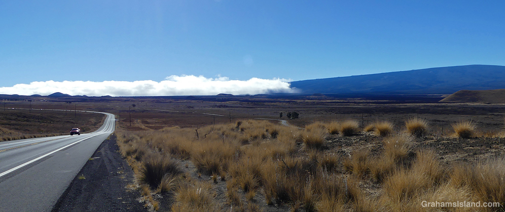
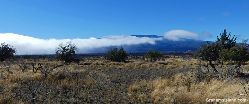
The Big Island’s weather is greatly influenced by northeast trade winds blowing up against Mauna Kea and Mauna Loa and dumping generous quantities of rain on the wet east side. Not much of this moisture reaches the much drier west side.
On a recent hiking trip to the saddle between Mauna Kea and Mauna Loa, I saw a visual example of what goes on. Cresting a hill, I saw a bank of cloud rolling in from the east. My hike was somewhere under that cloud. When I got closer to that wall of cloud, I could see it fading as it pushed to the west.
My hike started under gray skies, with some light rain, but on this day, the clouds did not keep building. Instead, they burned off somewhat so that it was dry and quite hot by the time I returned to my car, such is the fickle nature of Big Island weather.
The Queen Ka’ahumanu Highway was built in the 1970s to connect Kailua Kona to Kawaihae and Waimea along a coastal route. This also opened up the south Kohala coast for resort development that had been led by the Mauna Kea Resort, which opened in the late 1960s. Mauna Kea Resort is in the foreground of this image.
Spencer Beach Park is a place I visit fairly often. Recently, I had the opportunity to fly to Maui and, while I was in the air, took the usual plethora of photos. Some of these were of the park.
The top photo shows the park with its sandy beach, surrounding trees, and calm blue waters offshore. It also shows how close the recent brush fires came to the park. The building on the left side of the photo is the visitor center for Pu’ukohola Heiau National Historic Site, which adjoins the site.
In the bottom photo, Spencer is at the lower left. To the right is Mauna Kea resort, which did suffer some damage in the fires. Mauna Kea Volcano provides the backdrop.
I was driving home yesterday and I was struck by a contrasting view. The top photo shows the Keanuiomano Stream running down towards the Queen Ka’ahumanu Highway, the main road along the coast from Kailua Kona to the north.
I posted (here) about the river running high a few weeks ago, following the passage of Tropical Storm Calvin. Since then, there’s been a gradual decline in volume, but there’s still a trickle of water and the stream bed is full of pools. This area is popular with the goats, because it’s a good source of water and fodder after rainfall.
Crossing the road, the view is starkly different. The passage of Hurricane Dora triggered strong, dry trade winds. When fires broke out, they spread quickly (here). This view shows the aftermath of one of the relatively small fires, which burned about 500 acres next door to Mauna Kea Resort. The palm trees and houses on the left of the bottom image are part of the resort.
Ironically, when I took river running high photos, I checked out the other side of the highway for possible photos. I didn’t bother taking any, as I couldn’t see much because of the thick vegetation. Now it’s wide open down to the ocean.
Keanuiomano Stream has been bone dry for weeks, but yesterday’s passage of Tropical Storm Calvin transformed it into a roaring river. There was a lot of rain up in the Kohala Mountain area, which is the source of the stream. It was interesting, though, that the gullies that carry water off the leeward side of that mountain were still dry, so all that rain must have fallen mostly on the windward side and the east end of the mountain.