Category Archives: Activities

Pu’u Wa’a Wa’a hike

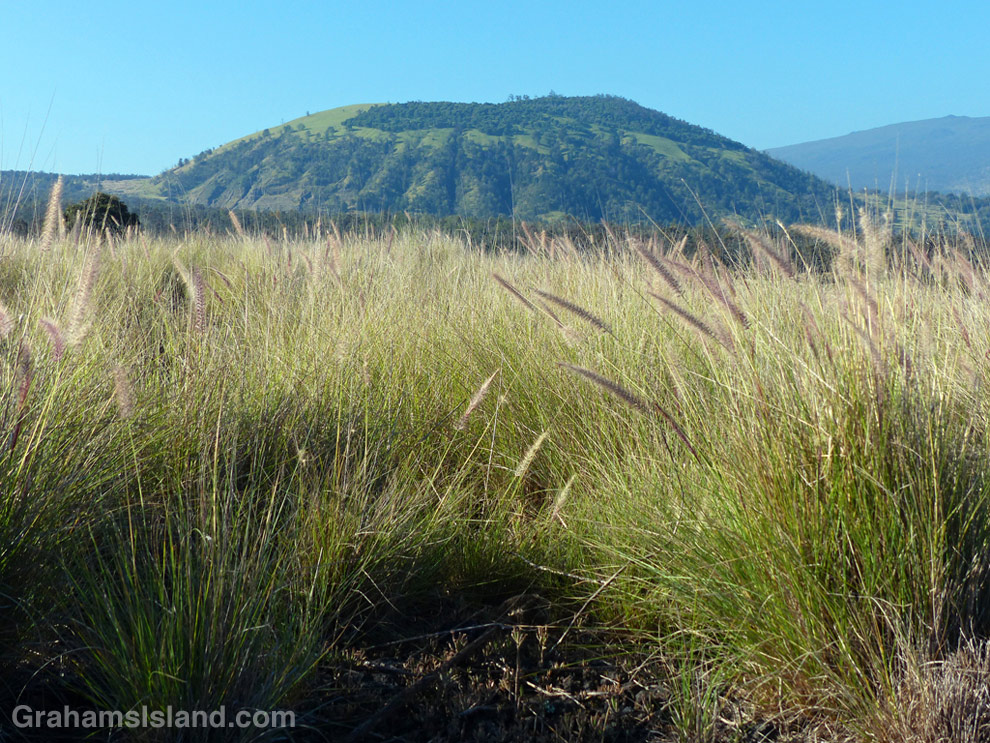
Pu'u Wa'awa'a seen from the trailhead.

Pu’u Wa’awa’a seen from the trailhead over a sea of fountain grass.

This old quonset hut, at the foot of Pu'u Wa'awa'a, was probably an old ranch building.

This old quonset hut, at the foot of Pu’u Wa’awa’a, was probably an old ranch building.

Tamaki Corral was used by the old Pu'u Wa'awa'a Ranch.

Tamaki Corral was used by the old Pu’u Wa’awa’a Ranch. Hualalai is visible in the background, before clouds rolled in.

Pu’u Wa’a Wa’a means “many-furrowed hill.” It’s popularly known as ‘jello mold,’ and is the biggest of several cinder cones on the slopes of Hualalai volcano.

The land is a State Forest Reserve with about 8 miles of hiking trails. The main trail leads to the top of the cone and is about 3 miles each way. The first half follows an old road that passes through a mostly forested area. There’s a good deal of bird life here, more often heard than seen in my experience. The trail then heads up the side of the cone itself in open country, passing old ranch buildings and likely some cattle, horses, sheep and goats.

Once at the top, the views can be tremendous, but an early start is needed. Clouds build up on the slopes during the morning and by midday the view can be fading or gone.

For more information about Pu’u Wa’a Wa’a and its trails, go to puuwaawaa.org.

The smaller Pu'u Iki cone seem from the top of Pu'u Wa'awa'a.

The smaller Pu’u Iki cone seen from the top.

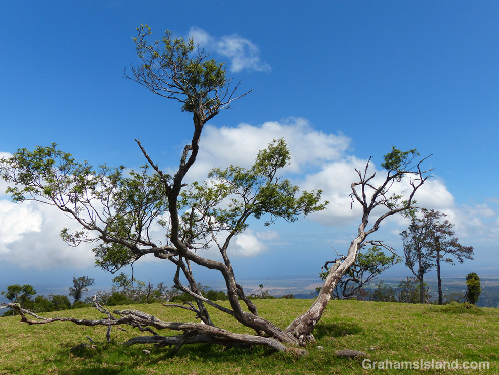
A Mamane tree atop Pu'u Wa'awa'a, with the coast in the distance.

A Mamane tree atop Pu’u Wa’awa’a, with the coast in the distance.

Hike to Kilauea’s lava flow

The Lava Ocean tour boat edges up to the new bench in the ocean, created by the flow from Kilauea volcano.

The Lava Ocean tour boat edges up to the new bench in the ocean, created by the flow.
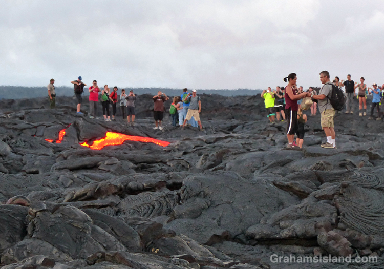
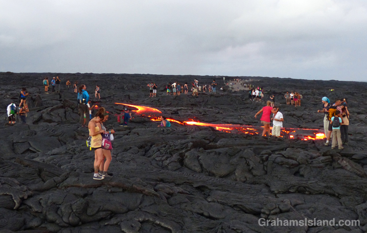
A lava breakout from the Kilauea lava flow.

This photo was taken within a few seconds of this lava breakout beginning. The couple on the right hadn’t yet noticed it.
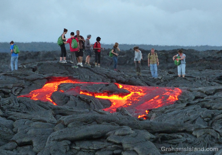
A lava breakout from the Kilauea lava flow.

The breakout spreads …

A lava breakout from the Kilauea lava flow.

… and extends toward the water. This was about as far as it got while I was there. All these people are standing on the active flow.

Last week, I posted twice (here and here) about a boat trip to see lava entering the ocean from Kilauea Volcano’s Pu’u O’o vent. Since then the ocean entry widened dramatically to more than 700 feet. With all that activity, I thought another hike to the flow was in order. This time, instead of hiking from the viewing area at Kalapana, I decided to go through Hawaii Volcanoes National Park.

The hike starts on the coast, at the end of Chain of Craters Road. It’s about an 8.5 mile round trip, and follows the emergency gravel road constructed in 2014. While the whole area is a stark covering of old lava flows, I liked seeing ferns and the occasional shrub getting a toe hold in cracks and under ledges. And then, with late afternoon light slanting from behind and rain showers approaching from ahead, a brilliant rainbow lit up the sky.

Regarding the current flow, the USGS website notes that “the entire area presents a significant hazard to visitors.” It goes on to list dangers from toxic gasses, explosive events, and unstable ground. So it was with some surprise that when I arrived, I found the flow crawling with people. This wasn’t because it had suddenly stopped and cooled. At the edge, where it crossed the road, the red glow of active lava could be seen. I talked to one of the park rangers keeping an eye on things. He said all they could do was post signs and try and make people understand the dangers. They had roped off some areas and people just stepped over the ropes. It gave me a warm glow to know that, if someone was injured here, that person would understand it was their own fault and wouldn’t turn around and try to sue the park service for millions.

I wandered down the edge of the flow to the cliff where the new bench being formed by the lava could be seen. Then back to the road and I figured, if everyone else is doing it, it must be safe, right? Ha, ha. The thing is, standing next to the flow, the heat was significant, and stepping on to it, it got hotter still. My feet got distinctly toasty, so I took a couple of photos and turned around. A few minutes later, I happened to be looking in the direction of one of the clumps of people standing on a lump of lava. Suddenly, a river a red burst from near the base of the lump. A breakout, and a decent-sized one at that.

Naturally, the people nearest to the breakout quickly moved away from the danger. Ha, just kidding. People rushed toward the lava because, though the surface was obviously unstable and could turn to deadly, molten liquid at any moment, it probably wasn’t going to happen to the lump they stood on. Frankly, it was all a bit surreal.

Later, I saw the ranger I’d talked to earlier doing a brisk trade in fixing the detached soles of shoes – flat tires, he called them – where heat from the flow had melted the glue. As the light dimmed, numerous glowing red patches of lava showed up, speckled with white and yellow flashlights as people meandered through the dark.

It was time to go before someone out there misstepped. I had a three hour drive ahead of me and I didn’t want their screams ringing in my ears.

For more information about Kilauea Volcano and it current eruption, go to hvo.wr.usgs.gov/activity/kilaueastatus.php.
For more information about boat trips to see the lava, go to lavaocean.com.

A rainbow rises over the road to the flow from Kilauea Volcano.

A rainbow rises over the road to the flow.

Abstracts: Bubble machine

Surging water creates storms of bubbles.
In the water, it’s wise to be aware of what waves and swell are doing. Caught unawares, it’s easy to get tumbled over rock and coral. But I like to get close enough to see fish sluicing back and forth, and also to see the waves crashing around the rocks leaving little whirlpools and storms of bubbles.

The spooky horses of Waipi’o Valley

A horse stands by a pool in the road to the beach at Waipi'o ValleyA horse stands by a pool in the road to the beach at Waipi'o Valley
Yesterday, I posted about my hike into Waipi’o Valley. One feature of the valley is that wild horses live there. These appear to be ‘wild’ in the sense that they aren’t owned, but they’re not the wild mustangs of the wide open west.

I saw the first of them when I came to this large lake spanning the sandy road leading to the beach. At first I didn’t notice it, but as I looked for my best path around the pond, I saw it standing off to the side, by the trees. My best path would take me in the horse’s direction; the other side looked too muddy.

I looked at the horse again. It hadn’t moved. Not at all. Not a swish of the tail, not a flick of an ear. It was eerily still, so still I wondered for a moment if it wasn’t a super-realistic, life size model set there to disconcert tourists. No matter. I had to go by it and it would surely move then. As I approached, I spoke to it. Still nothing. I passed behind it. Not a twitch, not a blink. I walked to the other side of the road and took another photo. Nothing from the horse. A few more photos and finally the horse flicked its tail, the first sign of life since I initially saw it. After a while, the horse gathered itself, turned around, and eased into the trees.

Later, on my return after going a little way up the Muliwai Trail, I took the trail which runs through the trees behind the beach. A short way along the trail I just got a certain feeling. I turned around and there was a horse following me only about 10 feet behind. I hadn’t seen it. I hadn’t heard it. It looked at me, then turned toward the ocean. I walked on a few paces, then looked back. The horse was gone, nowhere to be seen.

For more information about the Waipi’o Valley trail, go to bigislandhikes.com/waipio-valley/.

Waipi’o Valley hike

Waipi’o Valley with Hi’ilawe Falls in the distance, seen from a viewpoint on the Muliwai Trail which leads to Waimanu Valley.
Waipi’o beach seen from the overlook near the parking area.
The stream crossing to reach the far end of the beach and the Muliwai Trail.
The road down into Waipi’o Valley is rough, winding, and very steep.

There’s a 22 miles stretch of the northern Big Island coast, from Pololu to Waipi’o Valley, that isn’t accessible by car. At the southeast end of that stretch, the road ends at the Waipi’o Valley overlook. From there, a paved road descends into the valley. It’s rough, winding, and very steep. The average grade is 25%, steeper in places. Four-wheel drive and healthy brakes are a must.

The alternative is to hike into the valley, which is what I did. The road drops about 800 feet in just over half a mile. It’s hard on the knees, but easy on the eyes. There’s a gradual unfolding of details that aren’t visible from the overlook – fields, dwellings, horses. The valley, which is important in Hawaiian history, was wiped out in a 1946 tsunami. Now it’s populated by taro farmers and people who tend to shy from society. It’s a bit of a clash for it to be a popular tourist stop.

At the foot of the hill is a junction. The road continues straight on into the valley, but the public access soon ends. In the opposite direction the road heads to the sea. After a little under half a mile, the sandy, lake-filled road breaks out to the beach. There’s lots of parking under the trees. On the other side of them is the beach, a long, curved stretch of smooth sand, interrupted only by the ‘stream’ that has to be crossed to access the far end.

I can’t say where it’s best to cross this stream; conditions vary from day to day depending on the state of the tide and the flow of water. I waded out just inland of the furthest reaching waves. I felt my way across the rounded rocks underfoot, feeling reasonably pleased with my progress. But about three-quarters of the way across, I reached the fastest flow of water, which had also cut the deepest channel. It was probably only a couple of feet deep, but it required great care not to lose my footing. This fast-flowing channel was soon crossed and I hauled myself out, somewhat relieved, on the sand at the other side.

A deserted beach stretched out ahead. I strolled along the water’s edge and, at the far end, cut inland to find the Muliwai Trail, which leads to Waimanu Valley eight miles farther on. The trail is steep and narrow as it zigzags up the cliff. After a short while it breaks into the open and lovely views emerge, back the way I’d come and up the valley where there’s a good view of Hi’ilawe Falls. This was my turnaround point. The return across the stream was easier, knowing what was involved. The hike back up the road to the overlook a steady, sweaty haul, though I was surprised it only took me 10 minutes longer than the descent.

For more information about the Waipi’o Valley trail, go to bigislandhikes.com/waipio-valley/.

From the Muliwai Trail, a view back toward the road leading into Waipi’o Valley

Chilly Japanese white-eye?

A Japanese white-eye hunkers down on a branch
I came across this bird during a hike. Hunched on the branch with feathers fluffed up, I thought it wouldn’t look out of place on a Christmas card, if snow coated the branch and leaves. Not the case here though. The temperature was in the high 70s and I was sweating accordingly.