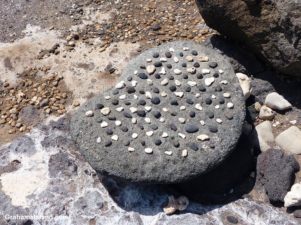
Kōnane is an old Hawaiian game with similarities to checkers or draughts but with more complications. It’s played on a board, or papamū, which can vary in size and material.
Older boards were often made in suitable rocks by creating hollows for the pieces to sit in. Sizes varied with most being rectangular with sizes such as a 14 by 17 configuration. The bigger the board, the longer the game. Game pieces were small pebbles of black lava and white coral. These days, wooden boards are common and some are made of cloth for portability. Square boards are more usual now such as an 8 by 8 configuration.
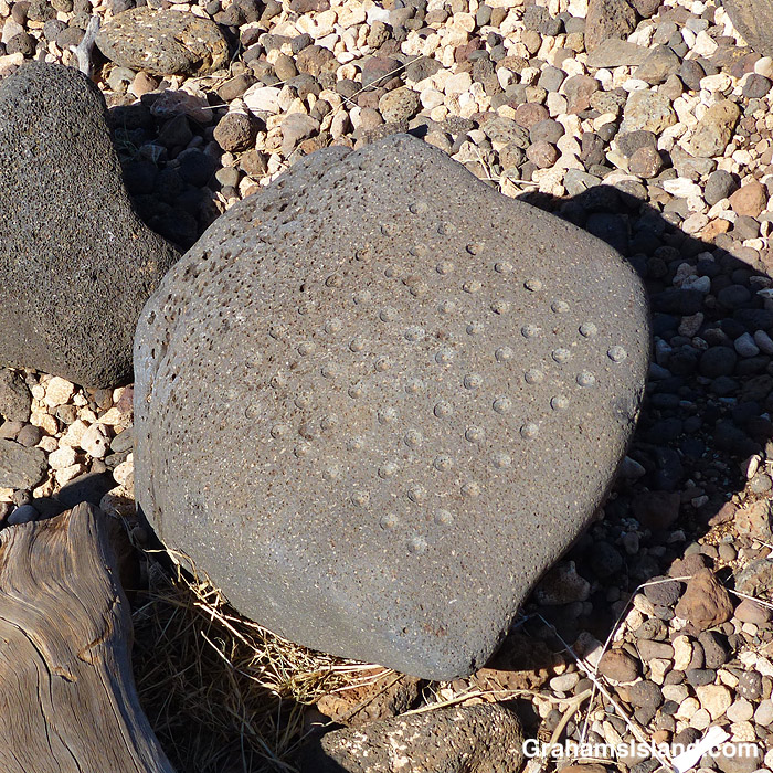
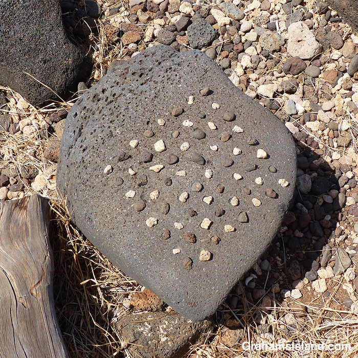
These photos were taken at Lapakahi State Historical Park, which was the location of an old Hawaiian village. The papamū in the top photo and the slider was probably made relatively recently judging by the smooth hollows for the pieces, but the board in the bottom photo was probably used by inhabitants of the village and show that boards weren’t necessarily a regular shape. Such irregularities only added to the challenge of the game.
To play kōnane, the board is set up as in the photos with black and white pieces on alternating squares. A correctly set up board should show all one color pieces on a diagonal line. After colors are chosen and the first two pieces removed, players alternate turns in jumping over the other player’s piece or pieces, removing those that have been jumped. Moves can be made up, down, or to the side, but not on the diagonal or around corners. The object of the game is to be the last player to make a move.
Kōnane was hugely popular in Hawaii, but was frowned on by missionaries who disapproved of the unproductive time spent playing and the rampant gambling on games. These days, it’s becoming more popular again, with tournaments and online games being held.
For more information about kōnane, go to hawaiiancheckers.com.