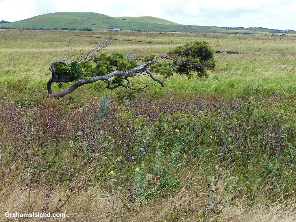
This photo tells you all you need to know abut the winds up here in North Kohala. It also says a lot about the cattle pastures here. Many are currently overrun by weeds of one kind or another thanks to an ongoing cycle of droughts and rain.

This photo tells you all you need to know abut the winds up here in North Kohala. It also says a lot about the cattle pastures here. Many are currently overrun by weeds of one kind or another thanks to an ongoing cycle of droughts and rain.
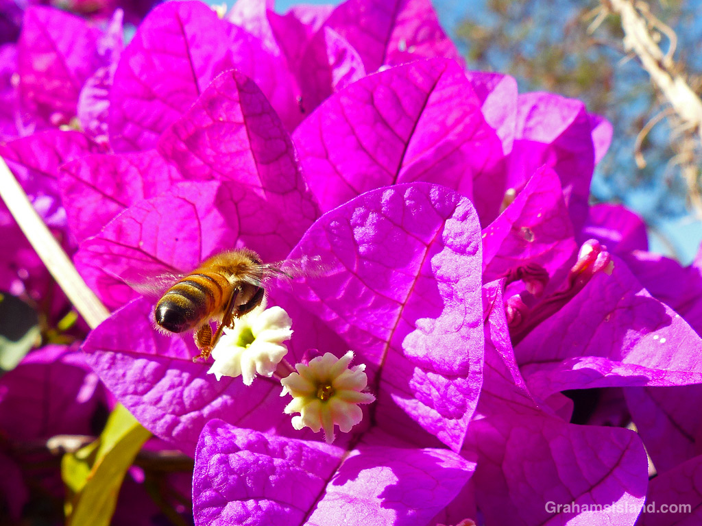
This week’s Sunday Stills Monthly Color Challenge is ‘Purple.’ See more responses here.
I’d like to say I have some kind of theme going here, but I don’t, outside the color.
First up is a bee approaching a very purple bougainvillea.
In the gallery, we have a Fiery Skipper butterfly feeding on a Blue Heliotrope (Heliotropium amplexicaule) flower, a purple and white spider lily, and some dark purple Helmet Urchins clinging tenaciously to a rock.


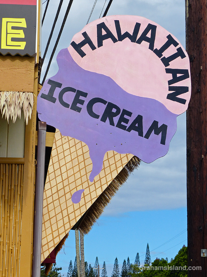
Then there’s a sign advertising purple ice cream. Not sure what flavor that is, but I’m a bit wary.
And finally, a lush purple orchid.


There’s still a bit of snow on top of both Mauna Loa and Mauna Kea. Every time it looks like it’s going to disappear, a new dusting bolsters the coverage.
This view is from Kohala Mountain Road. The dark strip snaking through the center of the photo is housing alongside Kawaihae Road, which goes down to the coast. These houses are part of the town of Waimea, which sits in the saddle between Mauna Kea and Kohala Mountain. This part of Waimea is known as the dryside because it receives significantly less rainfall than areas on the east side of the saddle, which is known, correctly, as the wetside.


This week’s Sunday Stills challenge theme is ‘Churches, Temples, and Spiritual Centers.’ See more responses here.
Here’s a few of the churches that can be found in this part of the island.
Kalāhikiola Congregational Church (top photo) is located east of Kapaau, where rainfall is plentiful and the foliage lush. It was built in 1855, though previous versions had existed for some years before this. The church was badly damaged by an earthquake in 2006, but rebuilt in the winter of 2009/2010.
St. Augustine’s Episcopal Church (second photo) was founded in 1884 in Kapaau, and expanded in 1913. It sits on a small hill by the main highway.
Sacred Heart Catholic Church (third photo) was founded in Hawi in 1905, but this structure was built in 1925 and continues to be used daily to this day.
Kohala Baptist Church (bottom photo) is located on the road to Pololu at Makapala. It can’t be seen from the road, but there is a sign by the highway pointing out the way. Currently, the church is undergoing some renovations and services are held in the area below the Royal Poinciana tree on the grounds.


‘Akala (Rubus macraei) is a native Hawaiian raspberry. It’s unusual for its large edible berries and slightly thorny stems. Most Hawaiian native plants didn’t need such lures or defenses because there were no grazing animals in Hawaii until their introduction by humans.
The berries are larger than non-native blackberries, but less sweet, and their juice was used as a dye in days gone by.
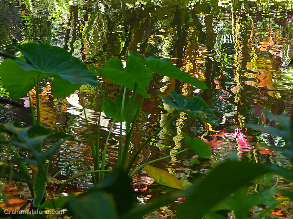
One of my favorite places at Hawai’i Tropical Bioreserve & Garden is Lily Lake. Surrounded by tropical foliage, the lake offers a bounty of reflections, such as this one.
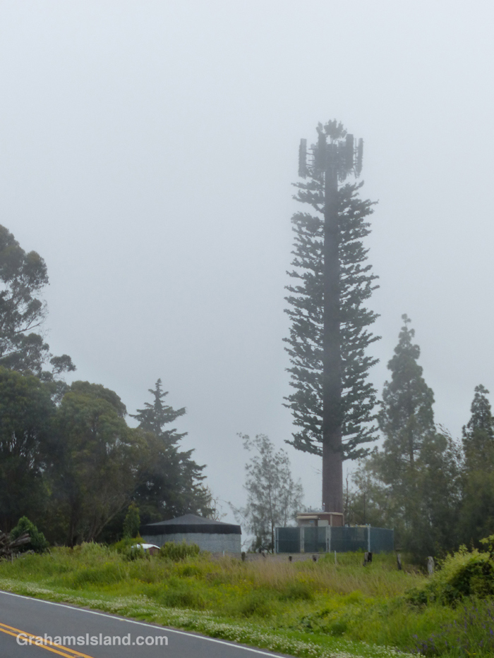
I went for a drive up Old Saddle Road yesterday and noticed this unusual tree. It is, of course, that now ubiquitous invasive species, the cell phone tower. At least this one had the good grace to try and blend into its surroundings, and does a decent job of it.
This ‘tree’ is located on the grounds of Camp Kilohana, the Girls Scouts Camp on the Big Island.
Posted for Bushboy’s Last on the Card photo challenge. See more responses here.


This week’s Sunday Stills challenge theme is ‘Roads, Paths, and Streets.’ See more responses here.
After a recent hike off Saddle Road, I had time to take a drive up one of my favorite roads on the island, which leads to the Mauna Loa Observatory. Well, it used to; it doesn’t get there anymore. That’s because a flow from last fall’s eruption of Mauna Loa crossed the road a few miles short of its destination. I was curious to see what the scene looked like now.
The cloudy skies added some atmosphere to the drive which was, as always, a lot of fun. It’s a winding one lane road, so even though there’s little traffic, one has to pay attention. Any distraction could result in driving off the road into the inhospitable lava fields bordering it.
I confess, my secret hope was that, when I arrived at the flow, there would be a sign saying ‘Road Closed.’ Alas, that was not the case. Clearly, the Department of Transportation figured the seven foot high wall of lava conveyed the message well enough on its own. The only sign there warned against walking on the new flow. I didn’t need that warning. This is a’a lava which is really hard to walk on anyway, and in a new flow it could be quite unstable and even harbor pockets where one could fall through into still hot lava! Still, I’m sure some folks have clambered up there just because it’s there.
I took a few photos, then turned around and headed back down, not least because it was damp, windy and I was freezing, which is not why anyone comes to, or lives in, Hawaii.

On the drive down, I got a good view of the HI-SEAS (Hawai’i Space Exploration Analog and Simulation) dome. This is where teams of volunteers do research for what it would be like to be living on the Moon or Mars. I’m not sure if it’s in use since the COVID shutdown, but at least it survived the last eruption.
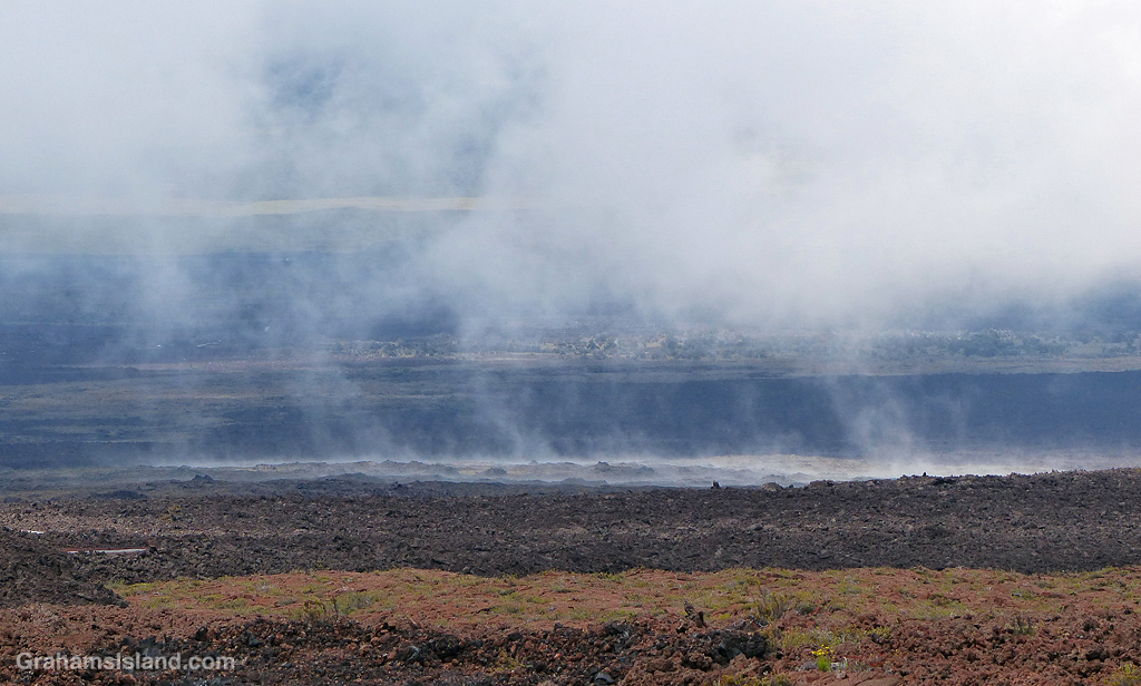
Farther down, the land seemed to be steaming, but in the saddle between Mauna Kea and Mauna Loa, the weather often seems to be part of the landscape.

And the views, which change with every twist in the road, are strange and stunning and wonderful. It may not be possible currently to reach the end of the road, but it’s still a great drive.
